
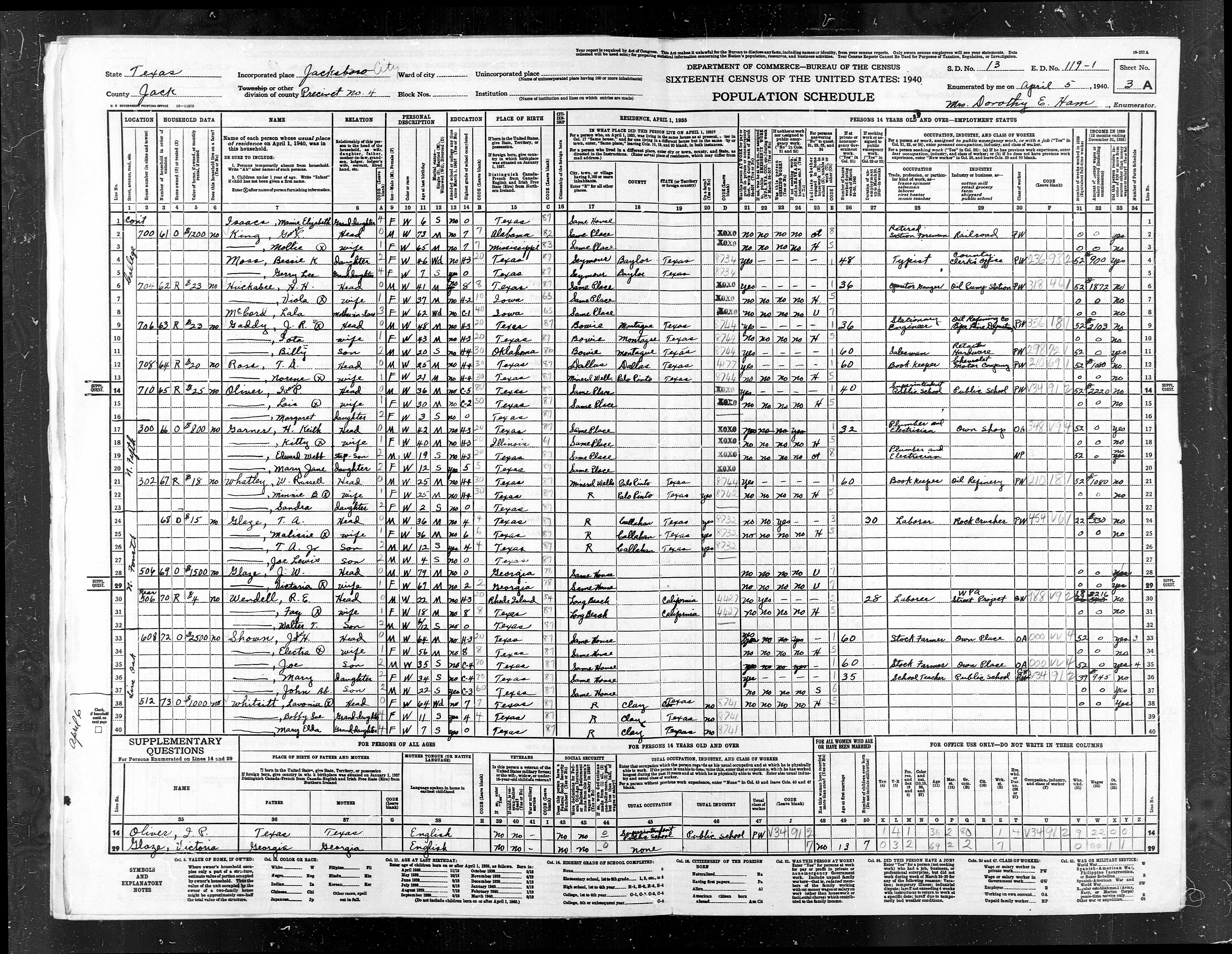
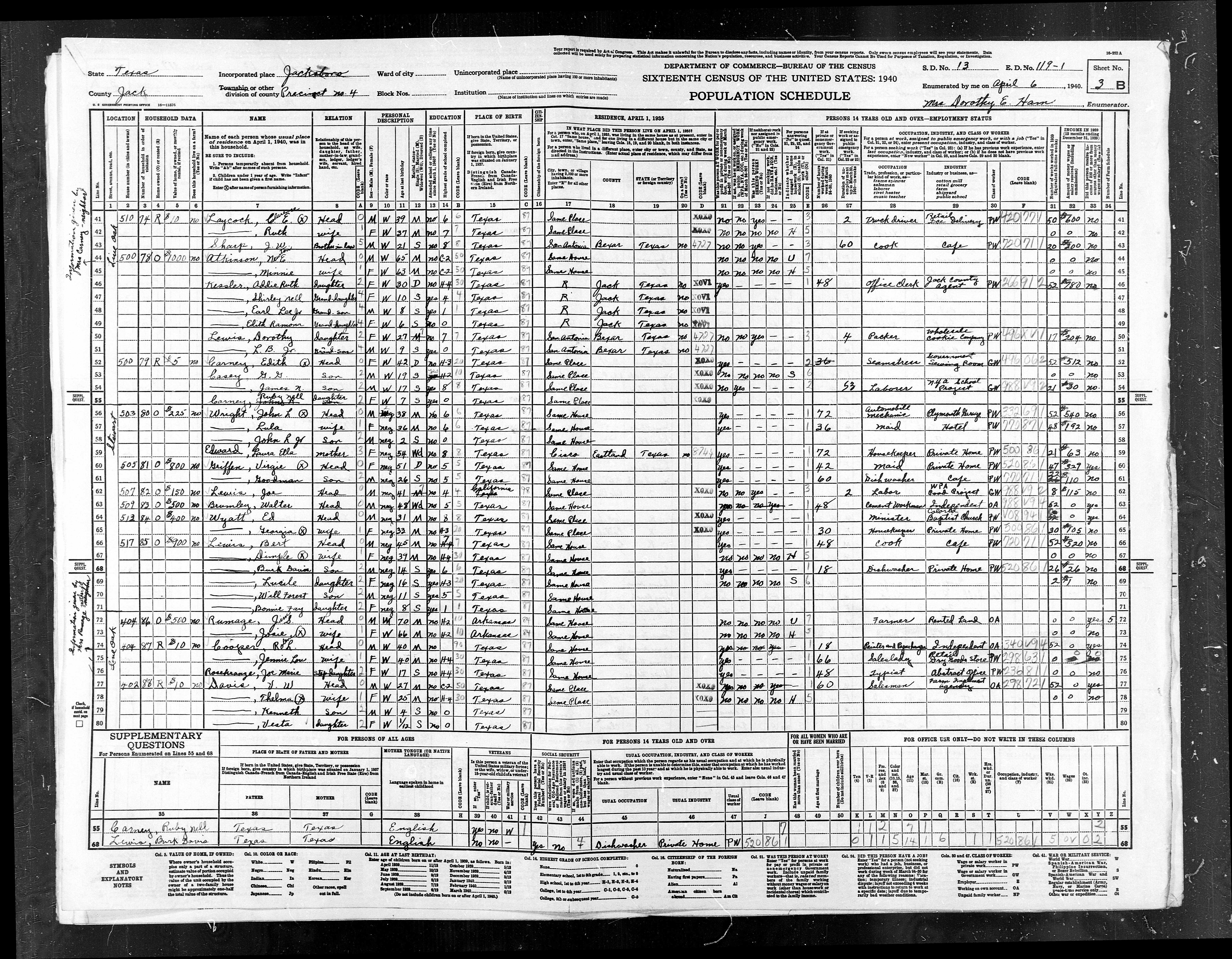
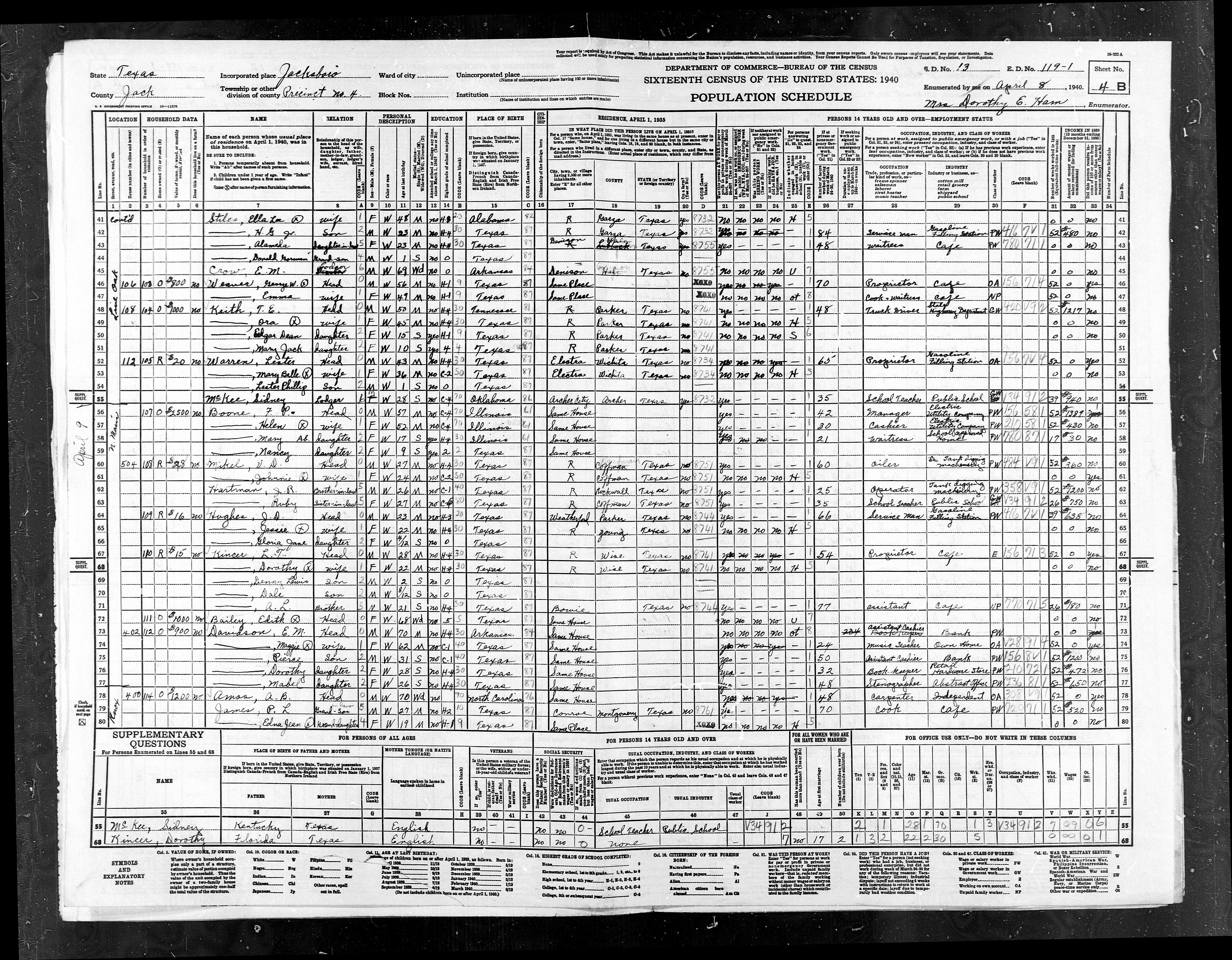
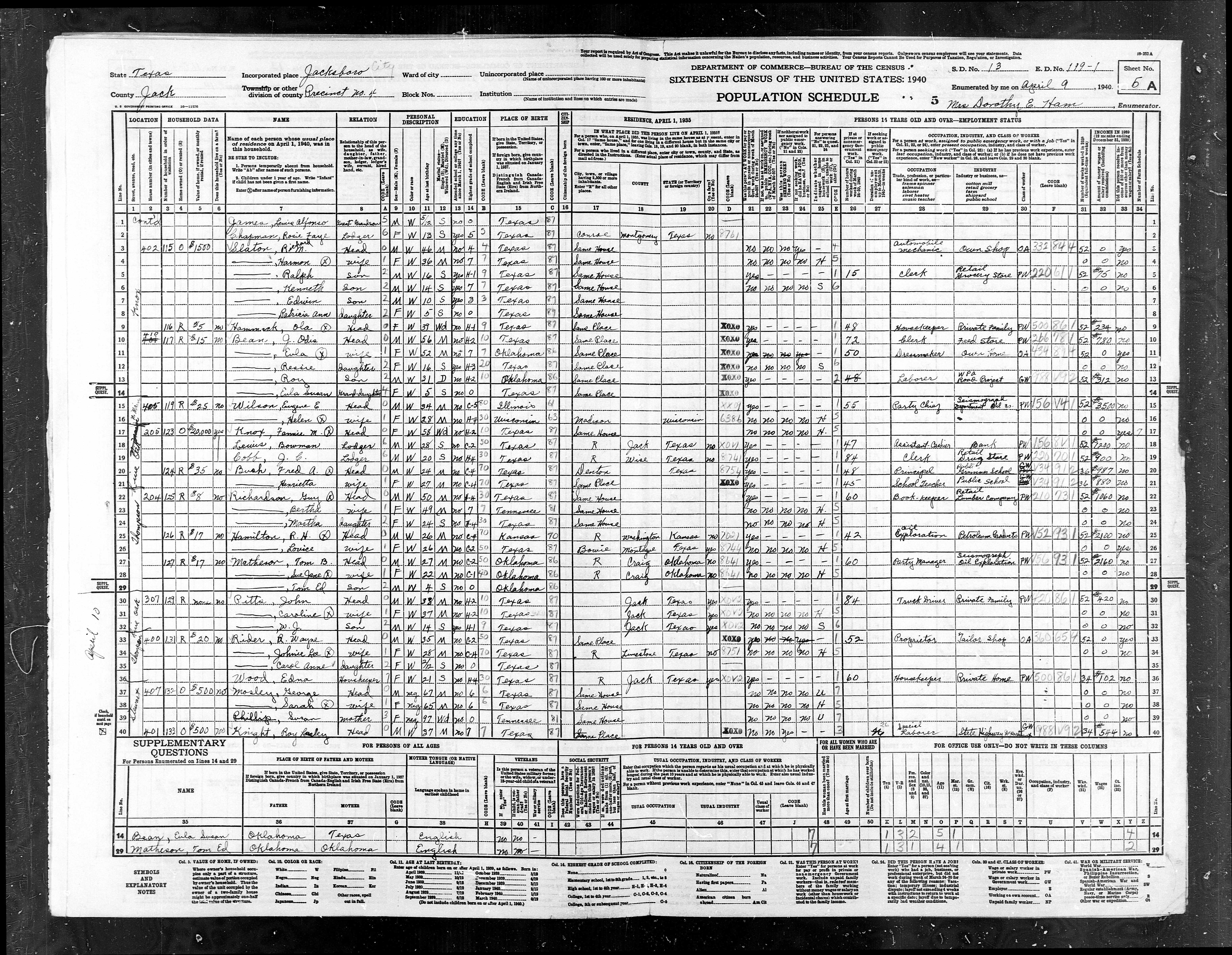
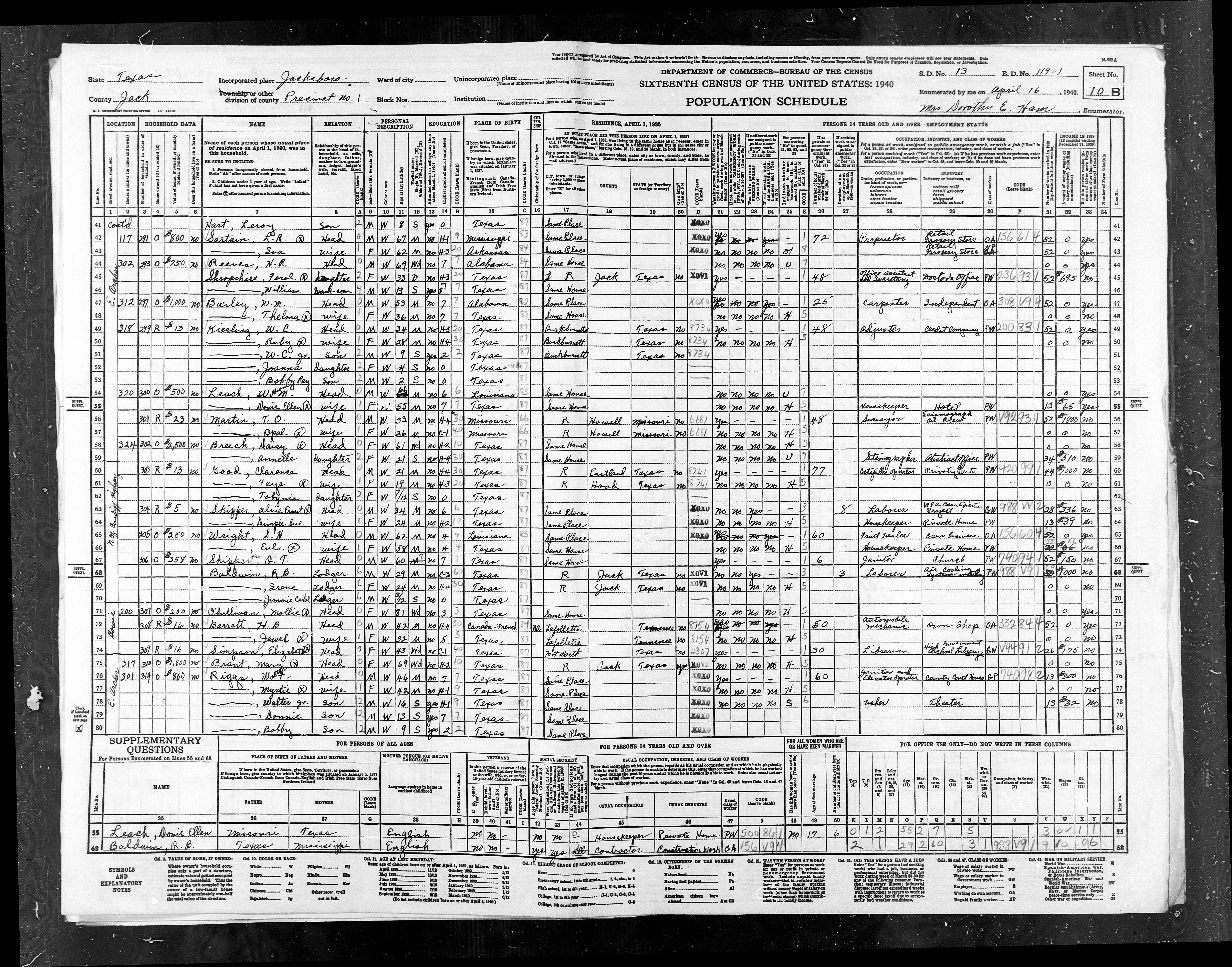
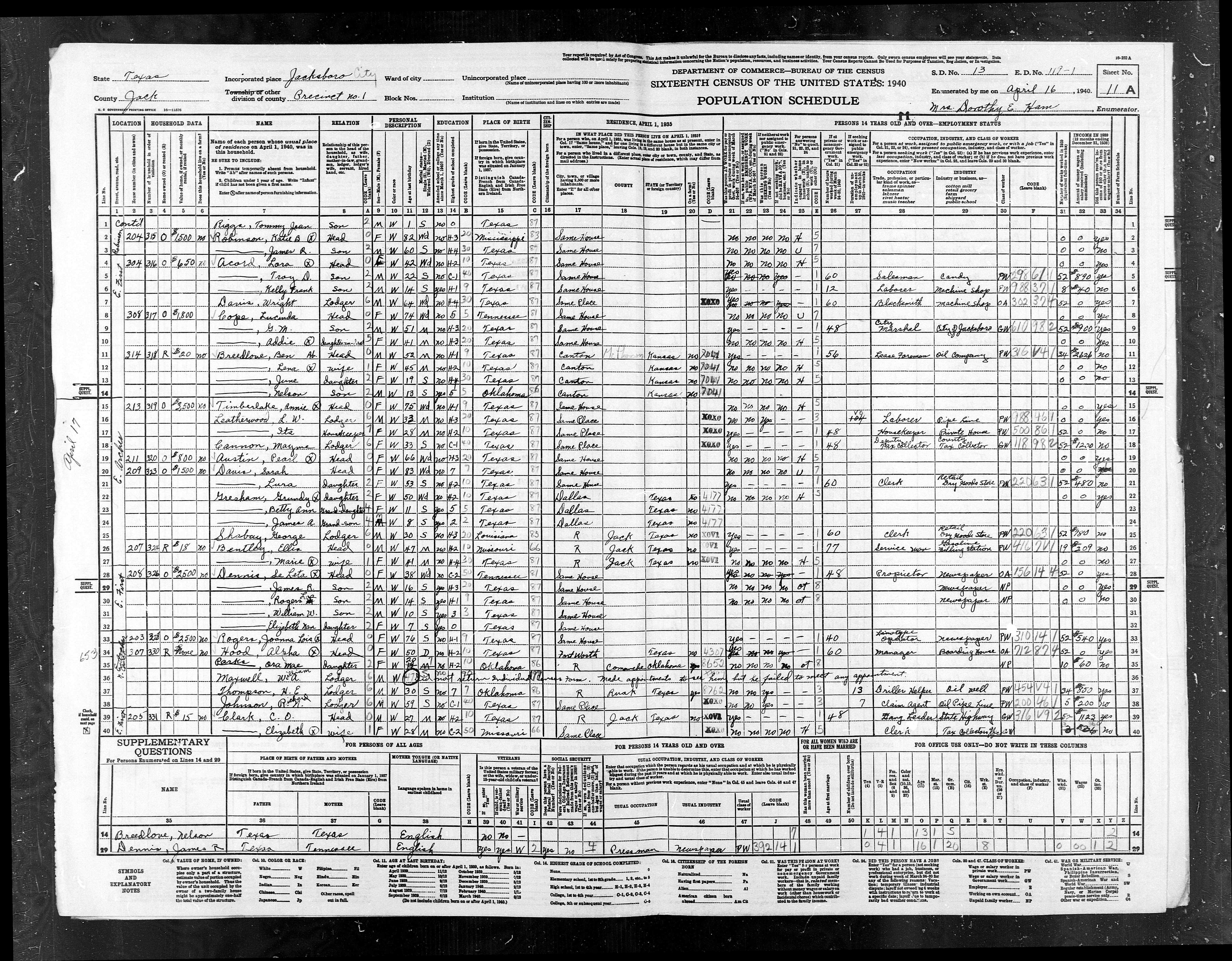
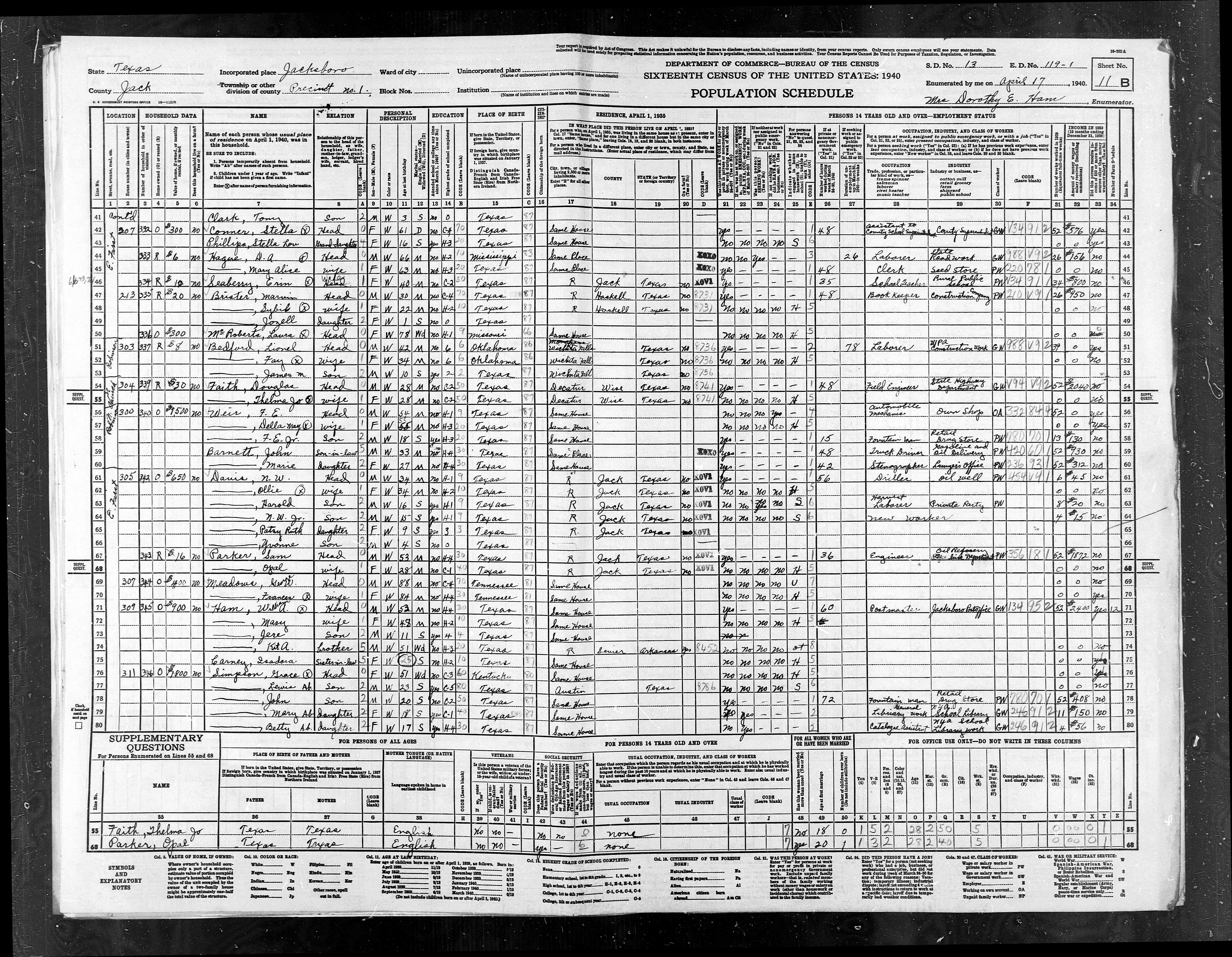
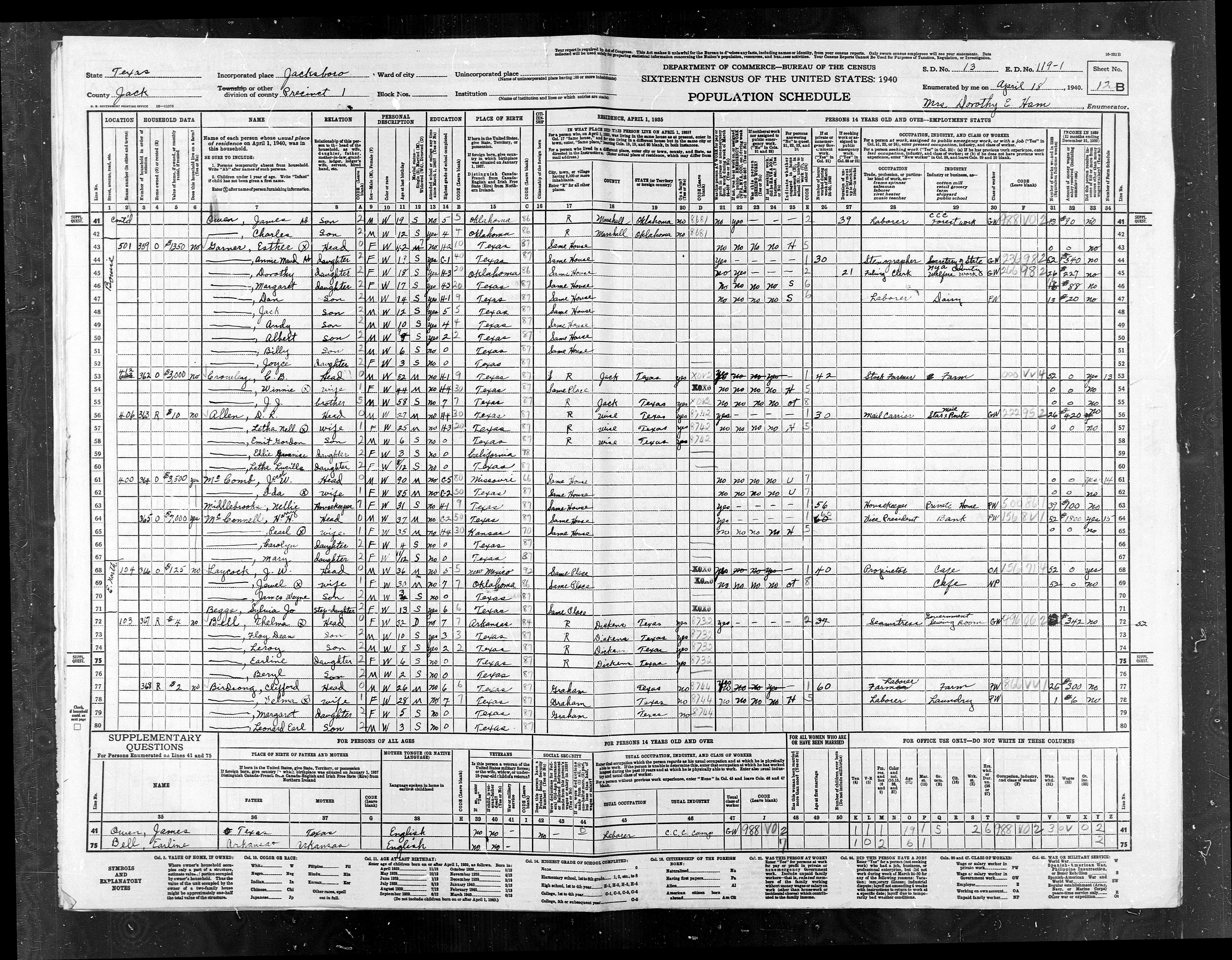
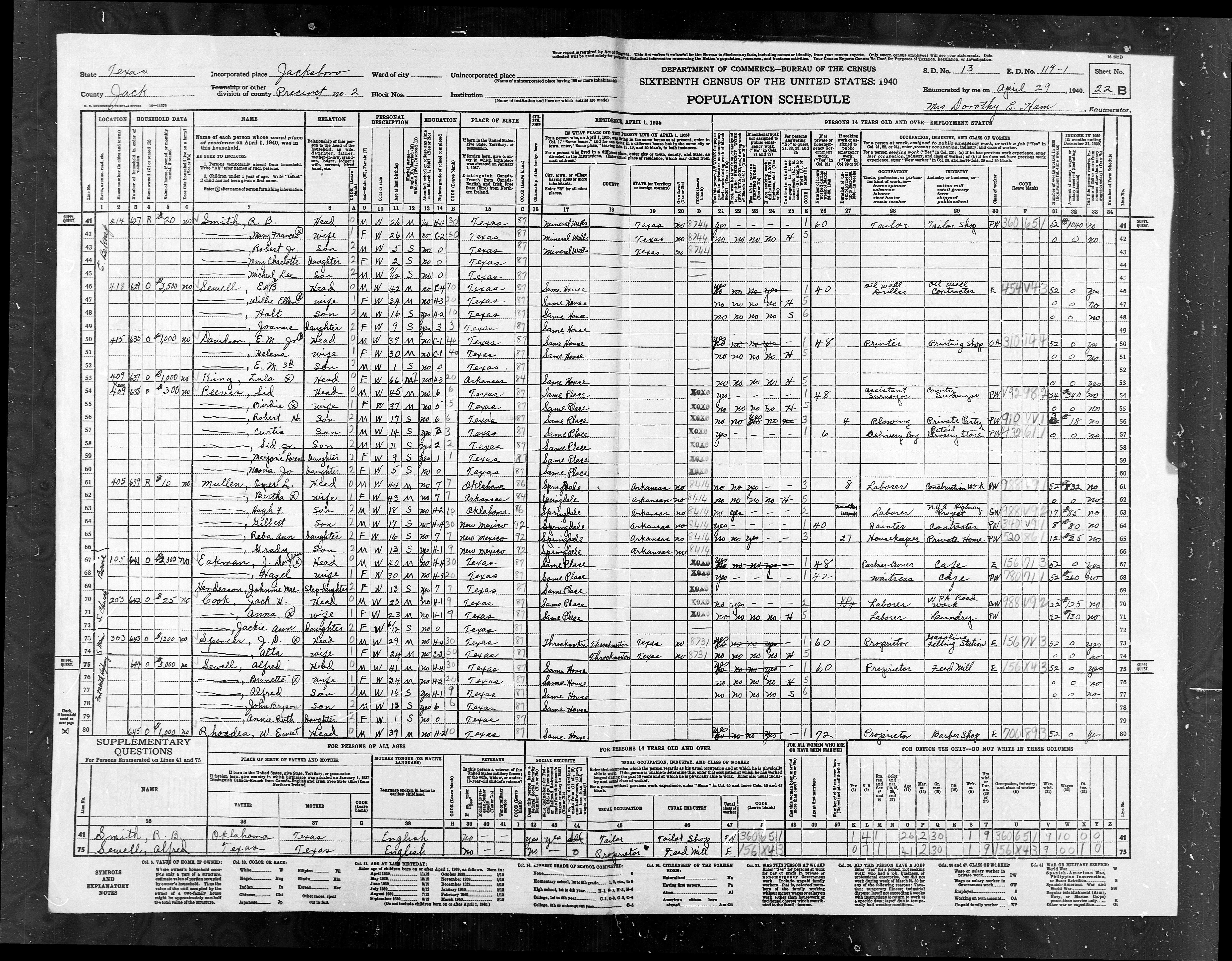
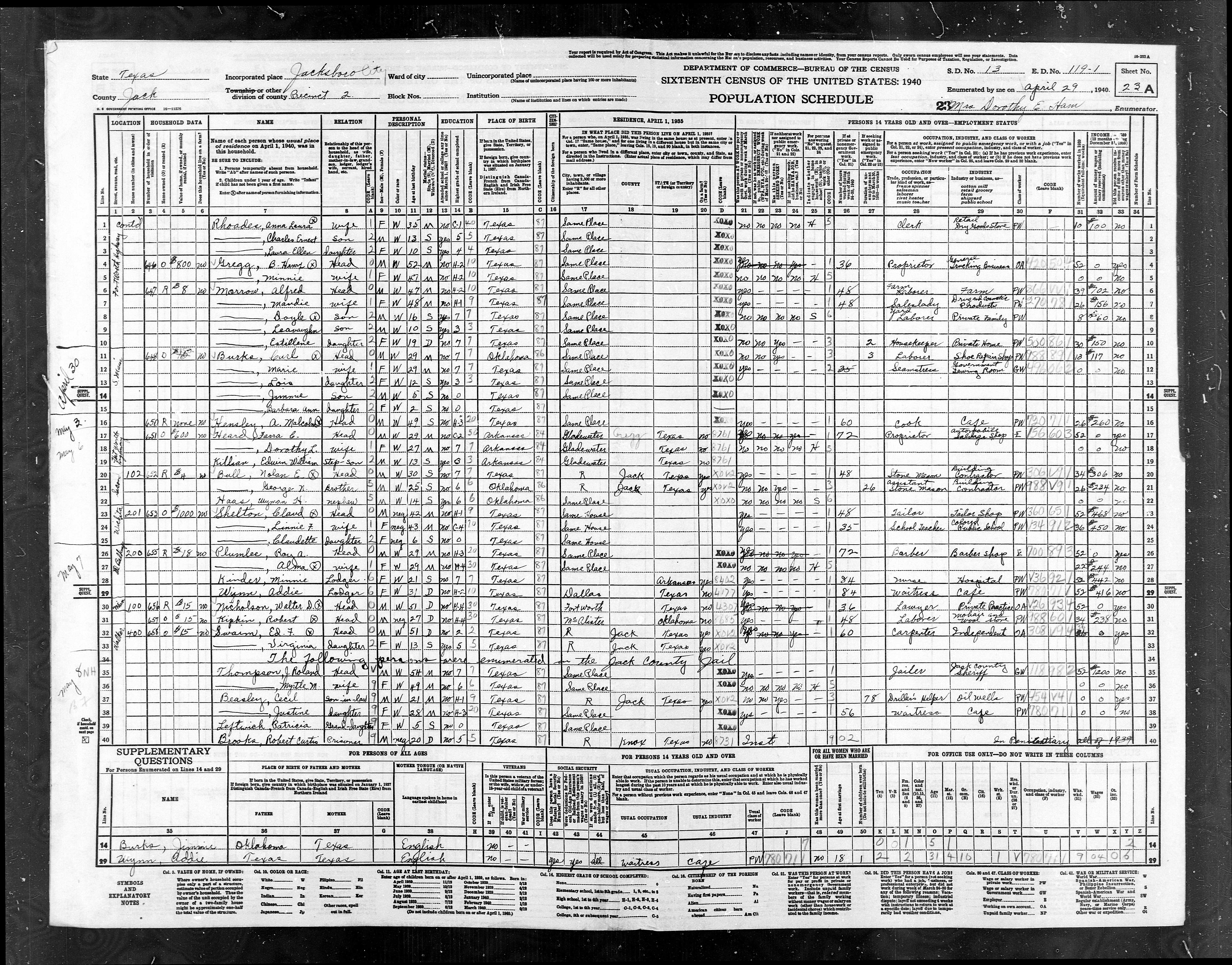
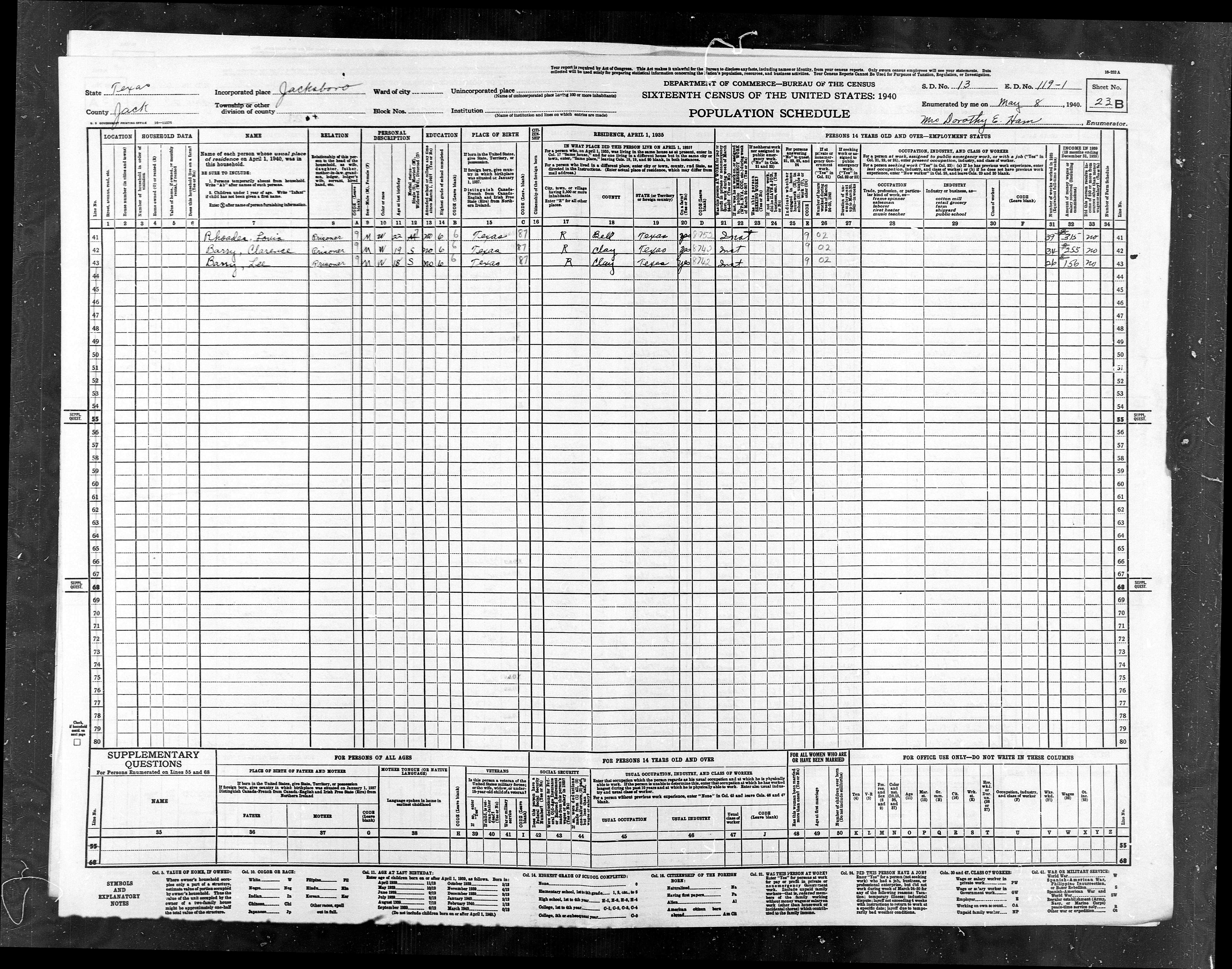
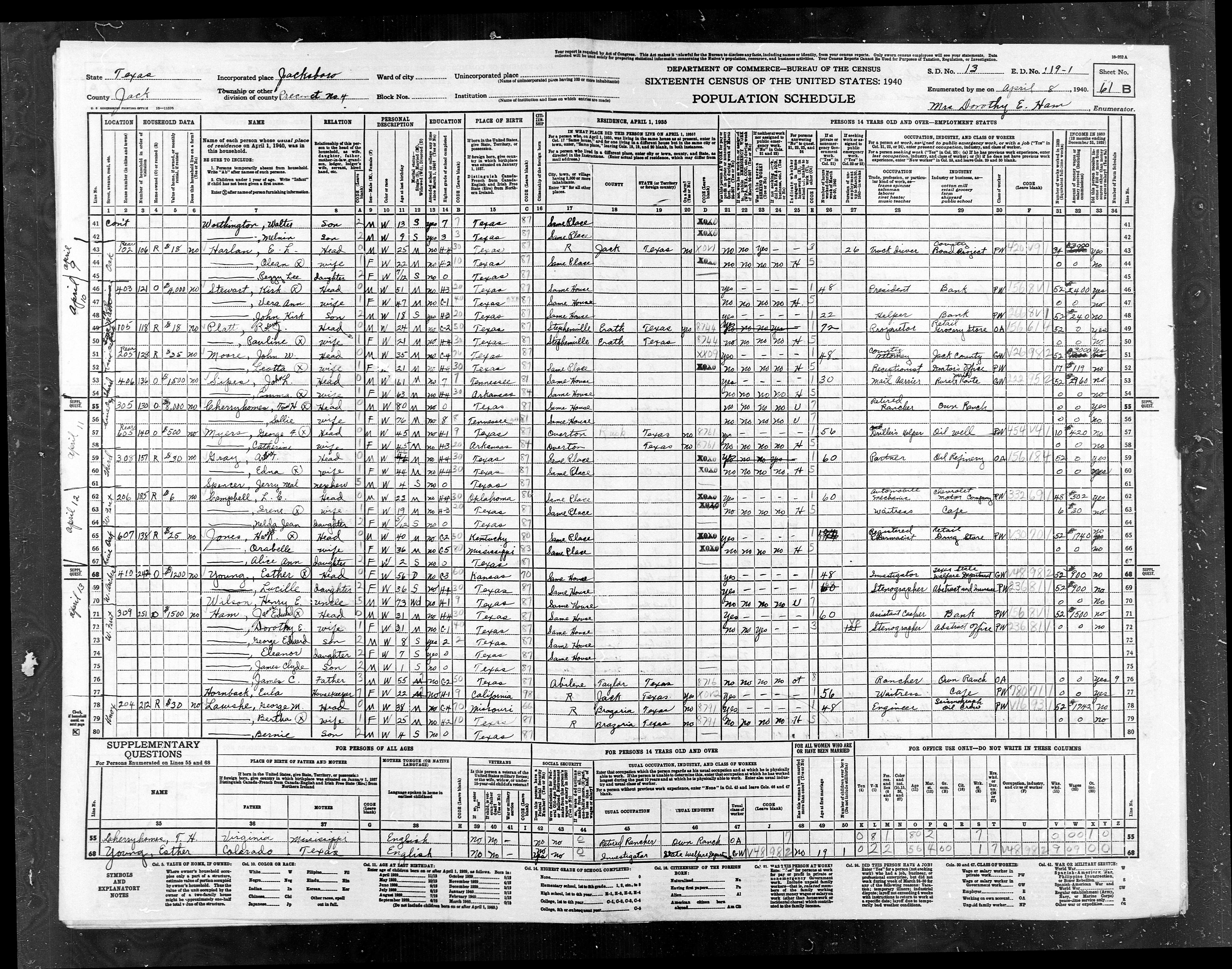
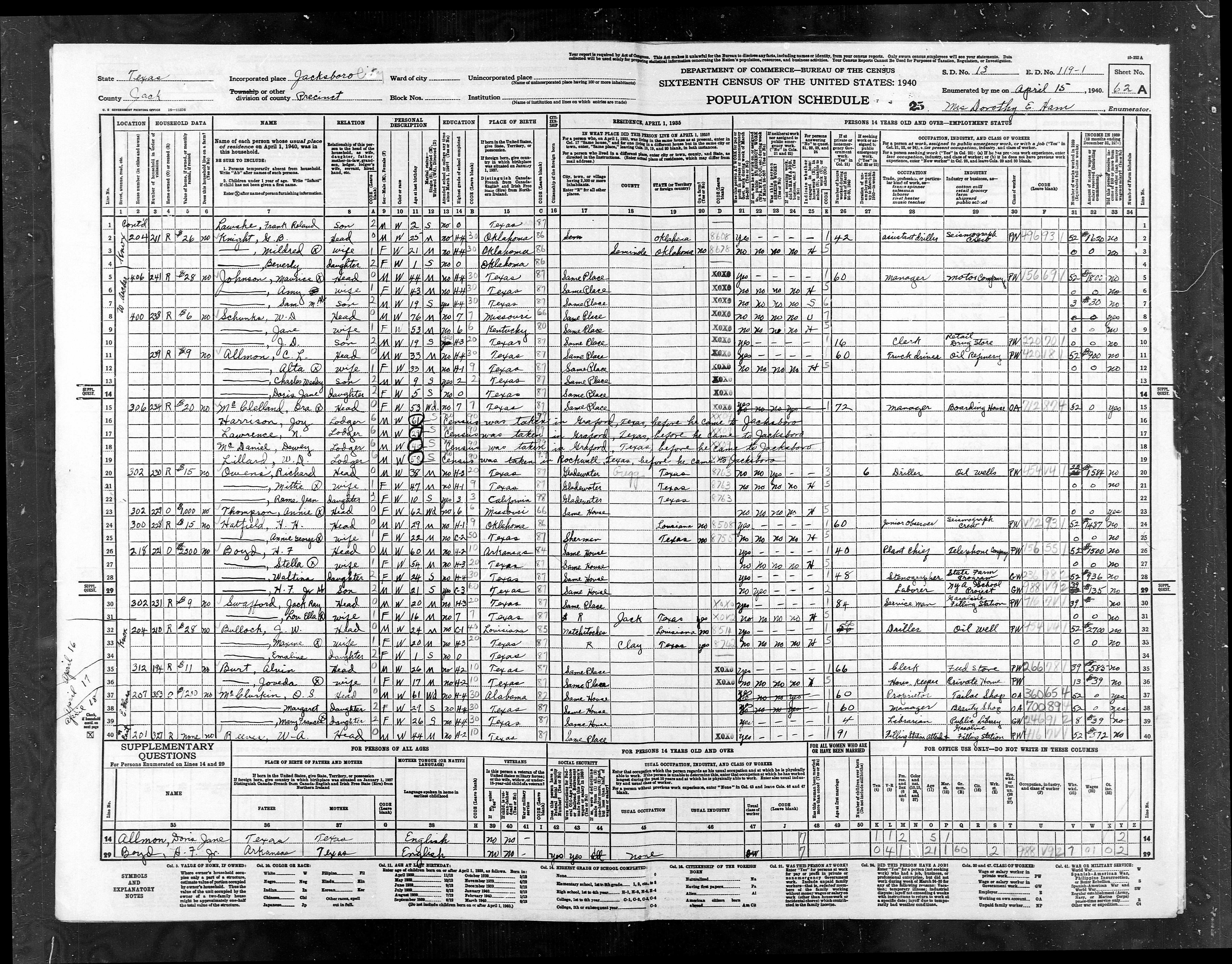
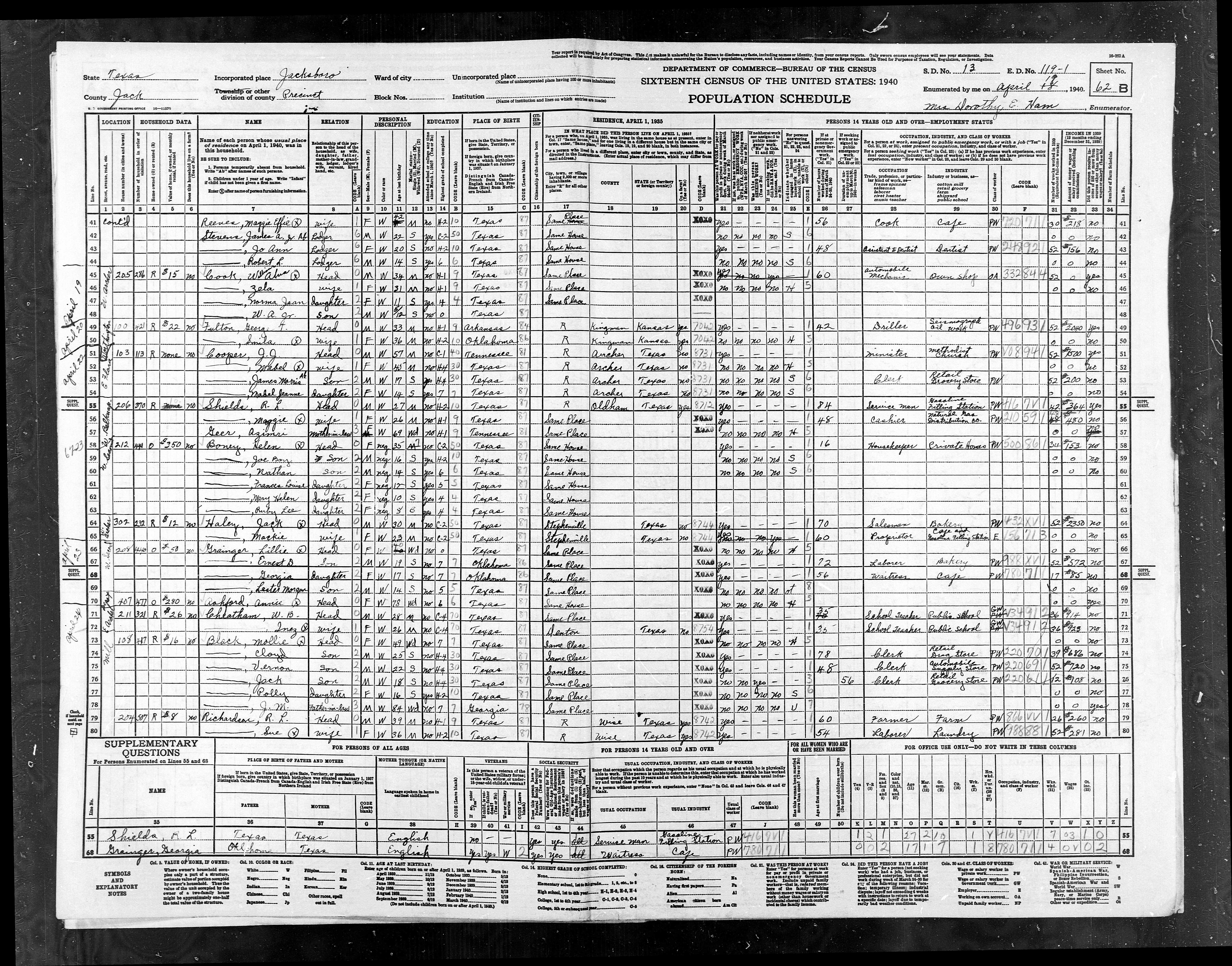
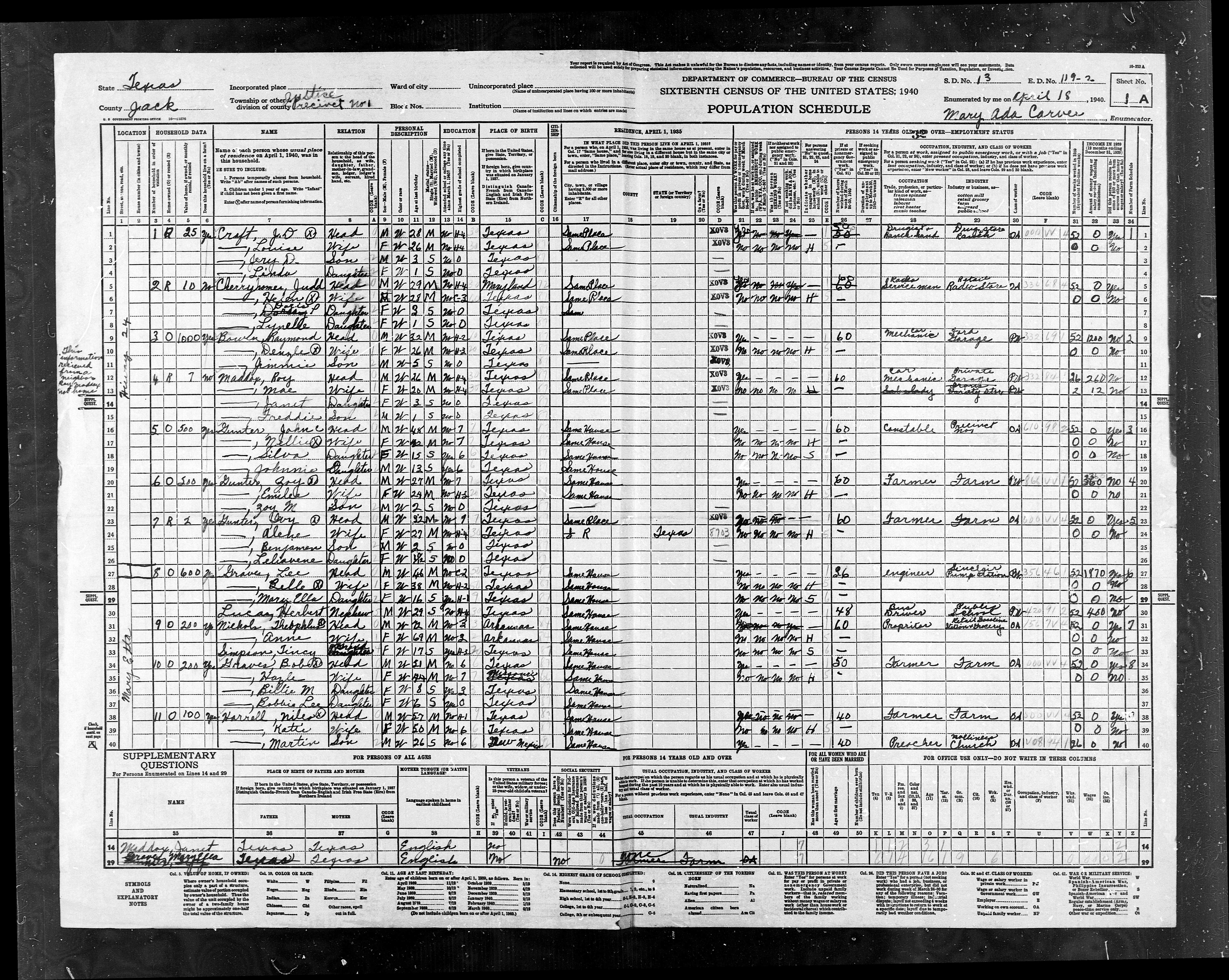
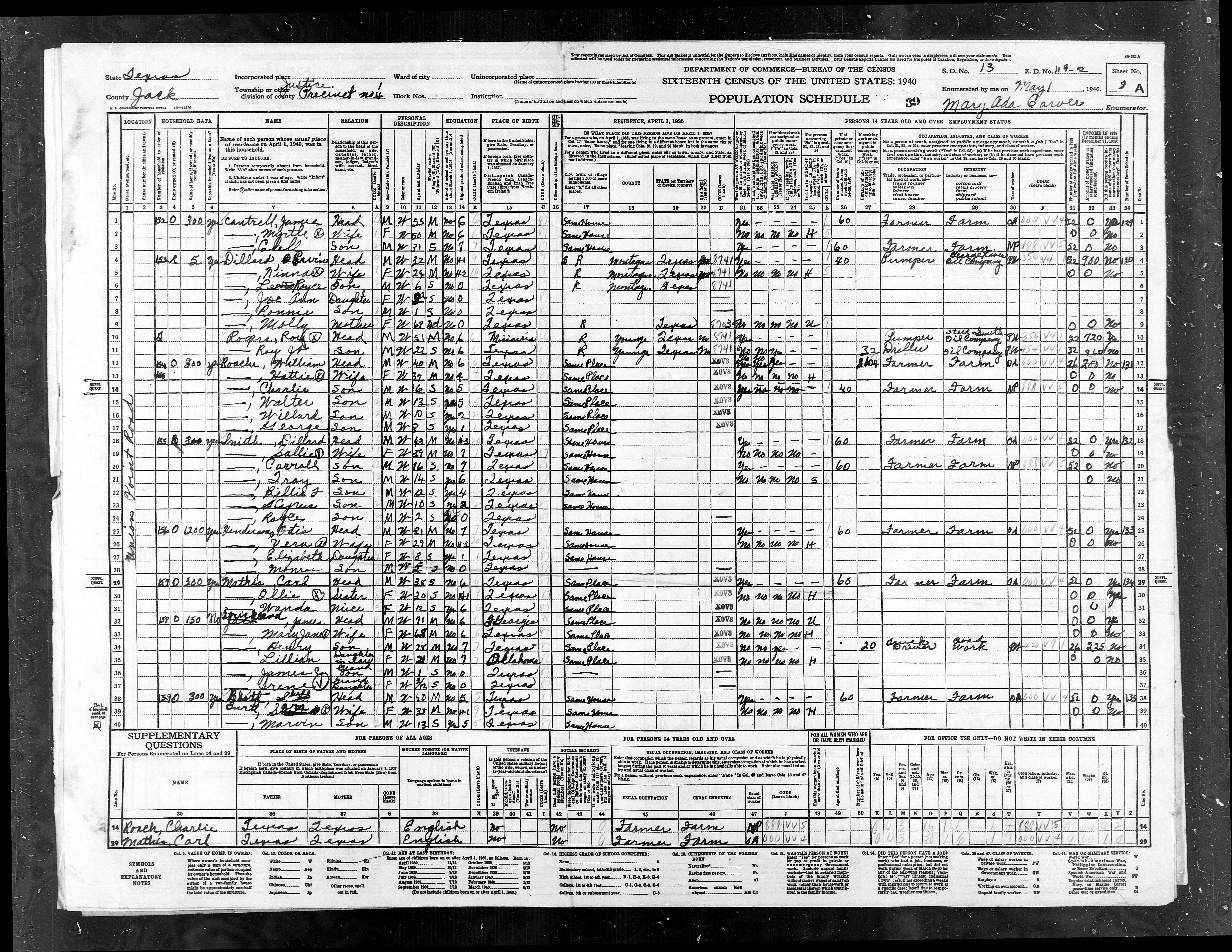
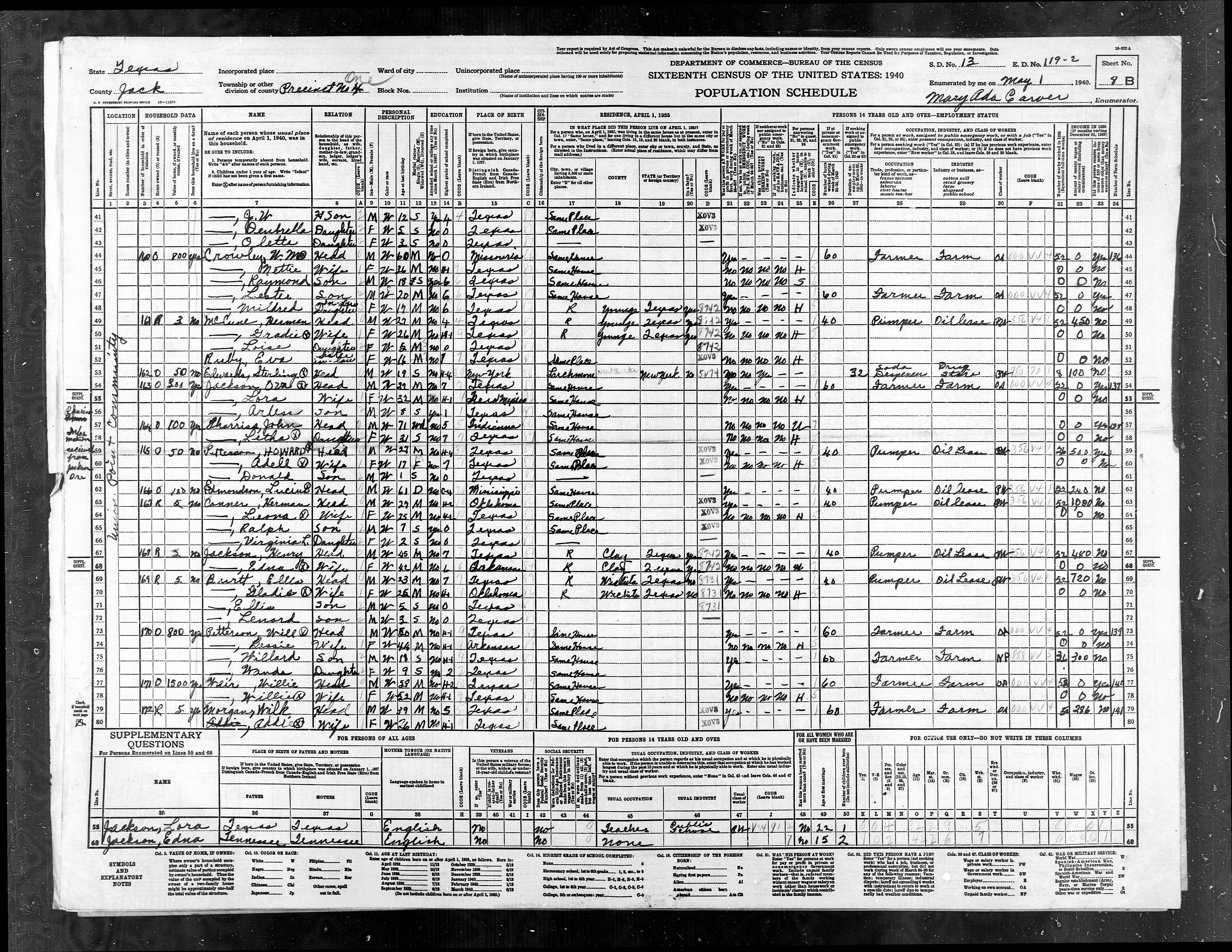
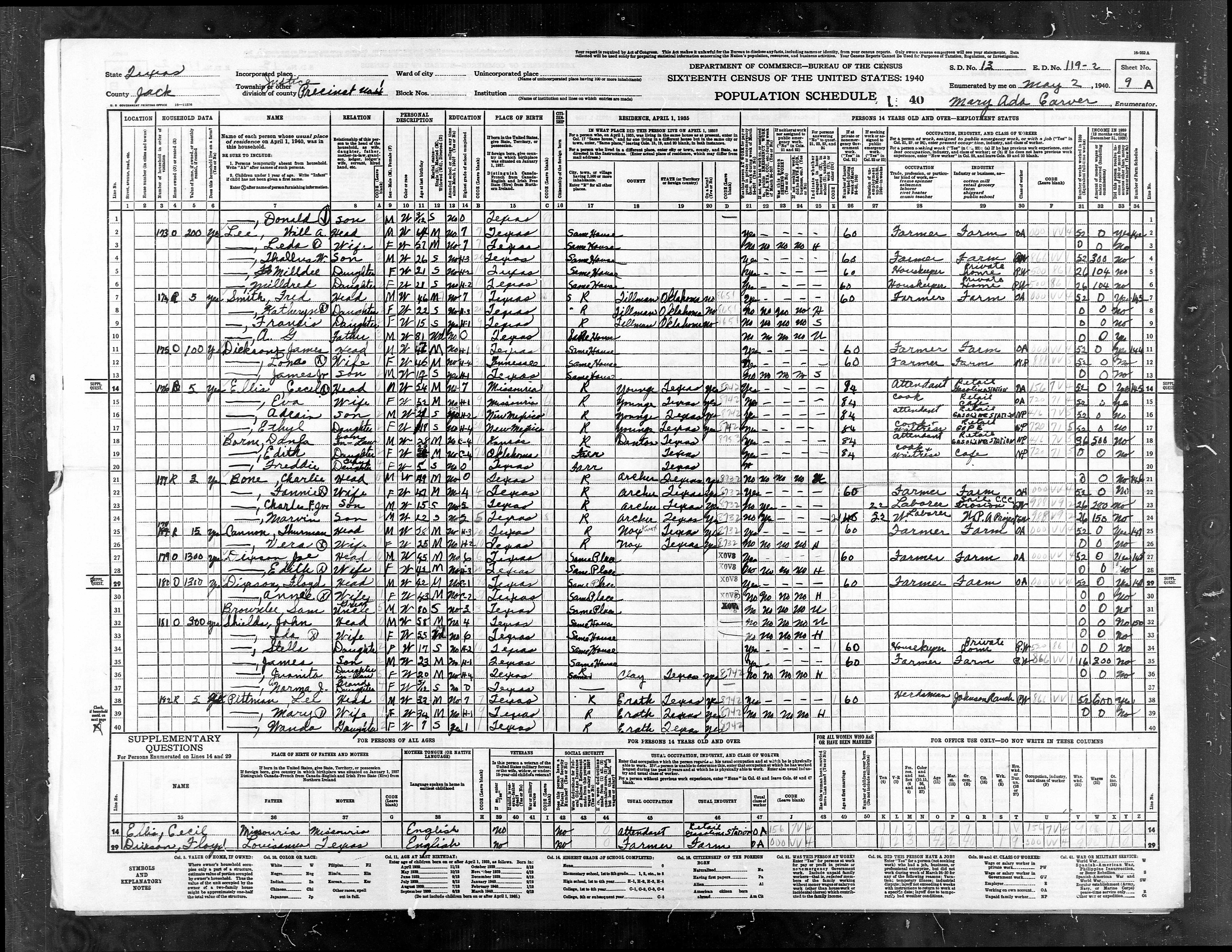
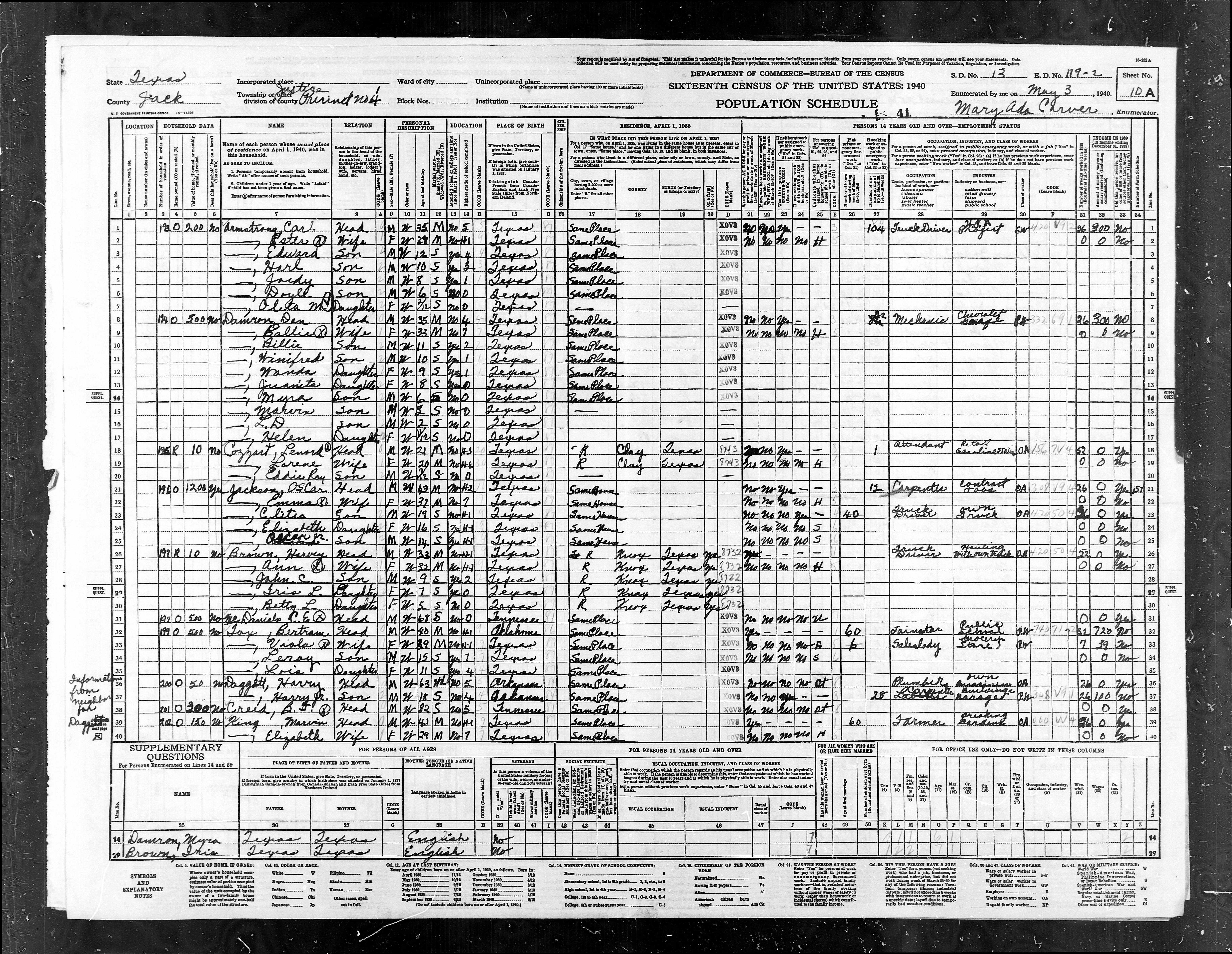
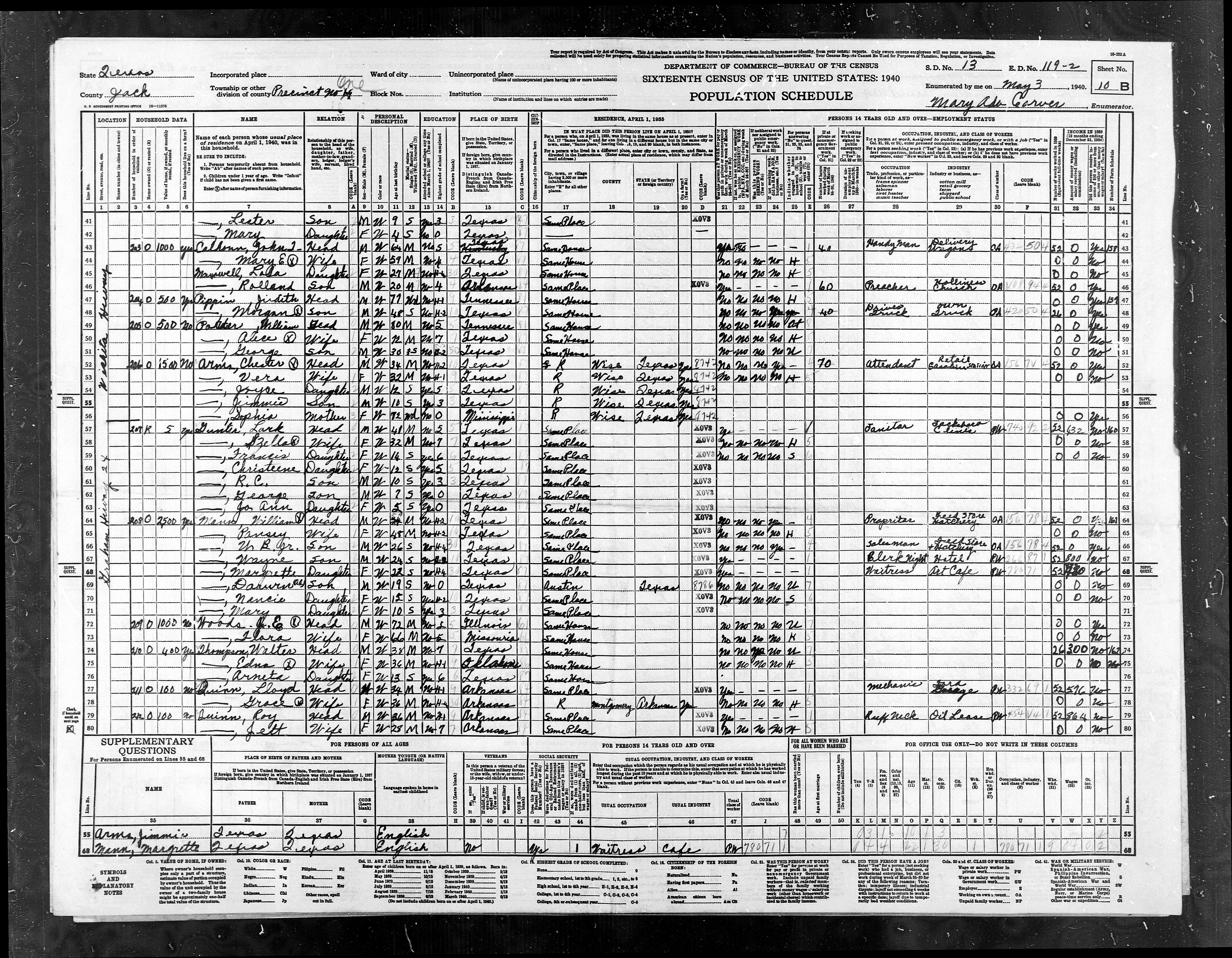
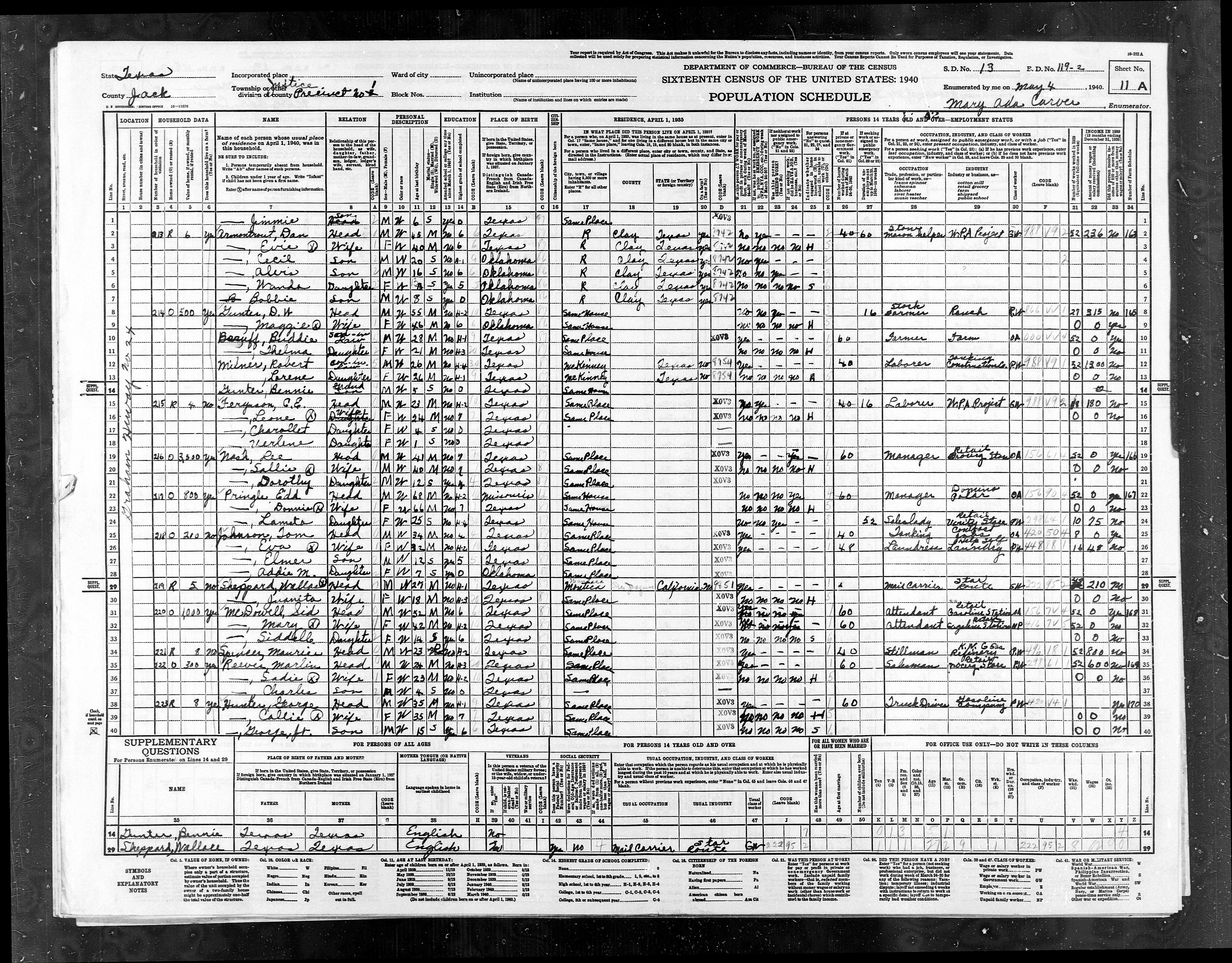
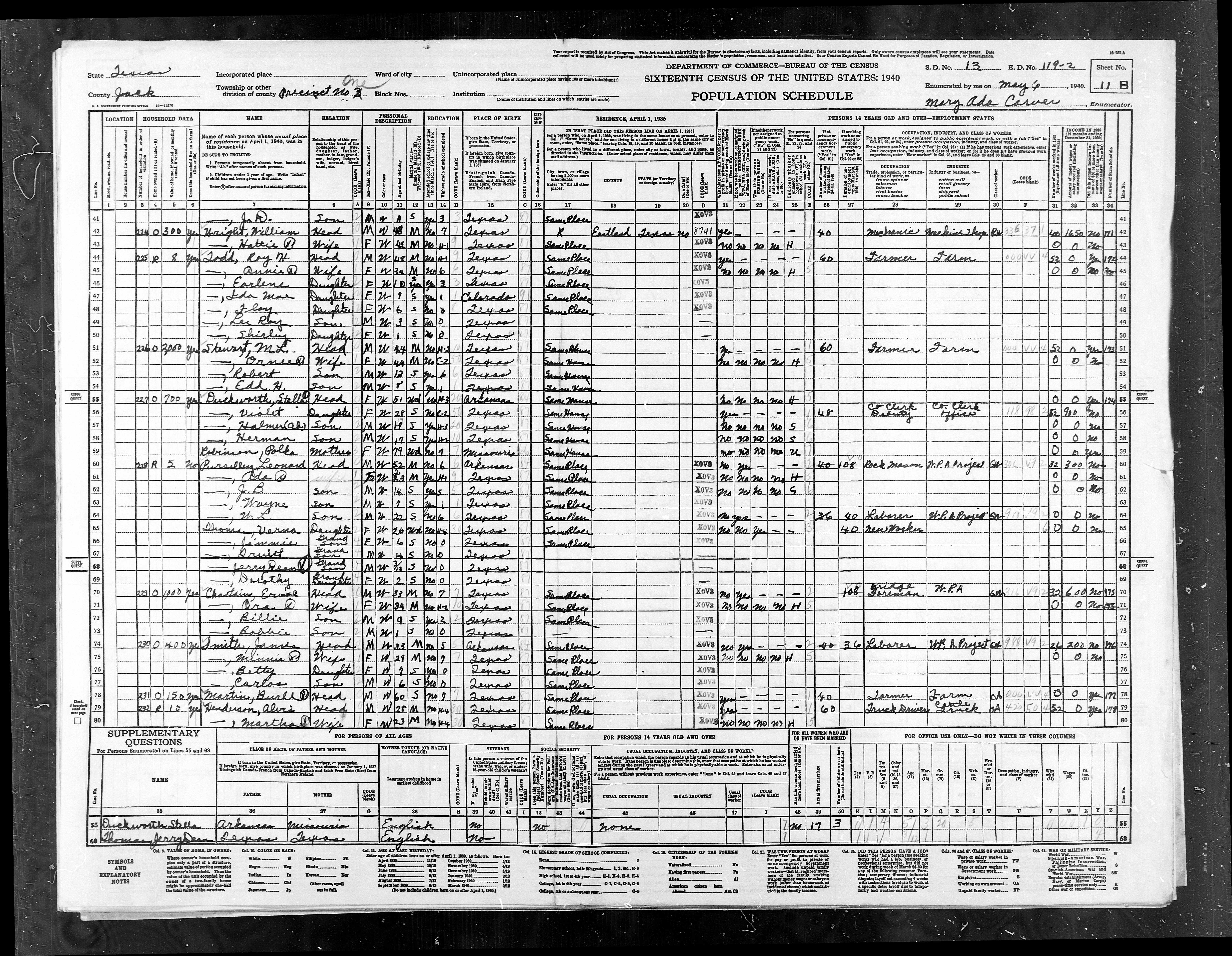
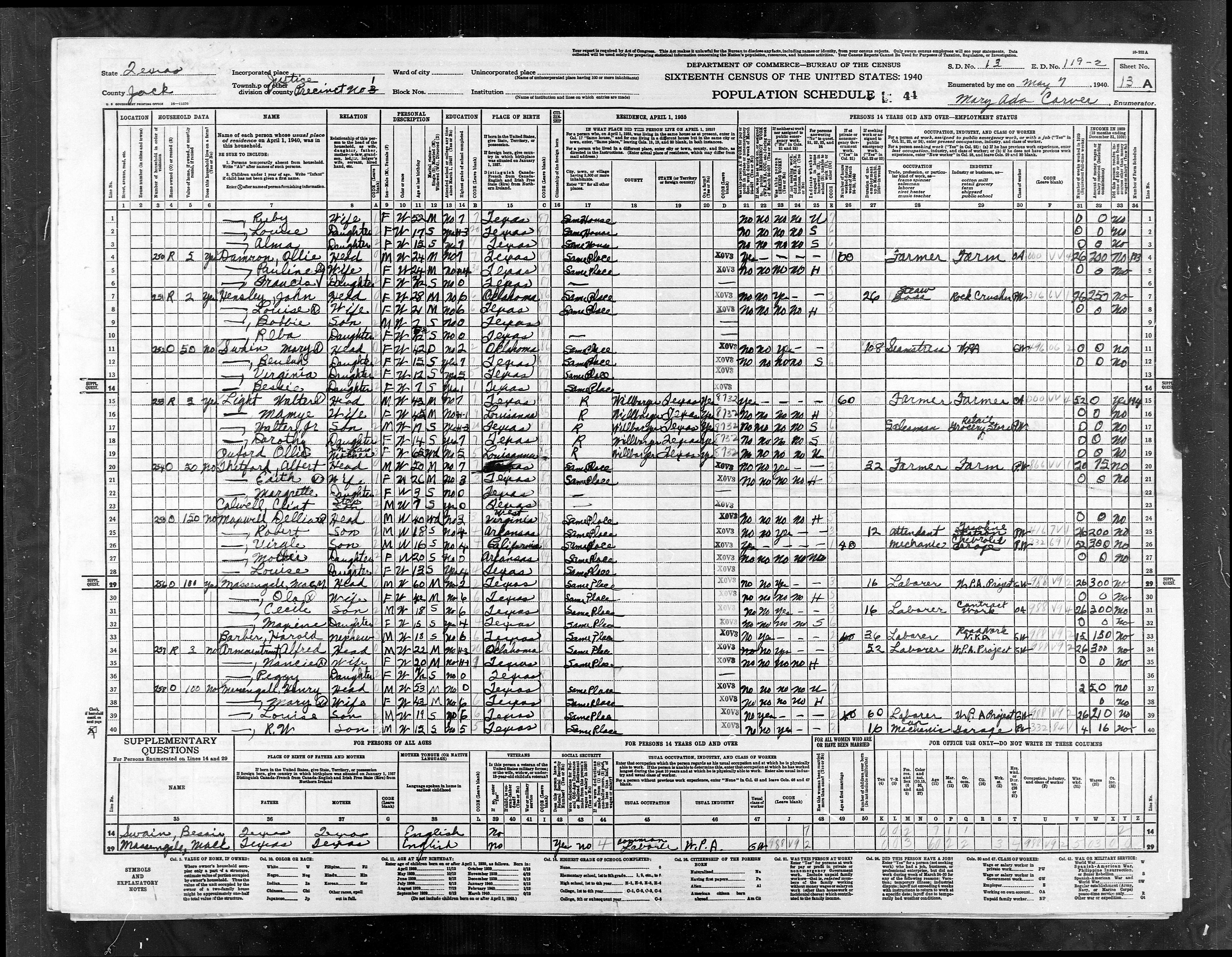
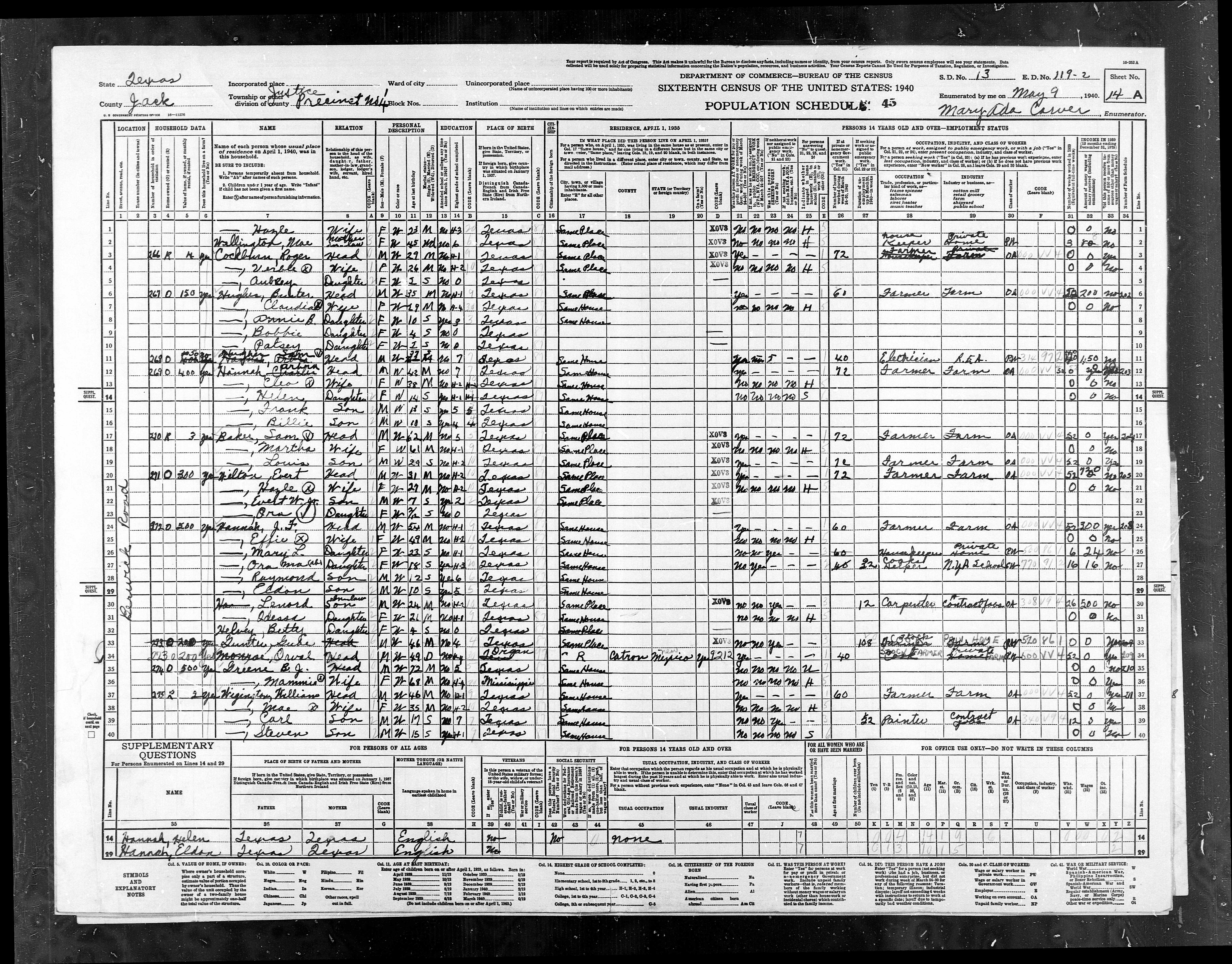
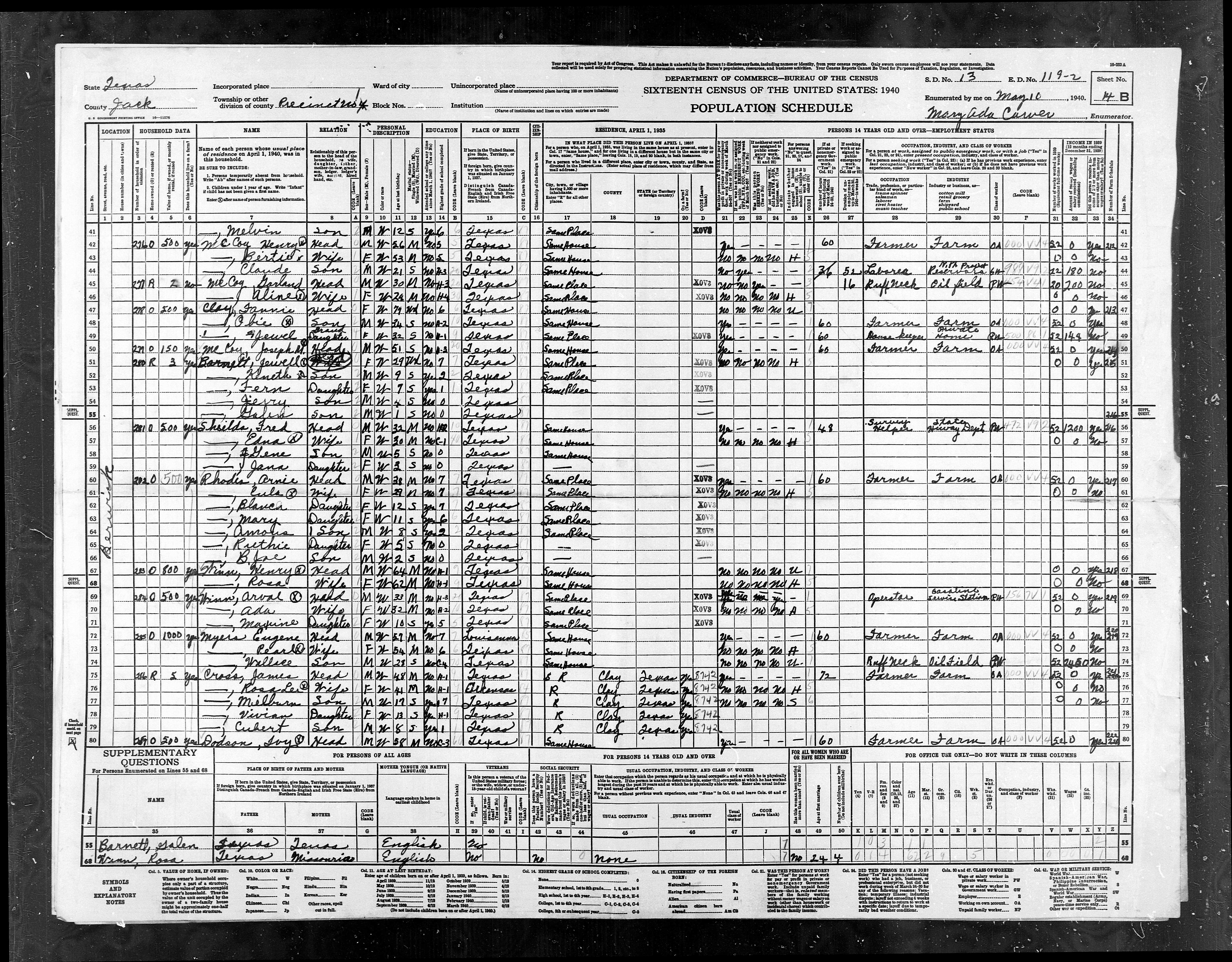
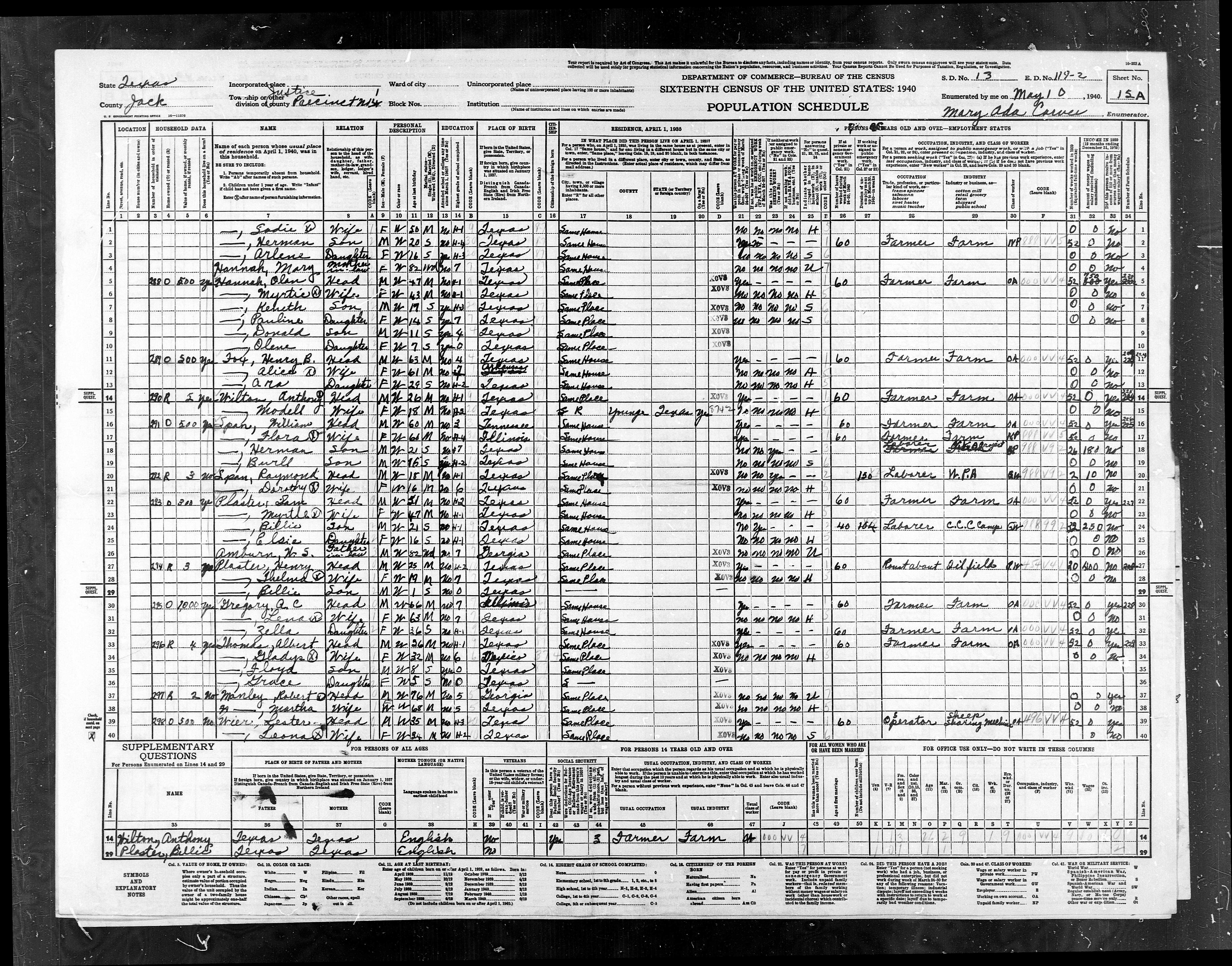
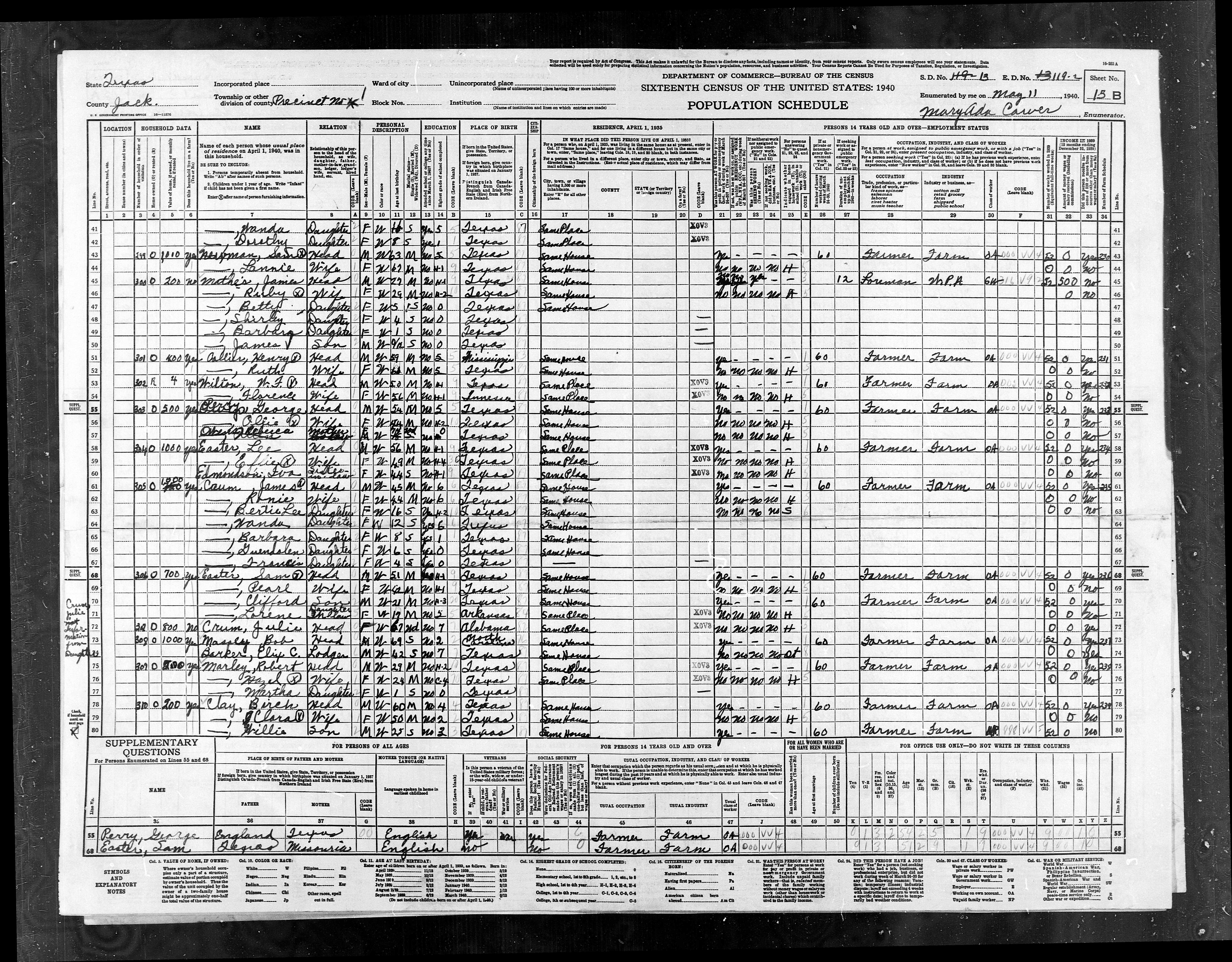
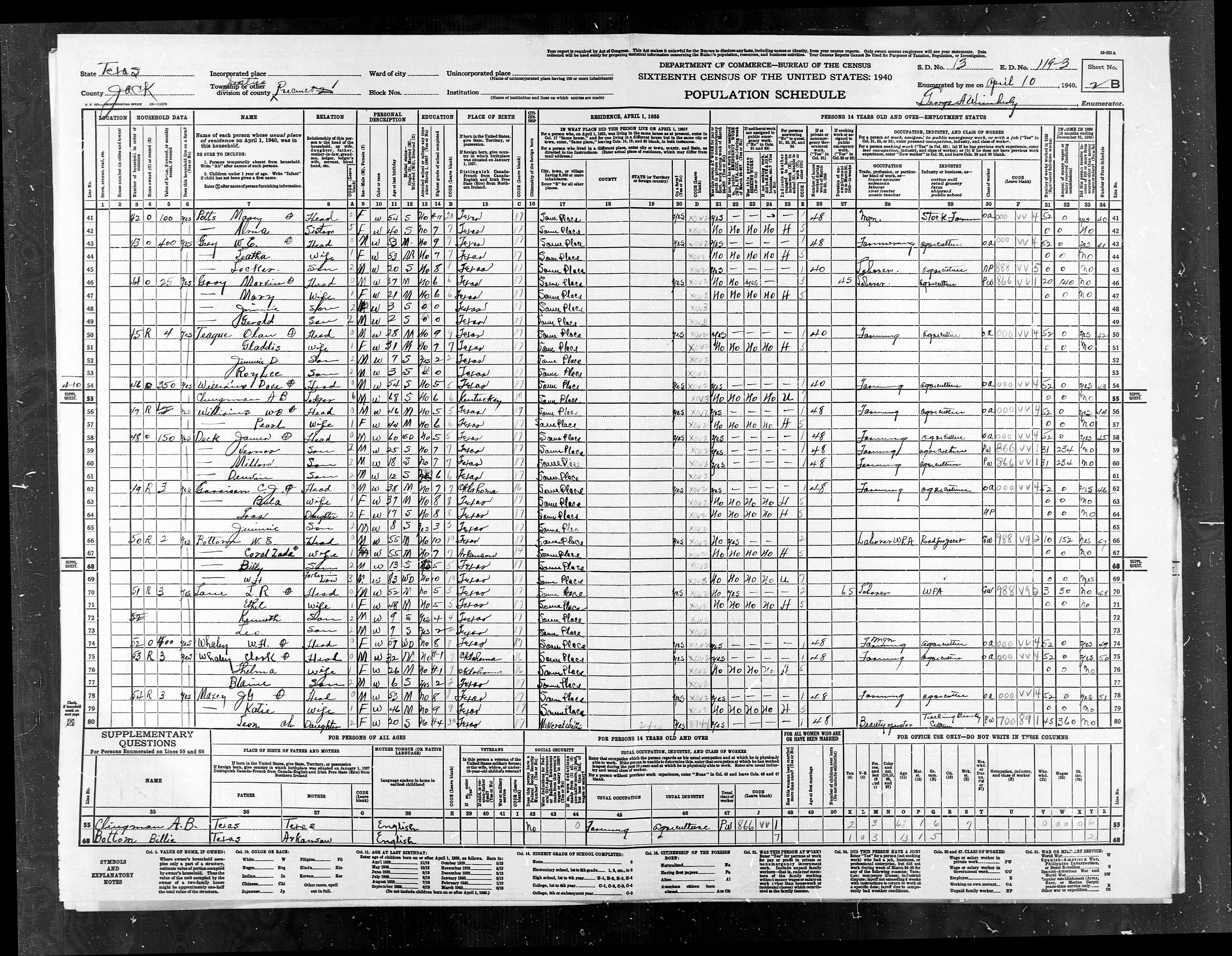
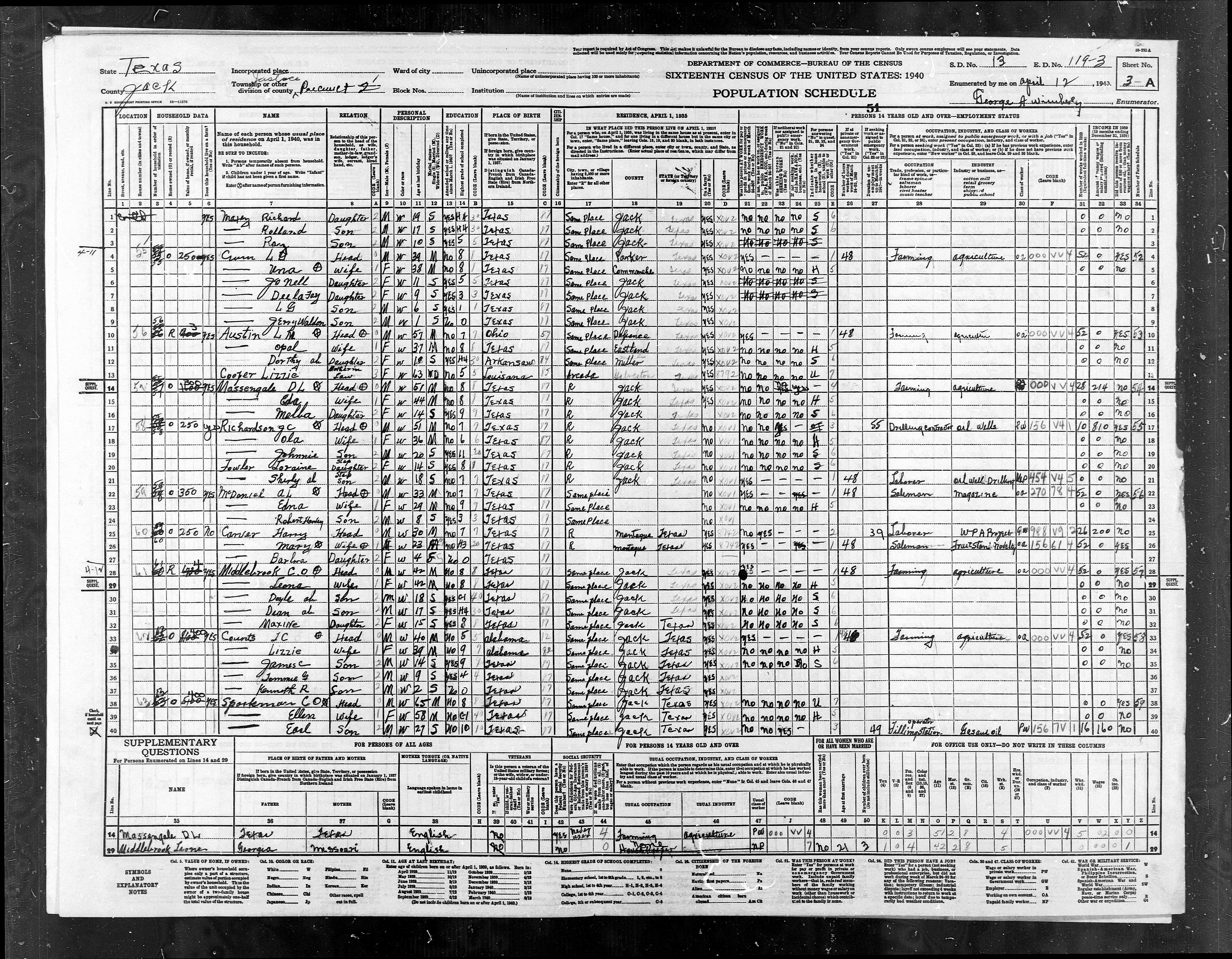
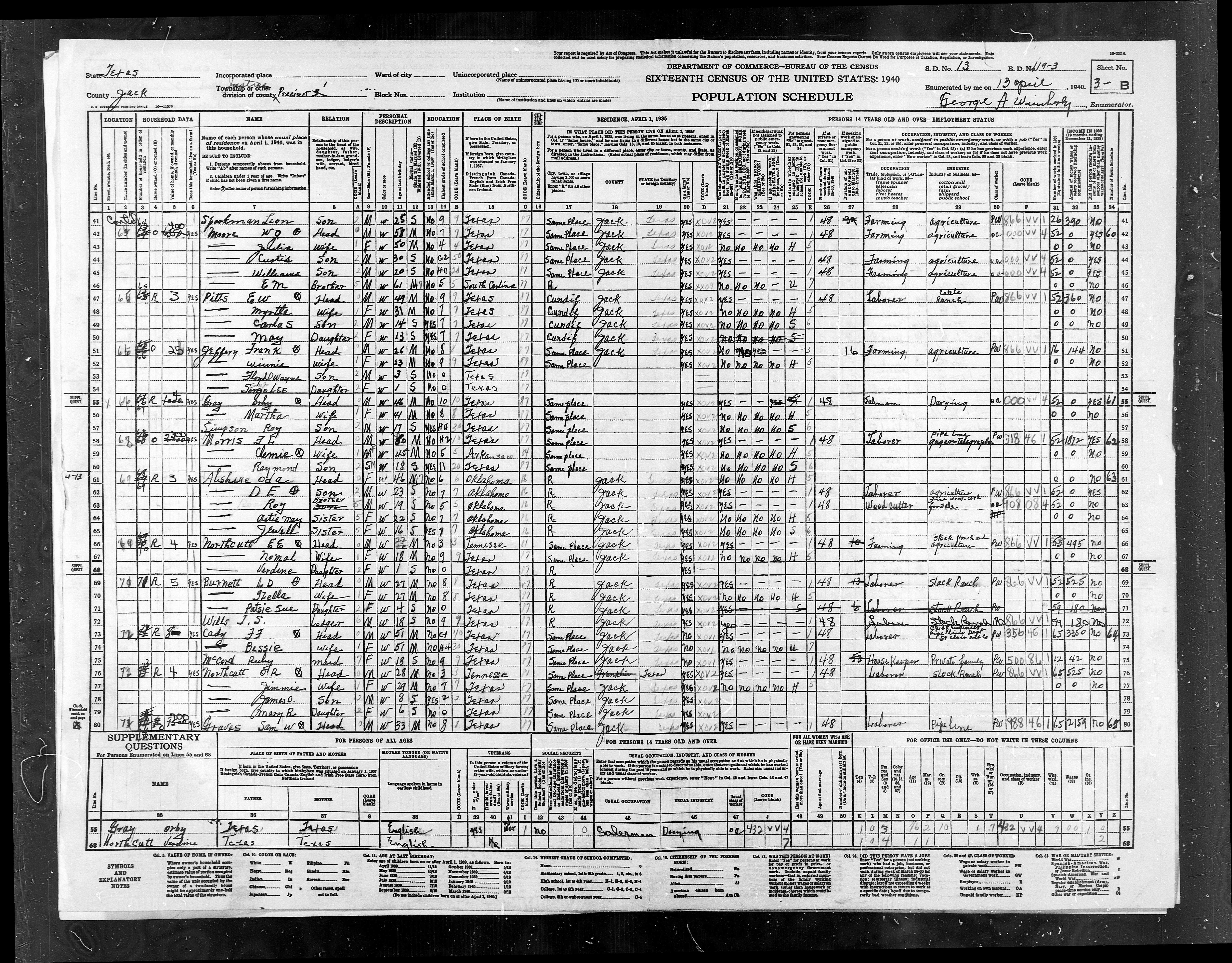
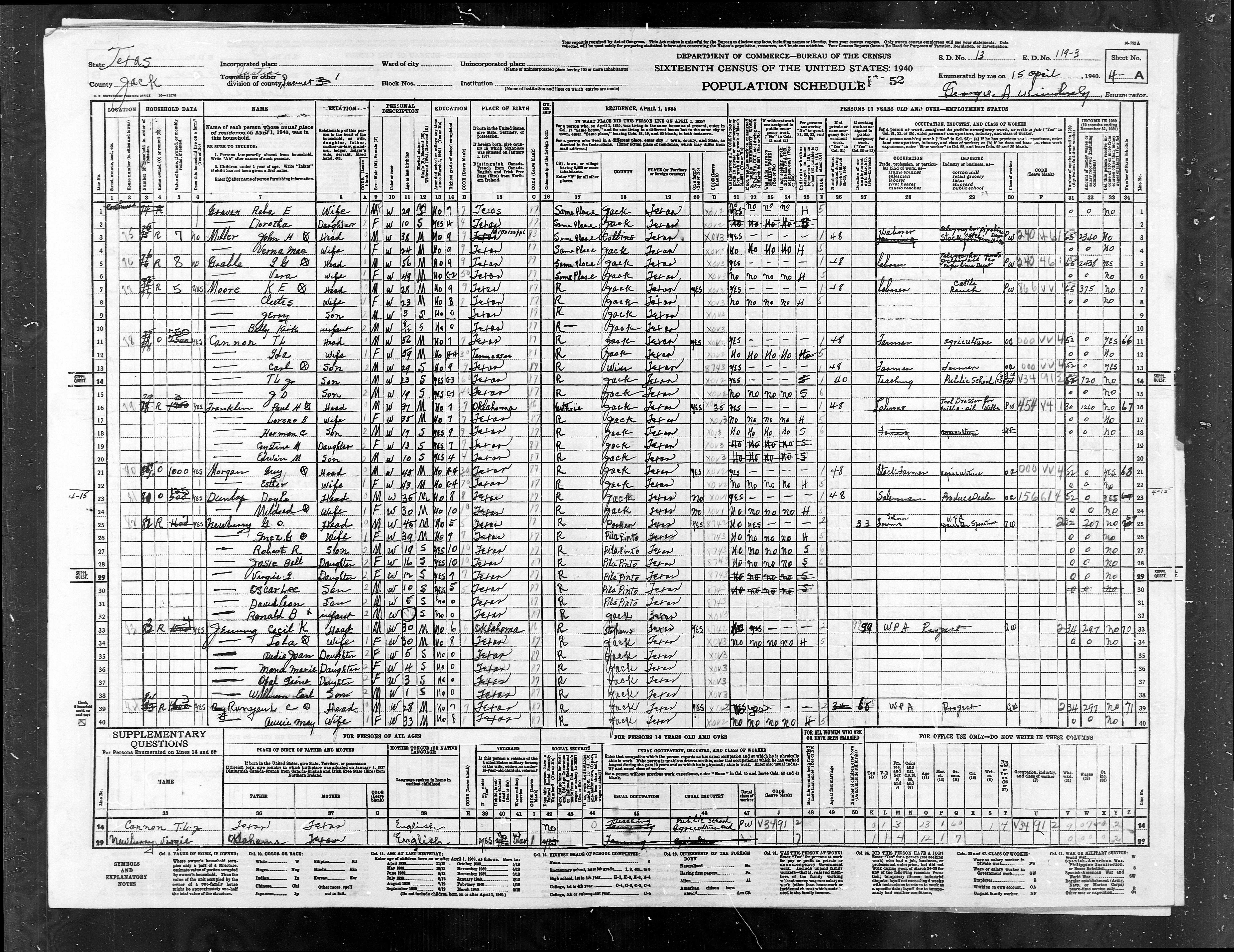
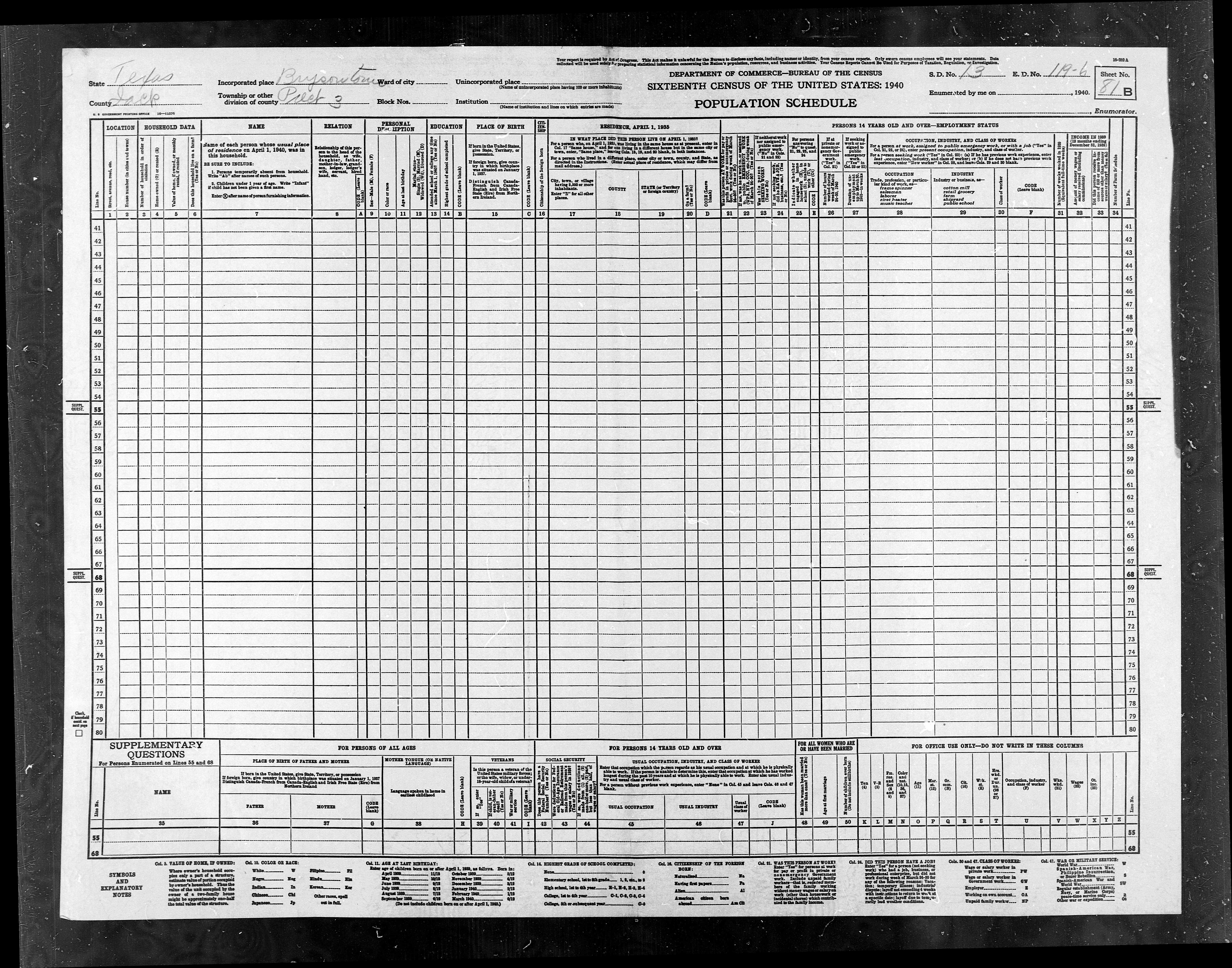
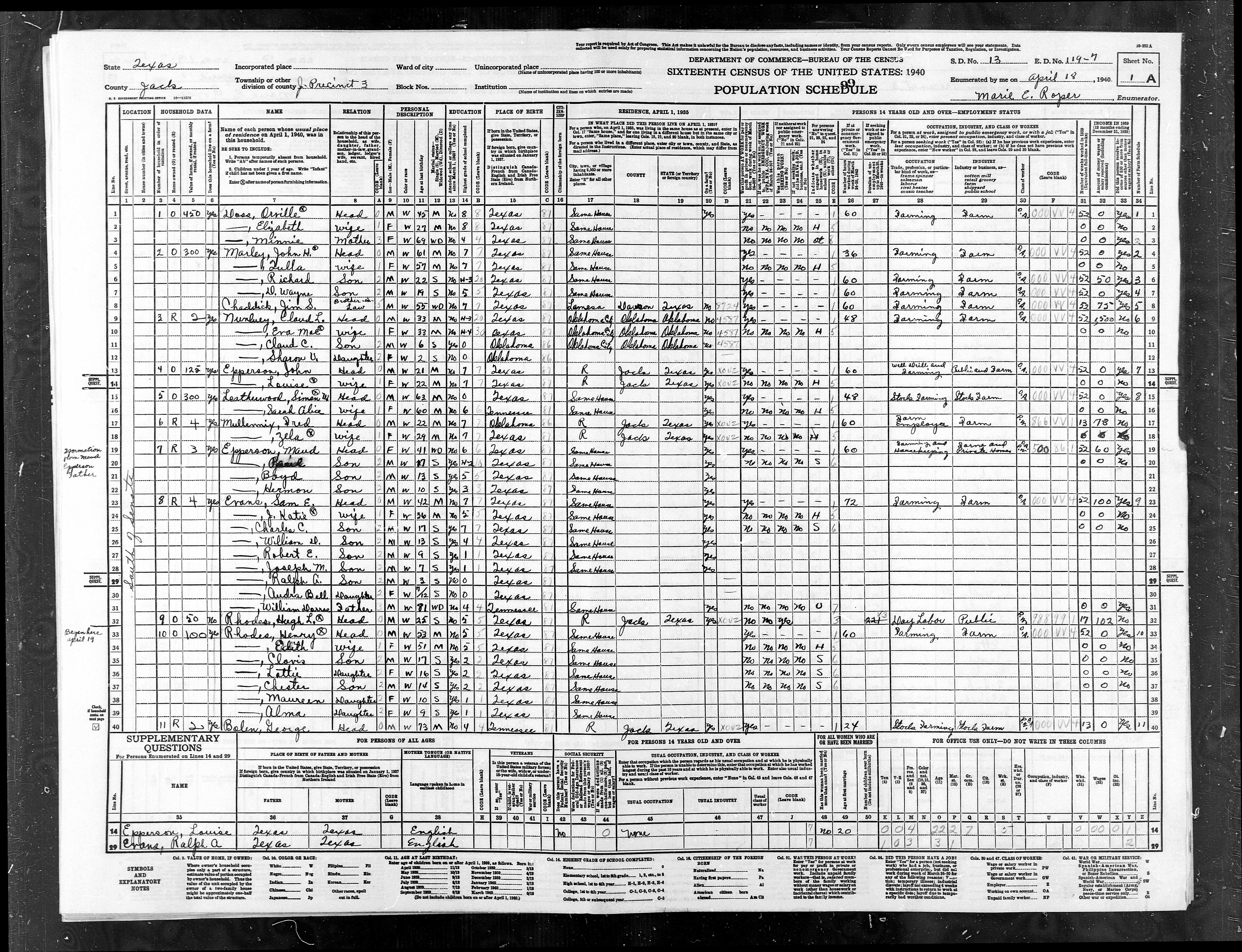
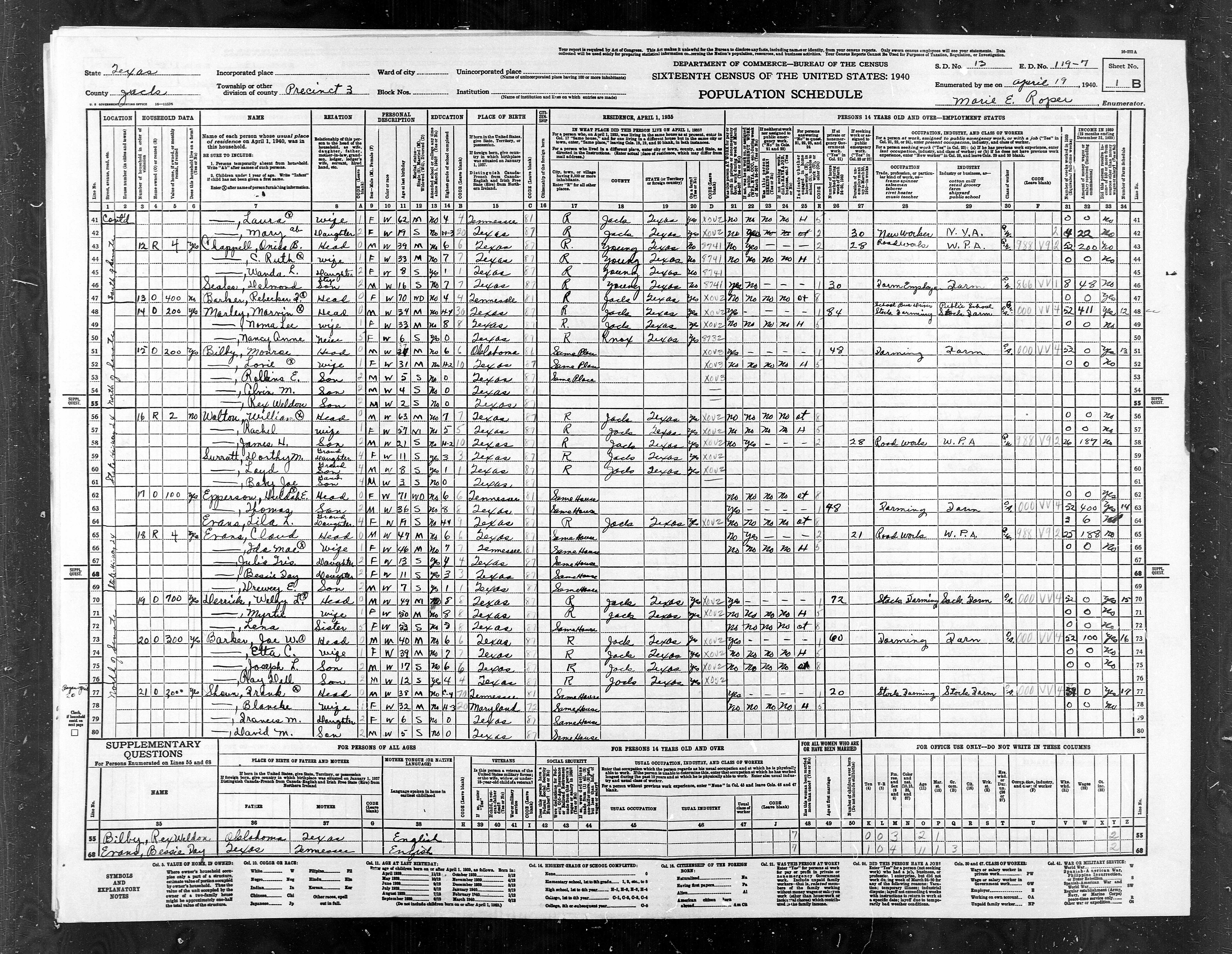
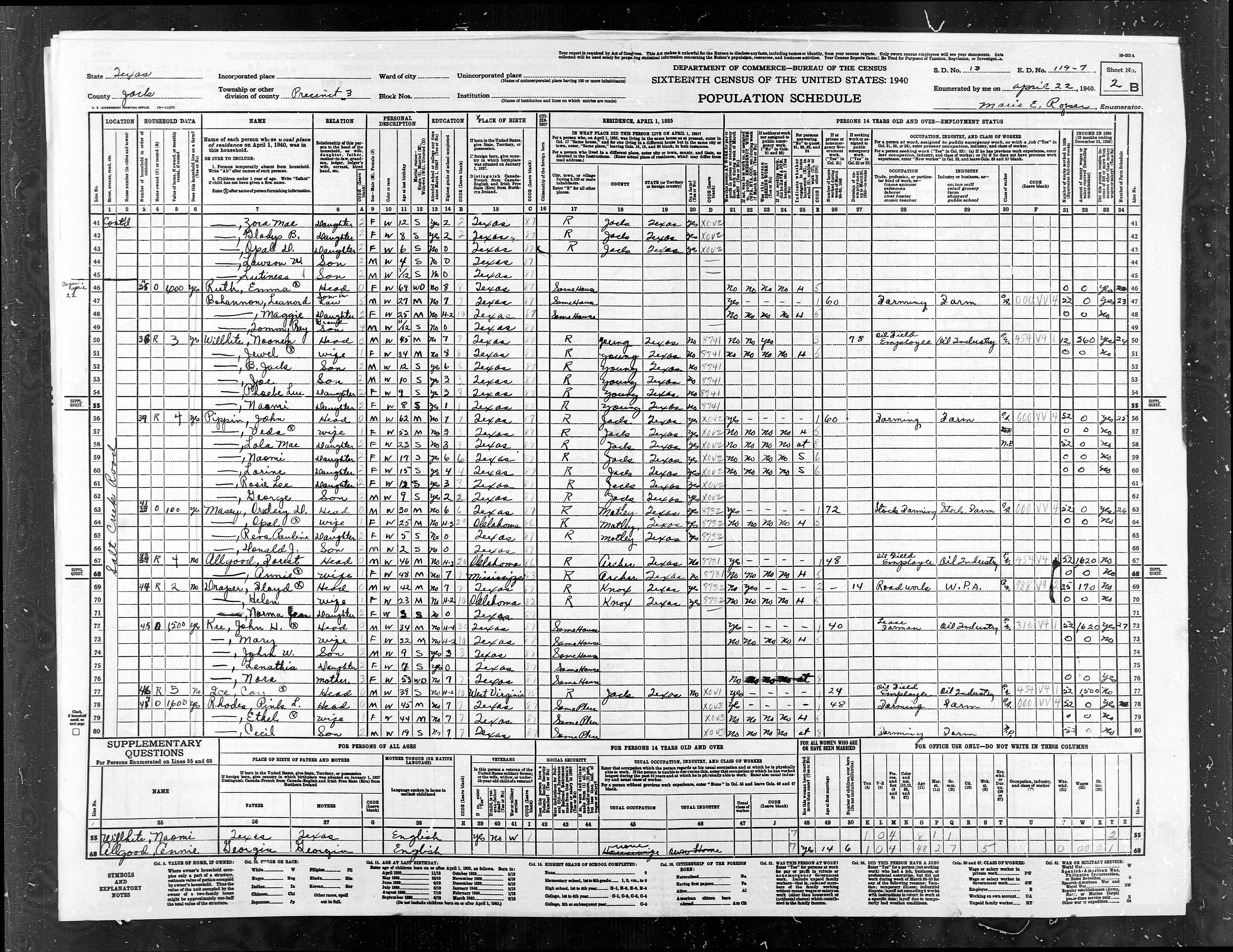
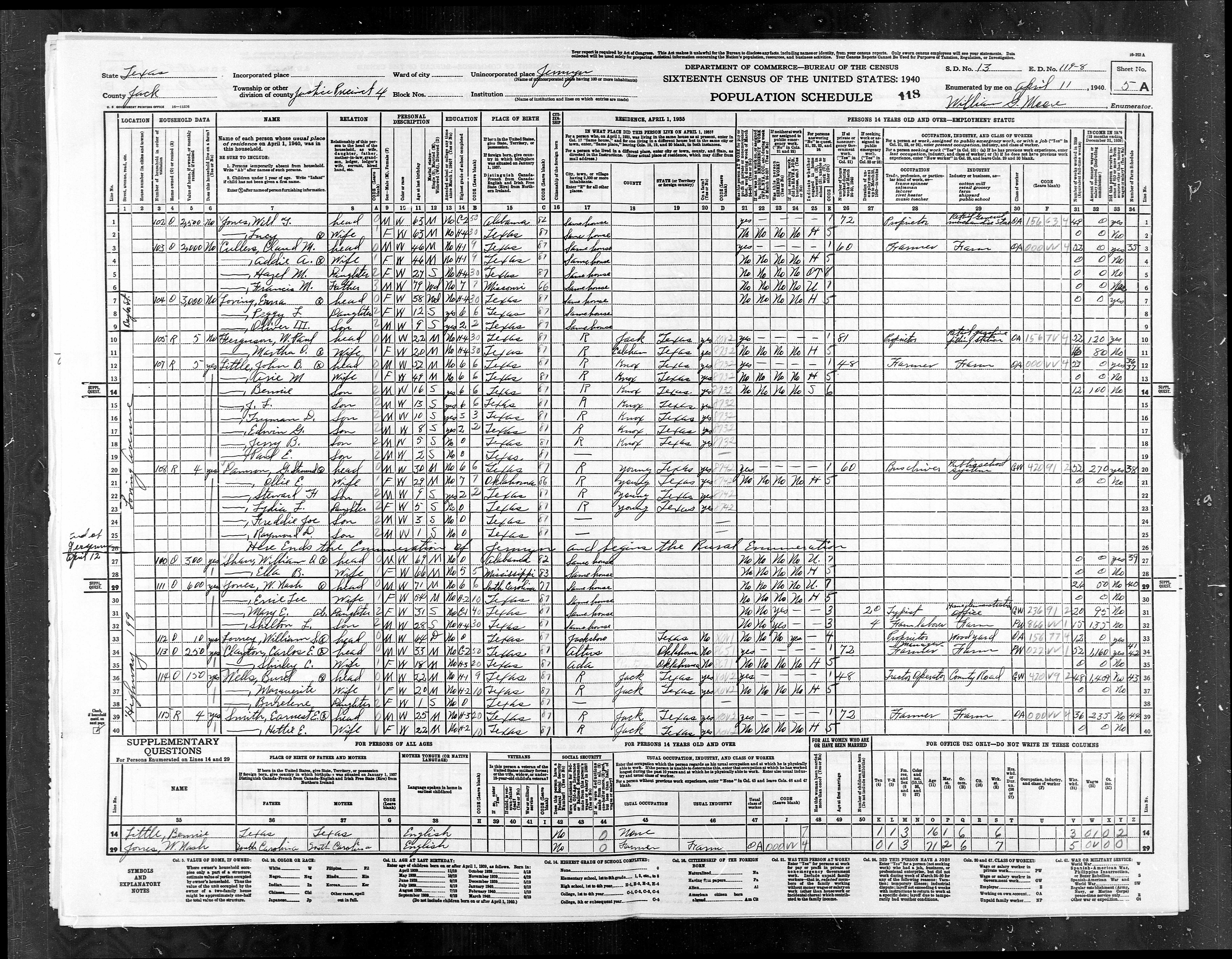
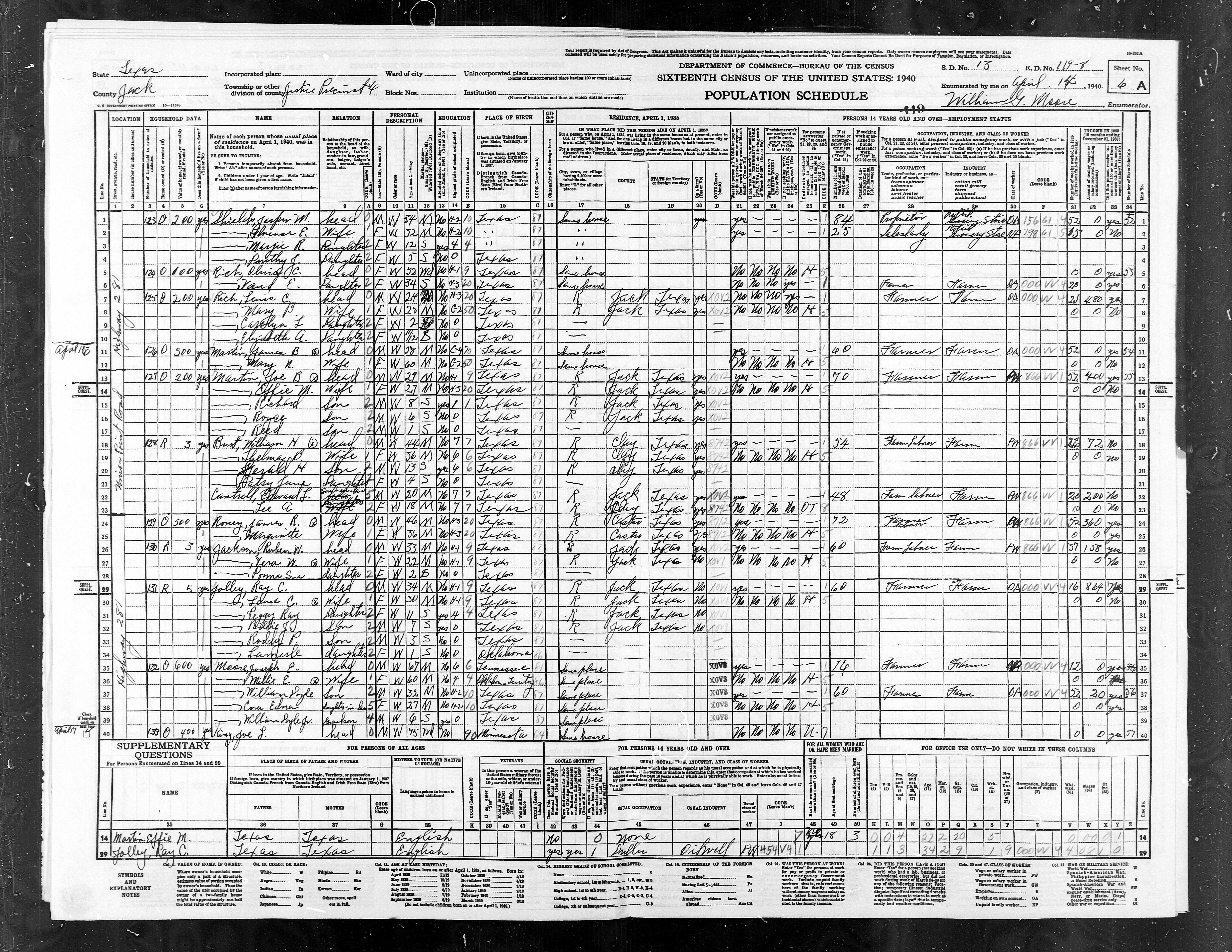
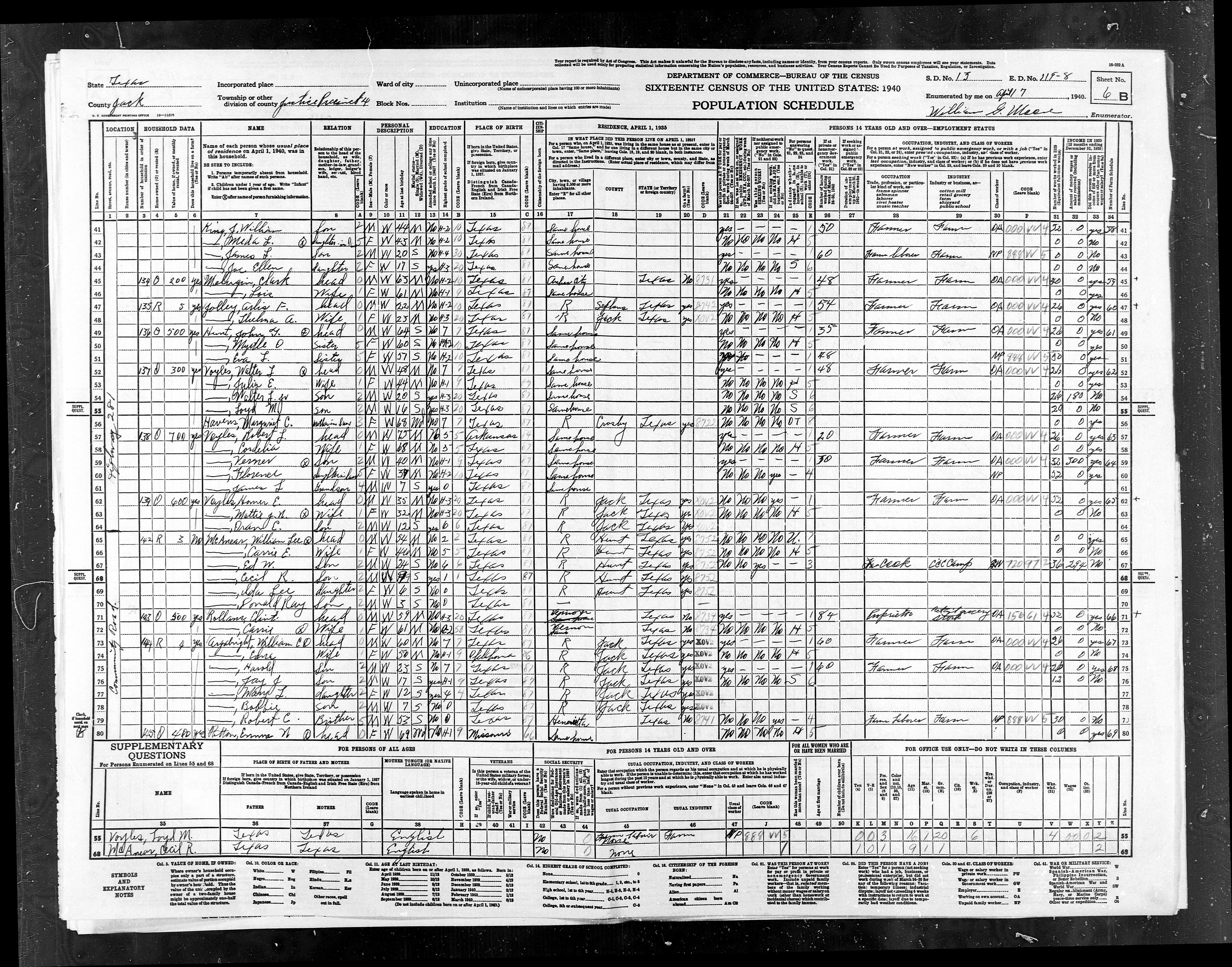
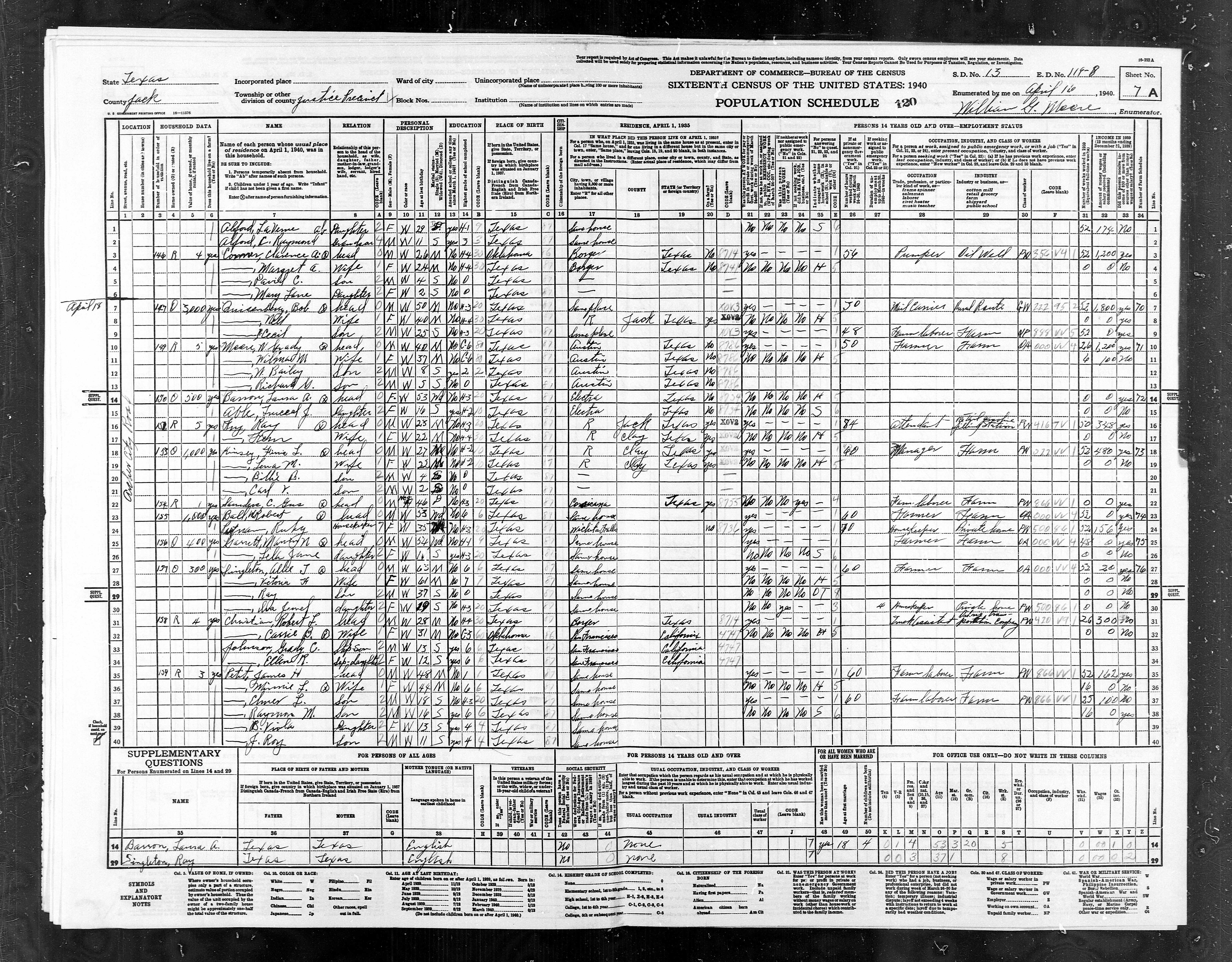
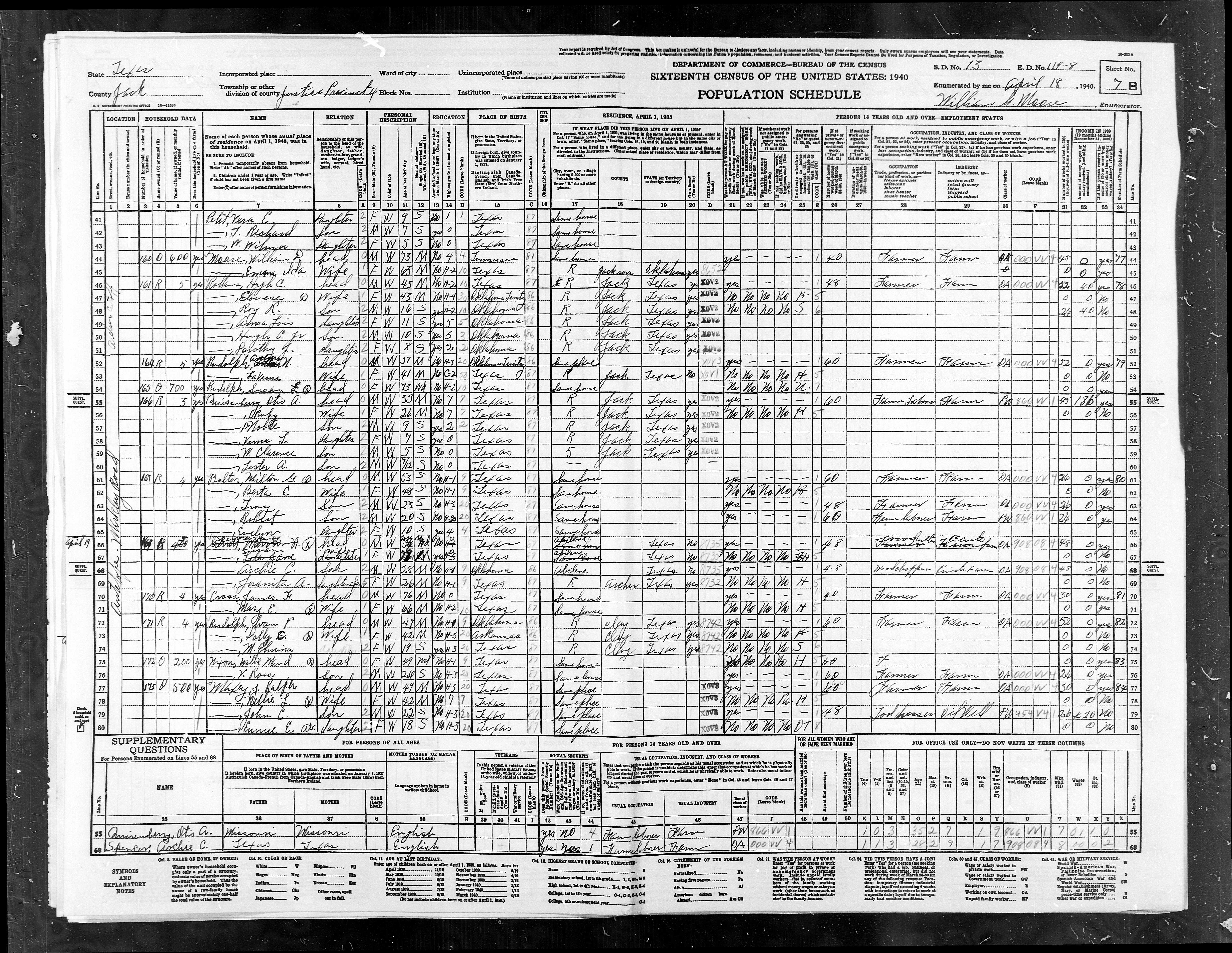
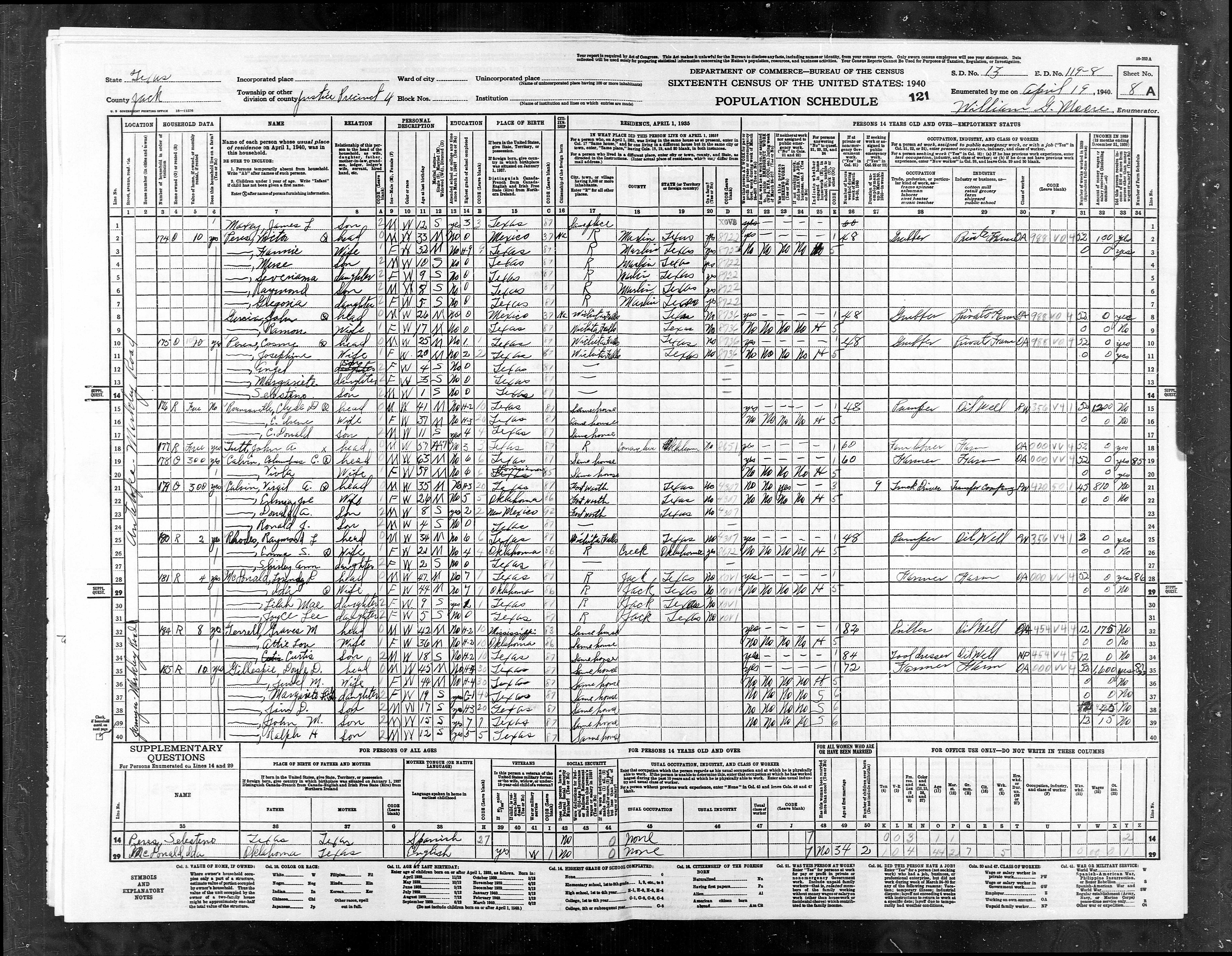
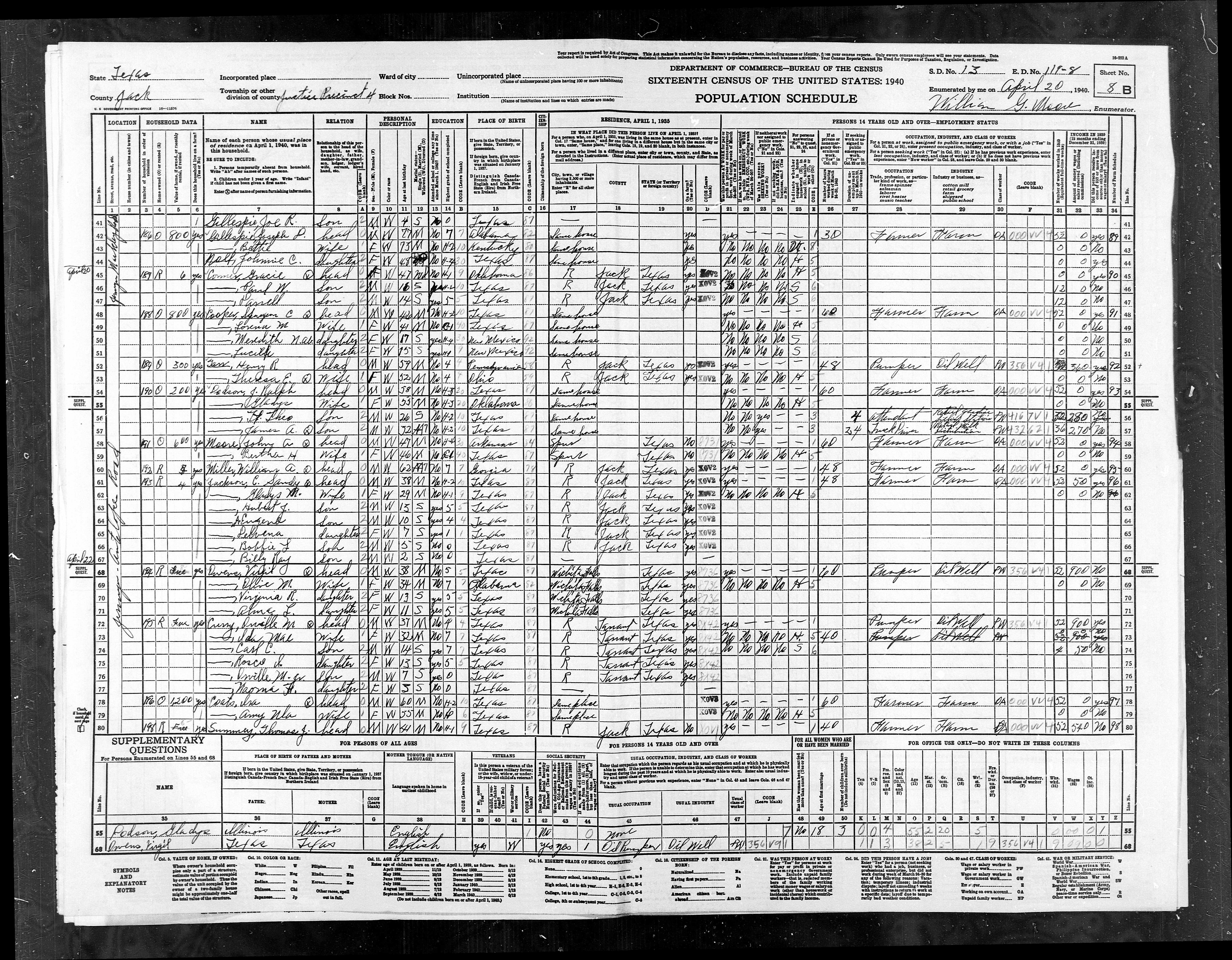
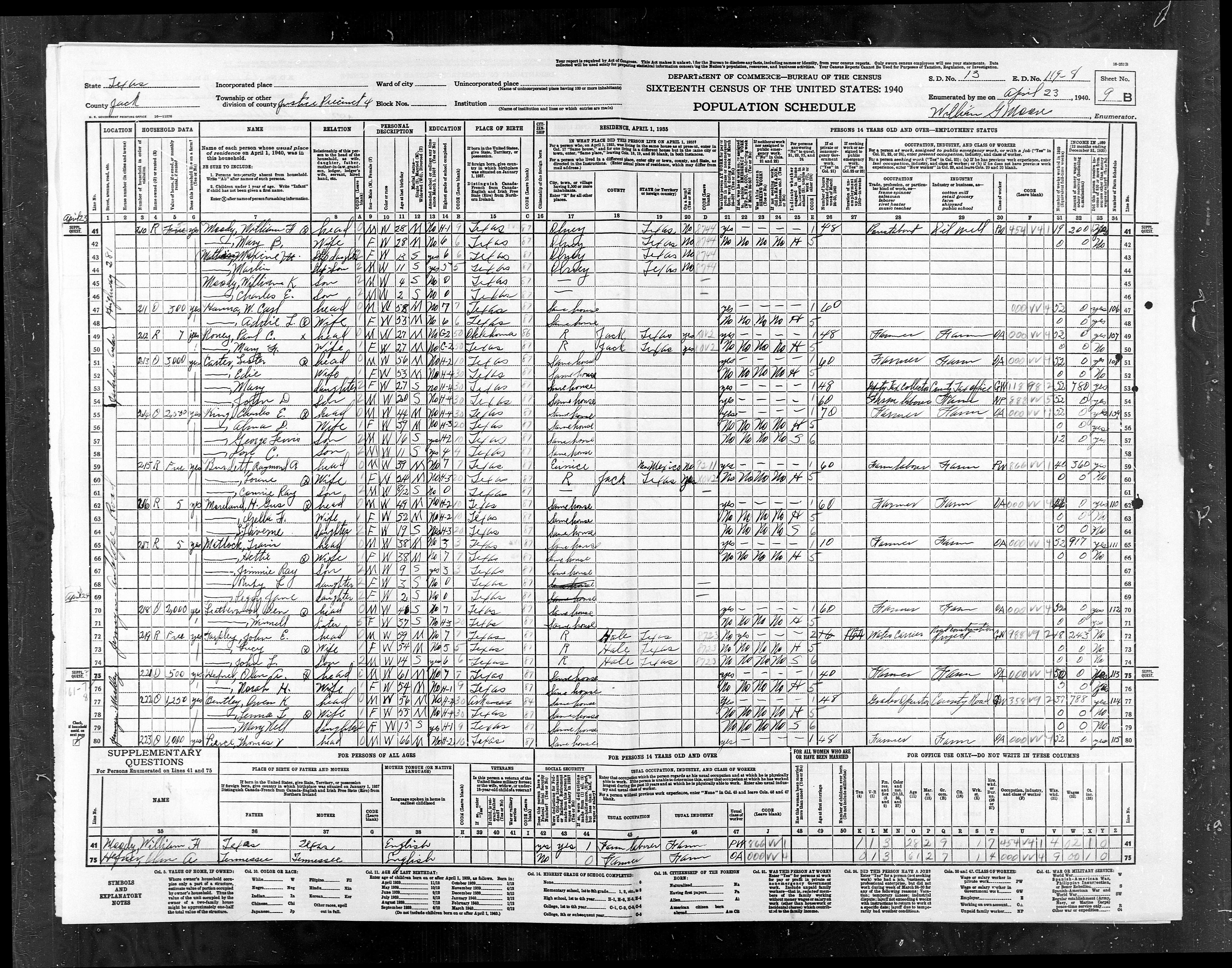
Jack County Texas
1940 Census
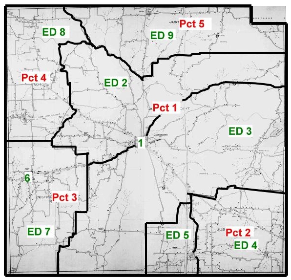
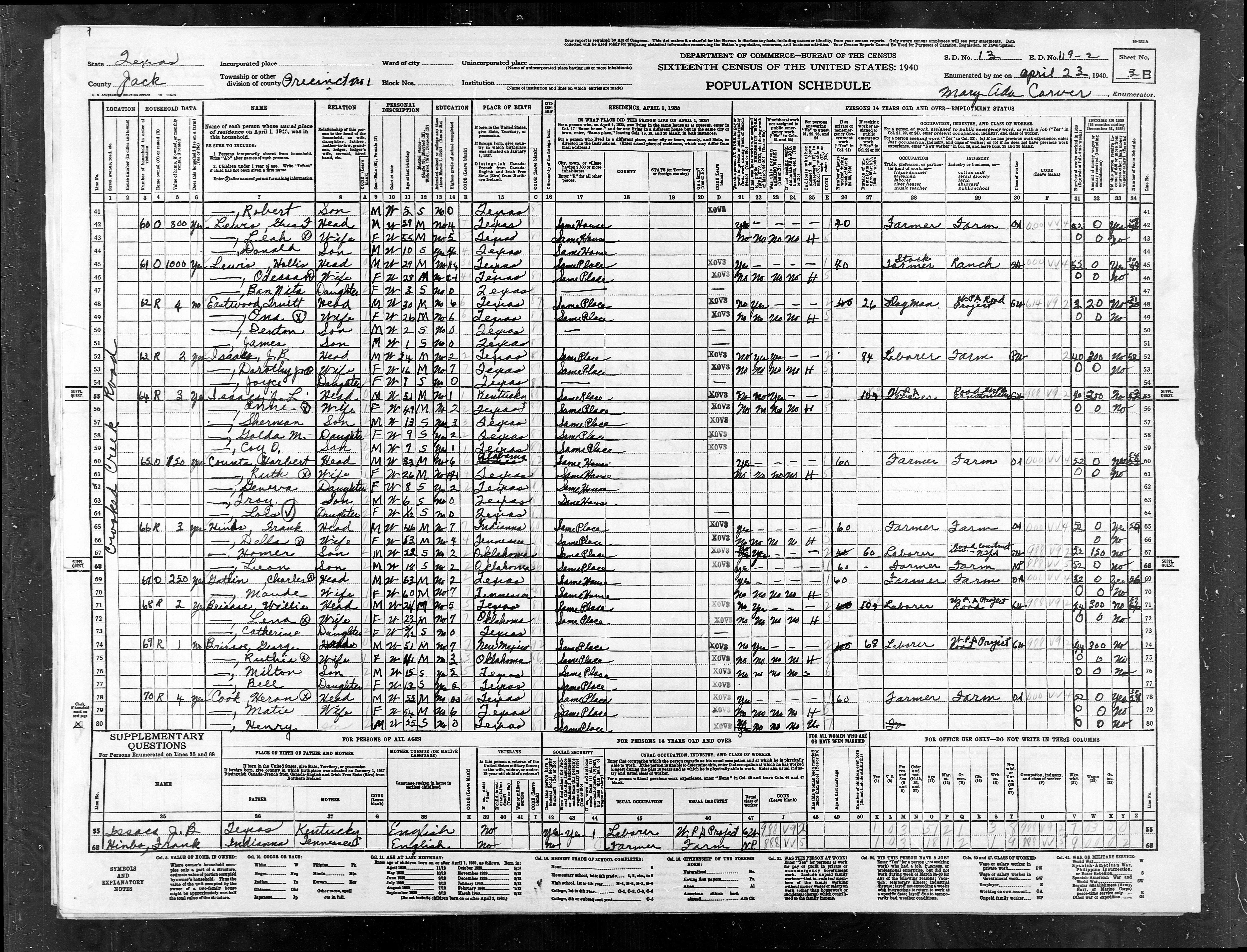
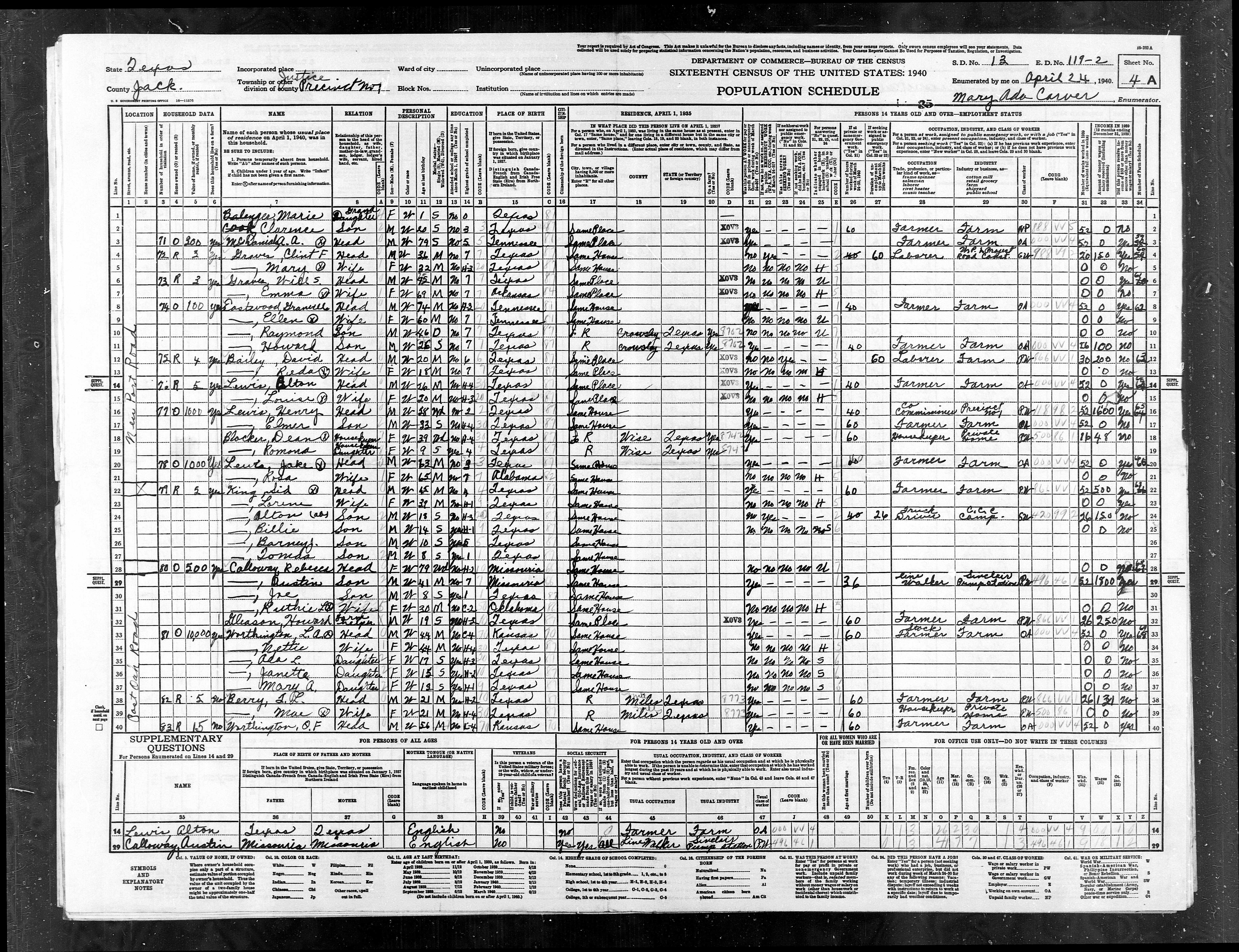
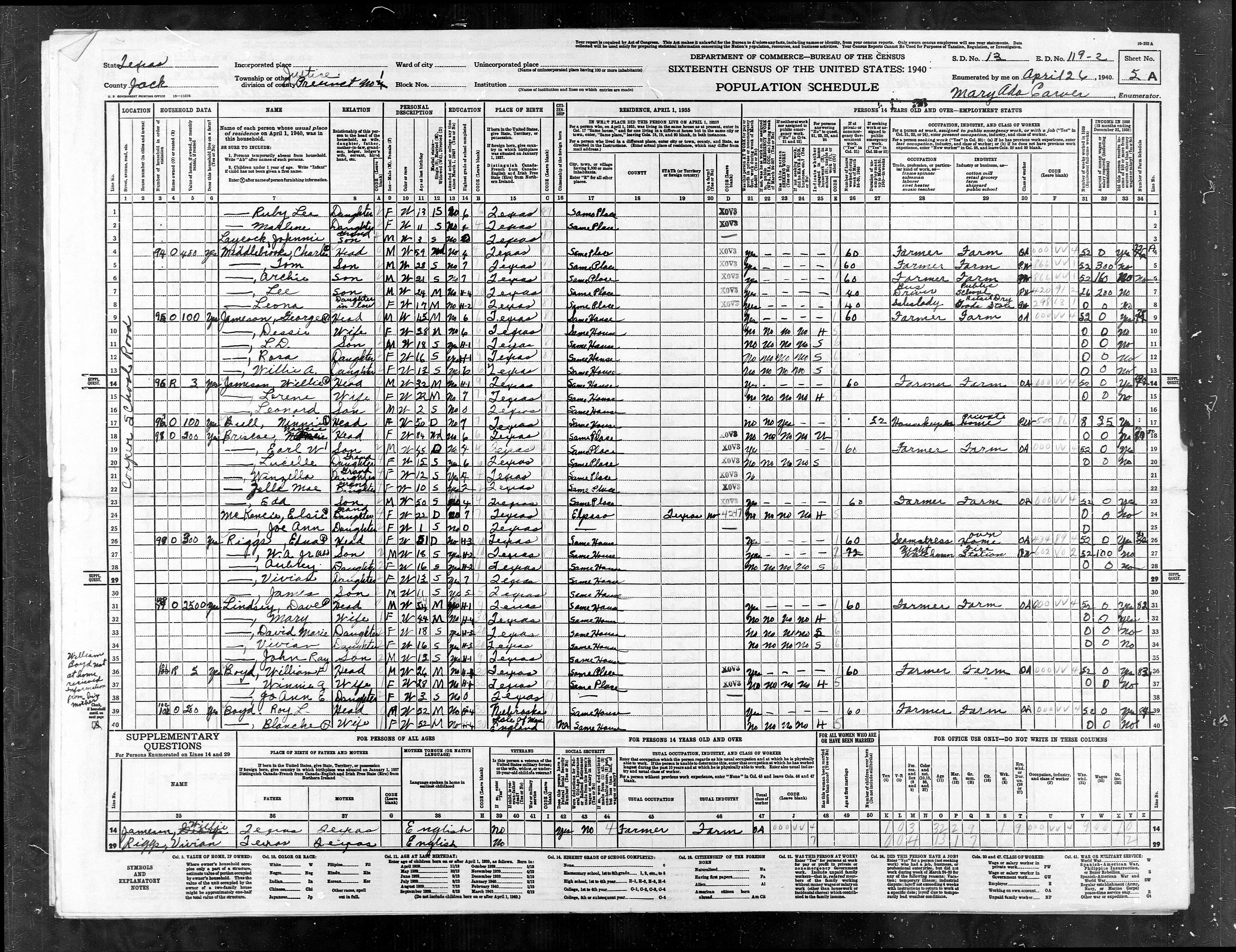
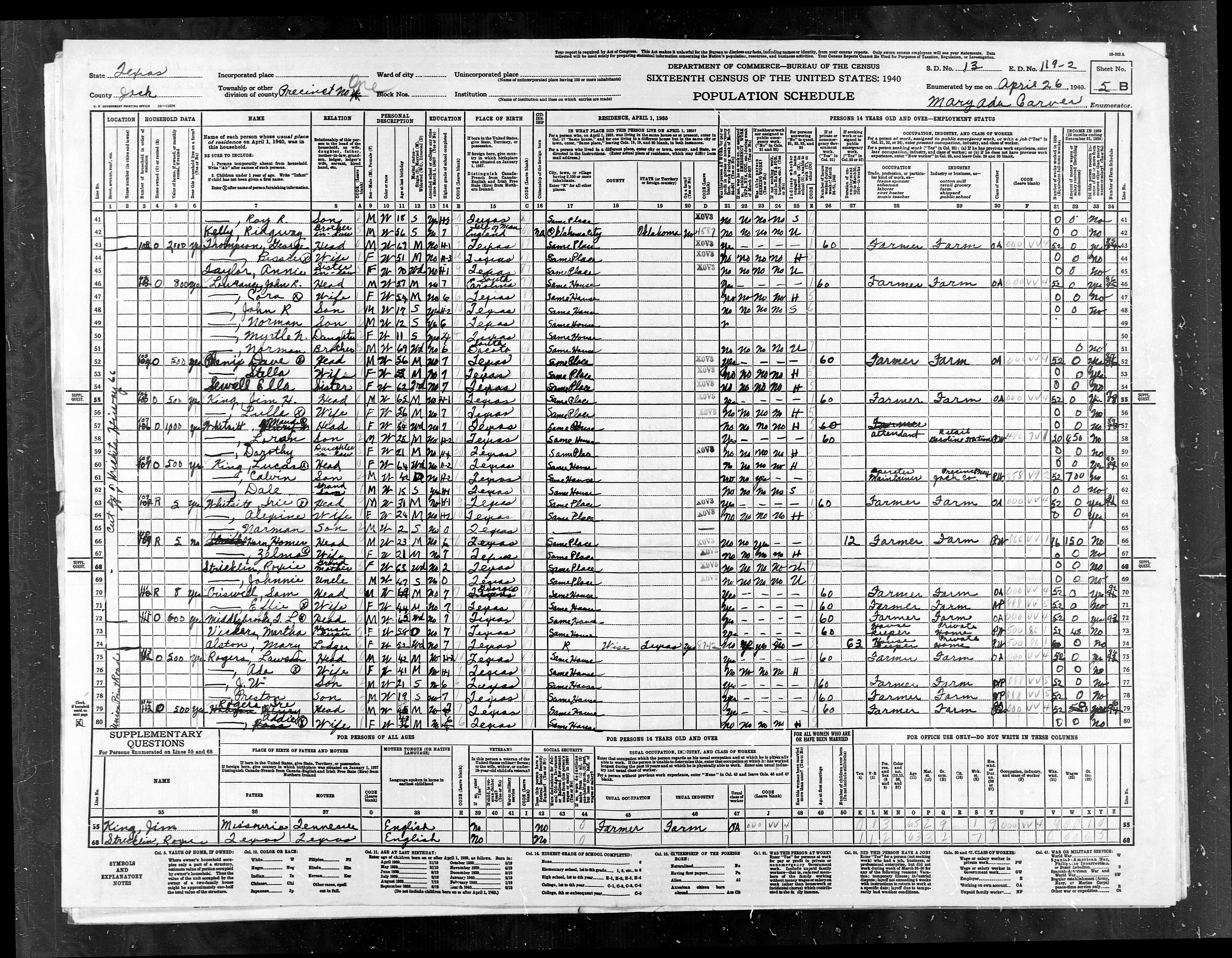
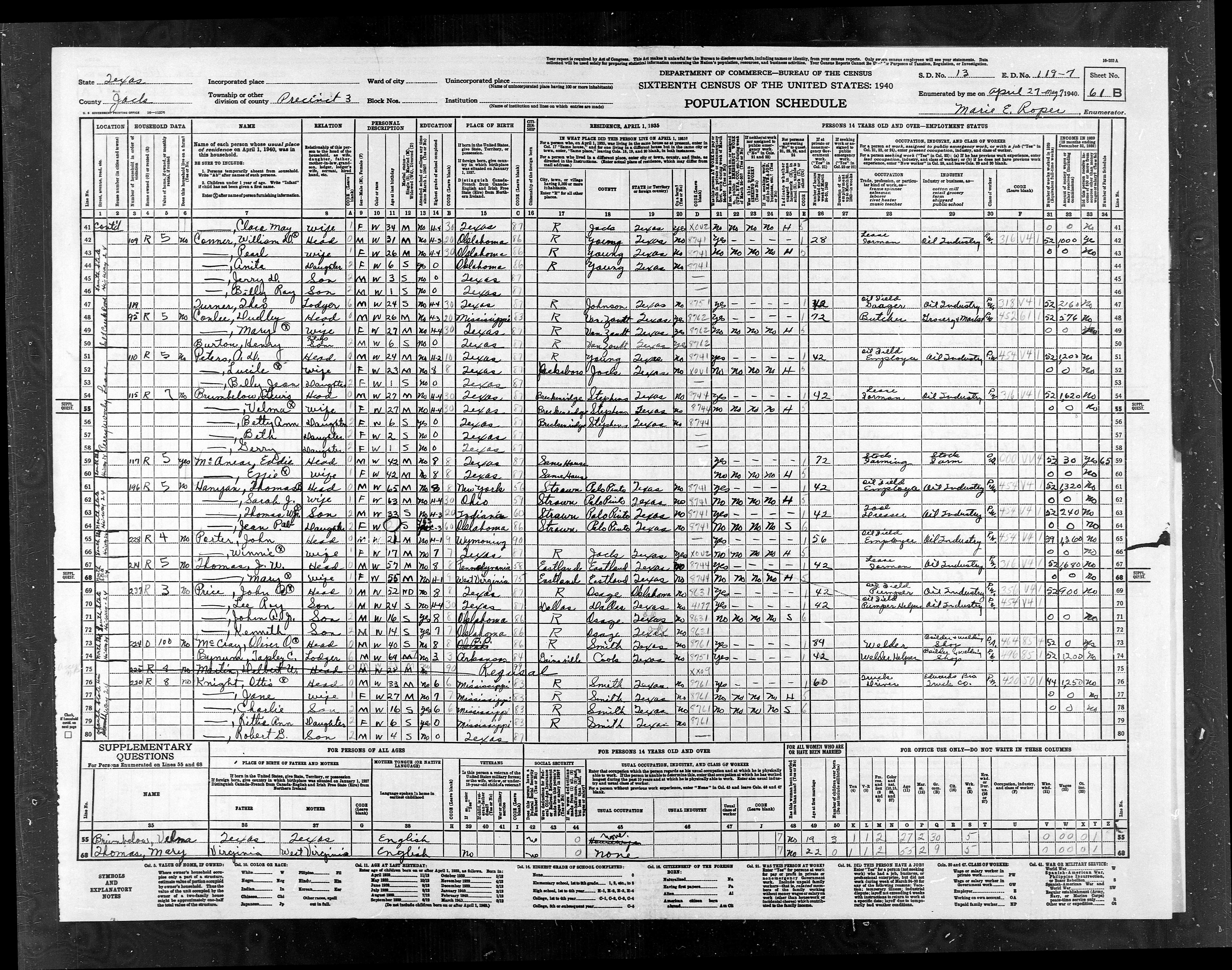
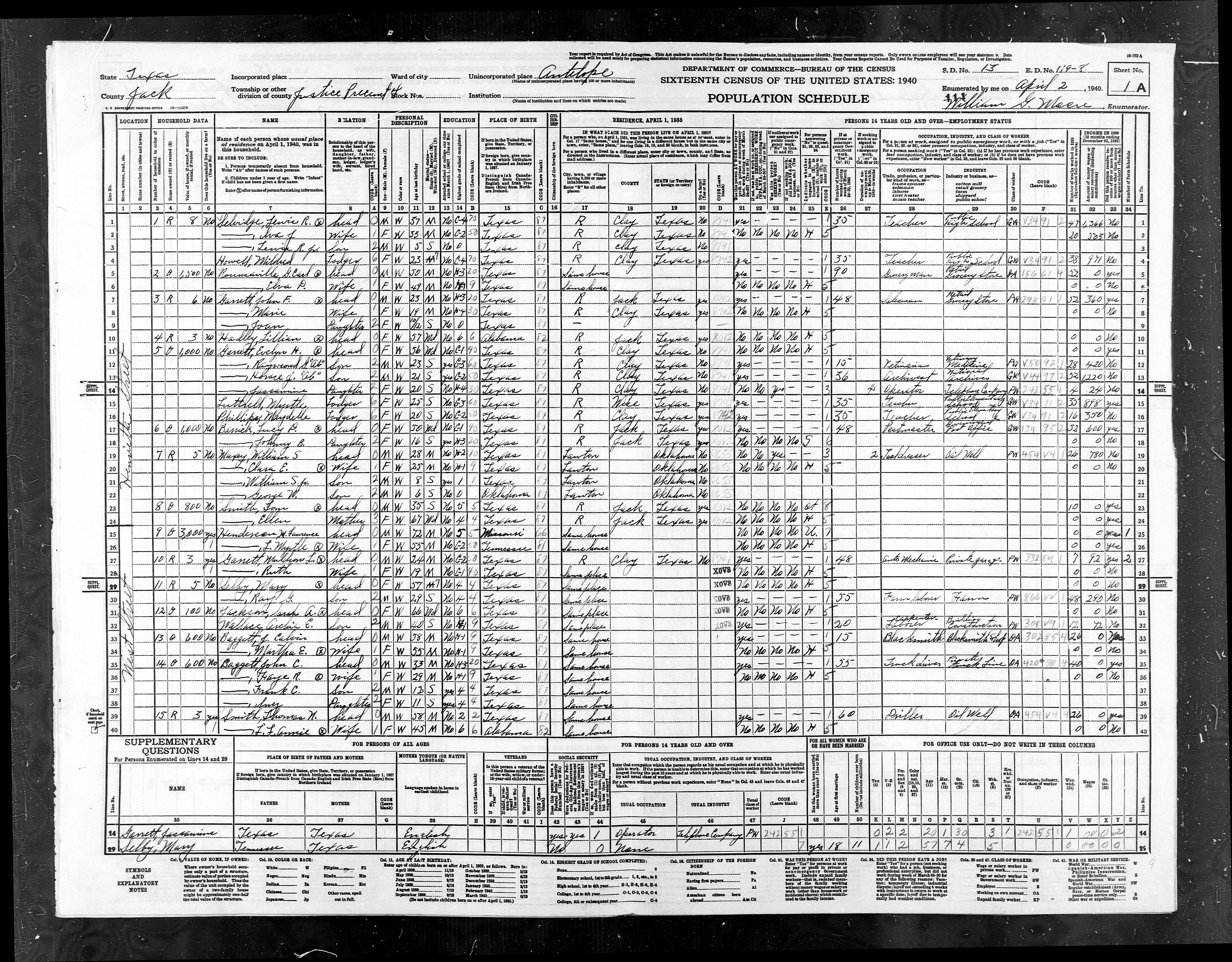
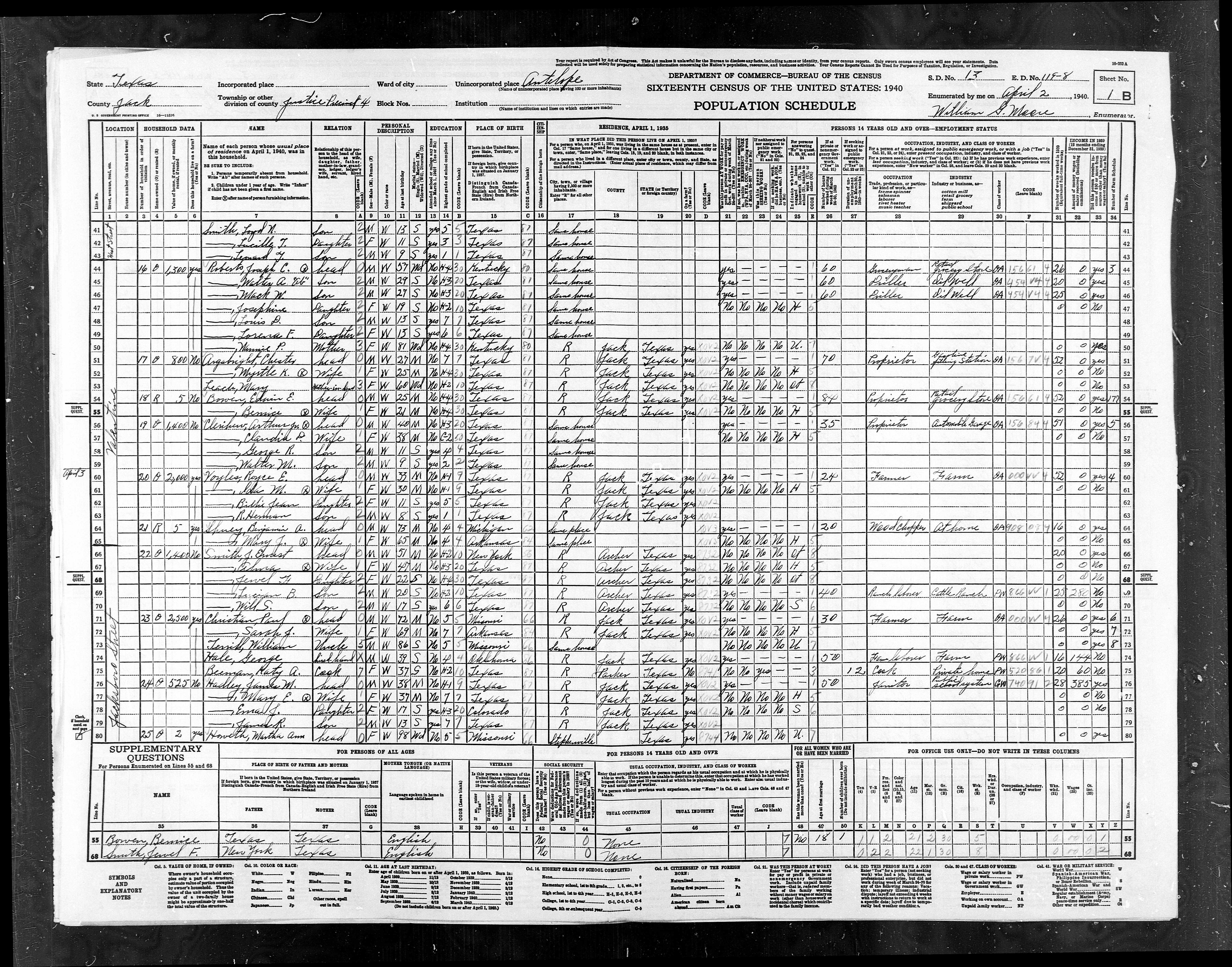
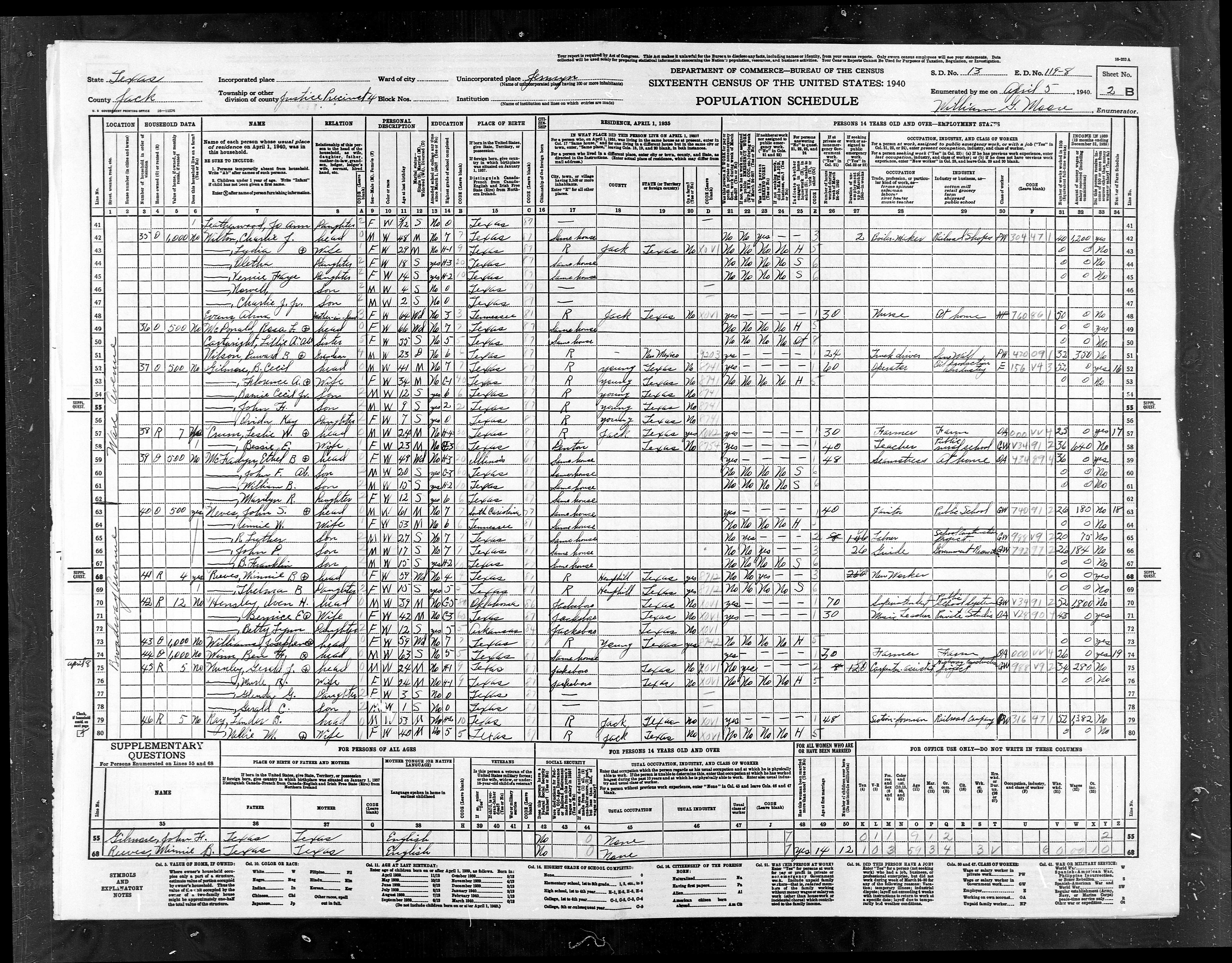
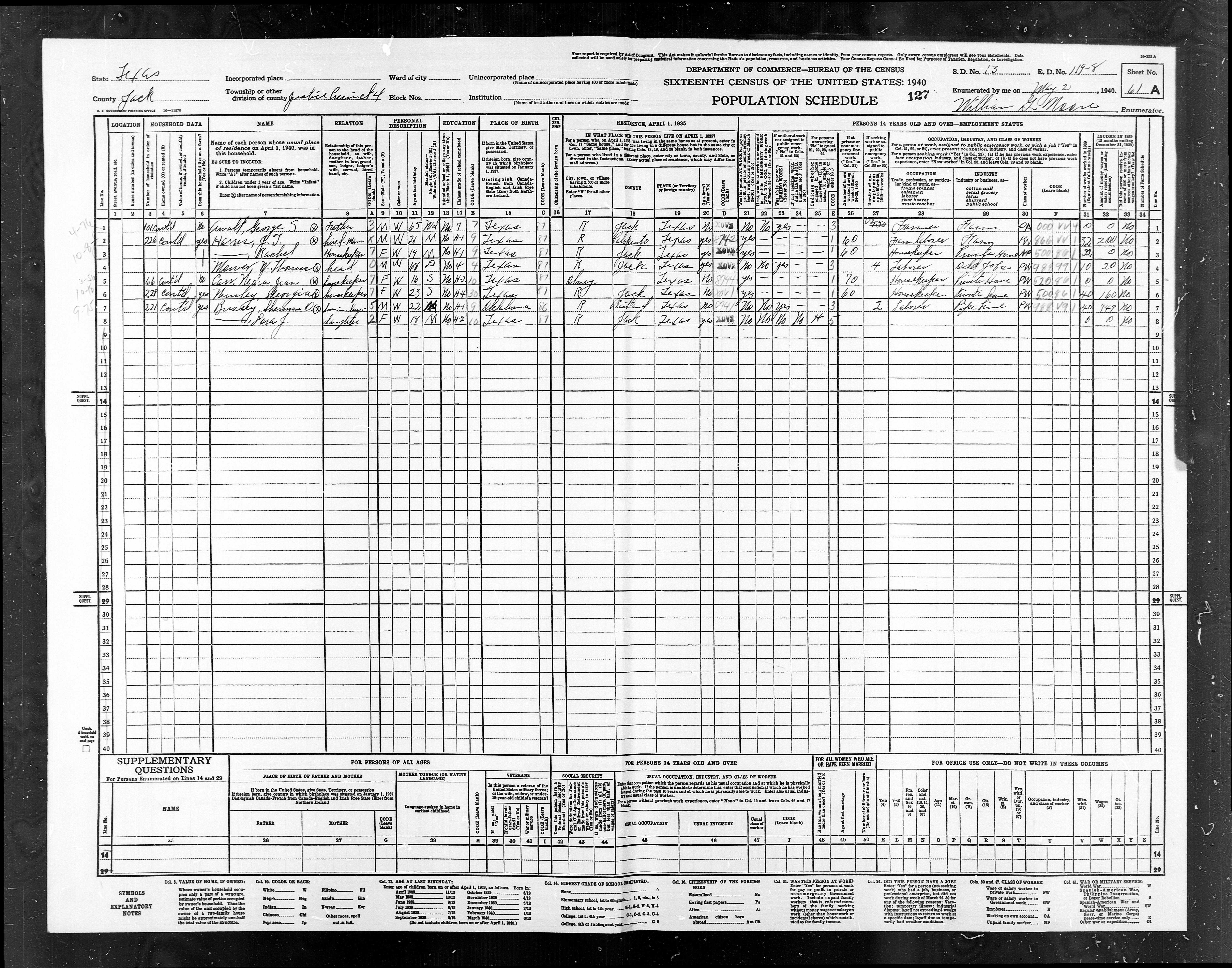
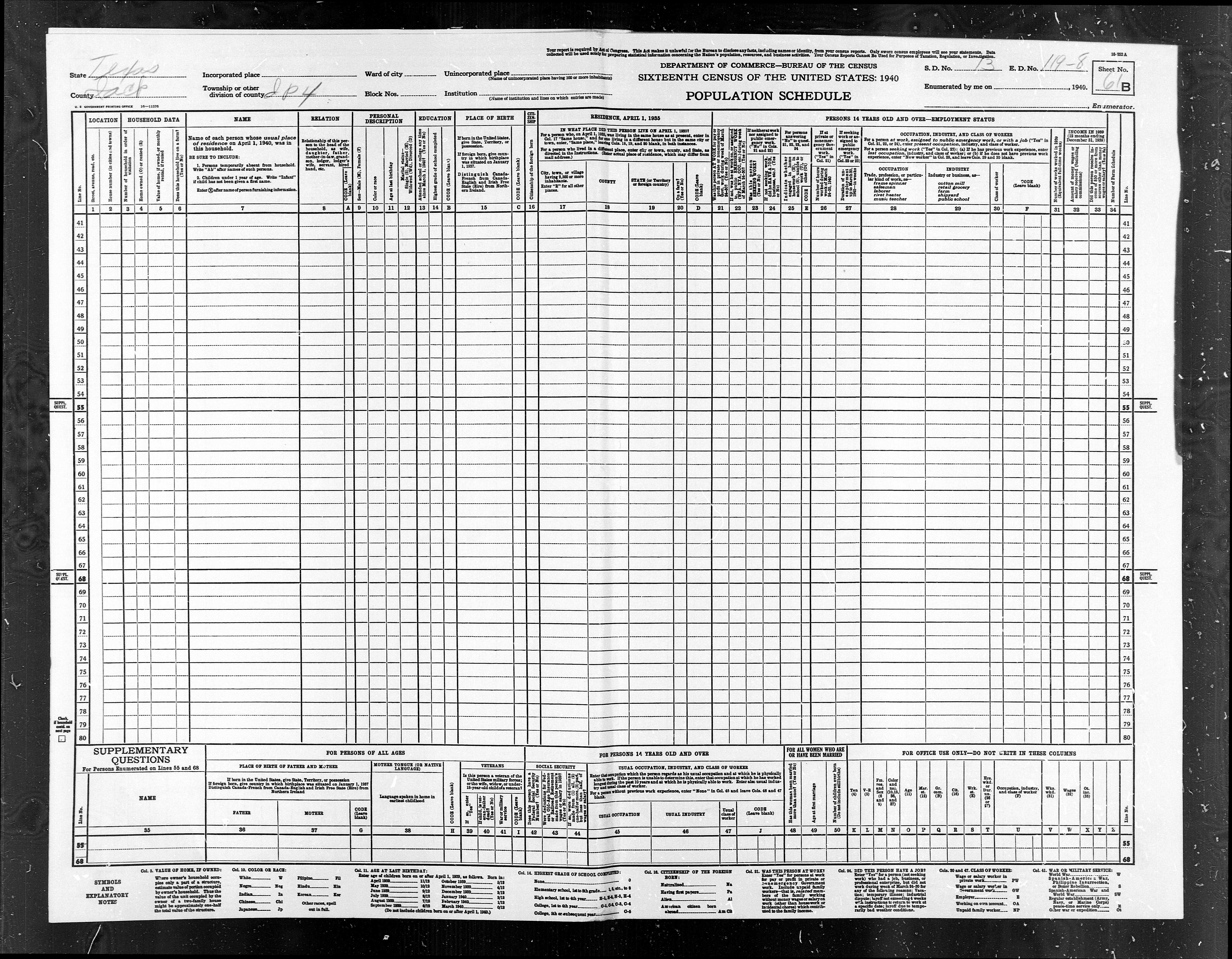
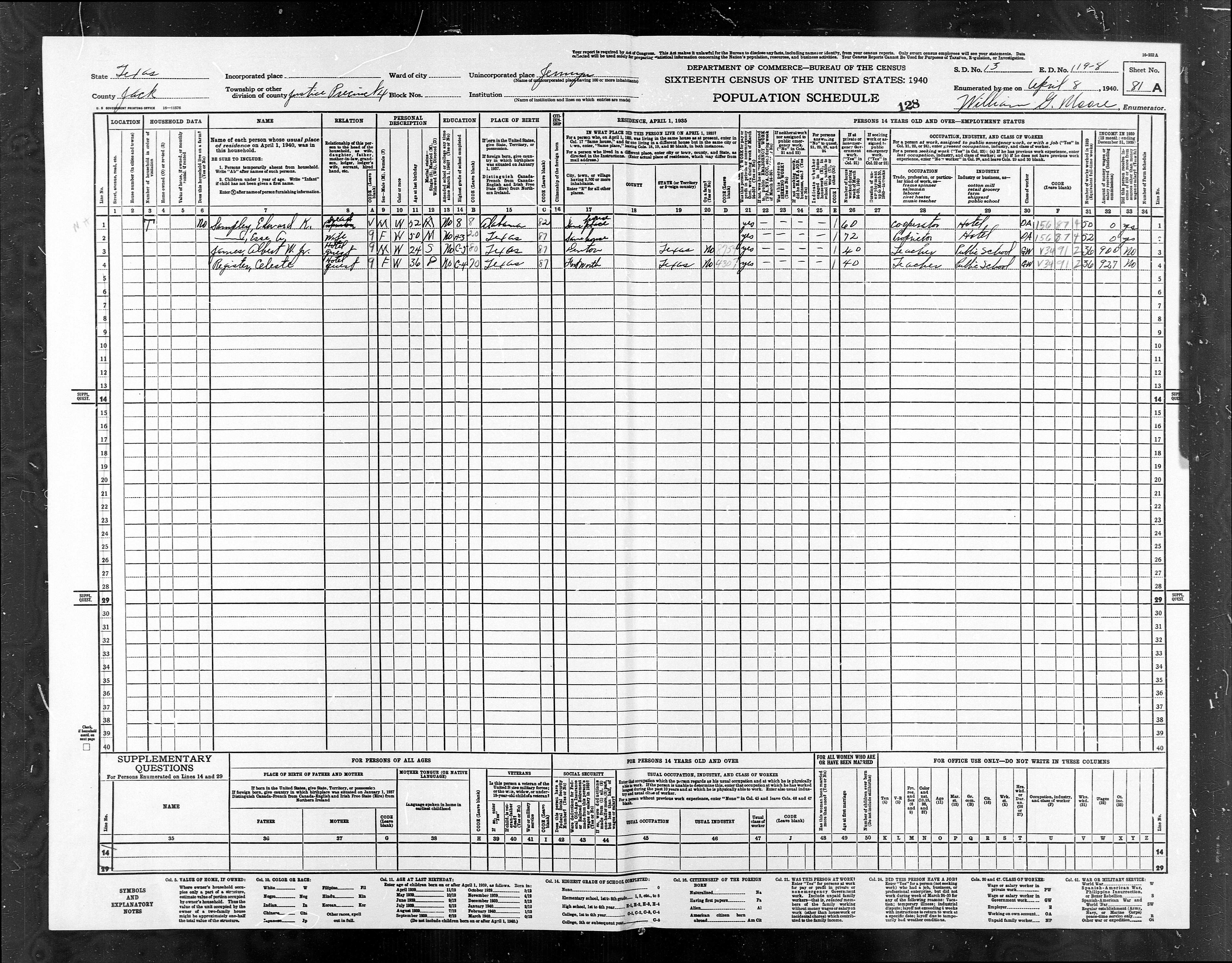
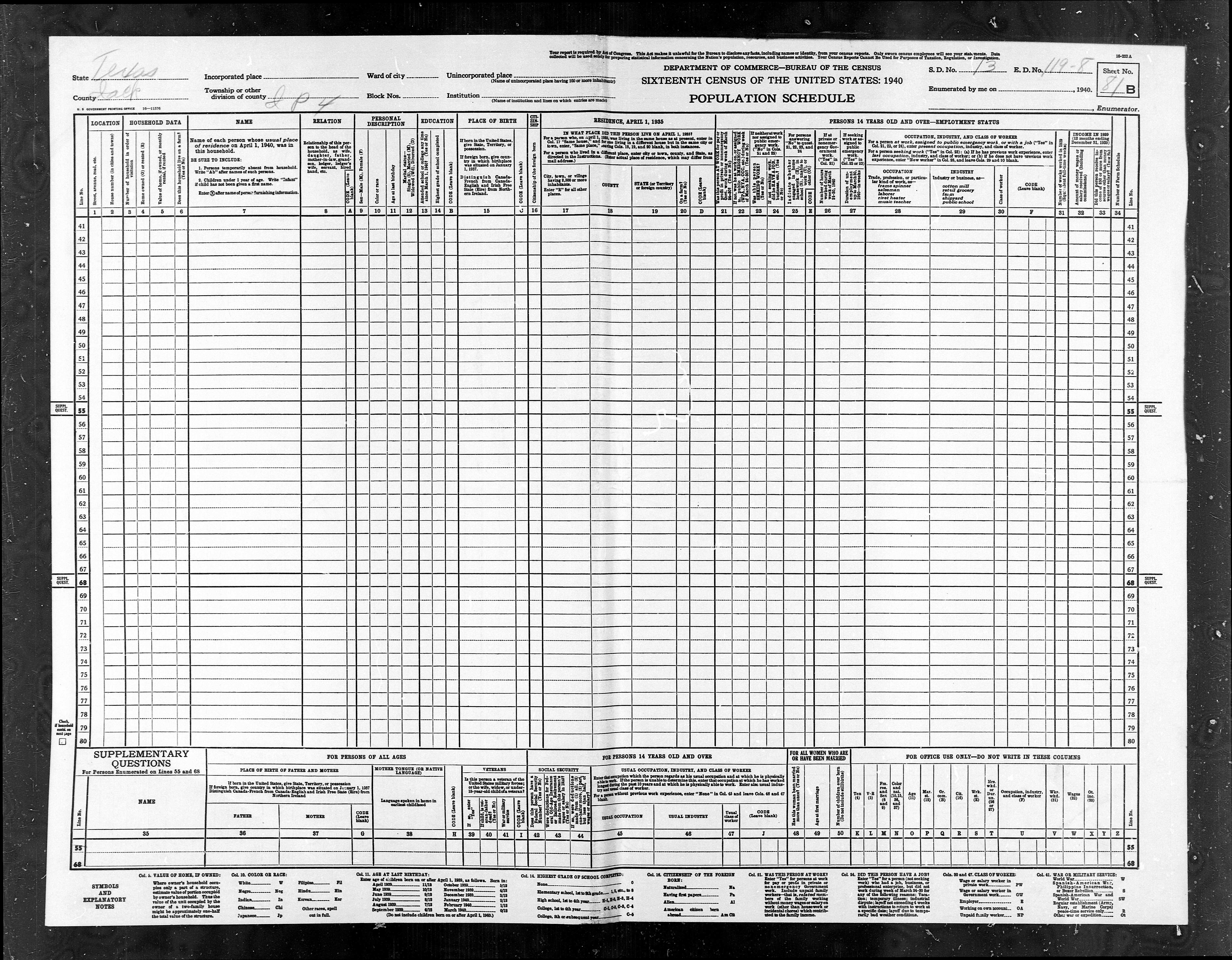
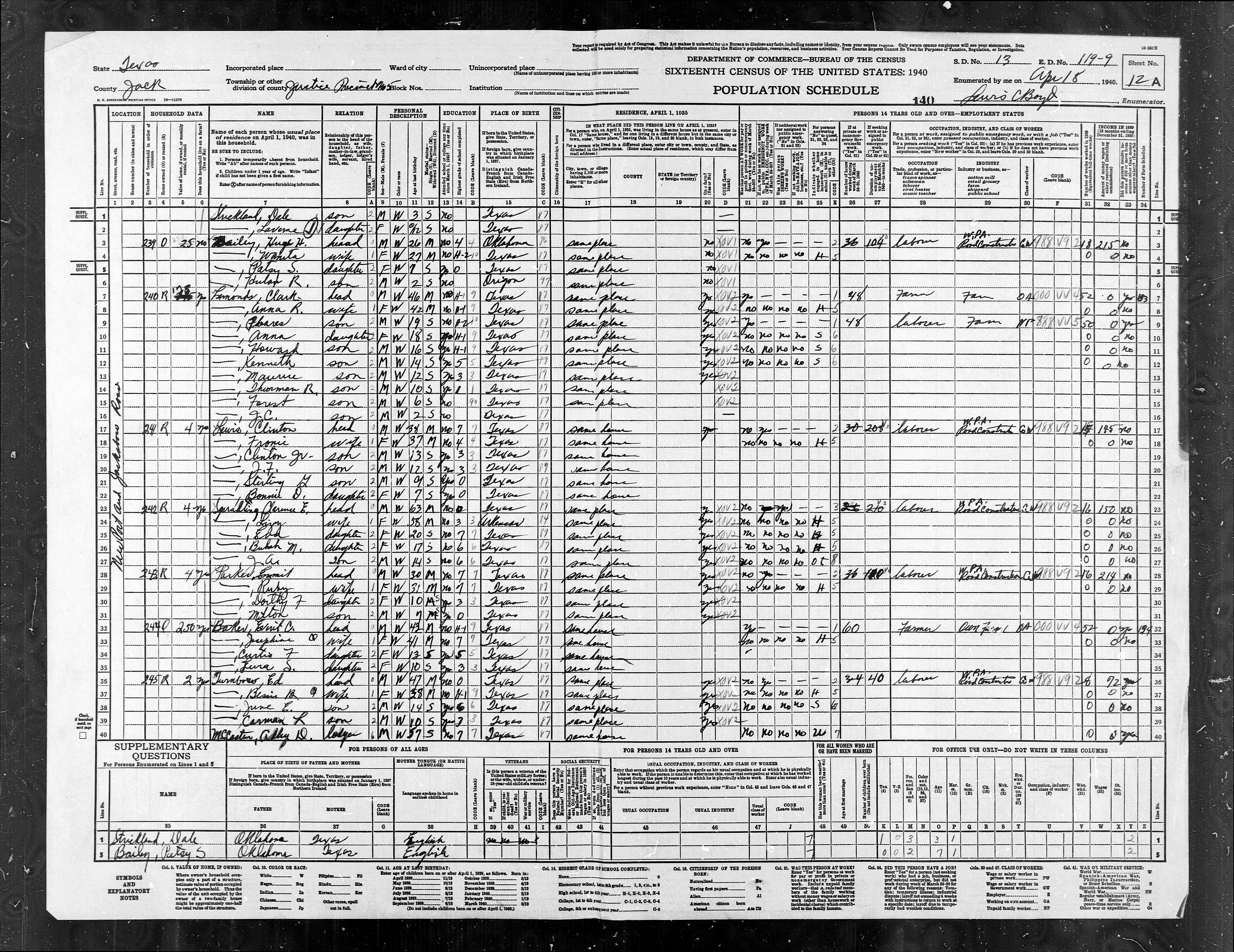
Links to Images of Pages and Area Maps
|
Jack
County Texas 1930 and 1940 Census Justice Precincts and Enumeration
Districts |
||||
|
1930
ED |
1940
ED |
Description |
1930
Population |
1940
Population |
|
ED
119-1 |
ED
119-1 |
Pct
1, Jacksboro Town |
1837 |
2368 |
|
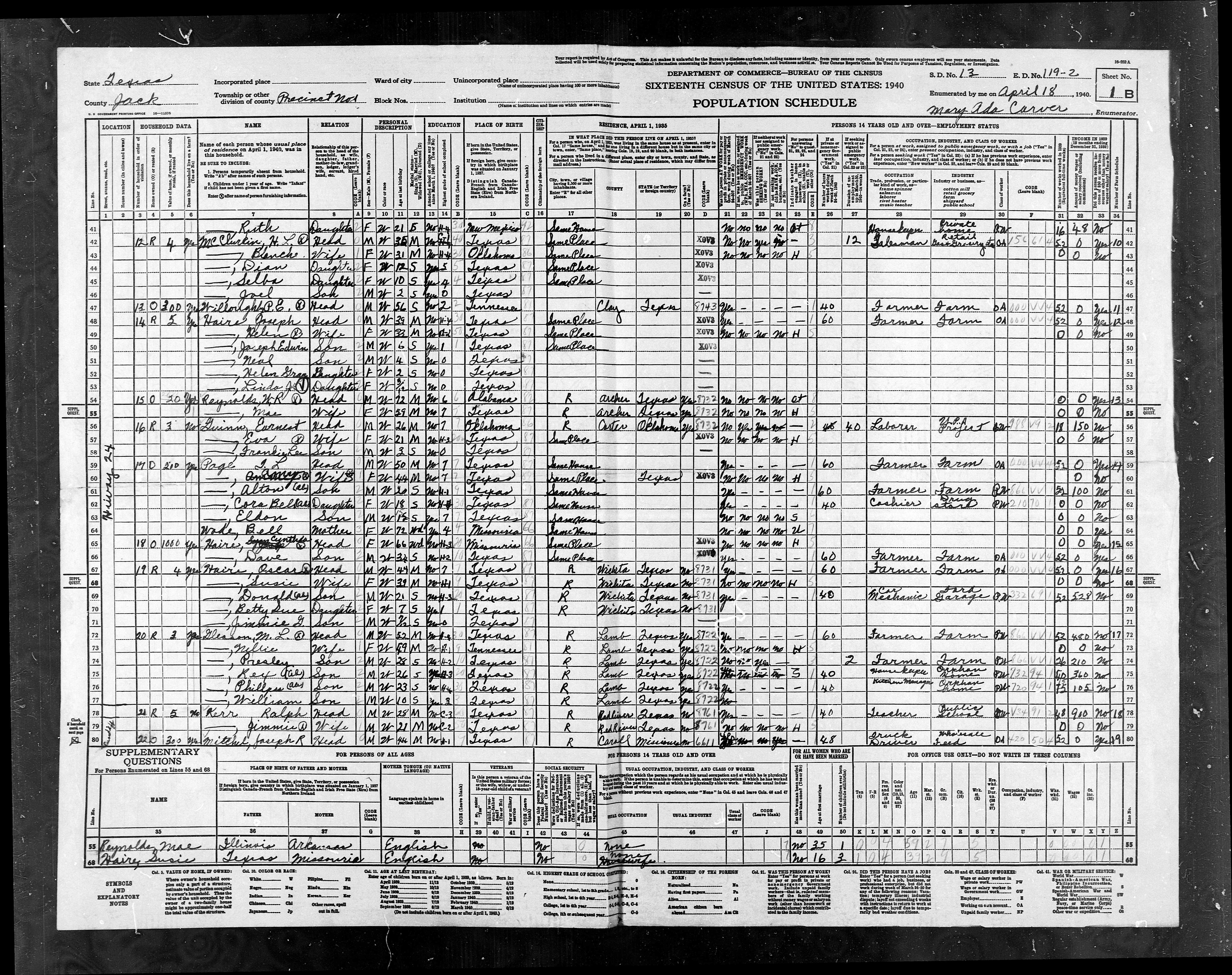
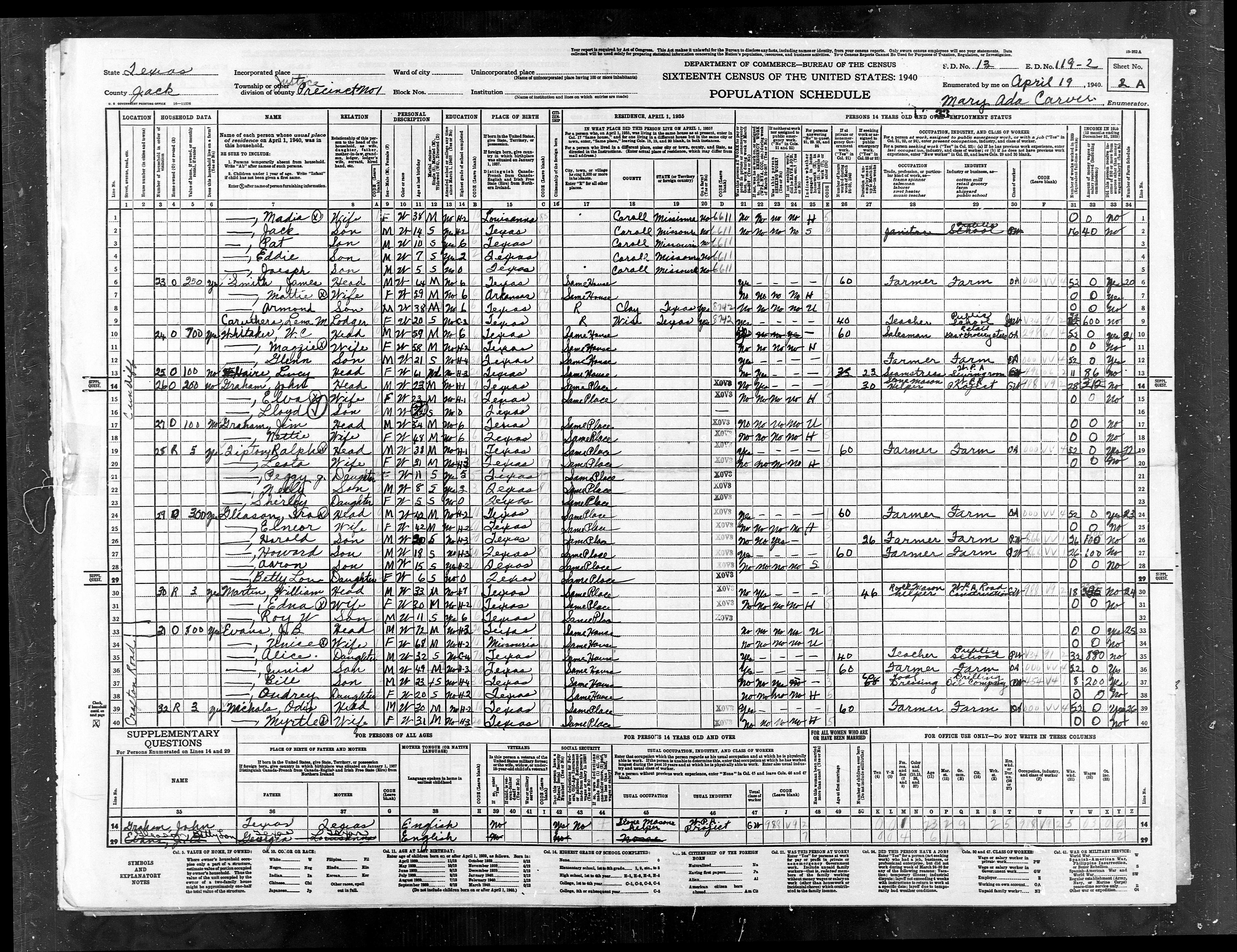
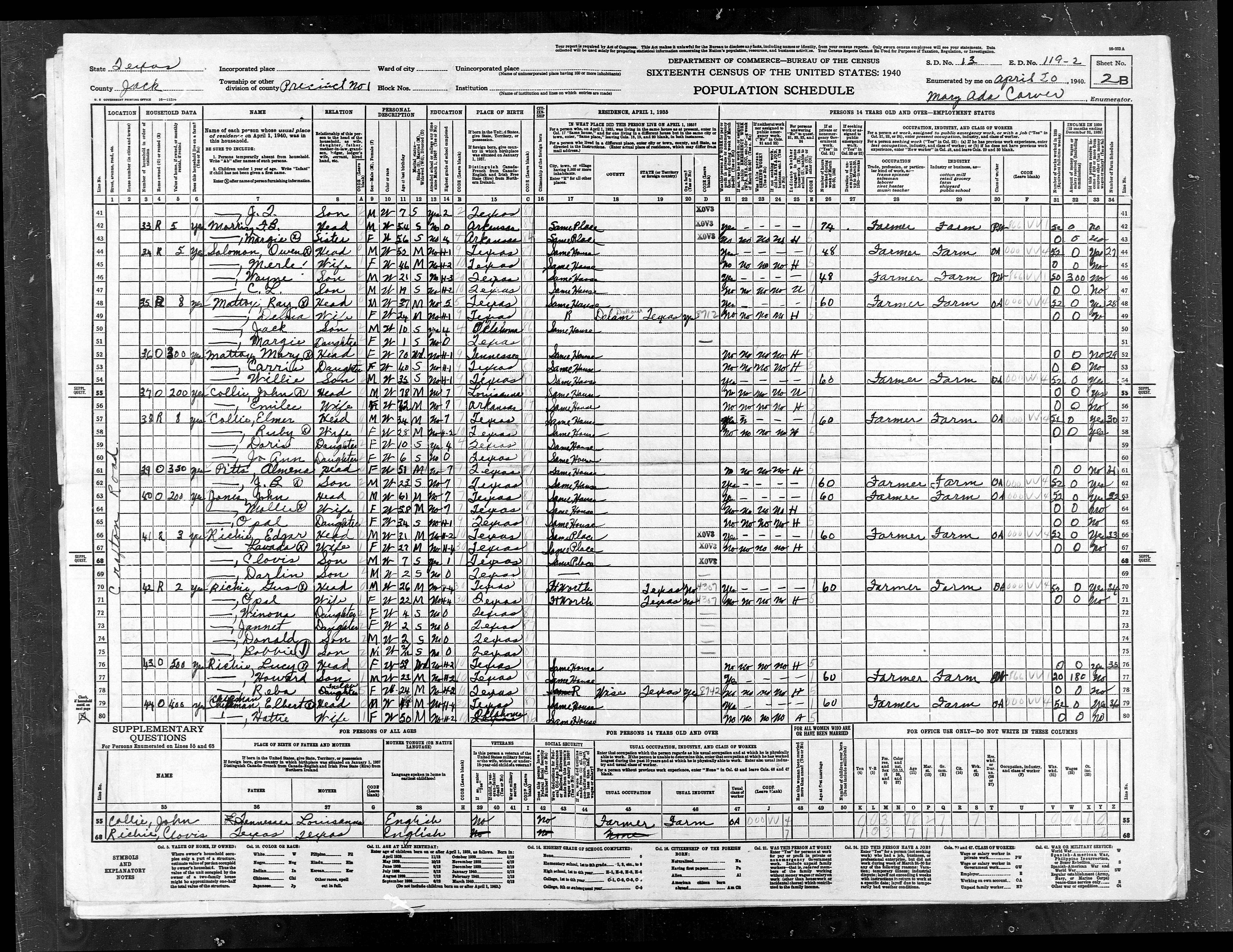
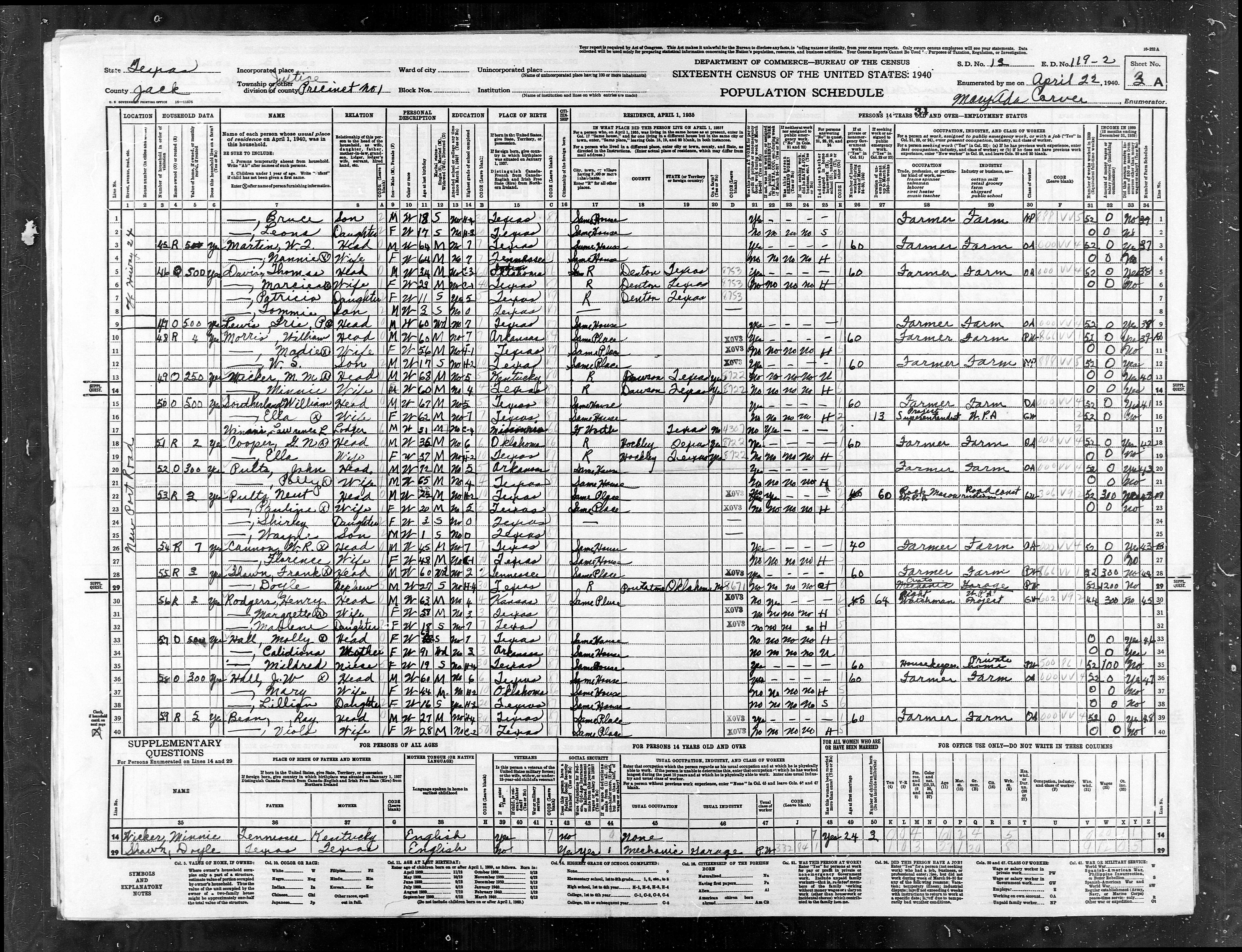
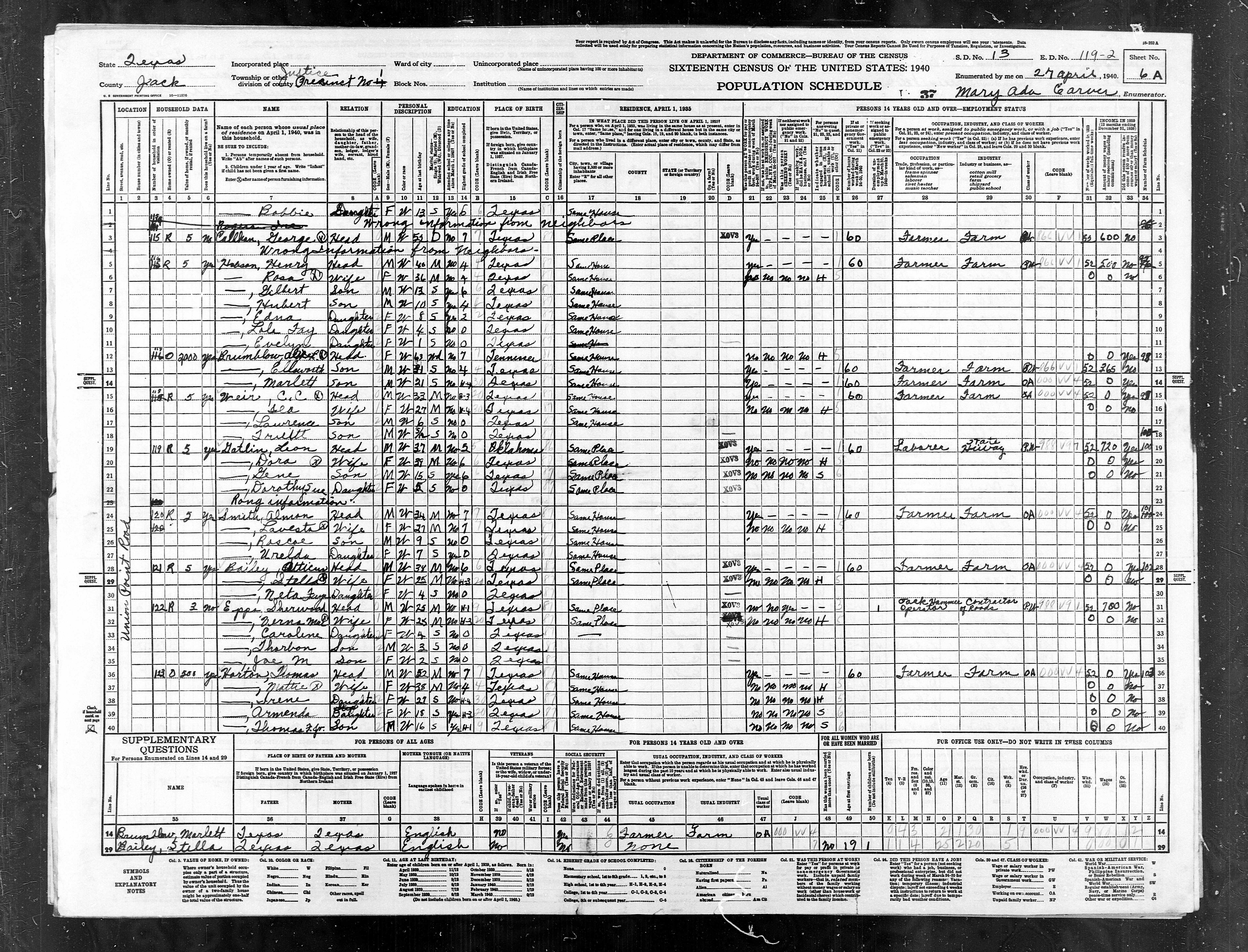
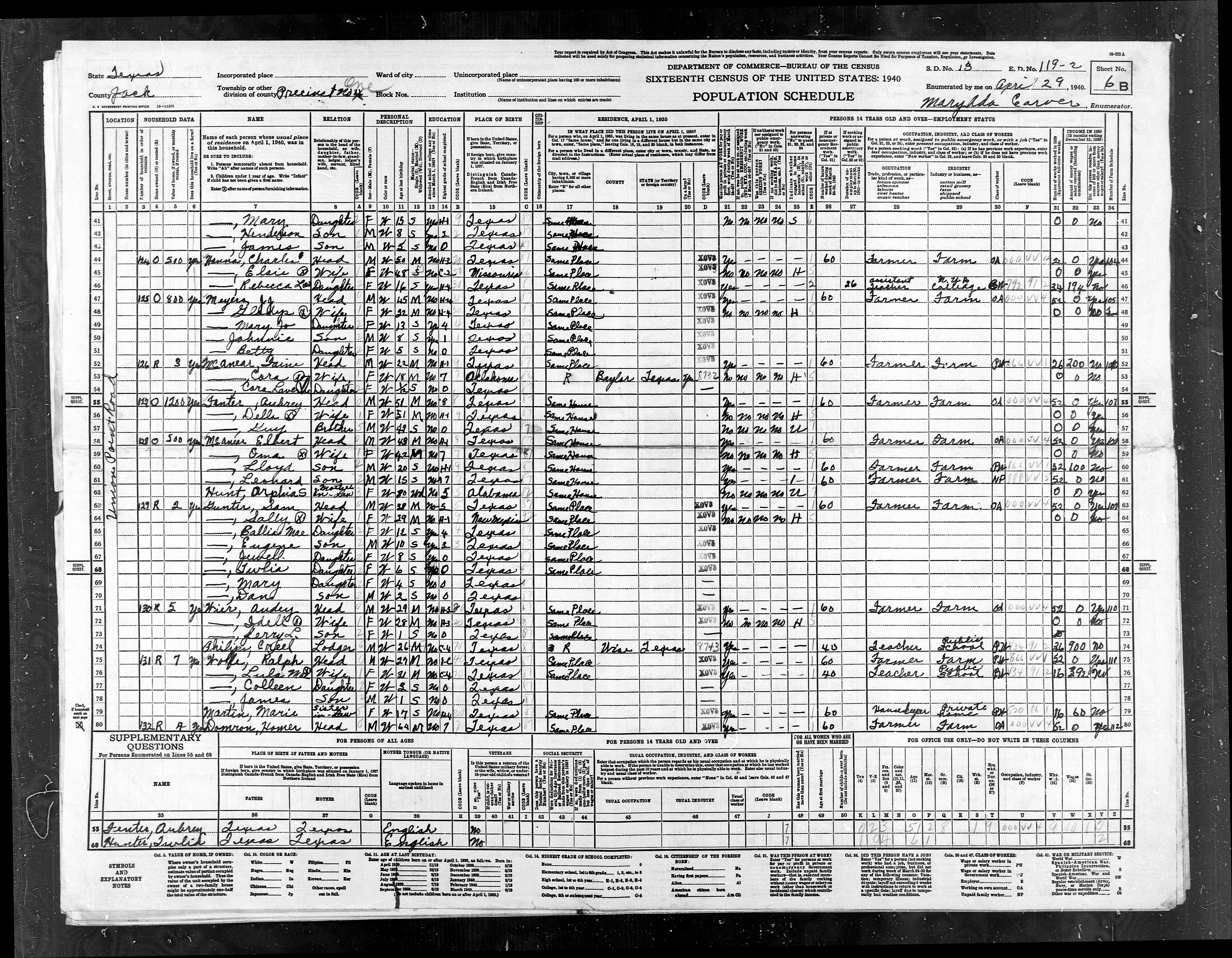
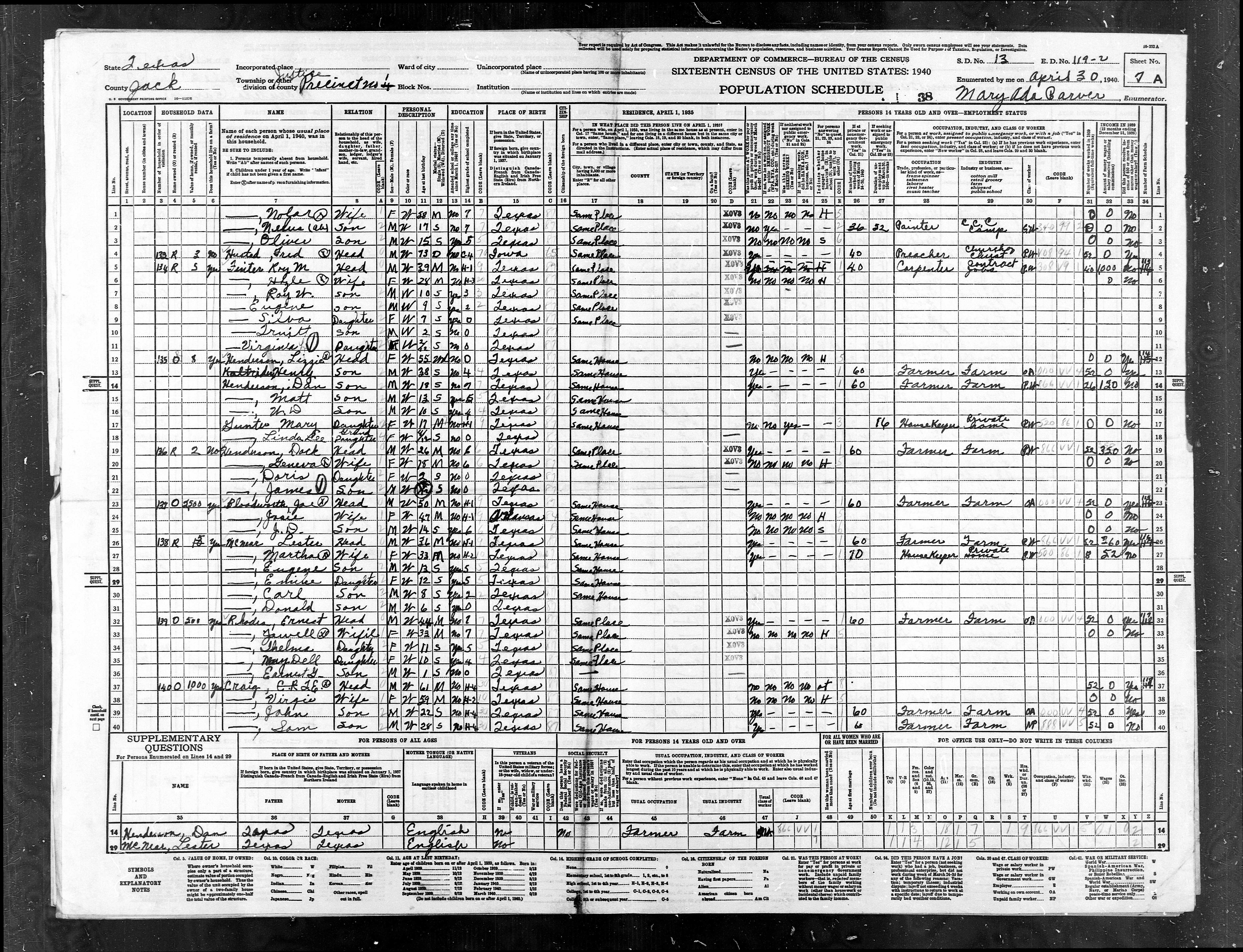
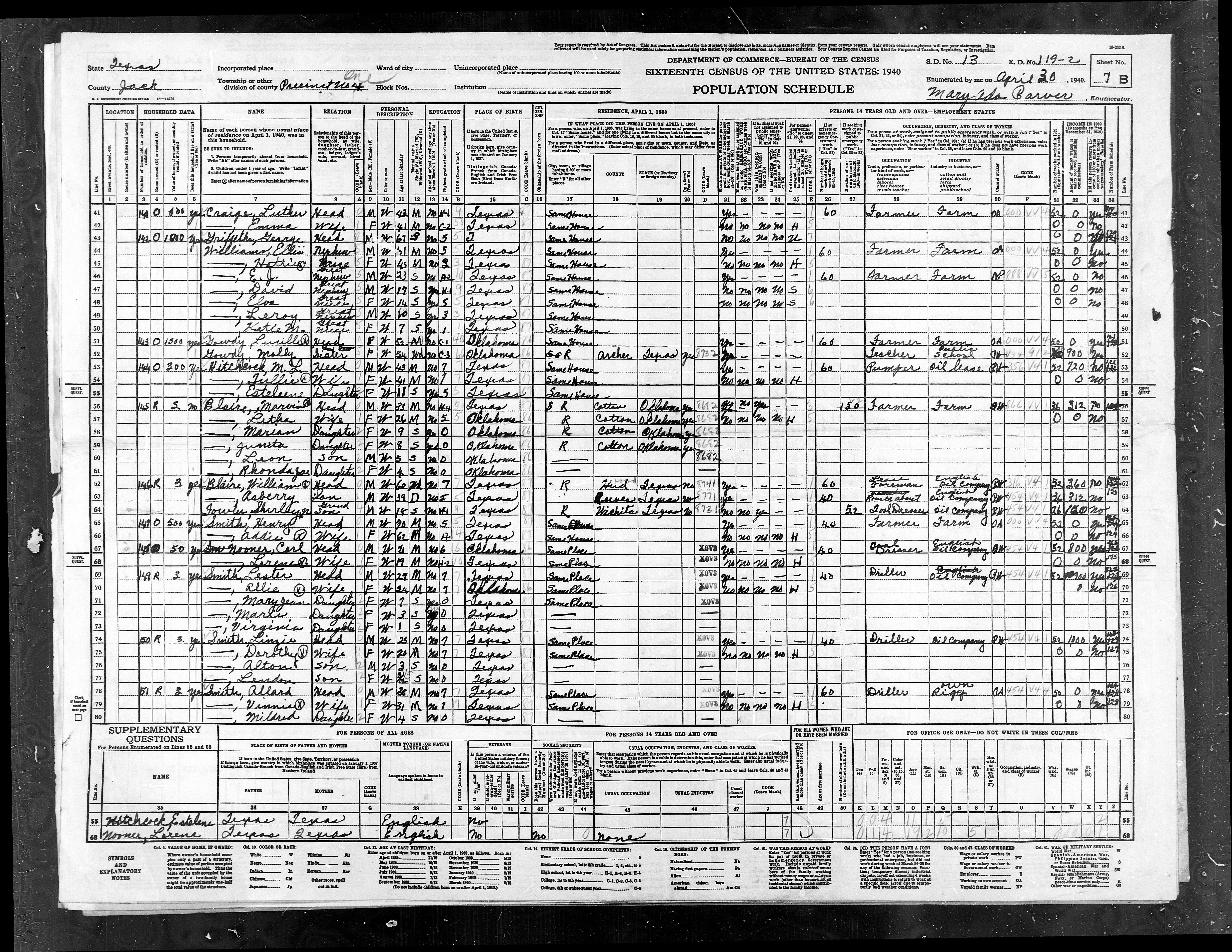
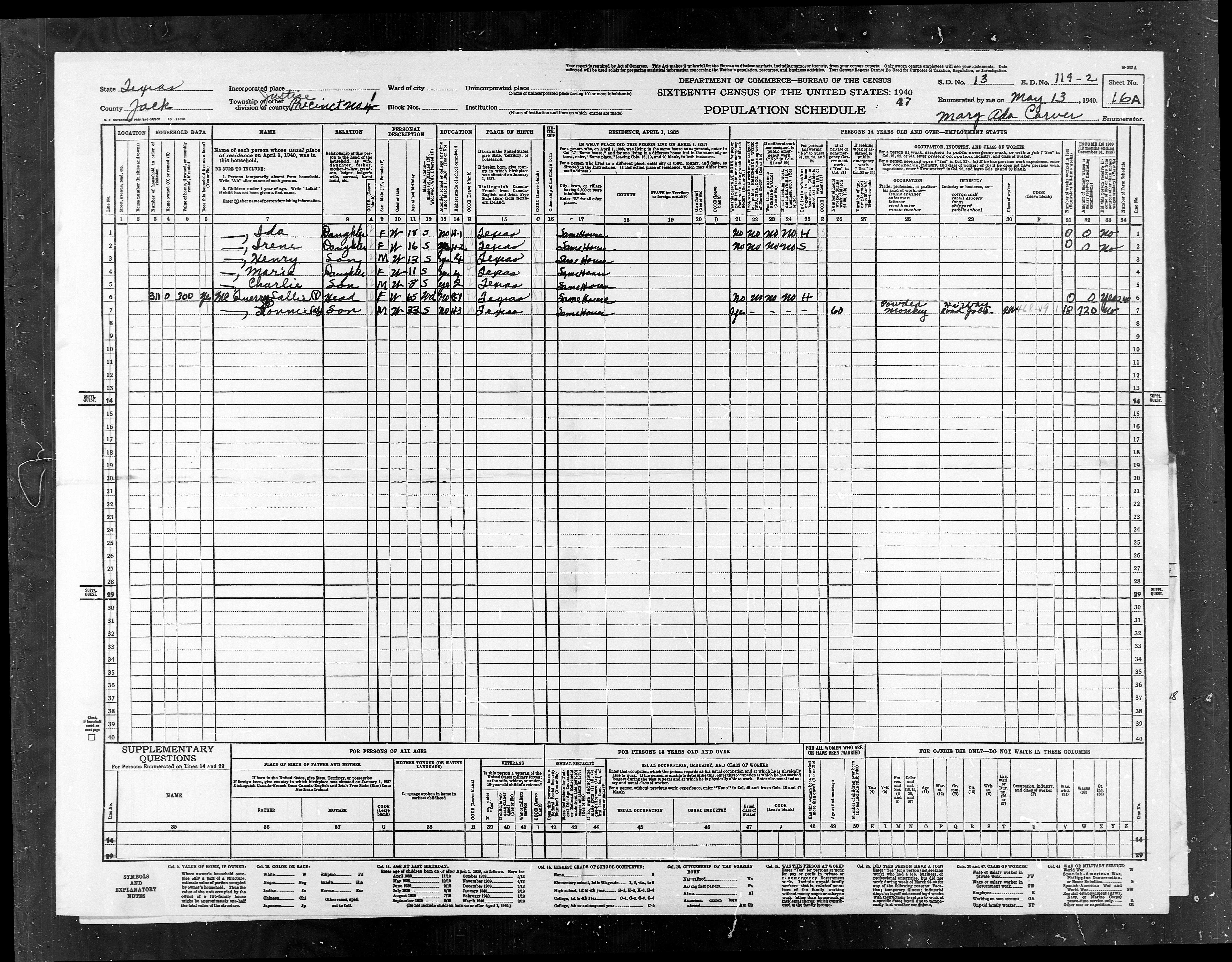
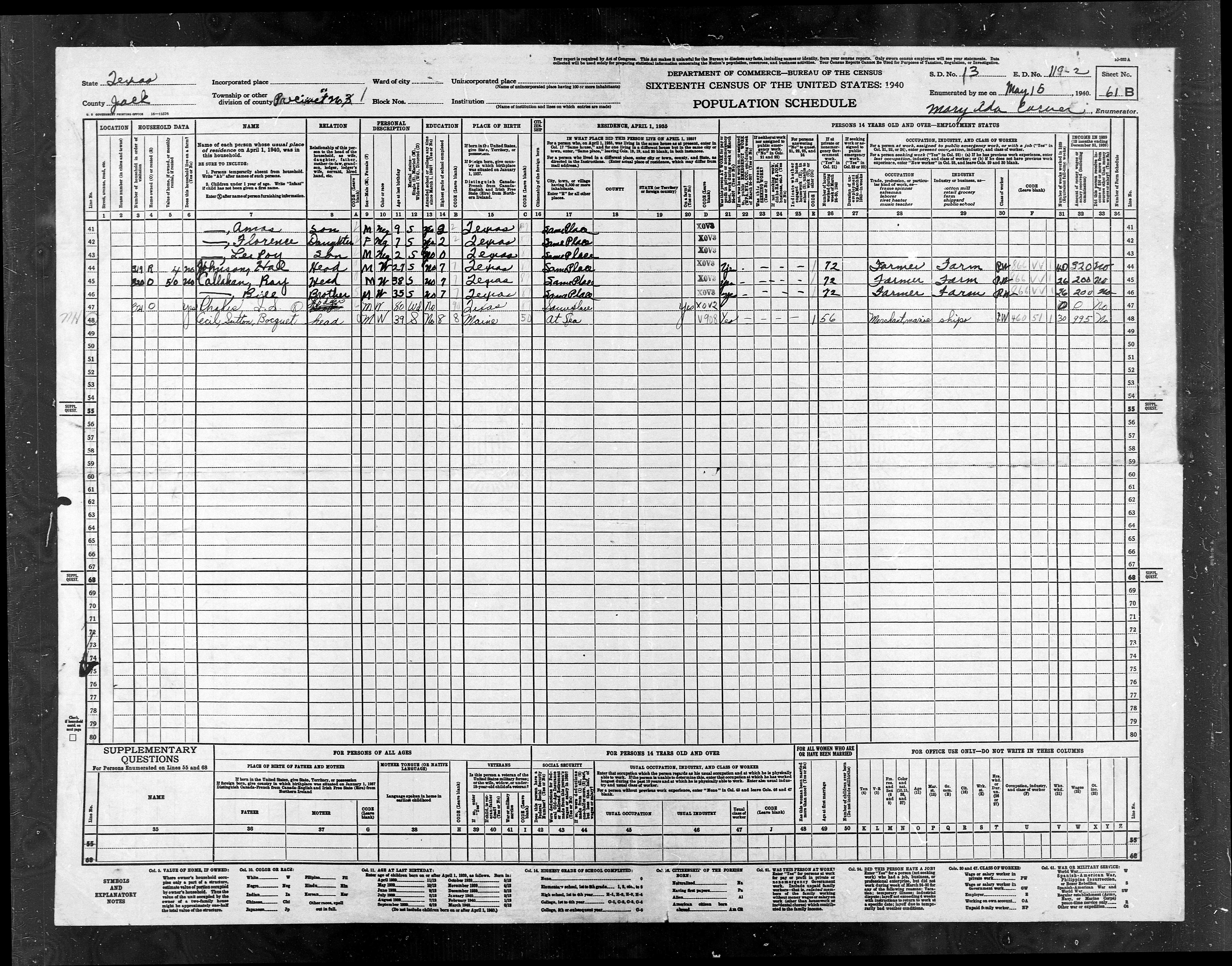
ED
119-2 |
ED
119-2 |
Pct
1, N of Hwy 24 (Fm 1810 + 380) - Poor Farm, Part of Cundiff |
1142 |
1252 |
|
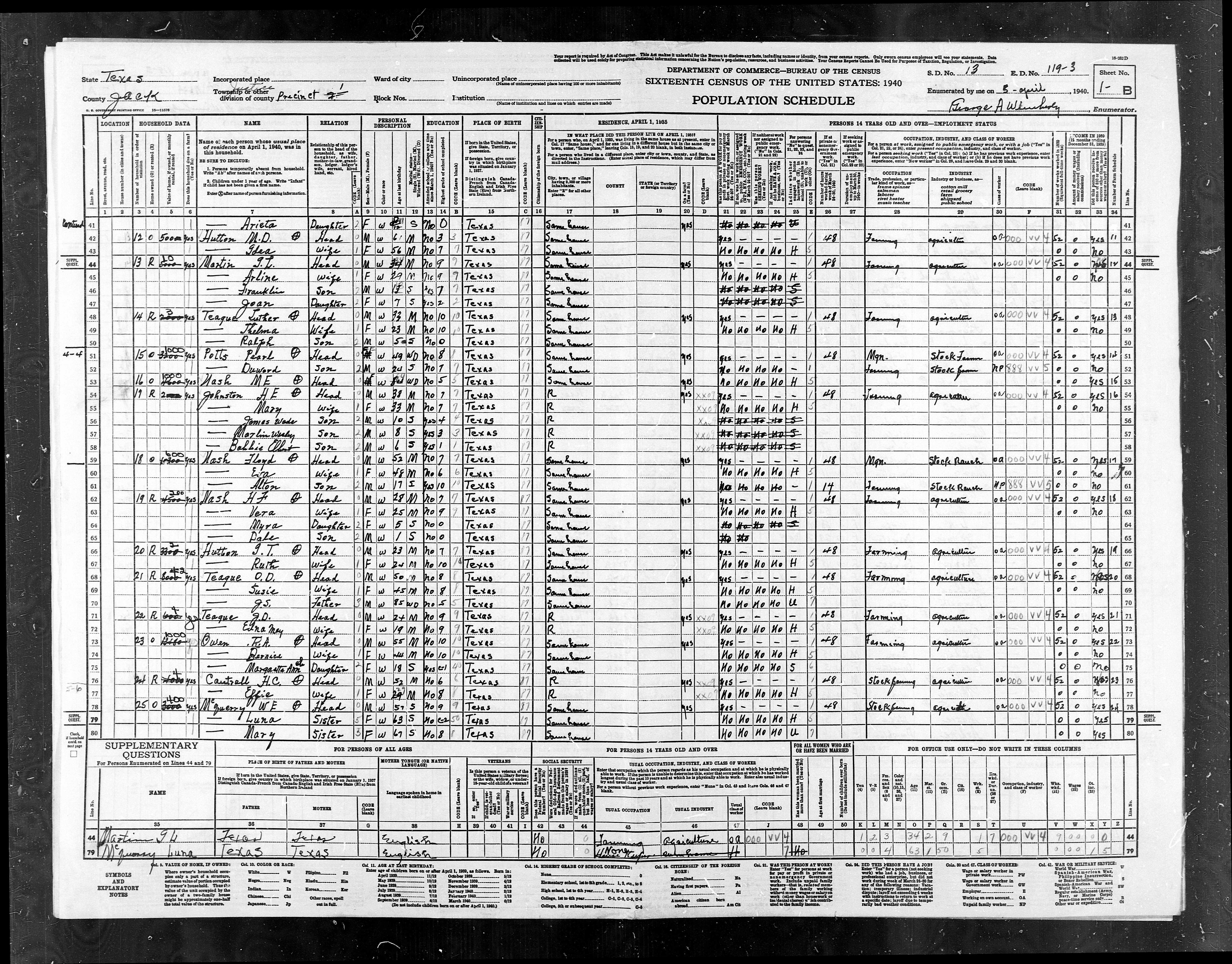
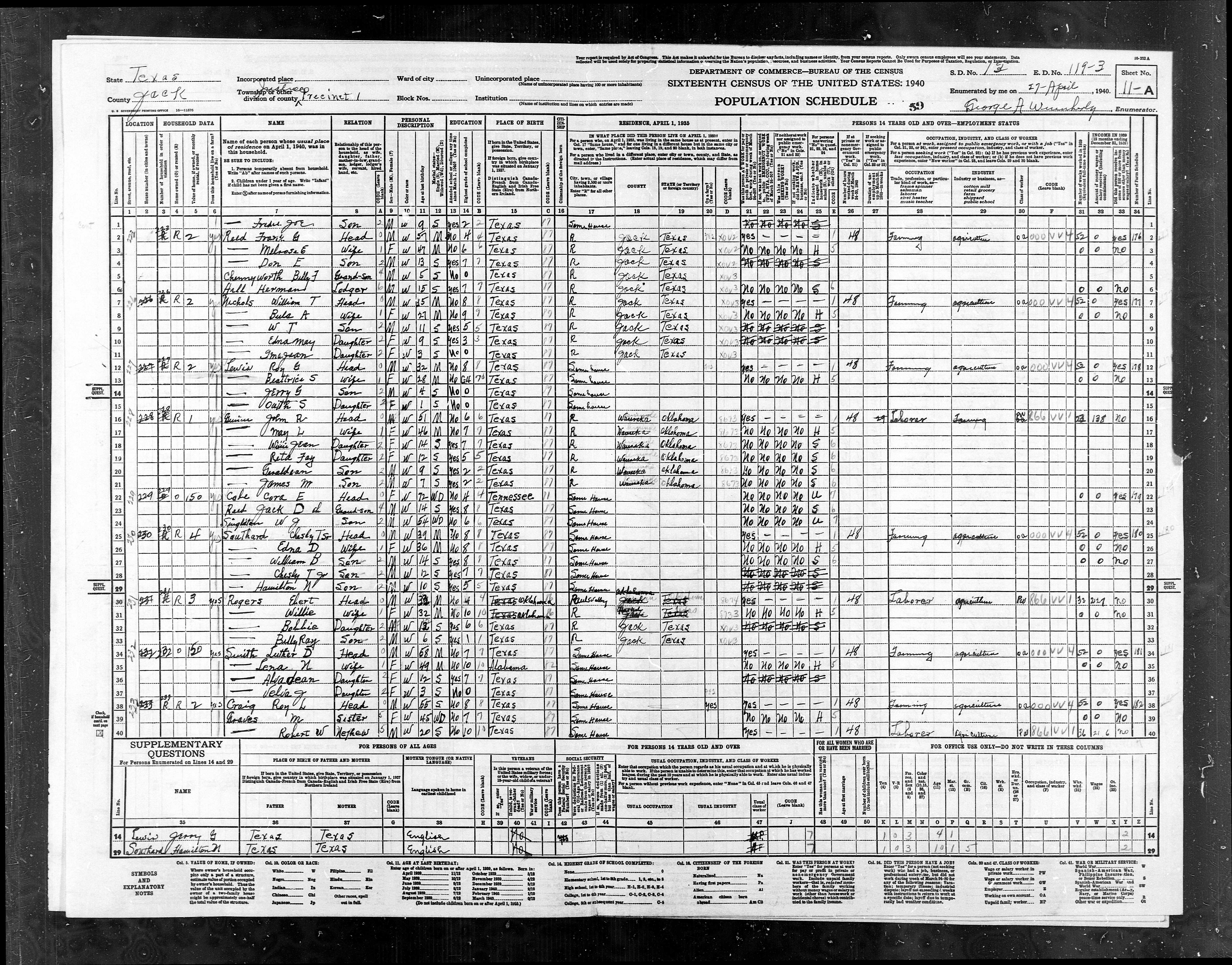
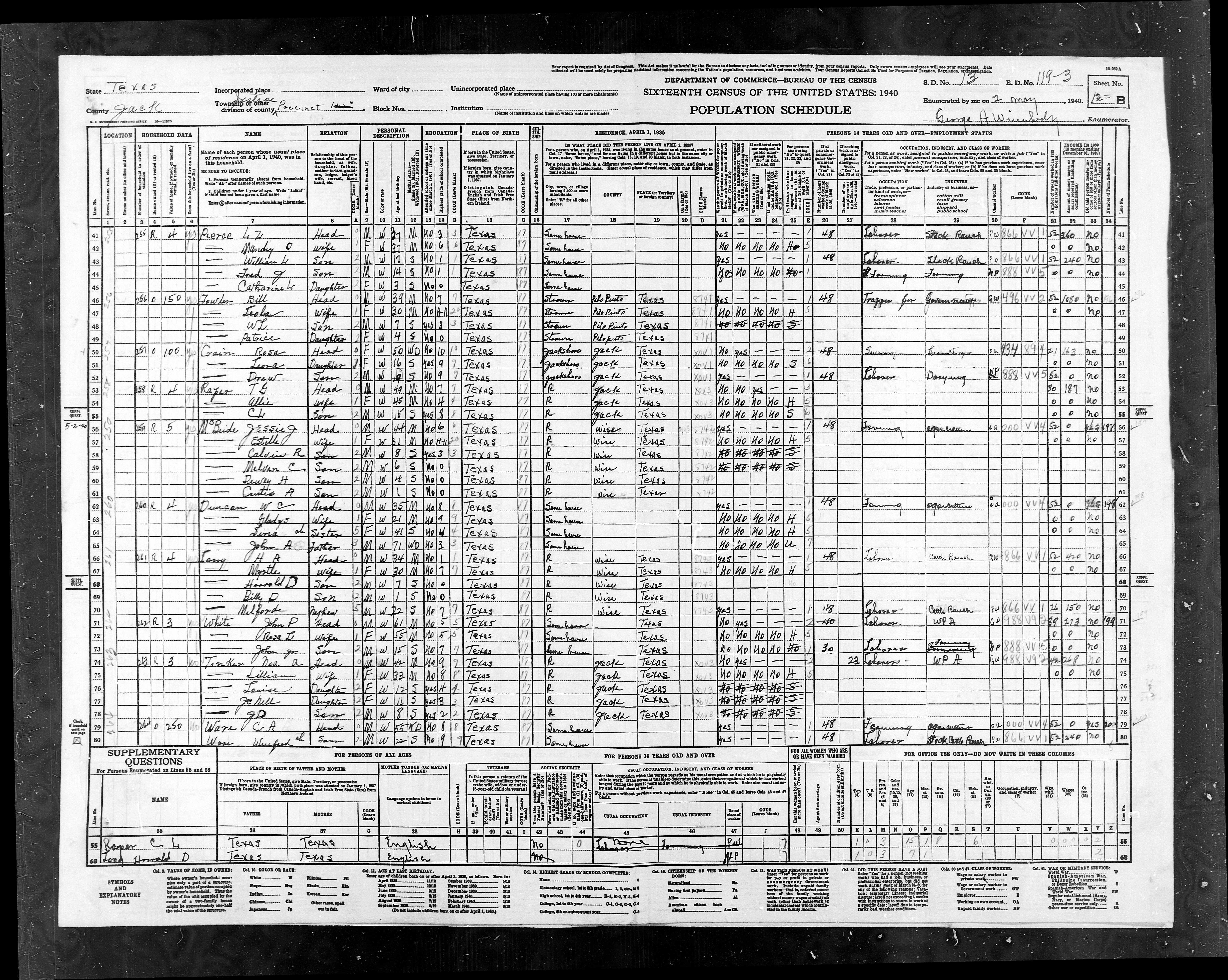
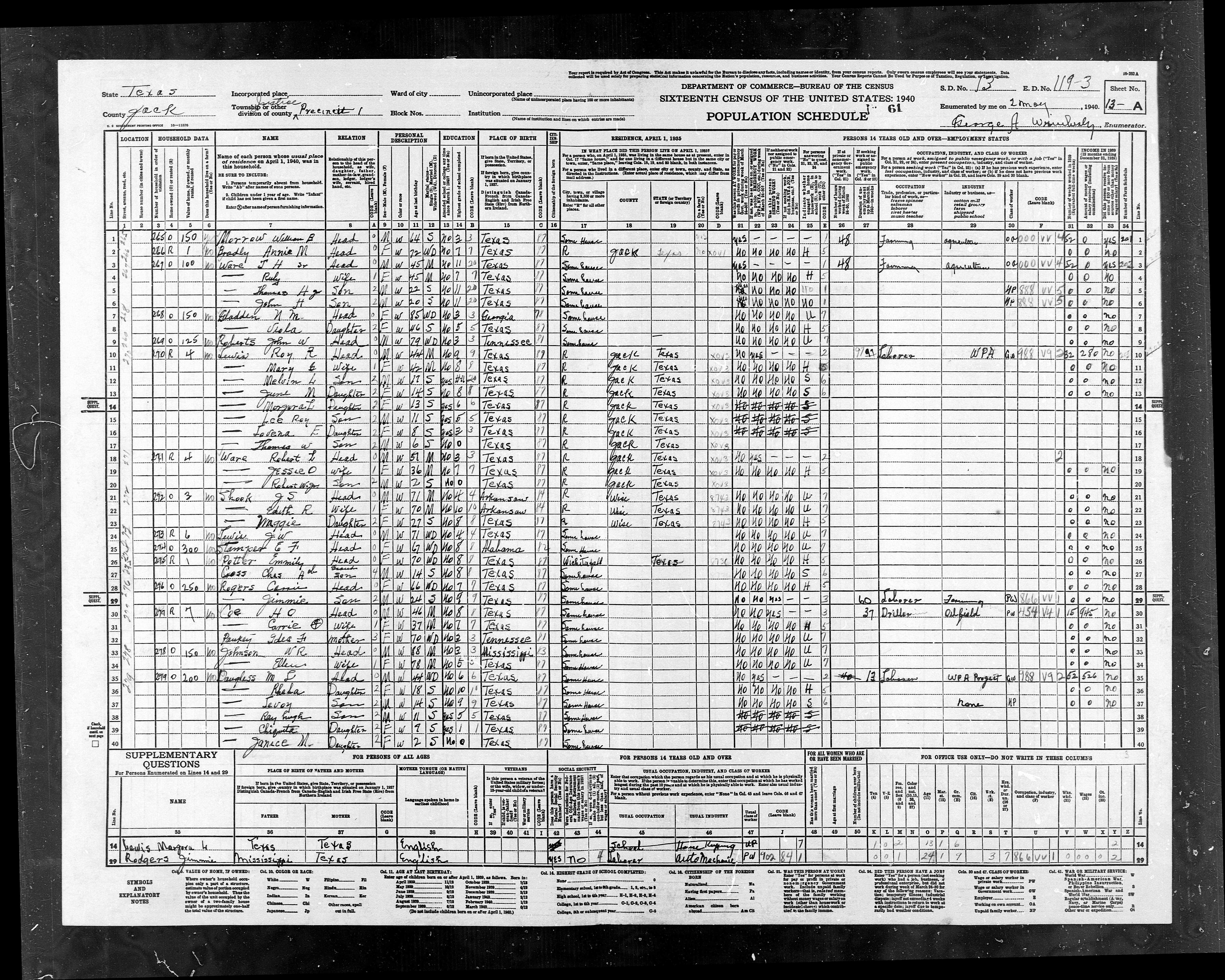
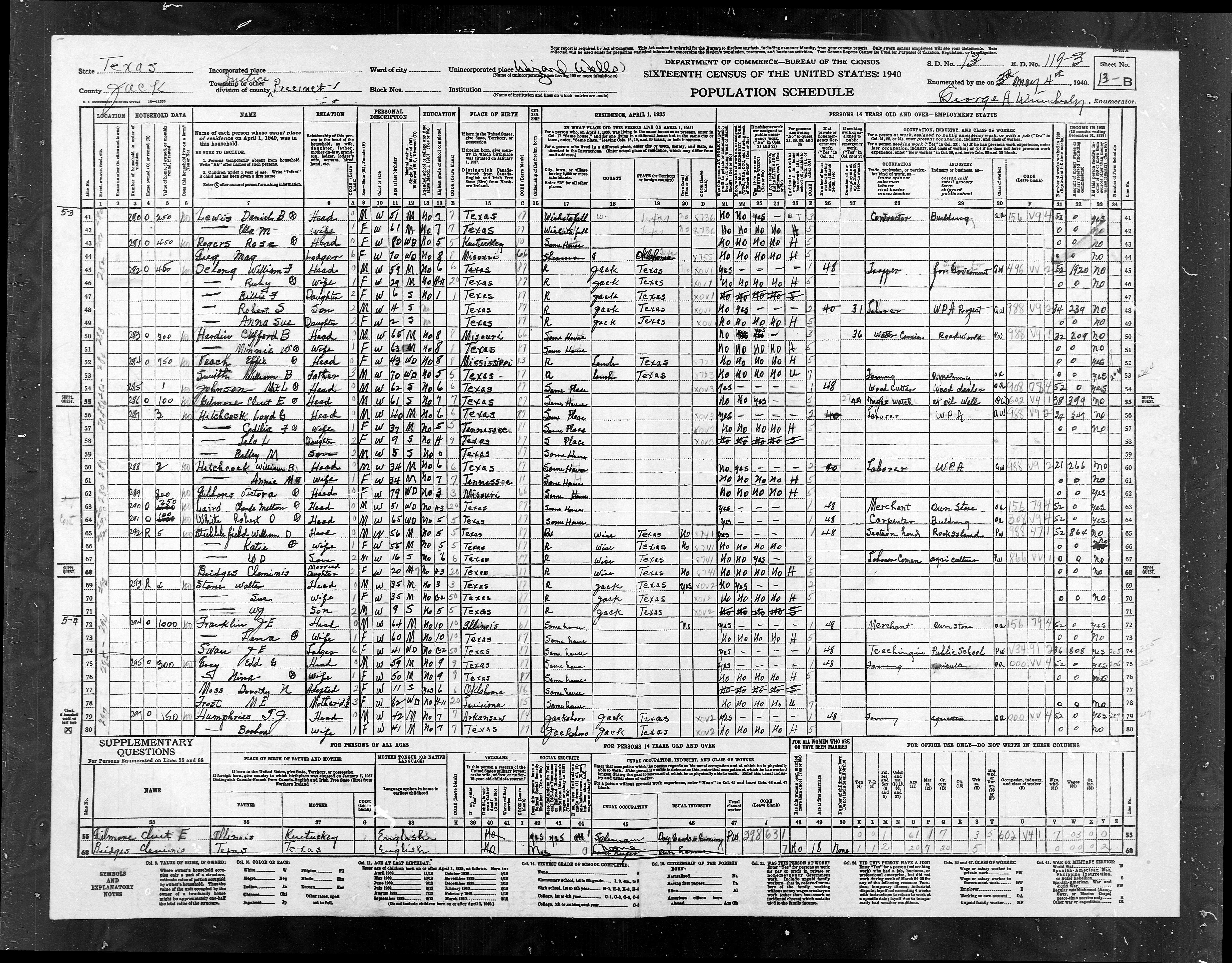
ED
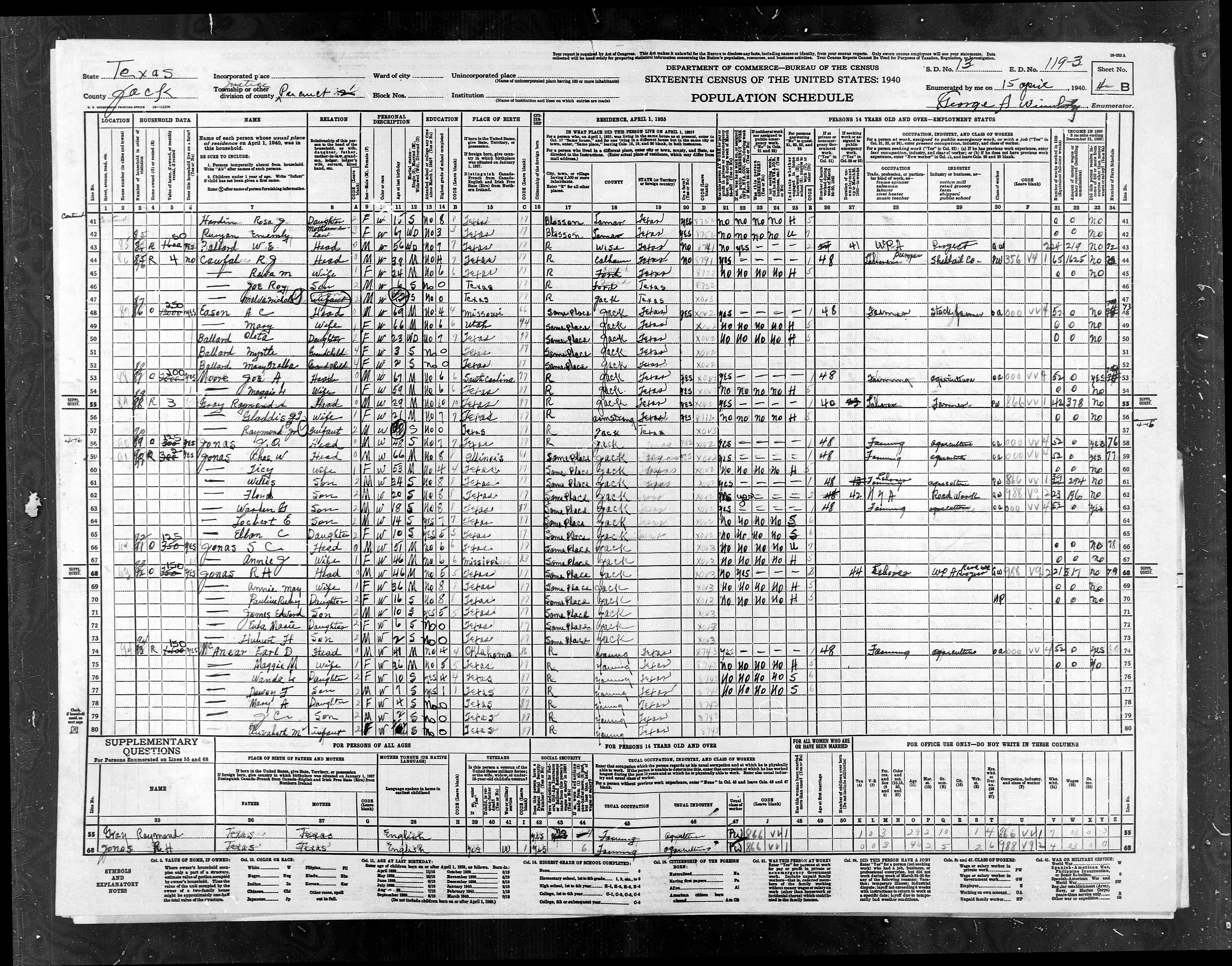
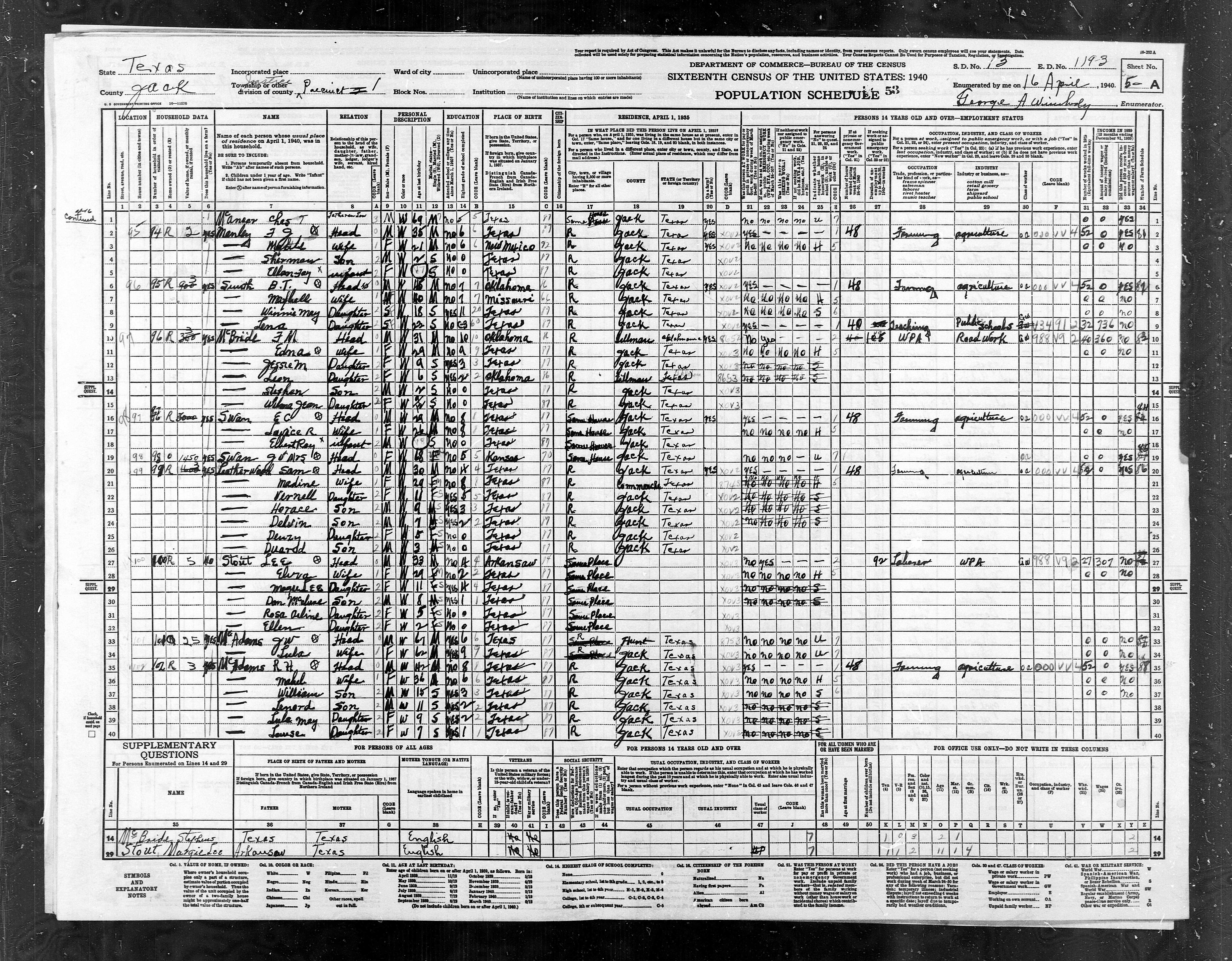
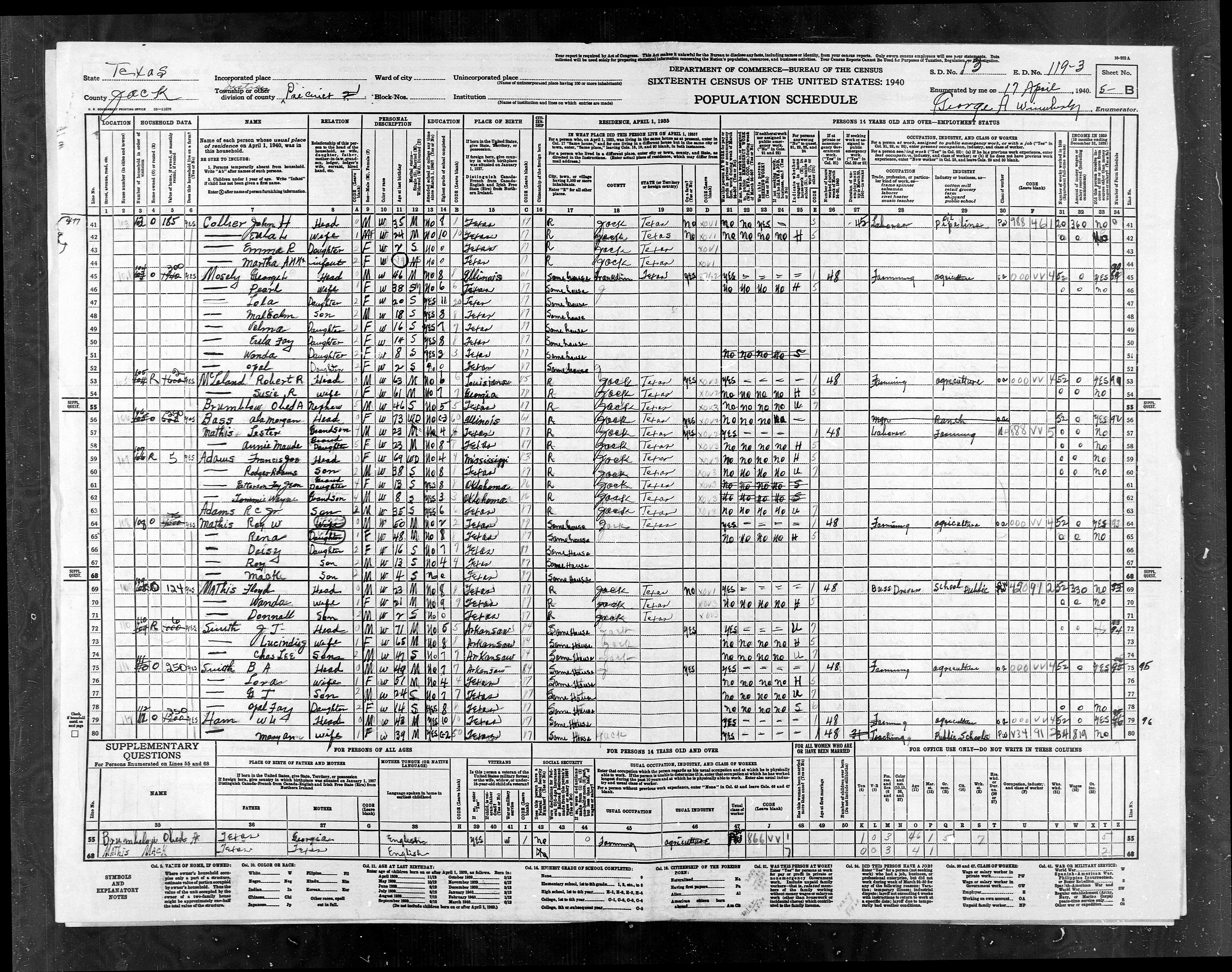
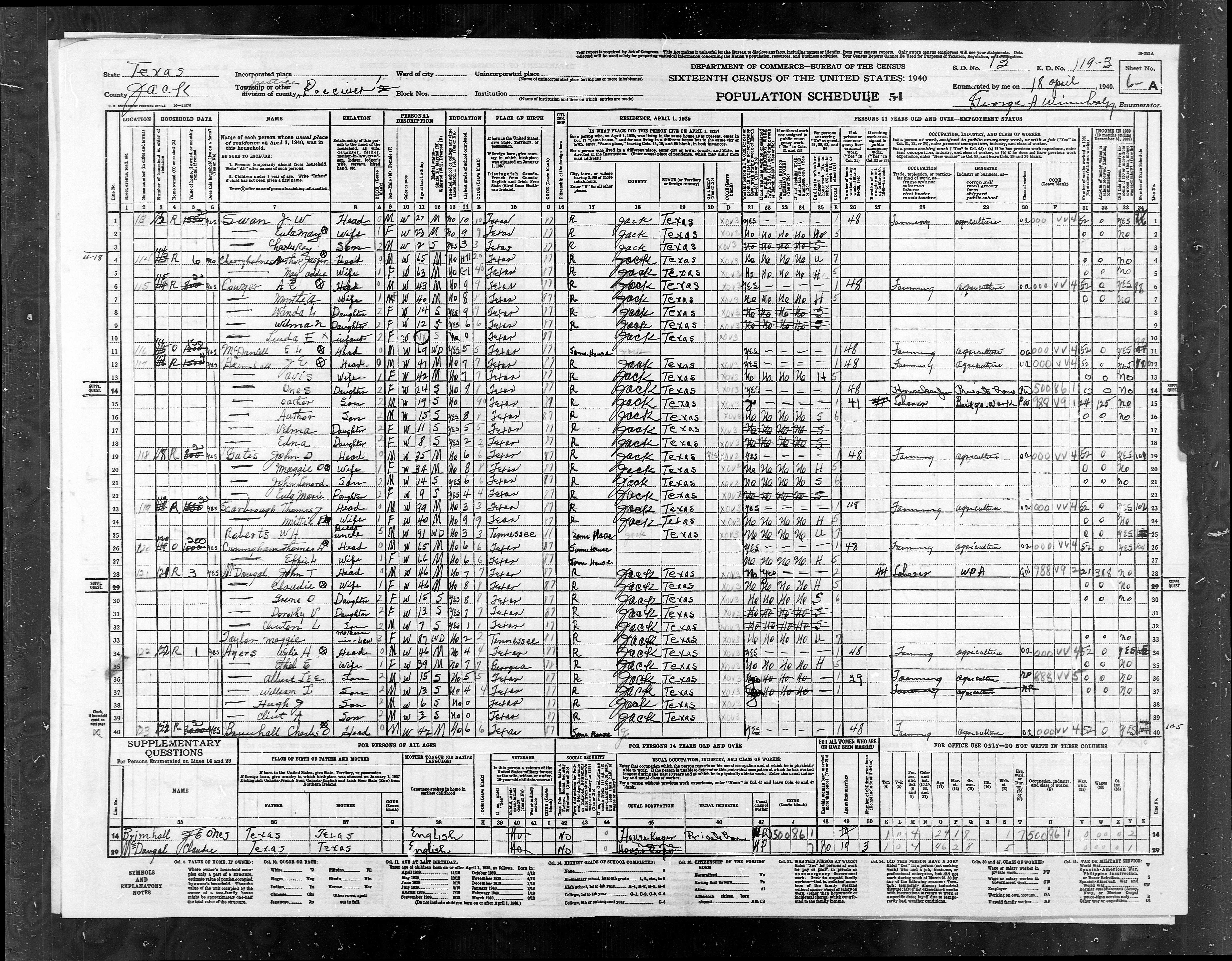
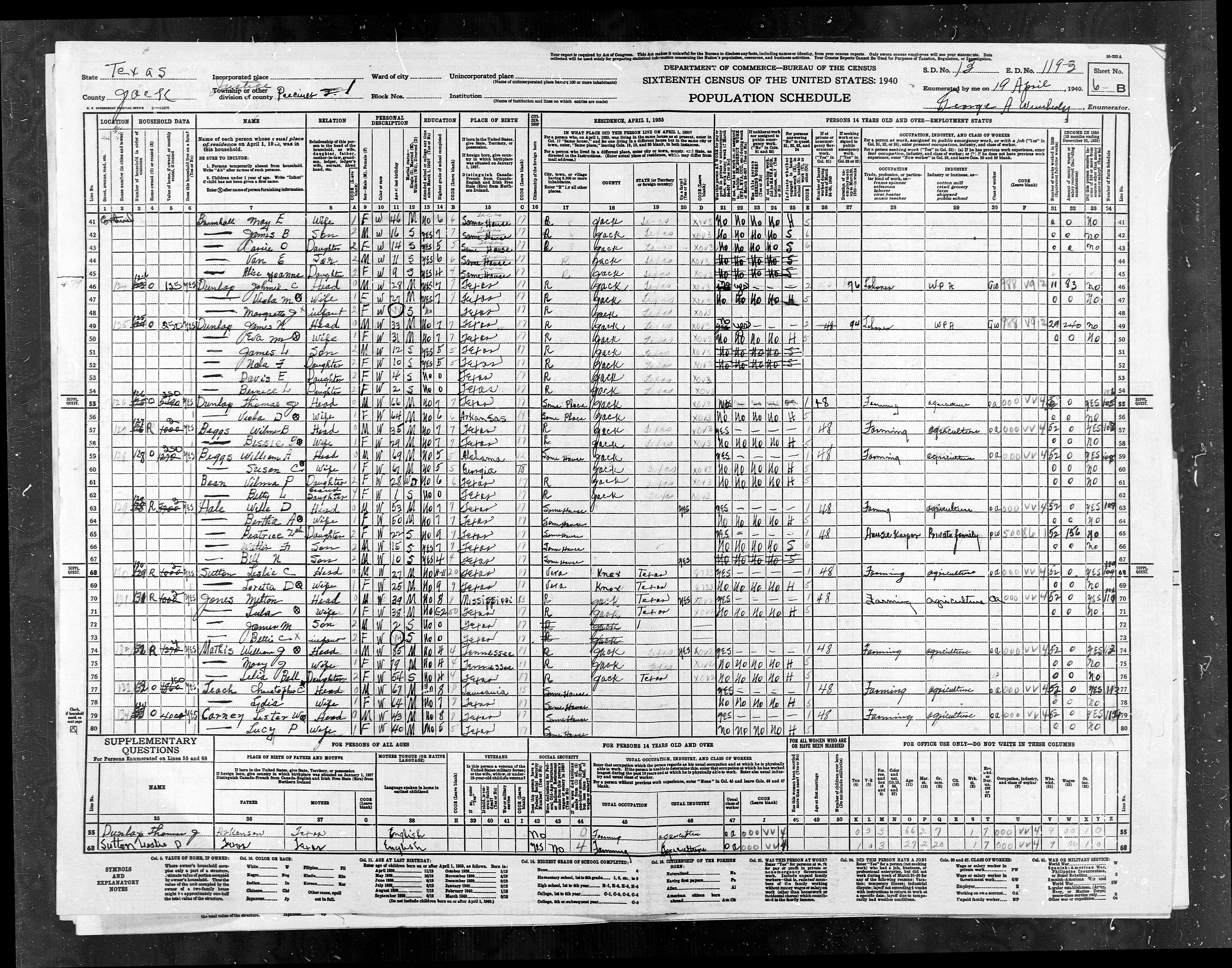
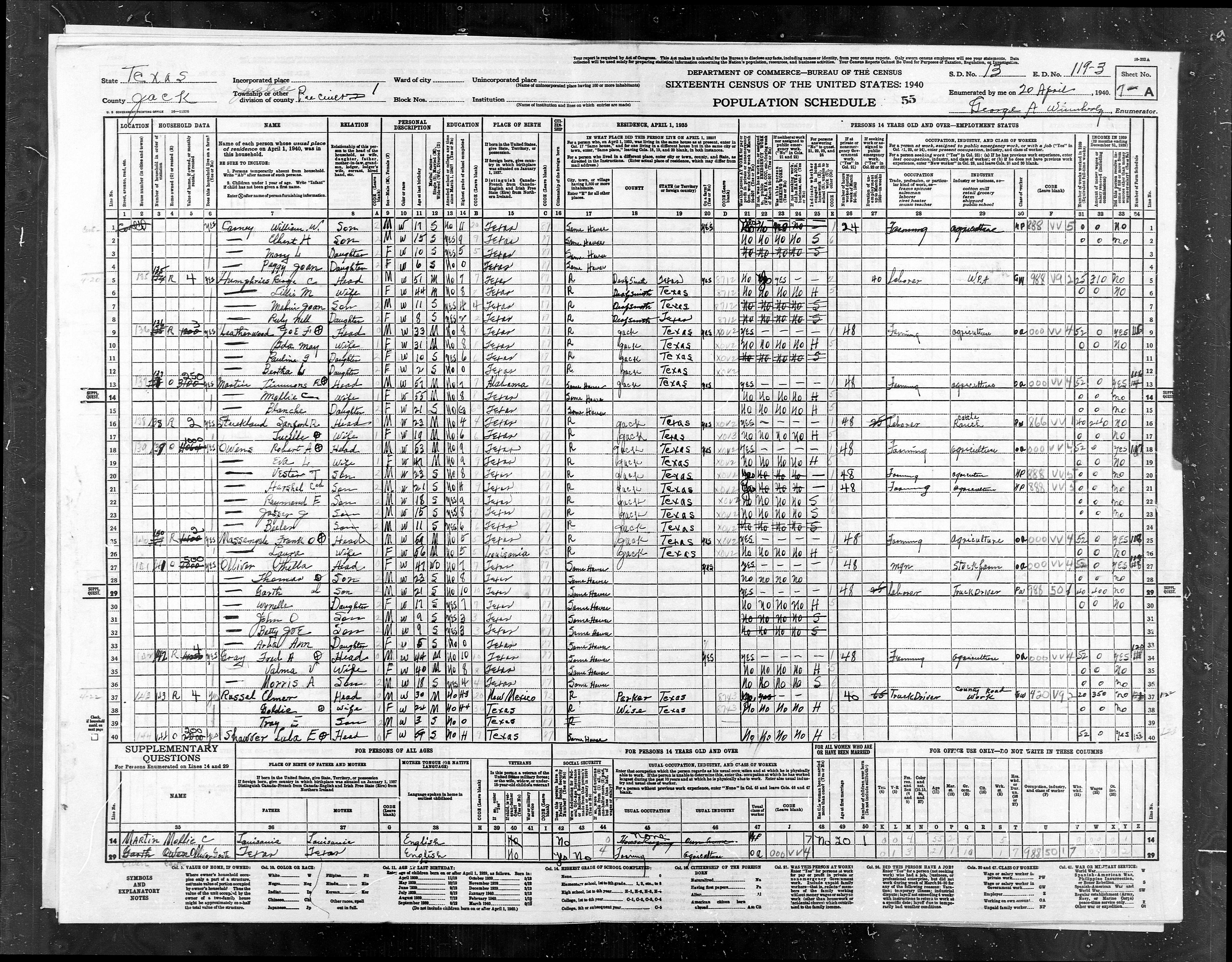
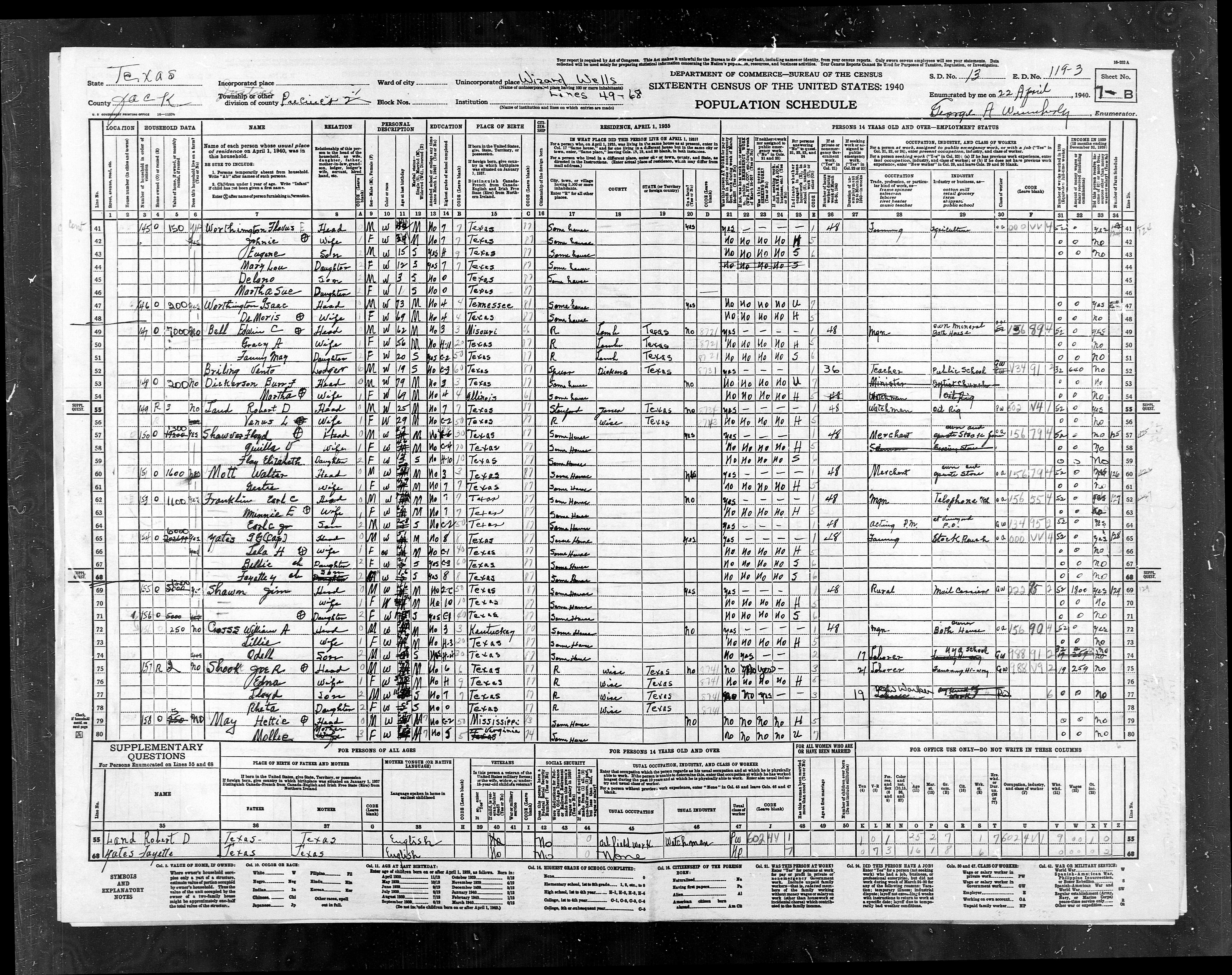
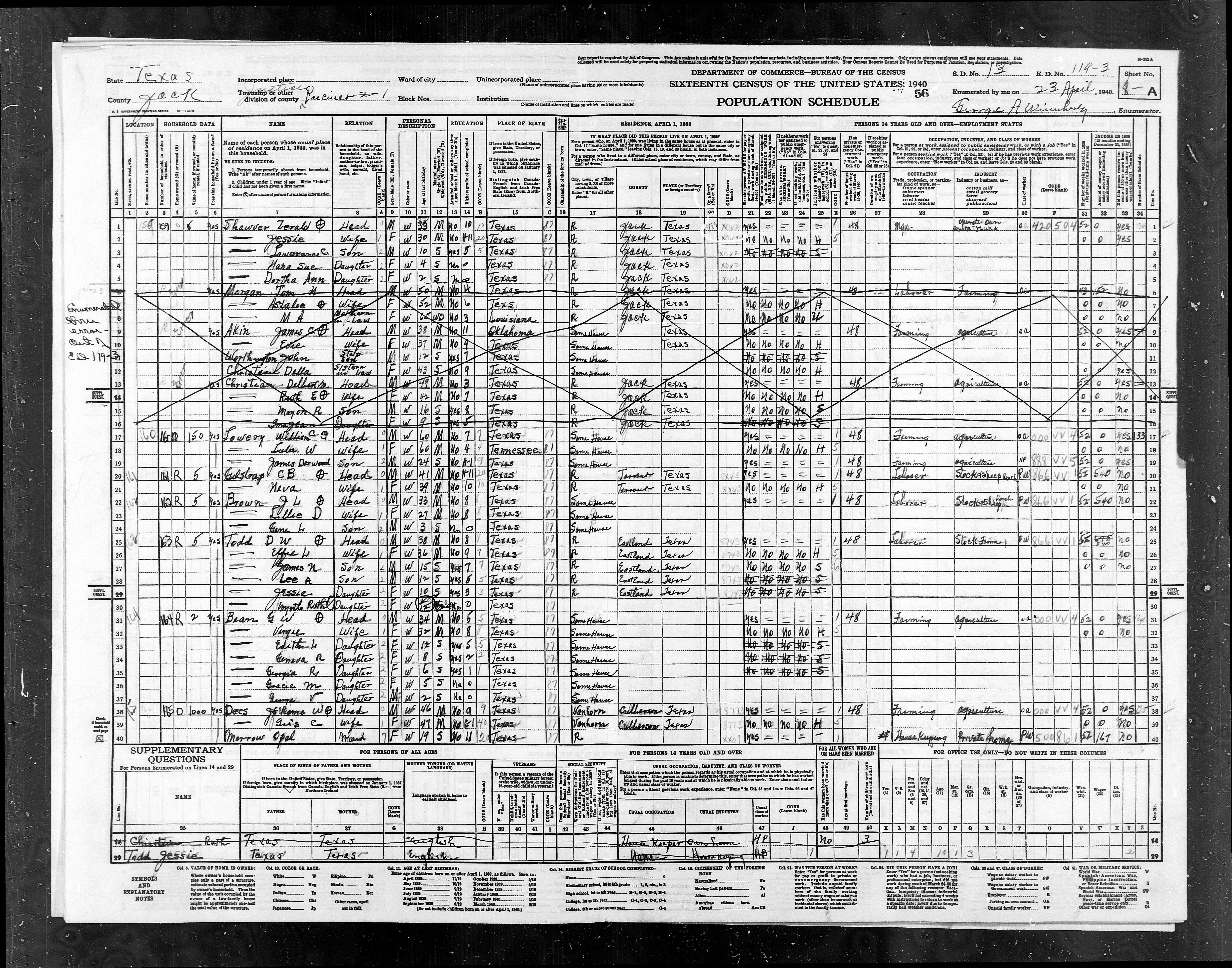
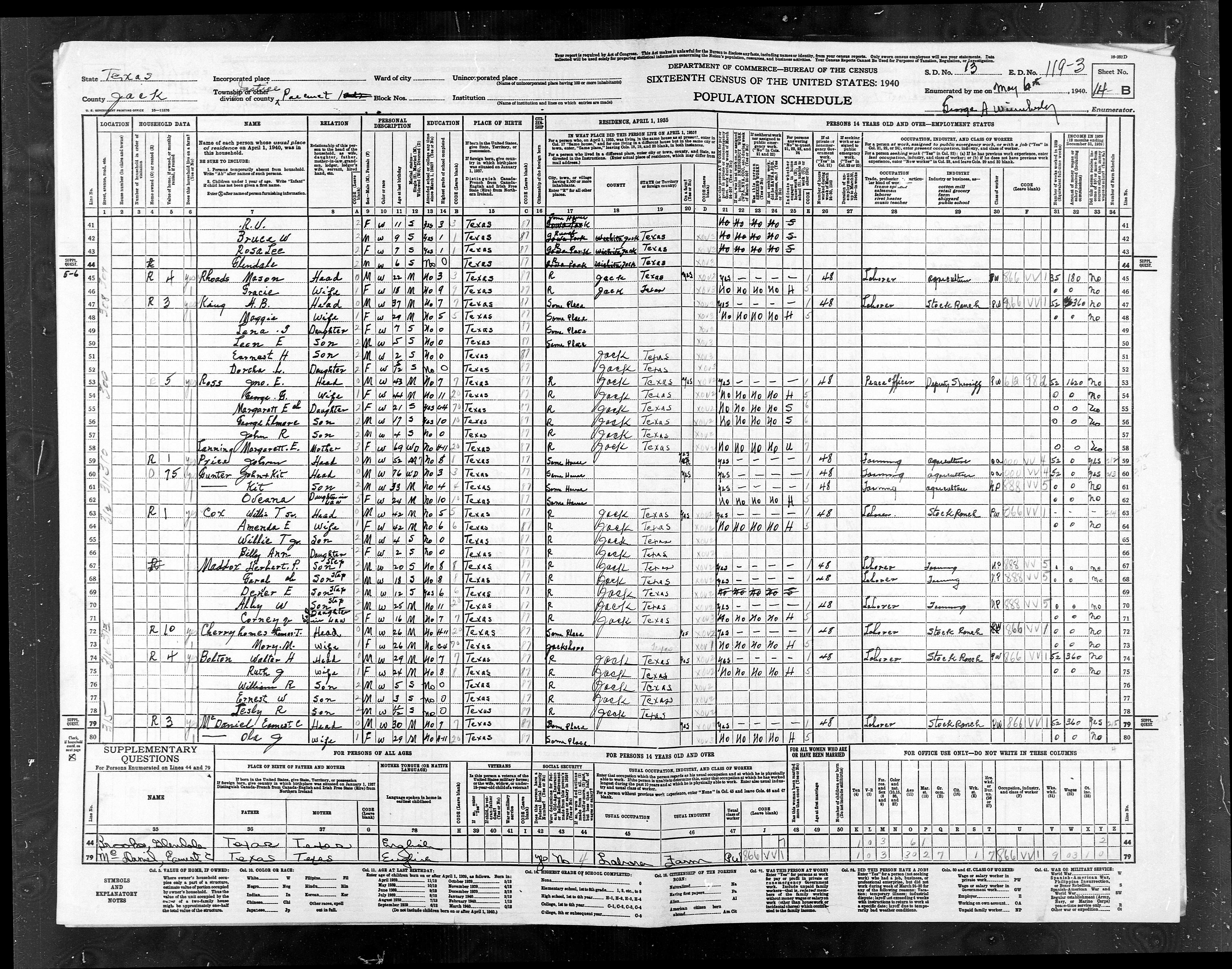
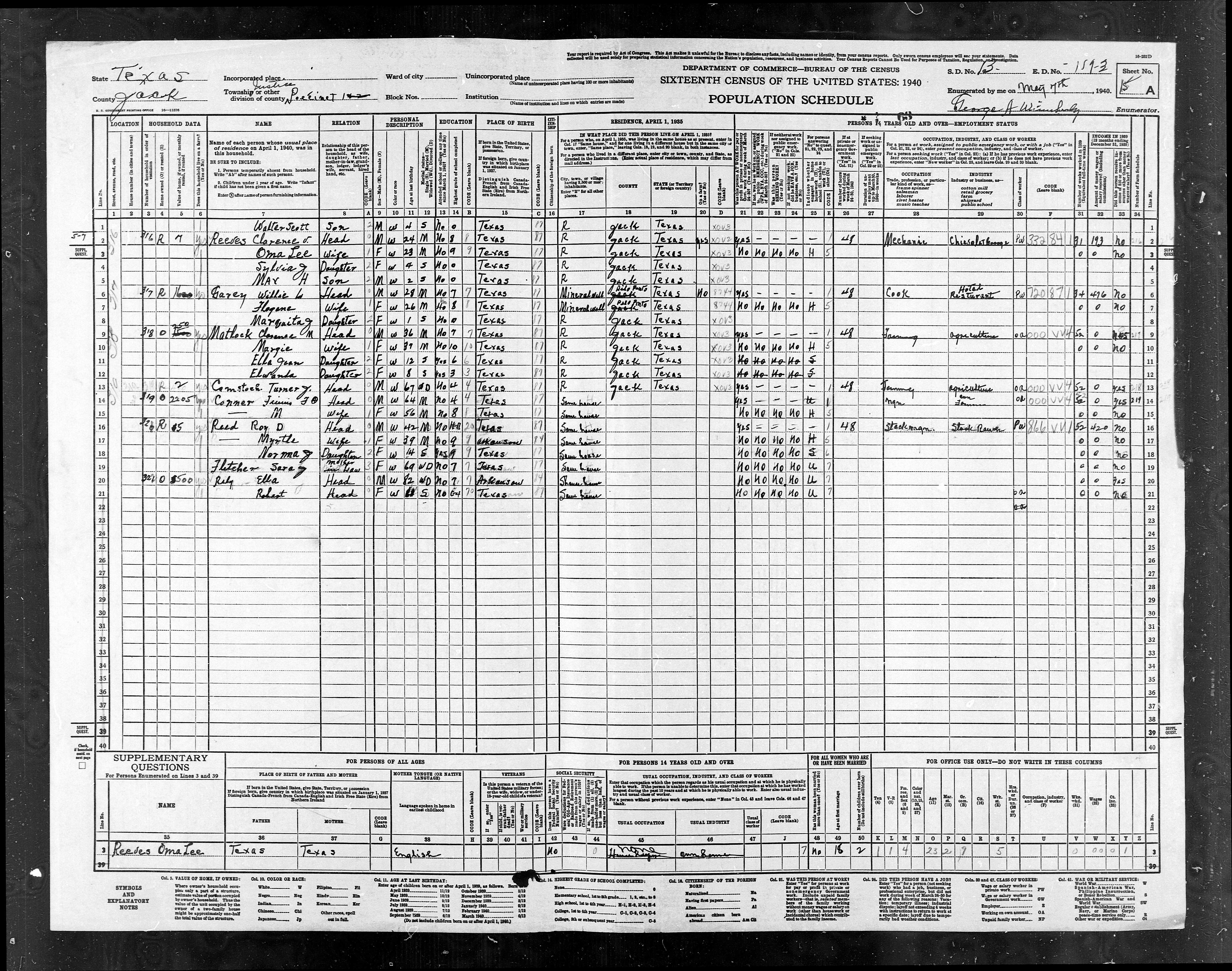
119-3 |
ED
119-3 |
Pct
1, N of Hwy 24 (Fm 1810 + 380) - Part of Cundiff, Wizard Wells,
Vineyard, Barton's Chapel |
1206 |
1130 |
|
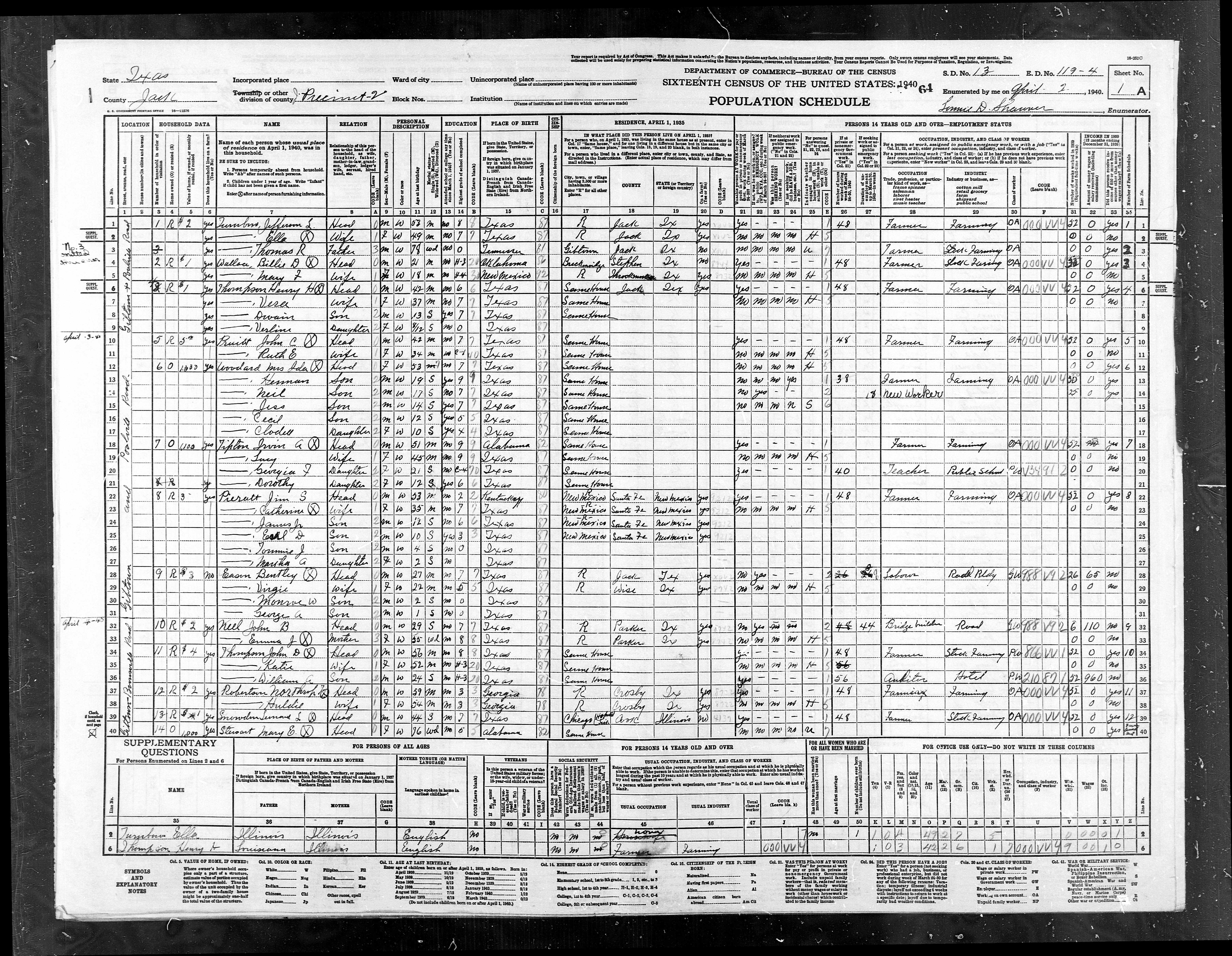
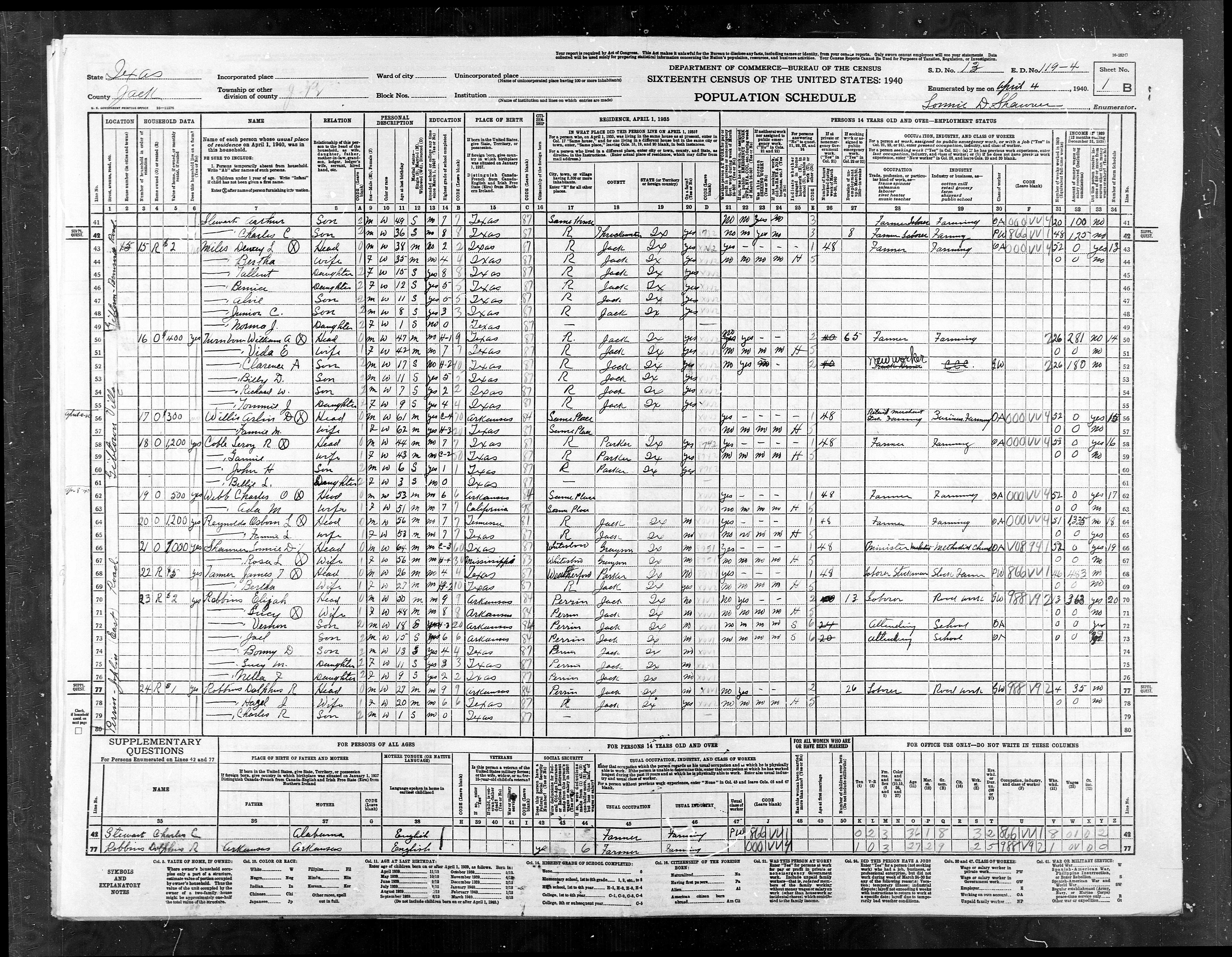
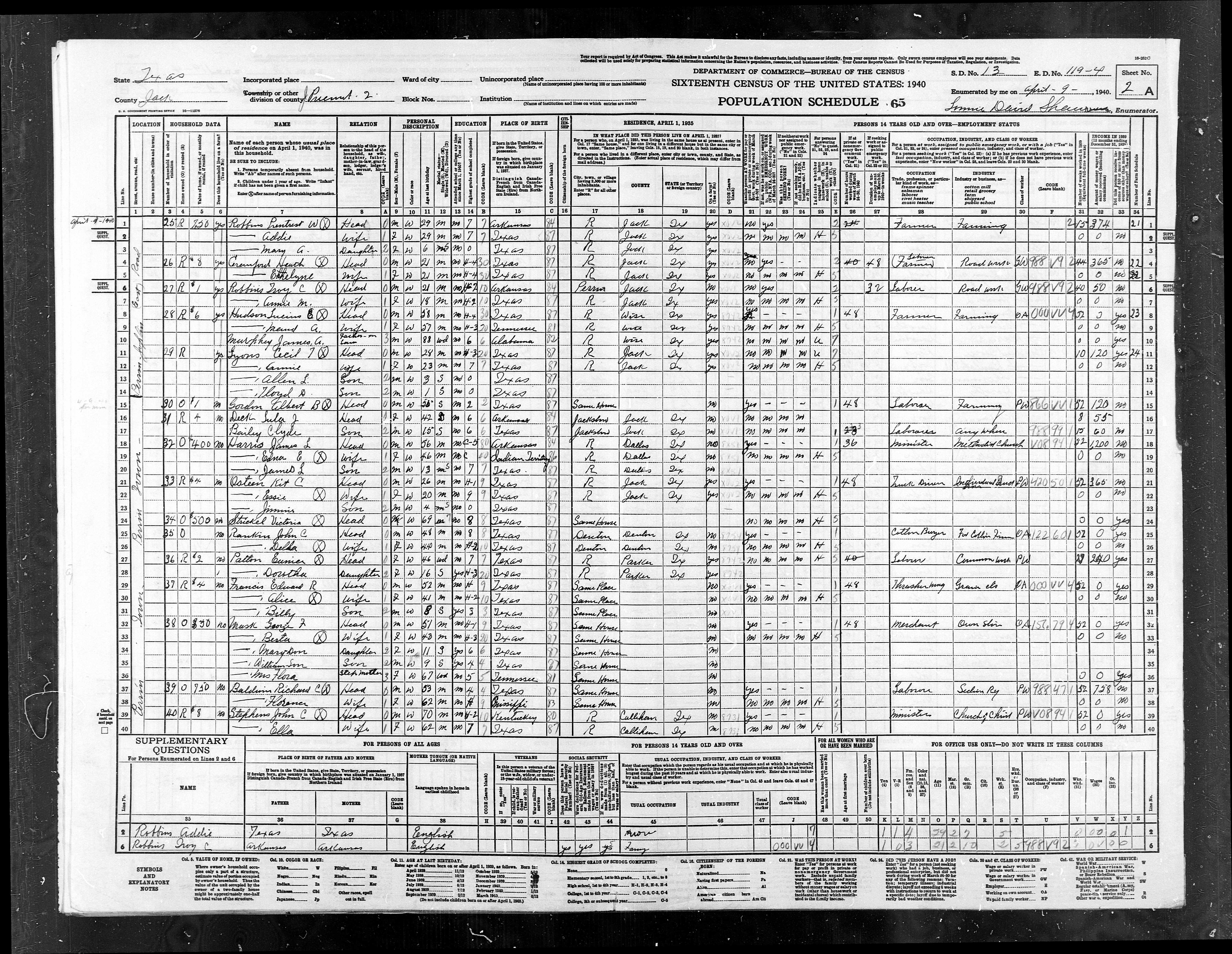
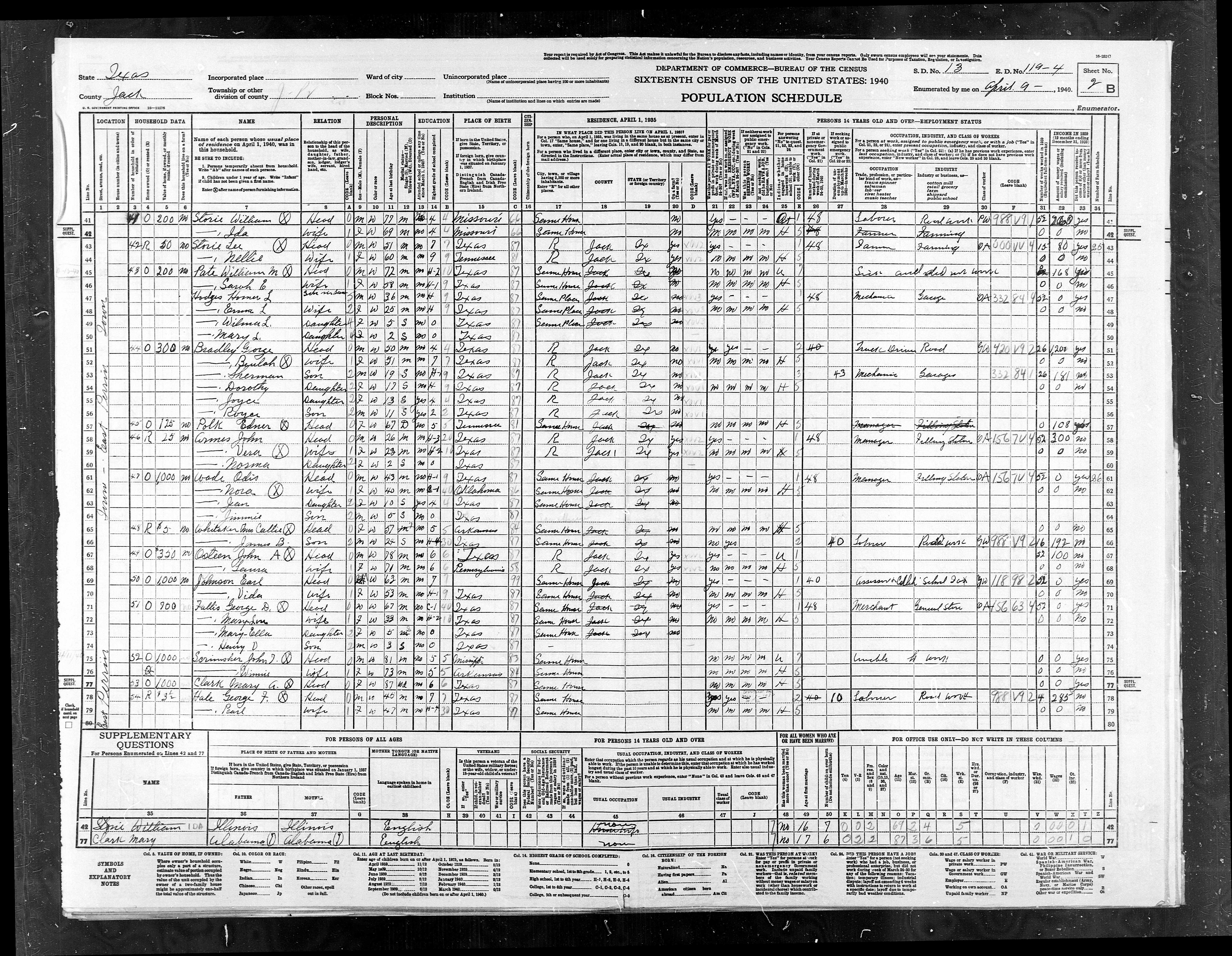
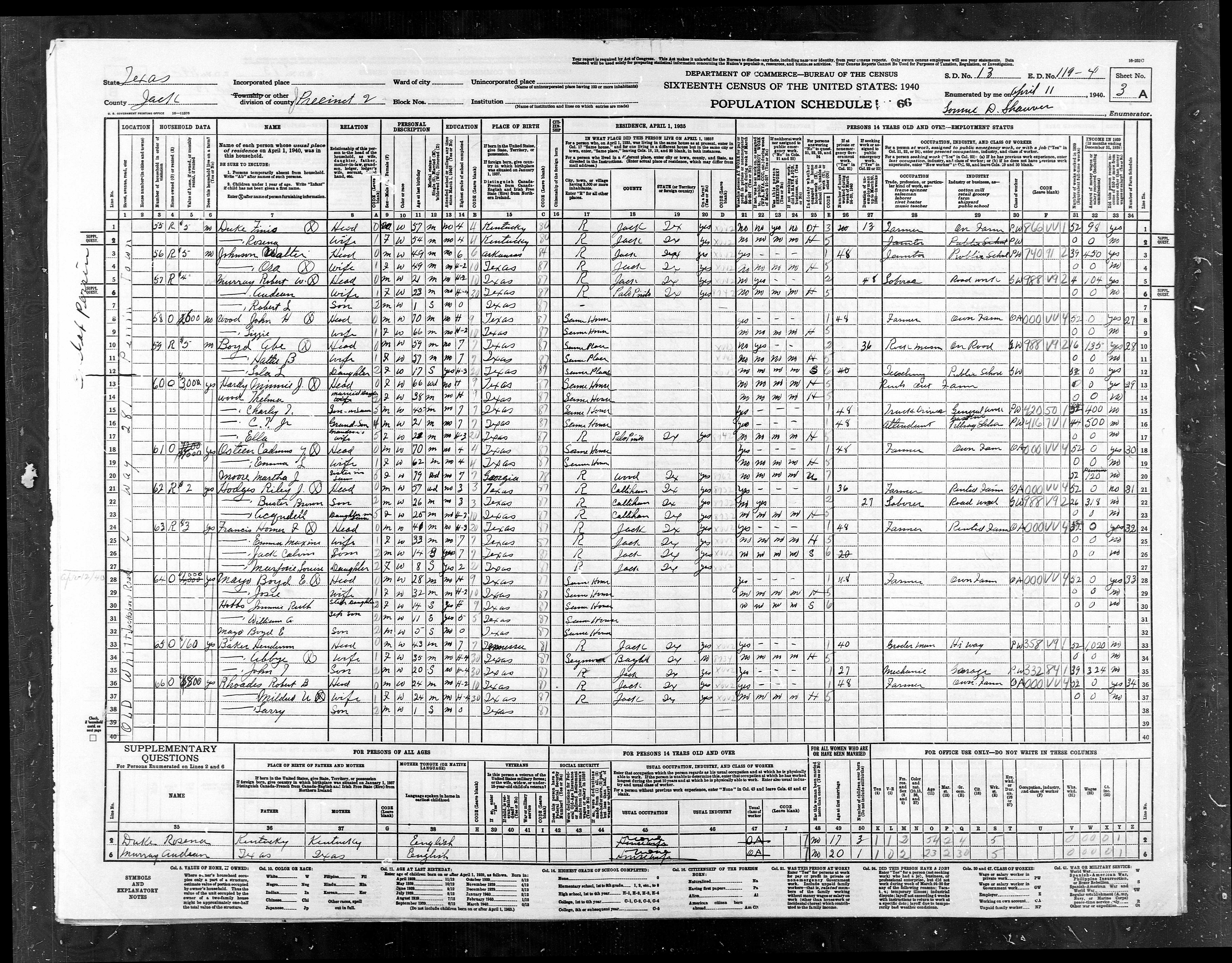
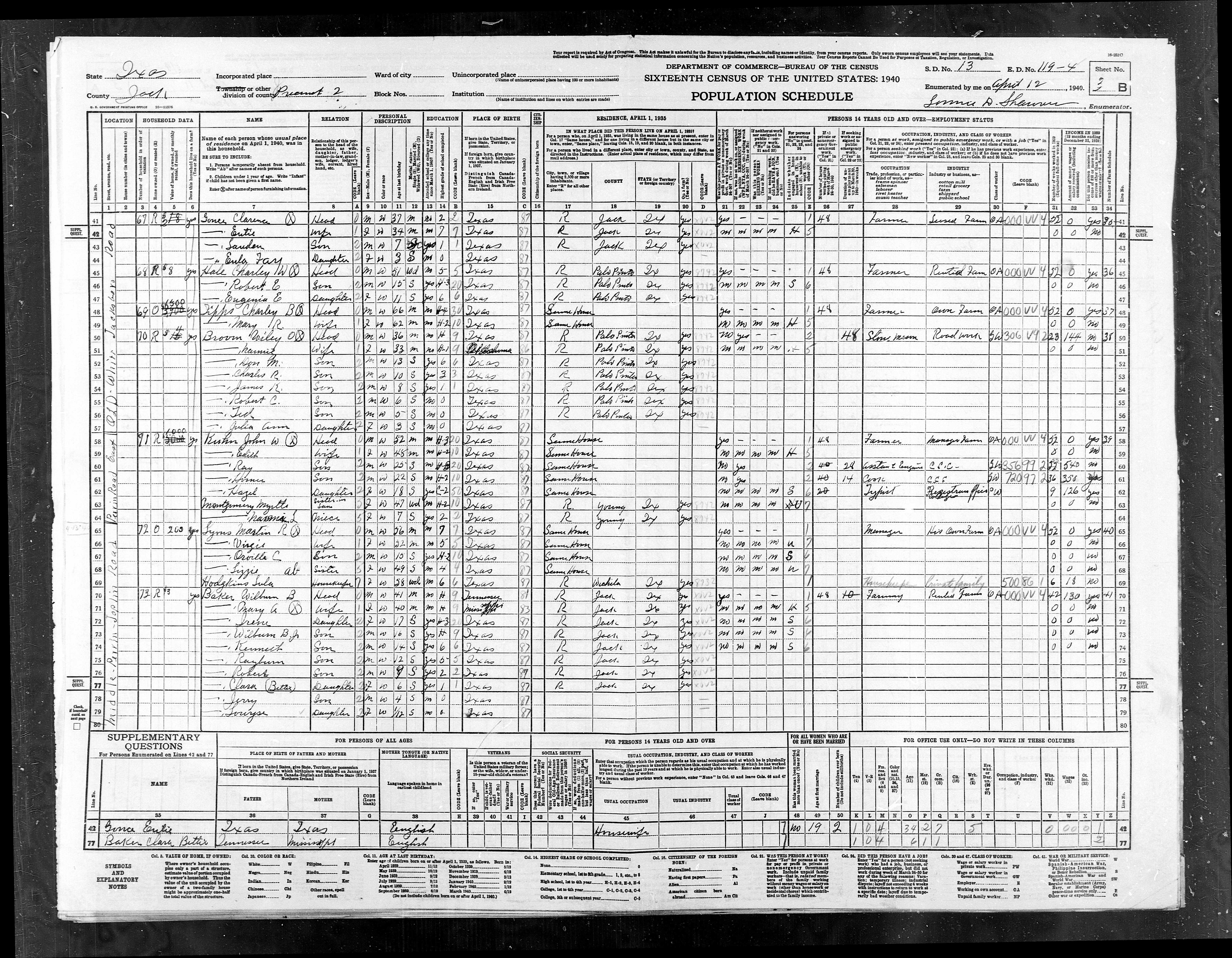
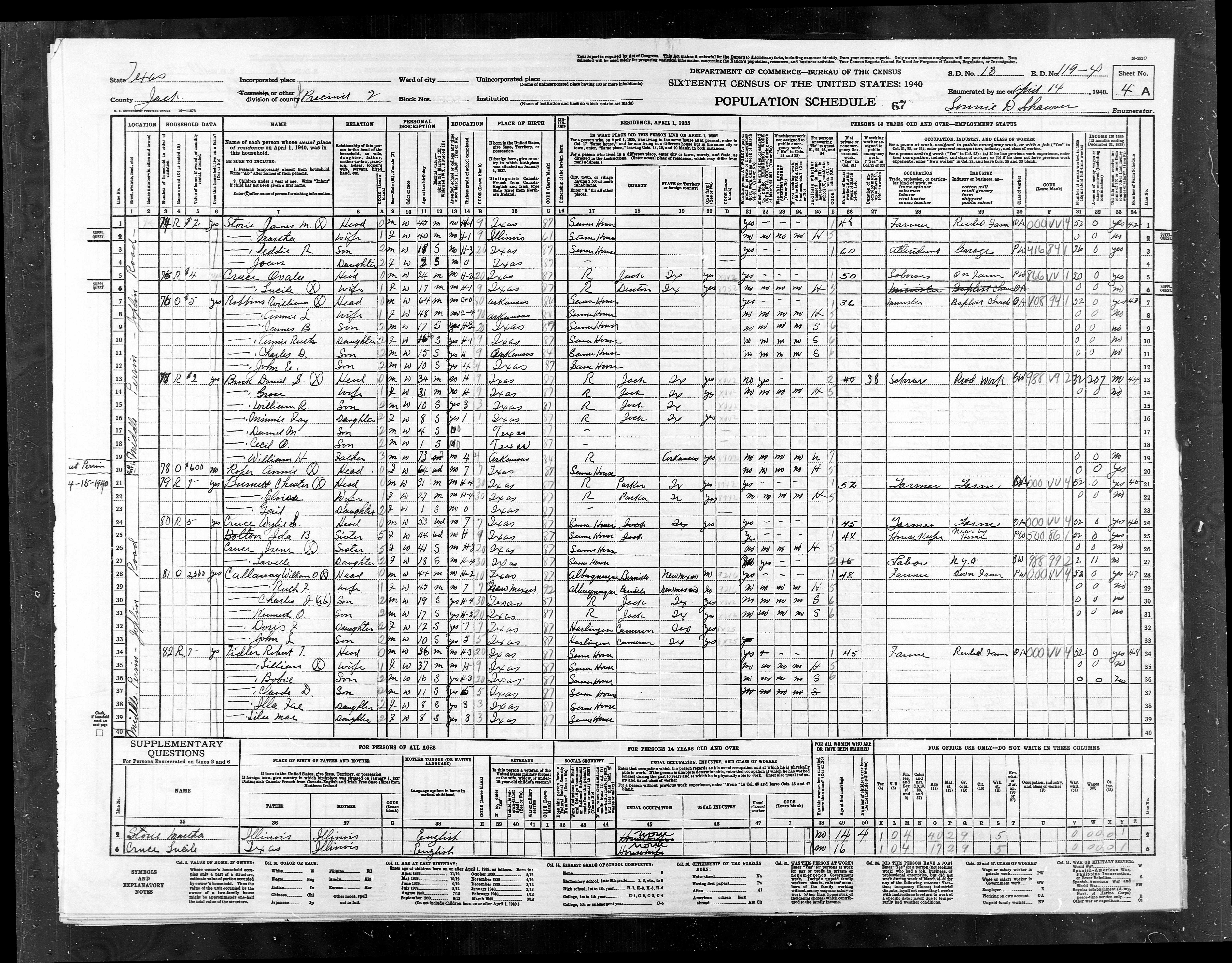
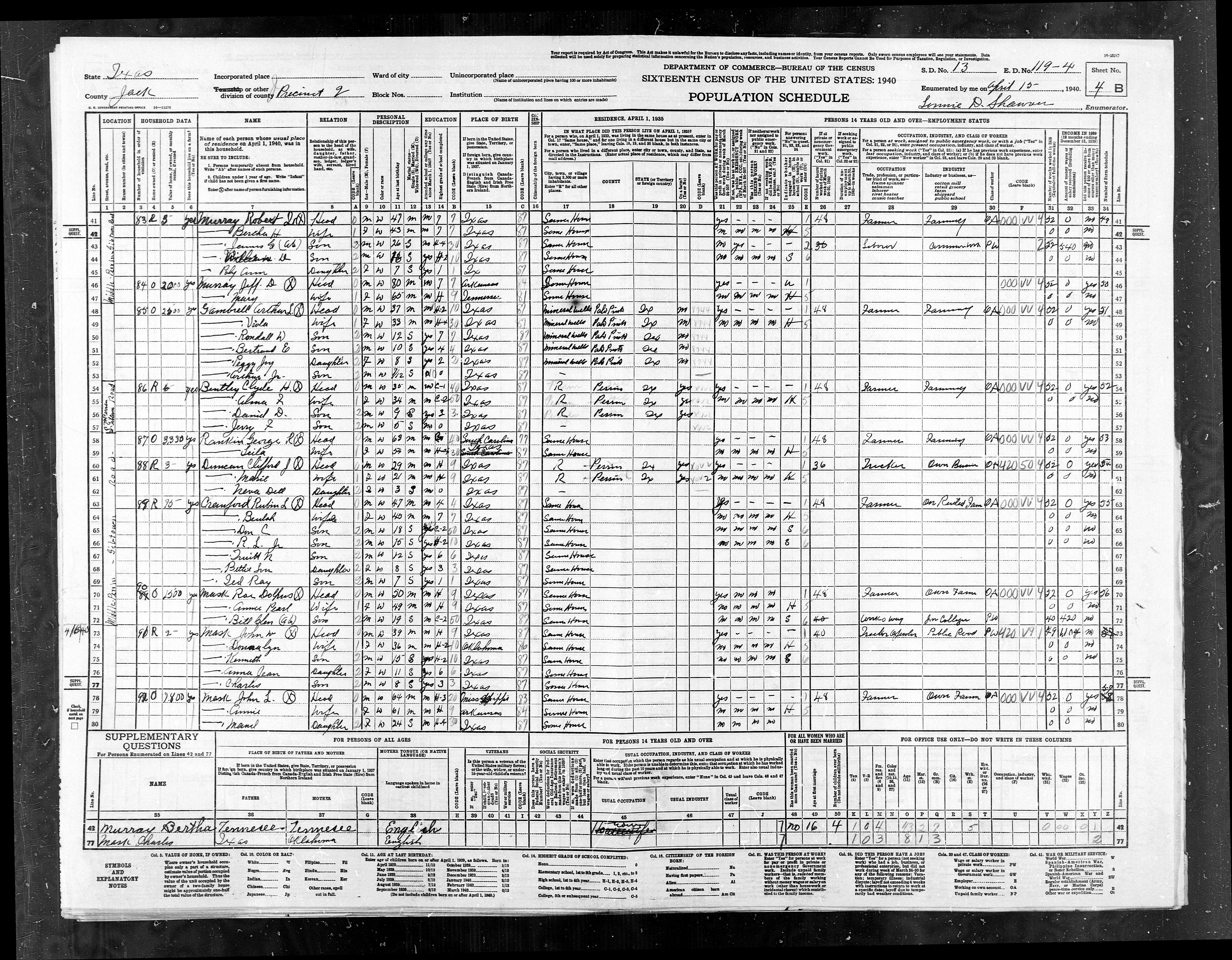
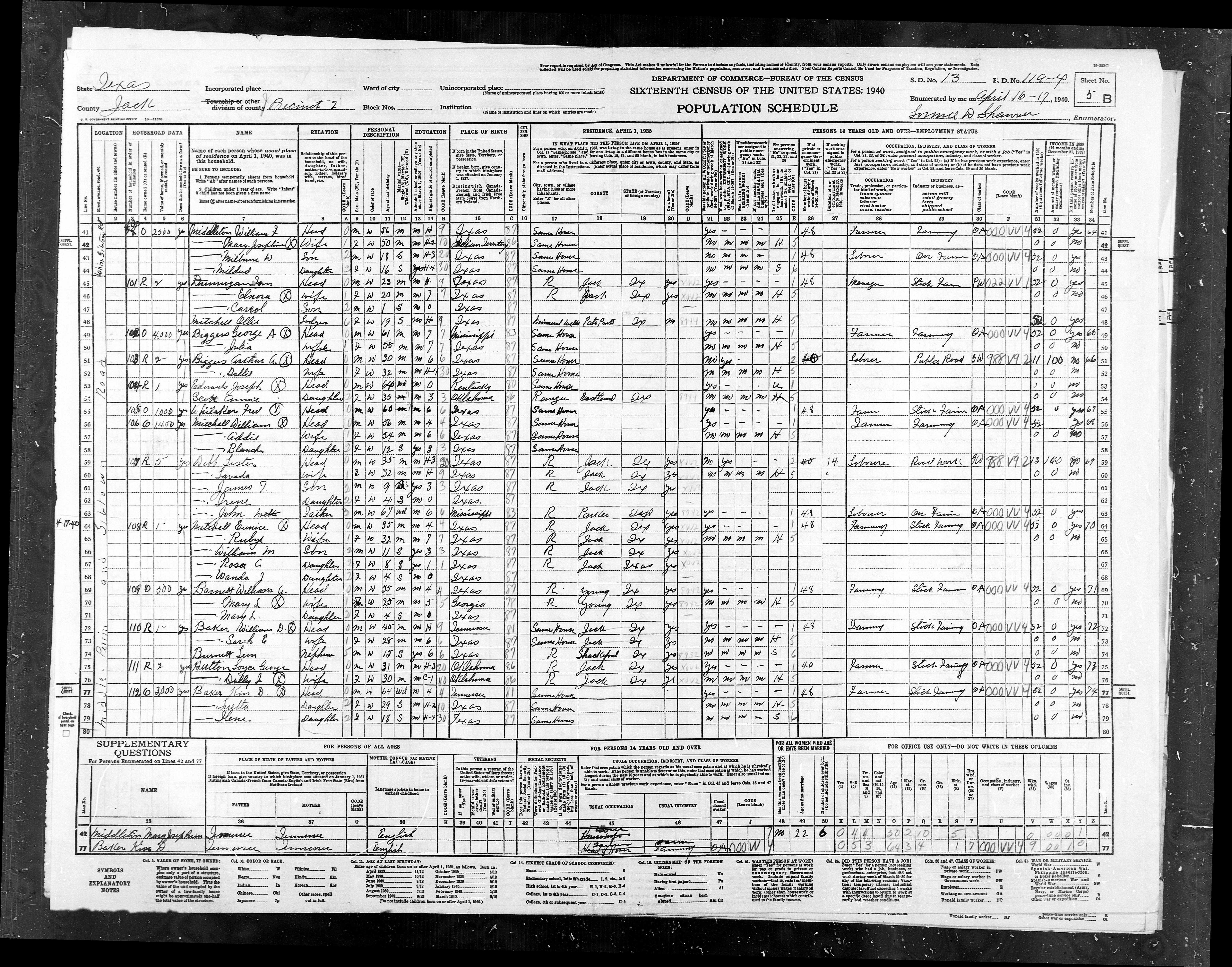
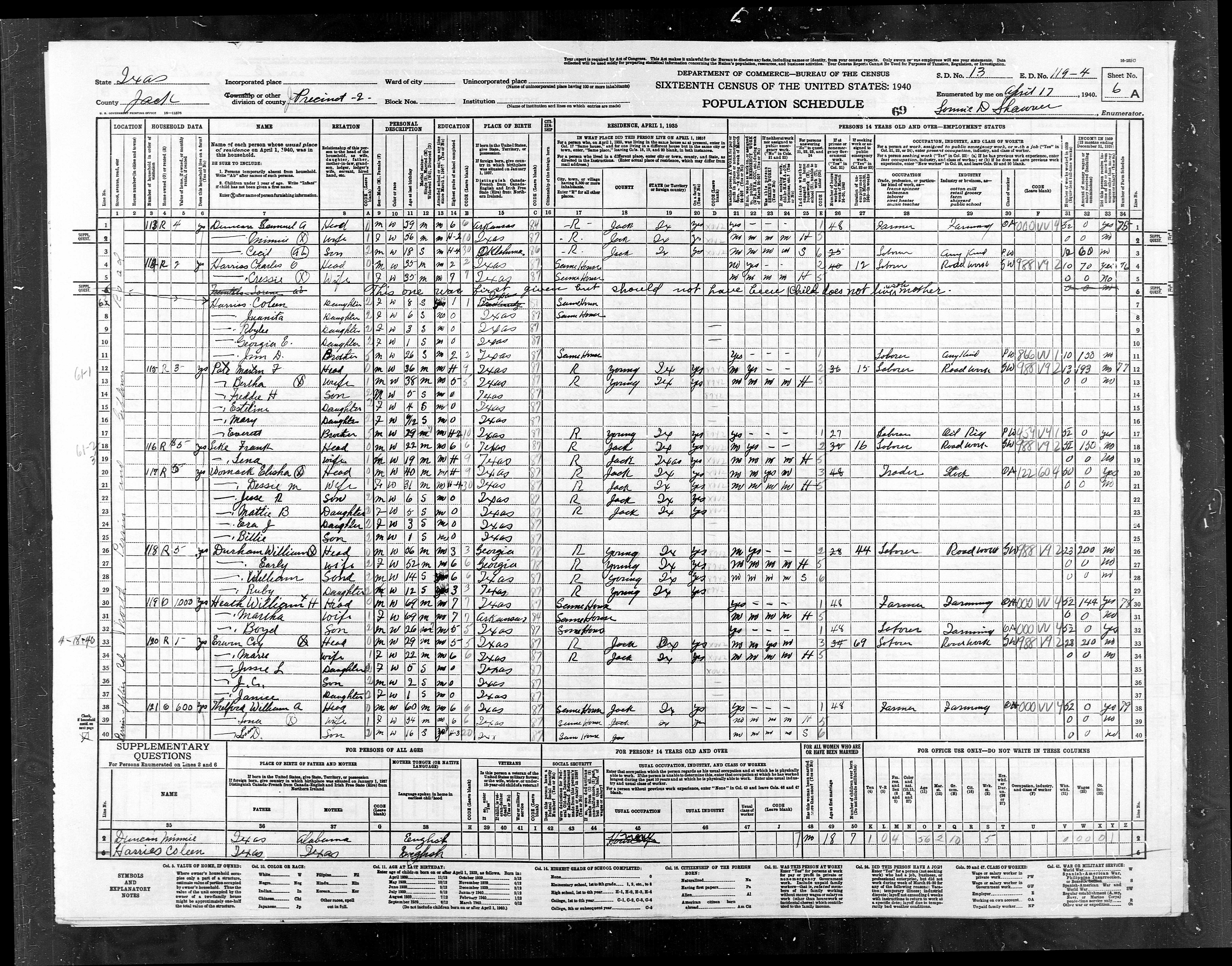
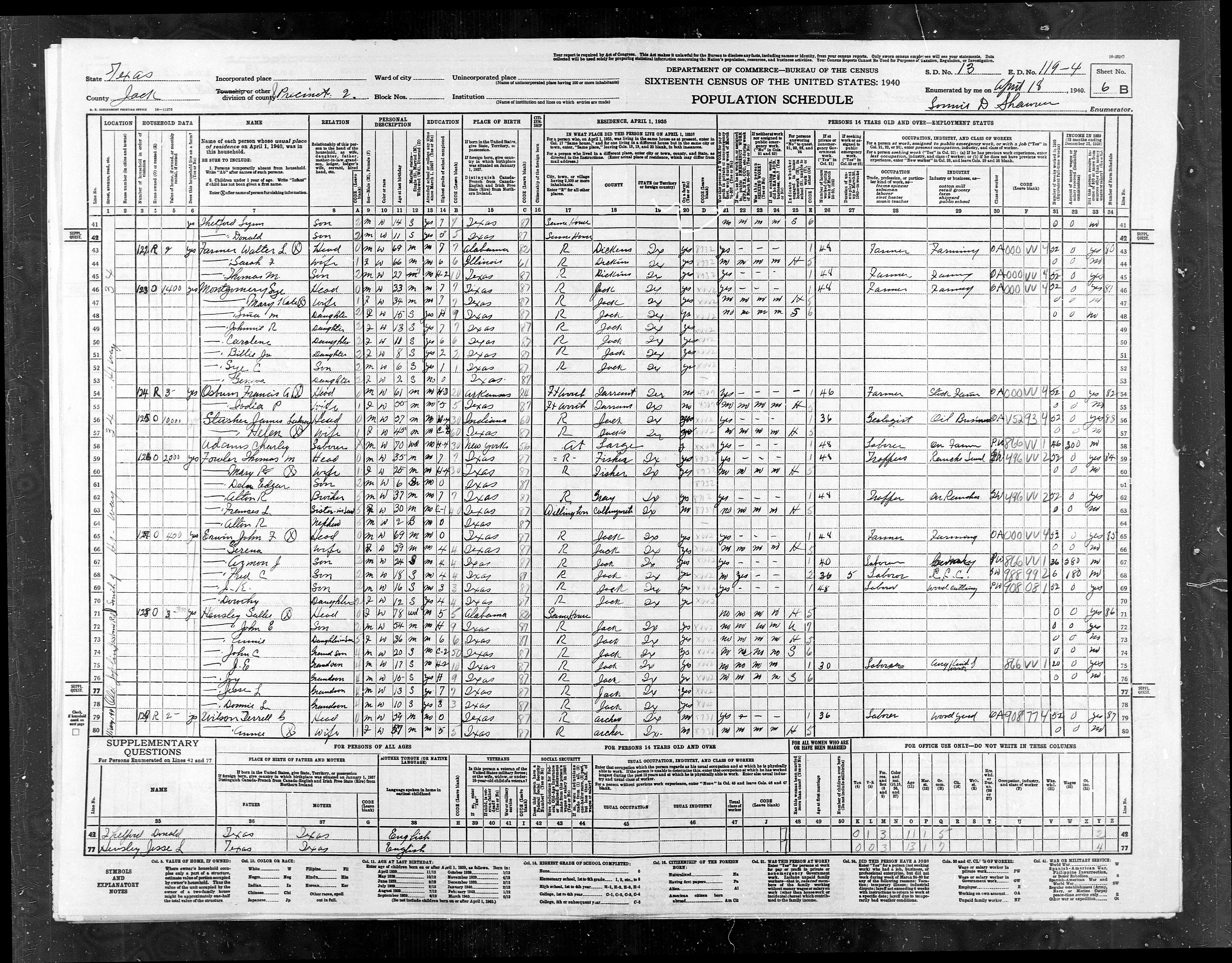
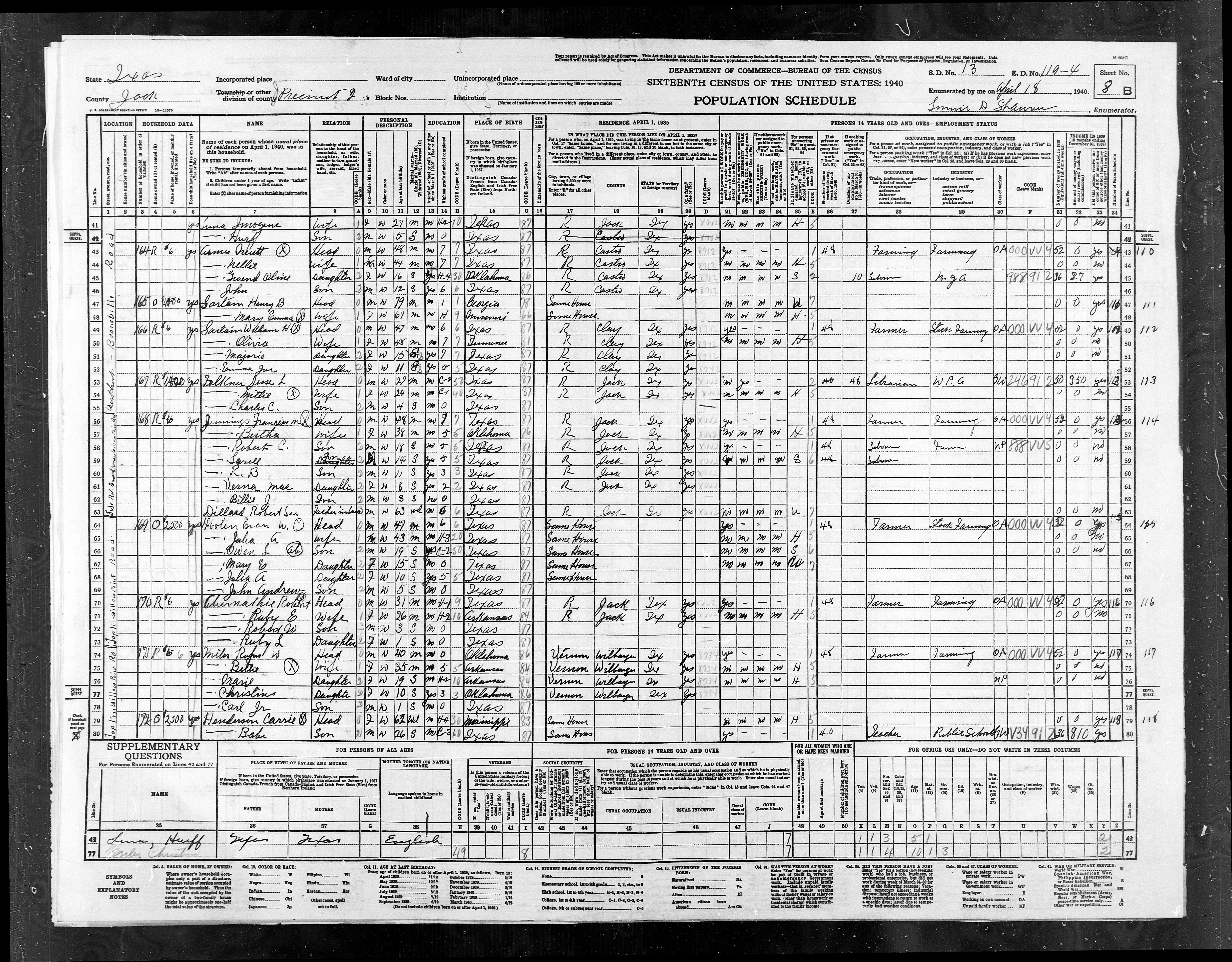
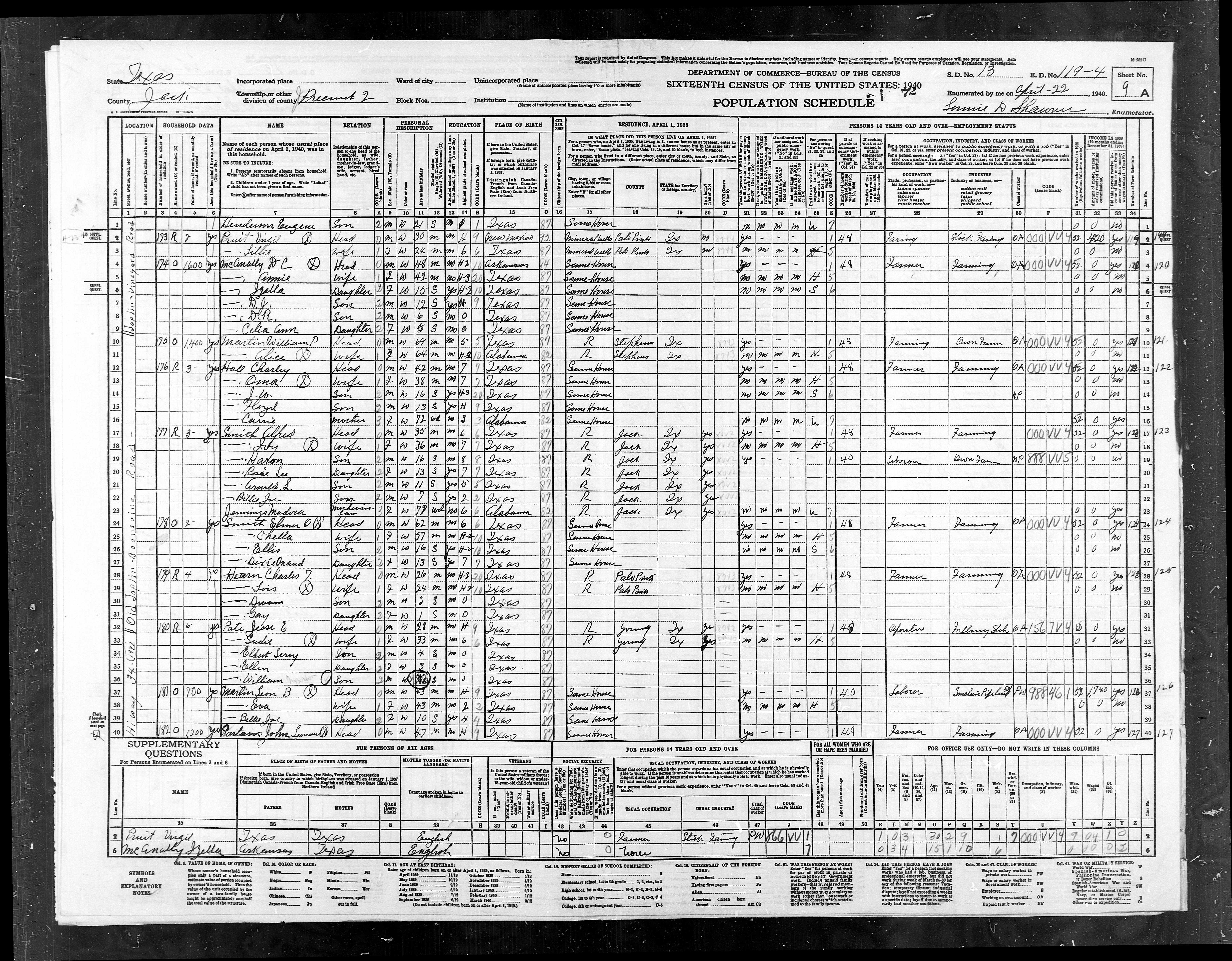
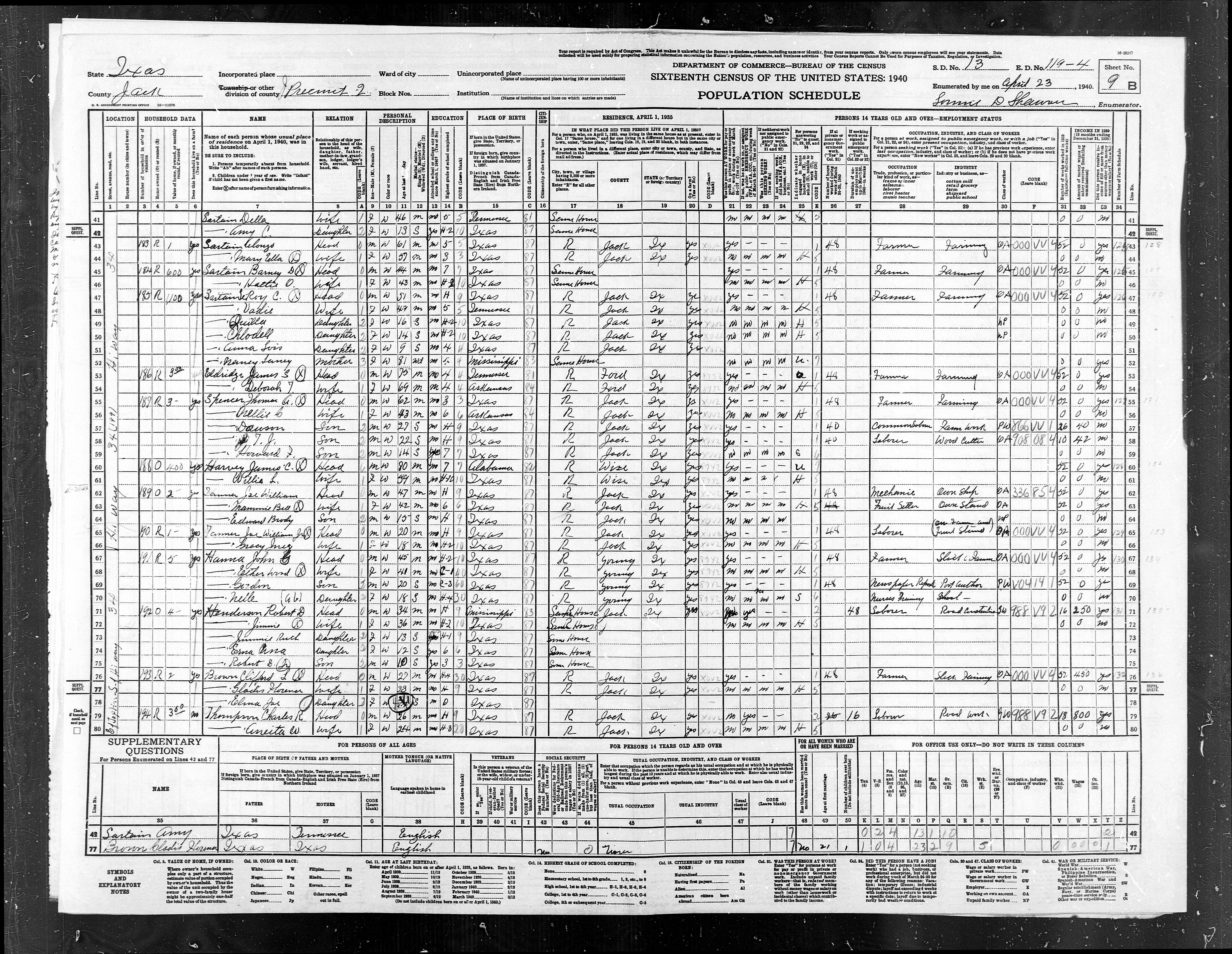
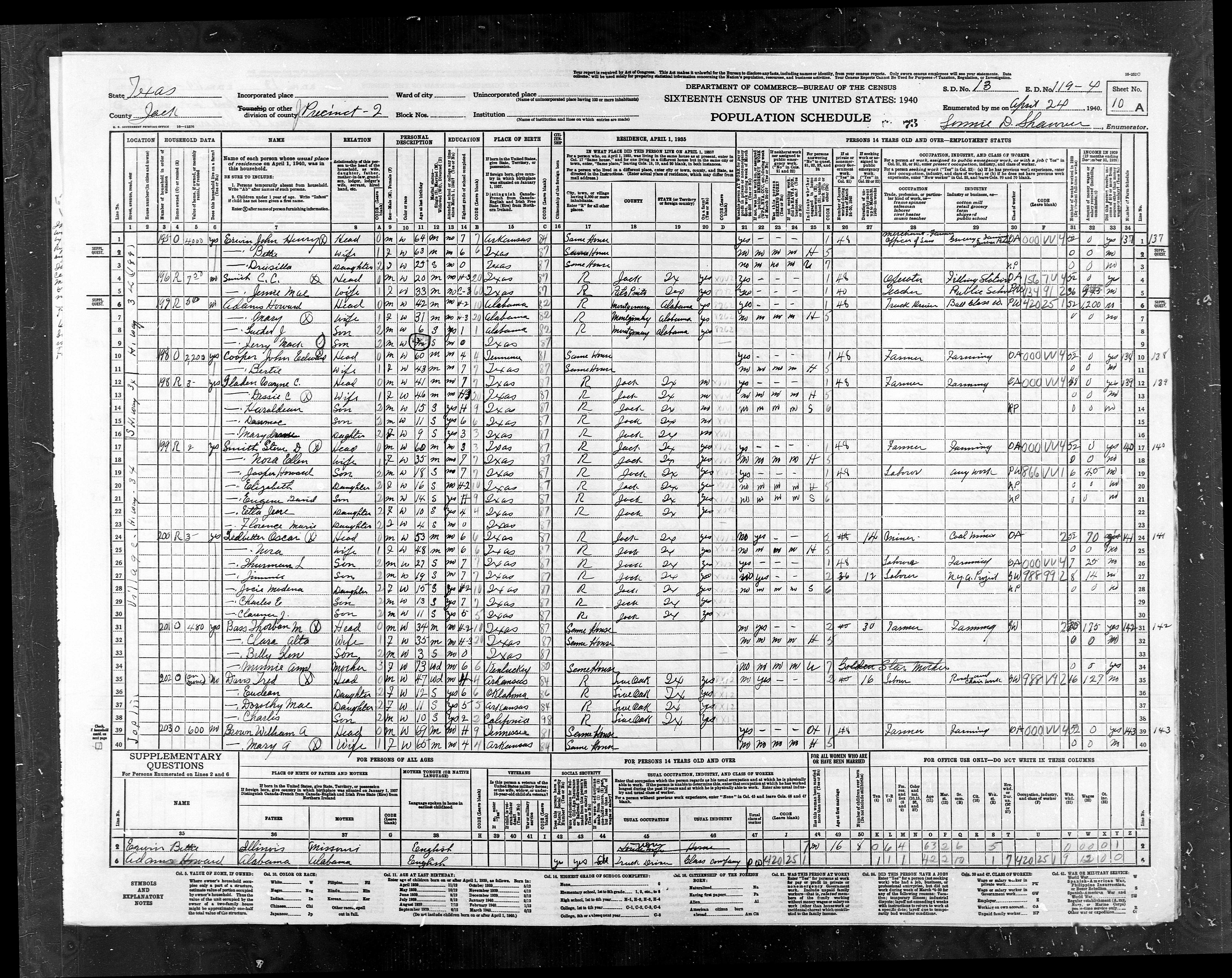
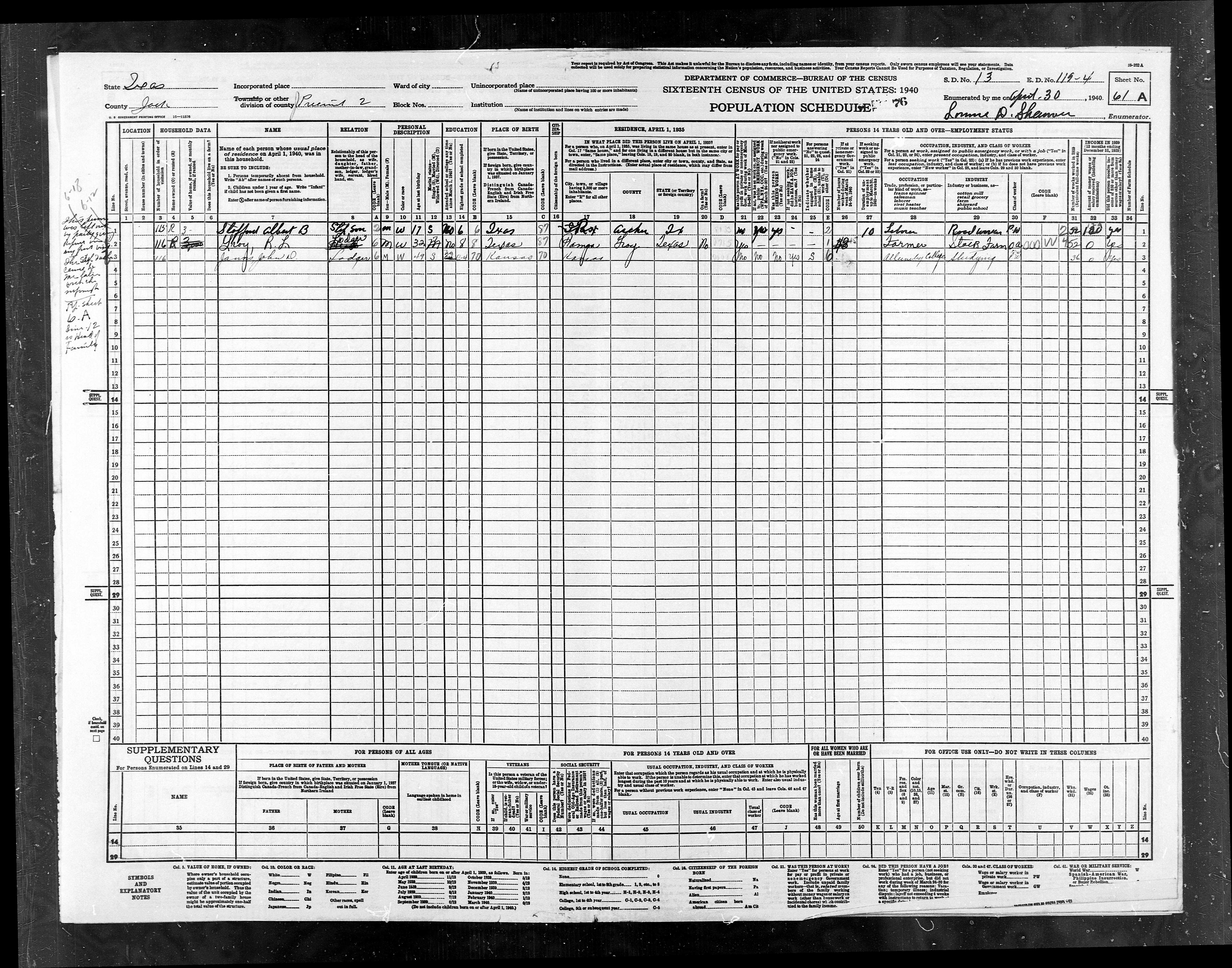
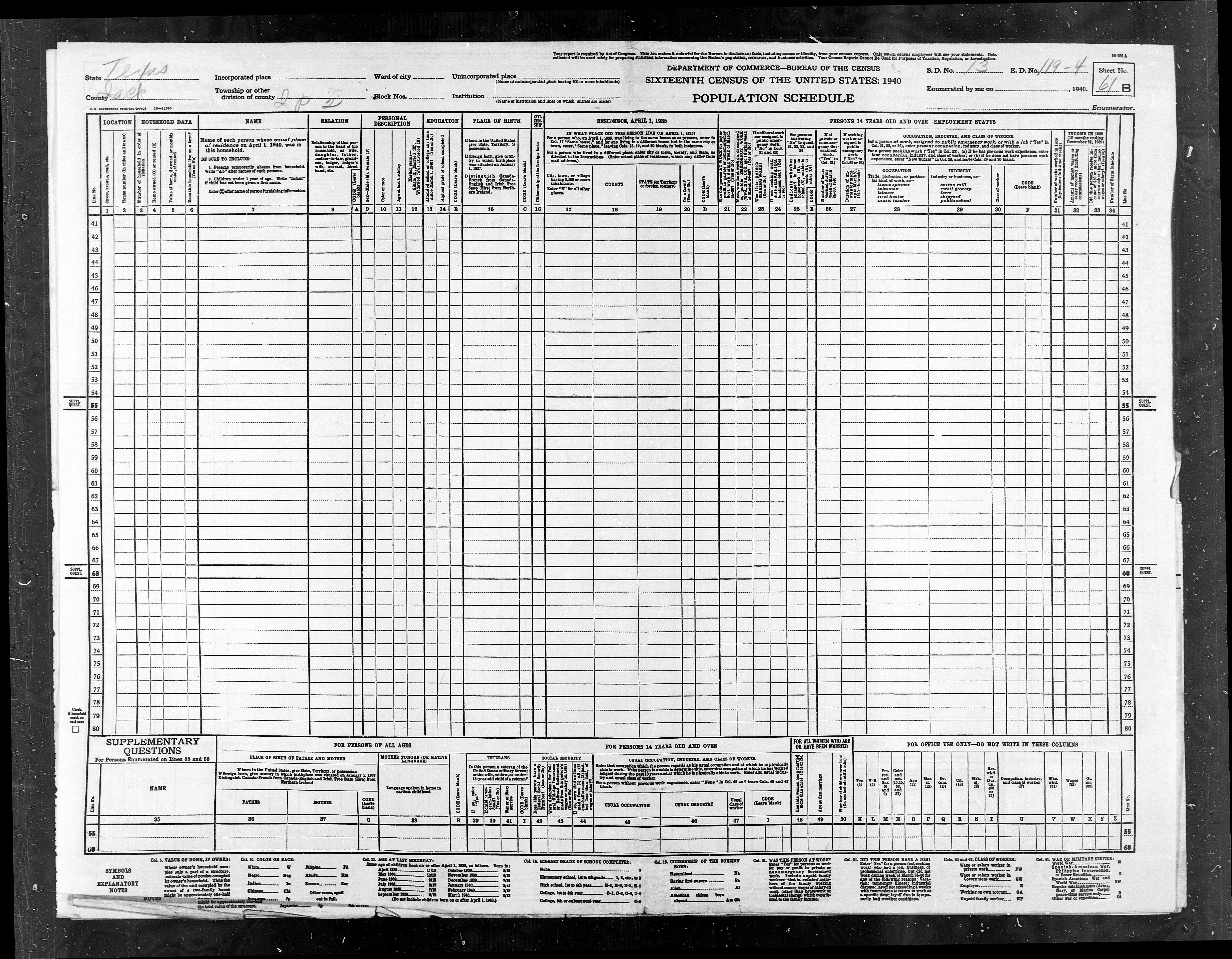
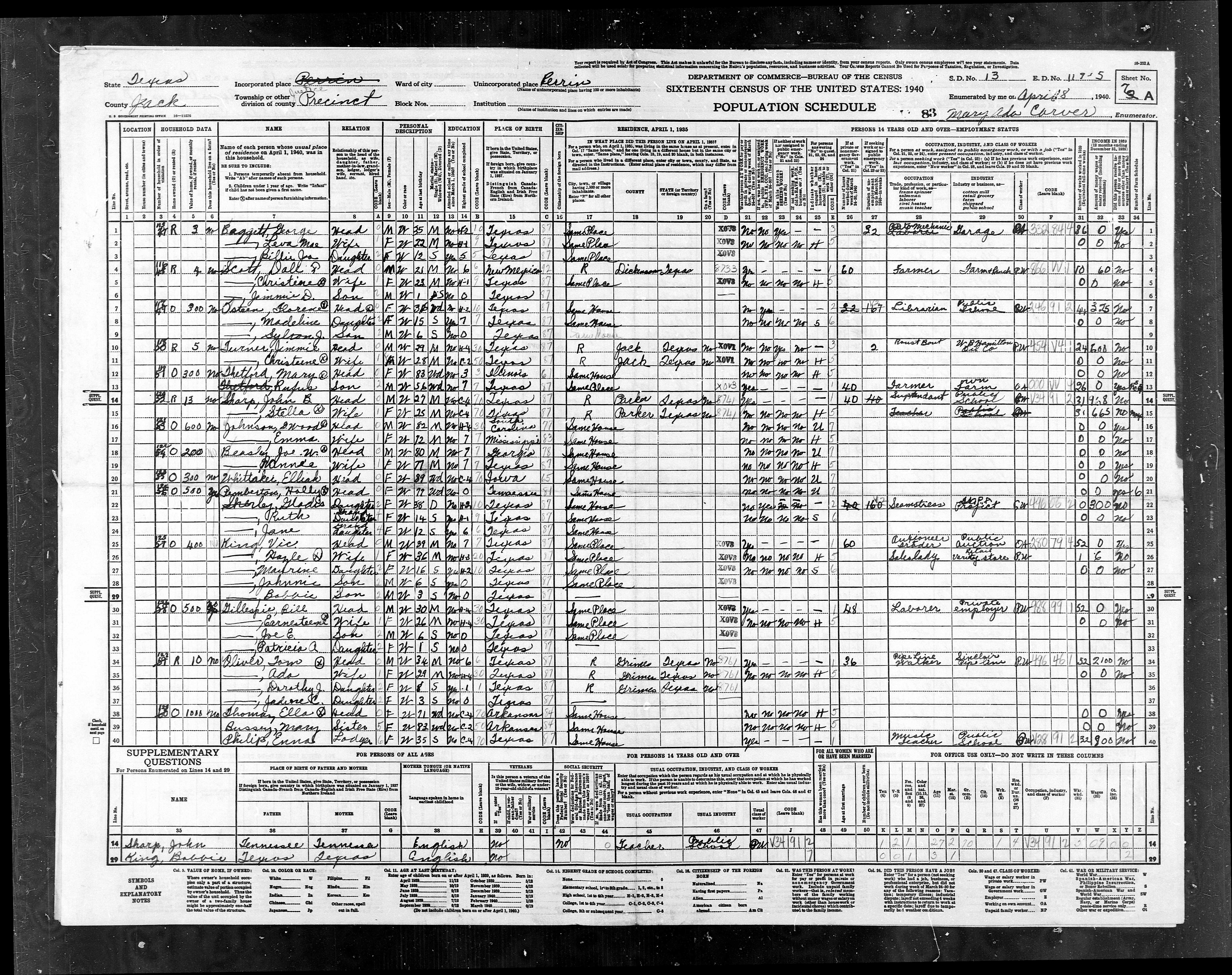
ED
119-4 |
ED
119-4 |
Pct
2, E of Hwy 281 - Part of Perrin, Gibtown, Joplin |
836 |
950 |
|
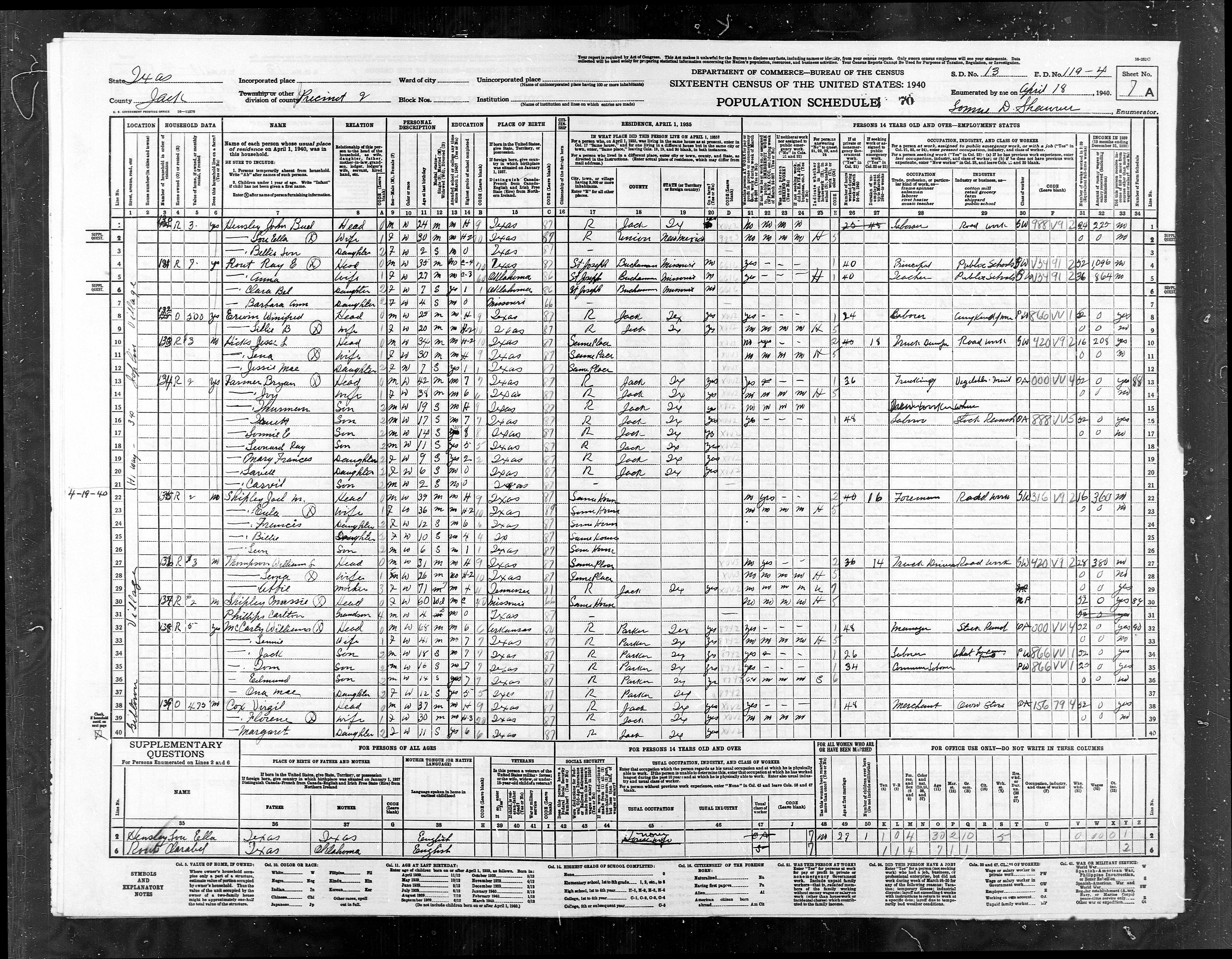
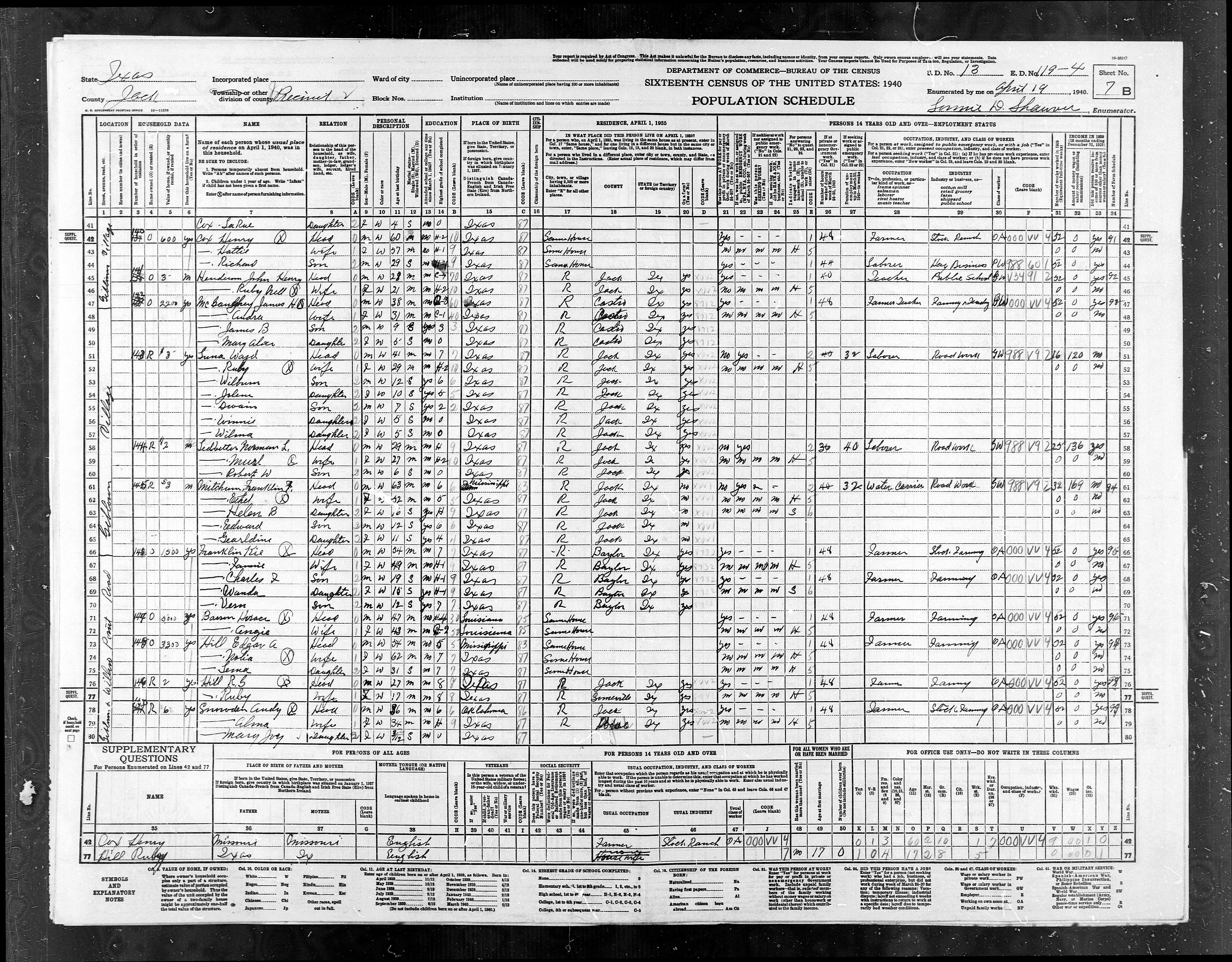
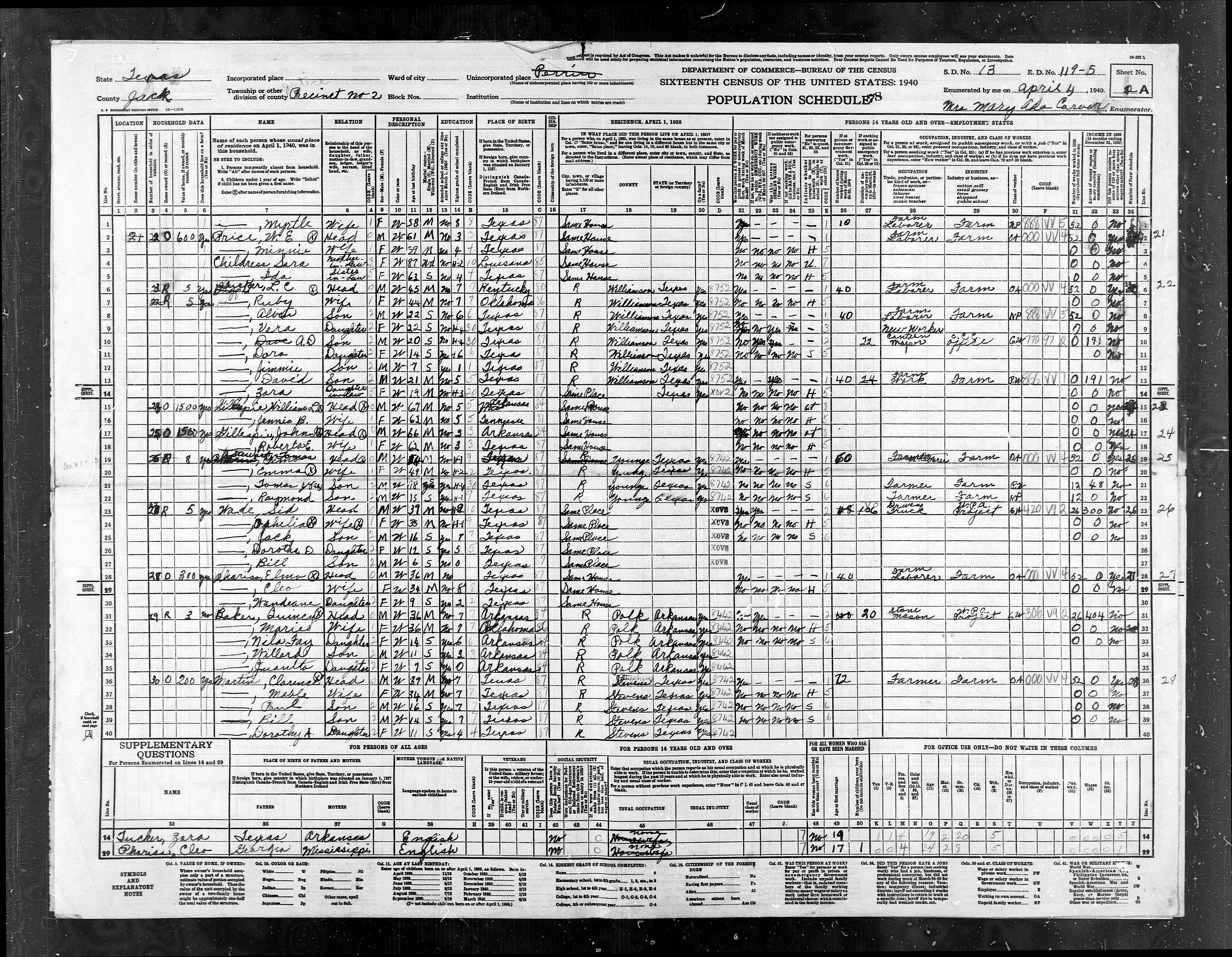
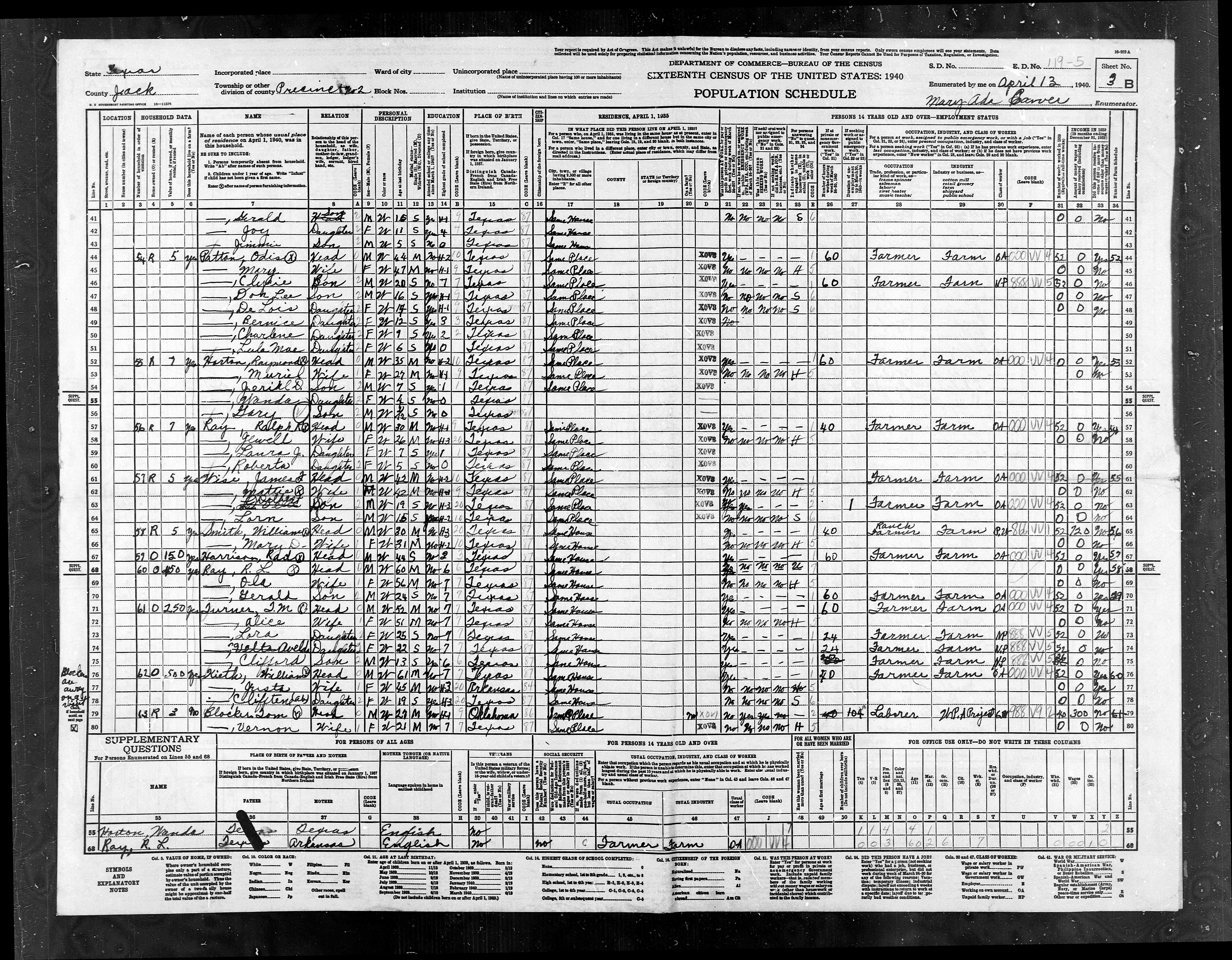
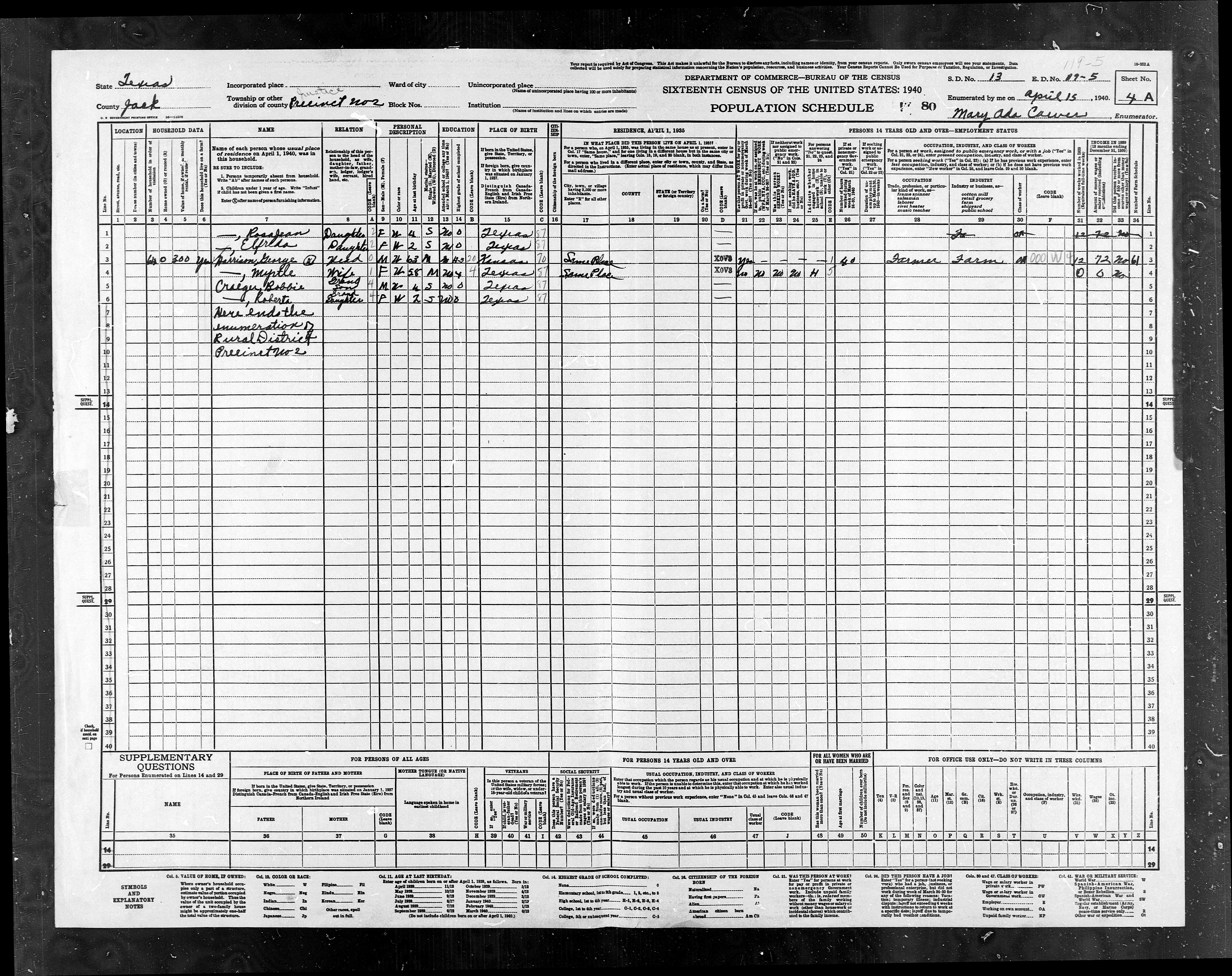
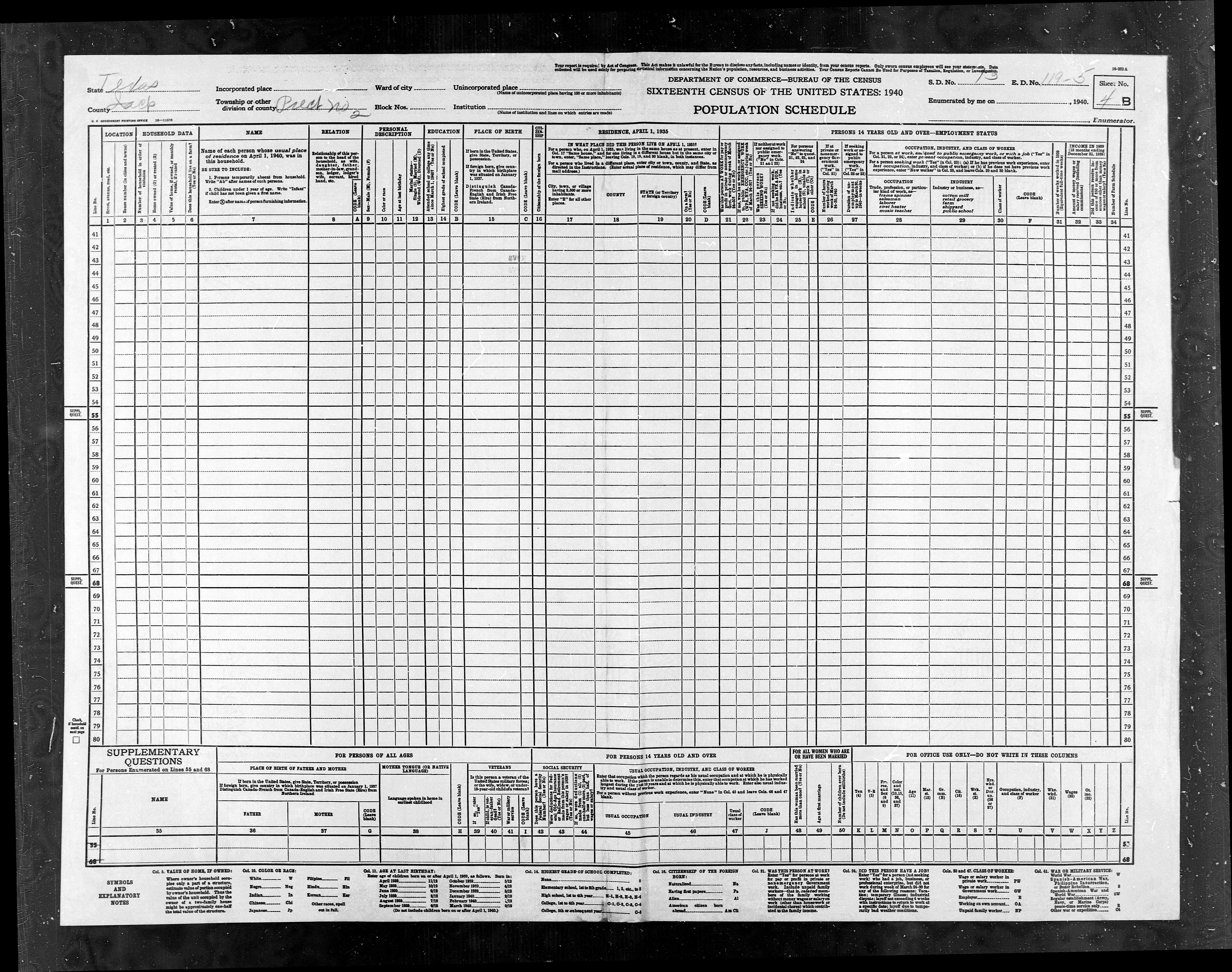
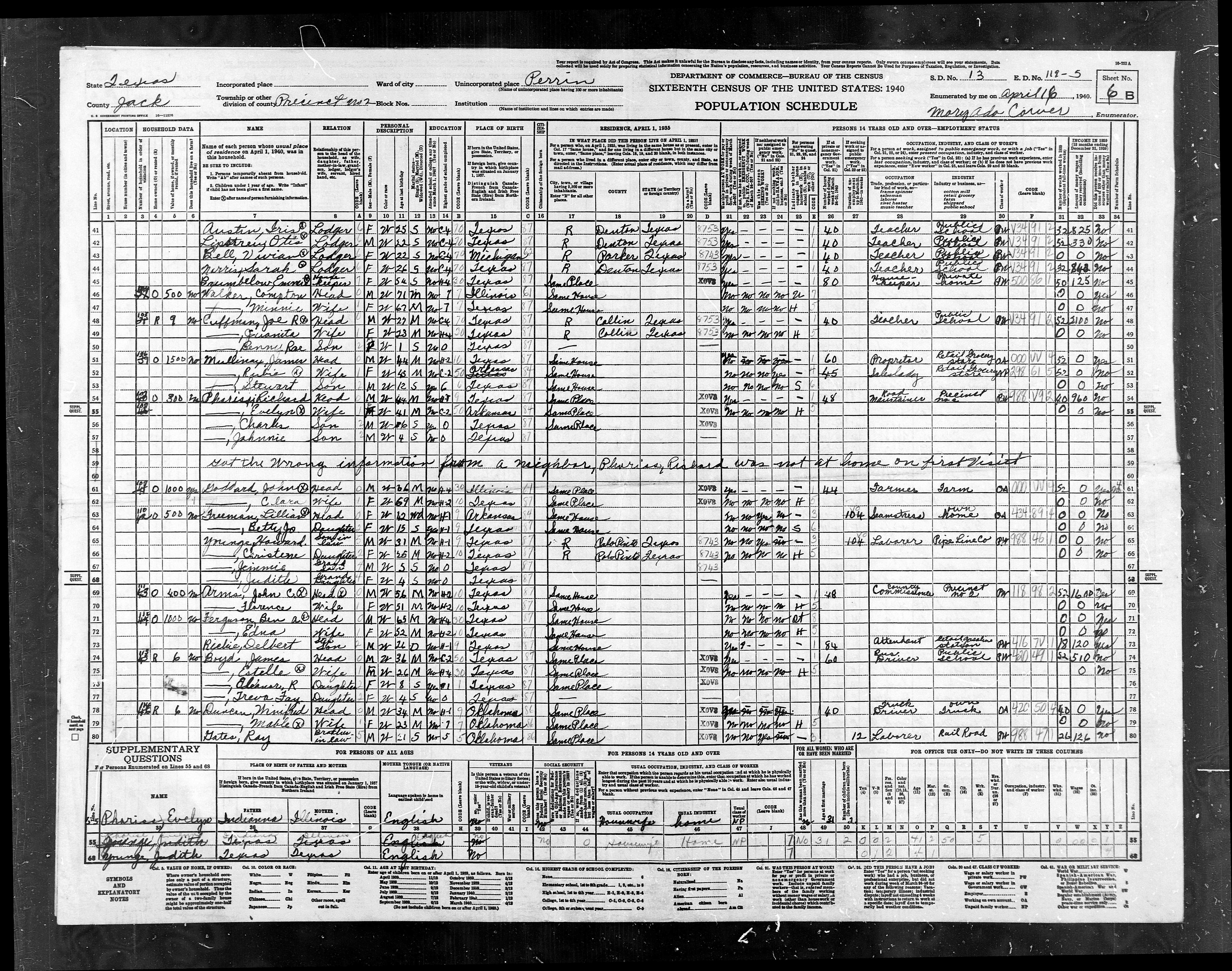
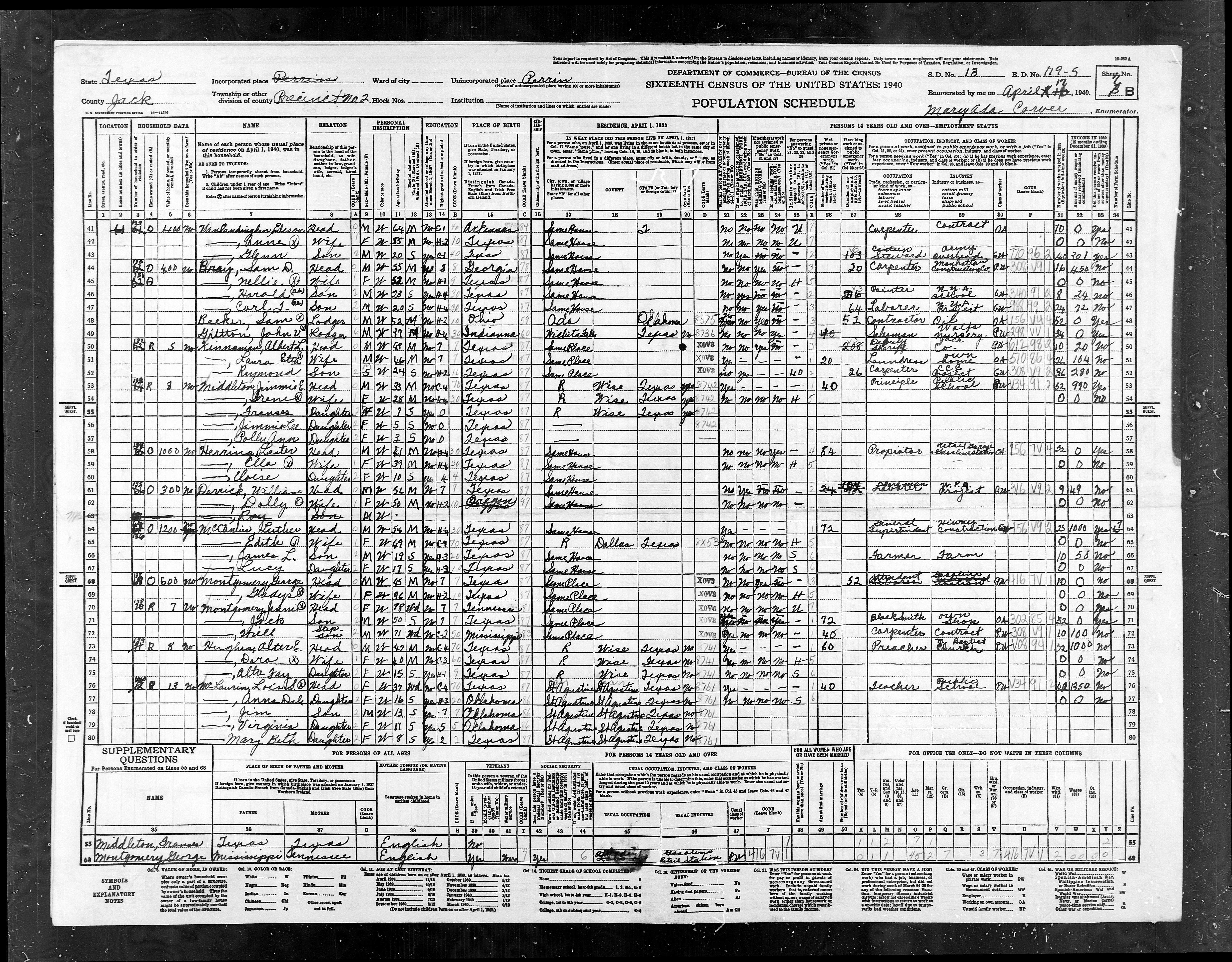
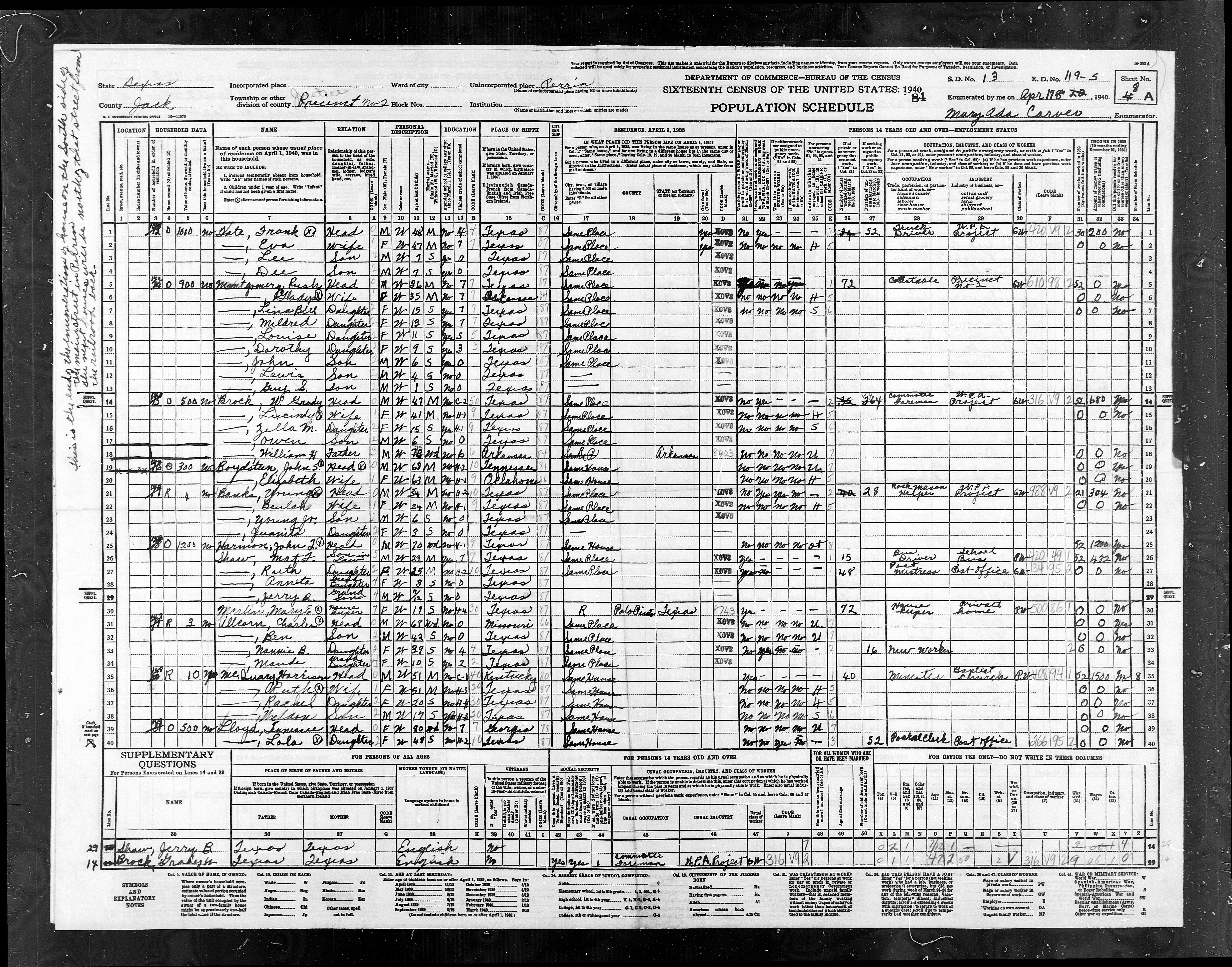
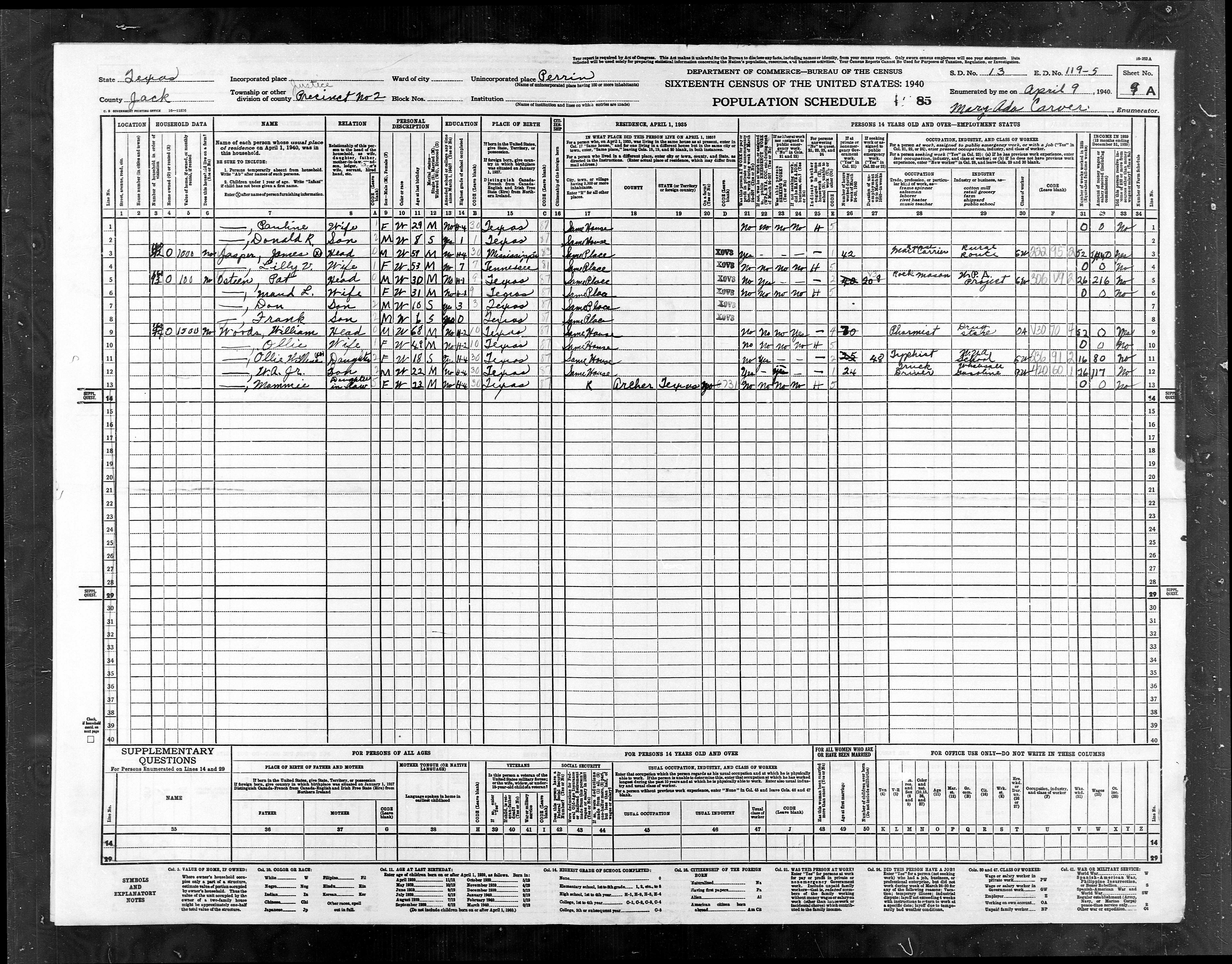
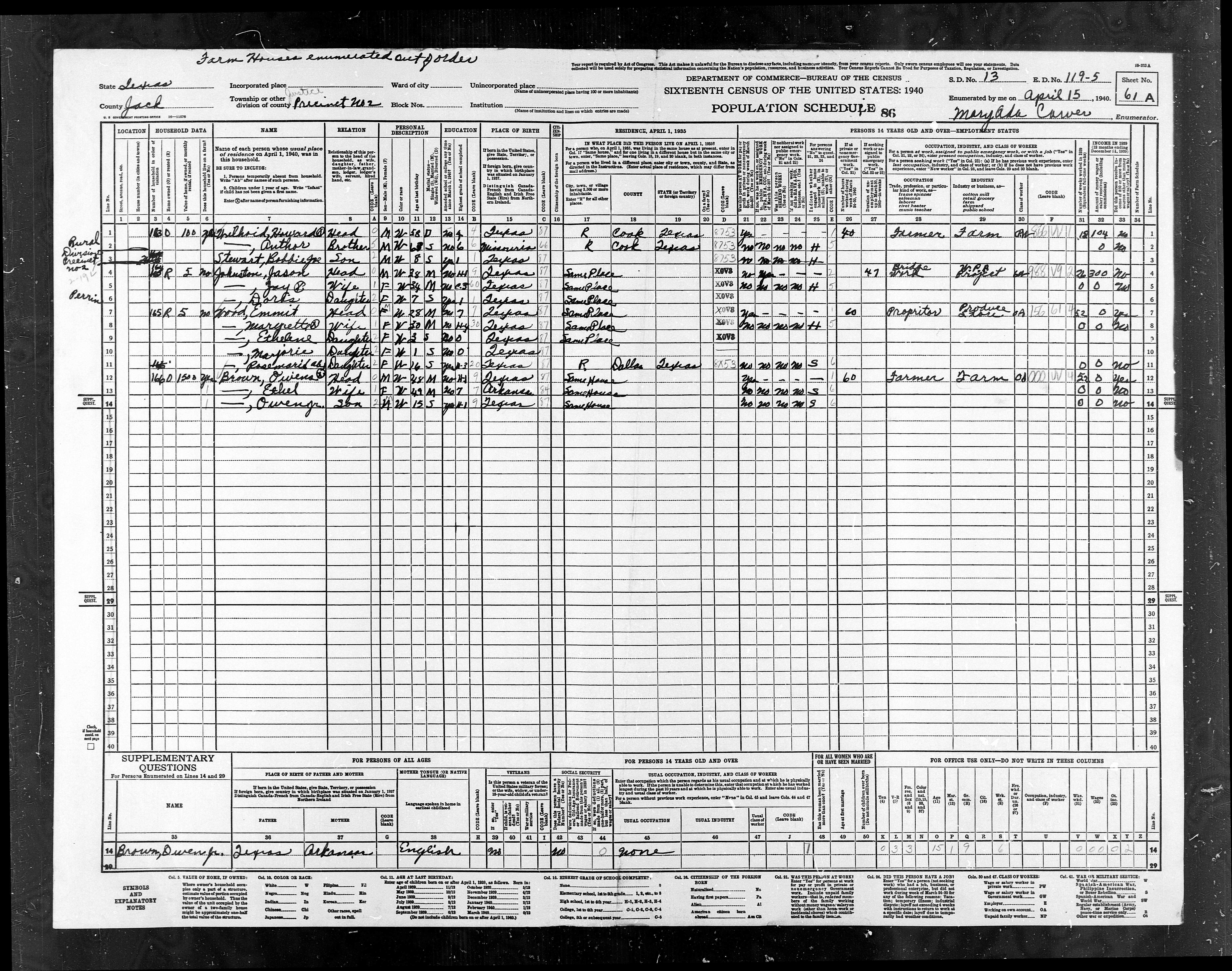
ED
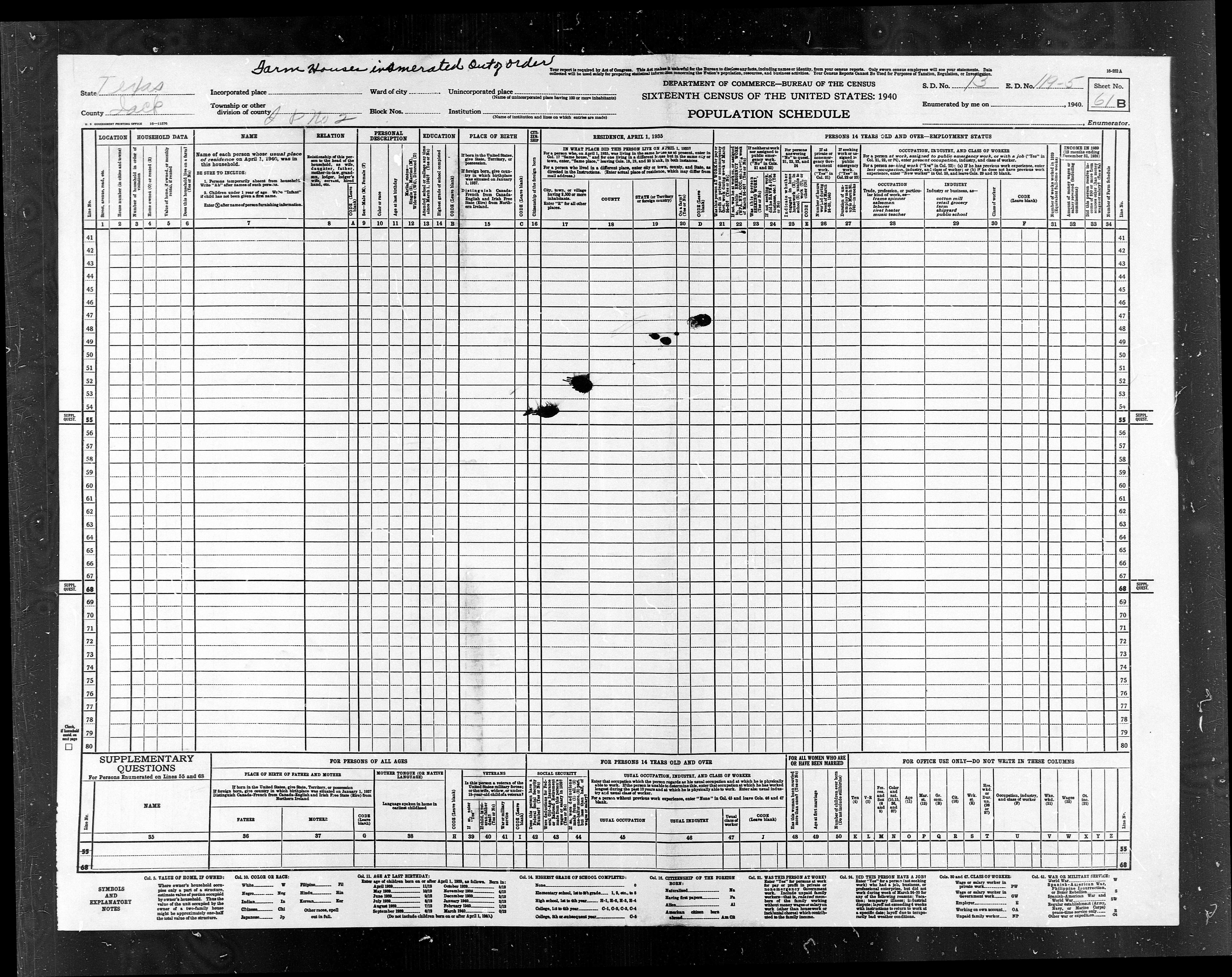
119-5 |
ED
119-5 |
Pct
2, W of Hwy 281 - Part of Perrin |
591 |
588 |
|
ED
119-11 |
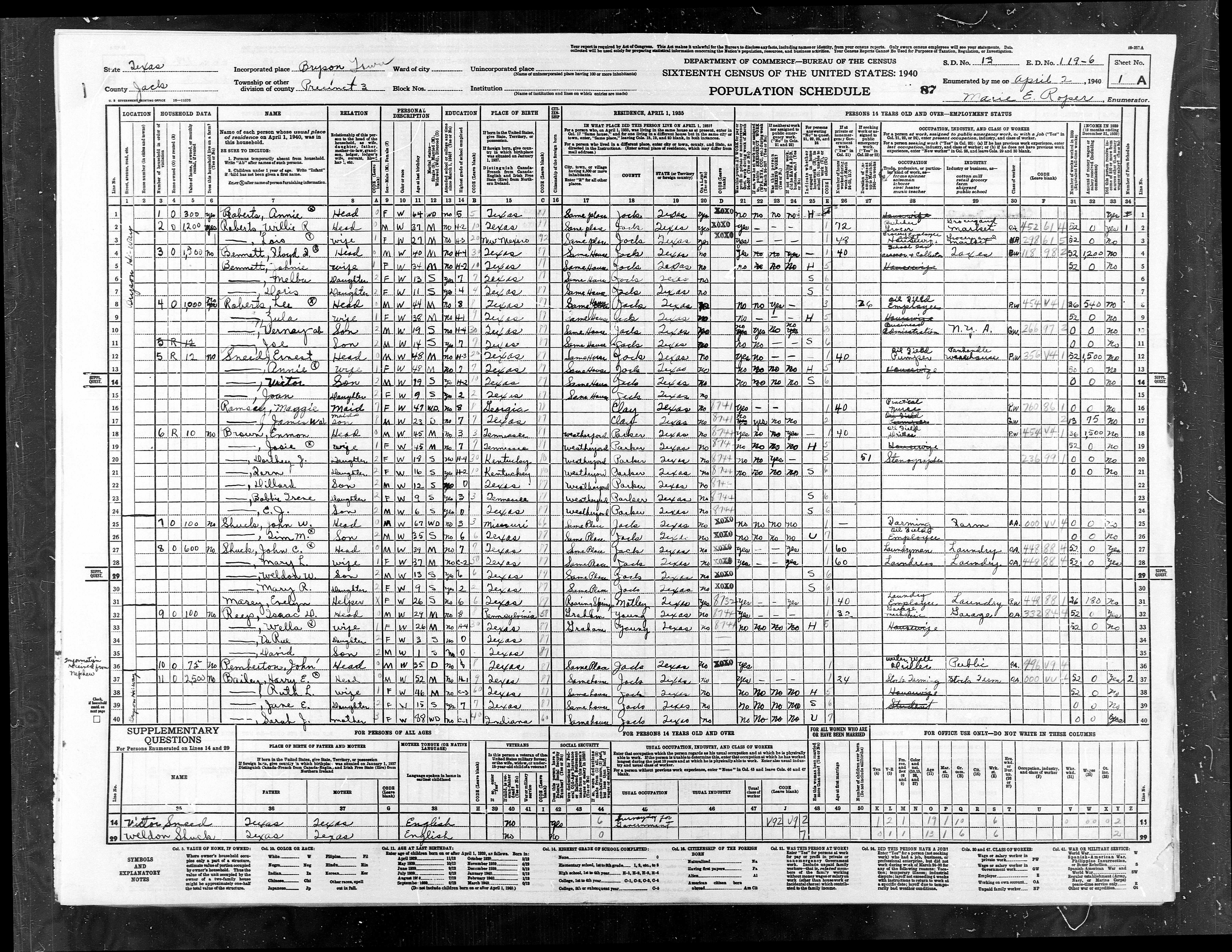
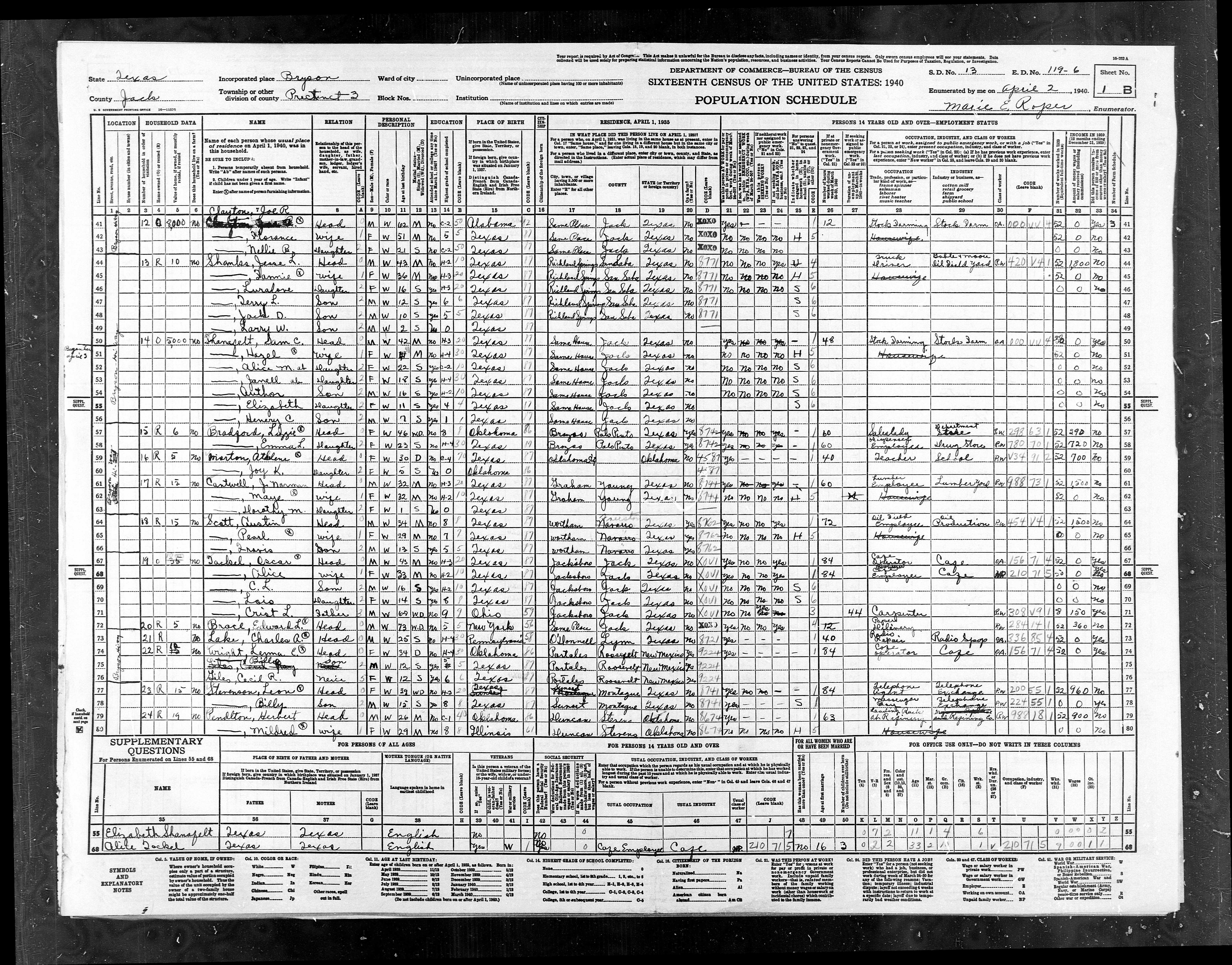
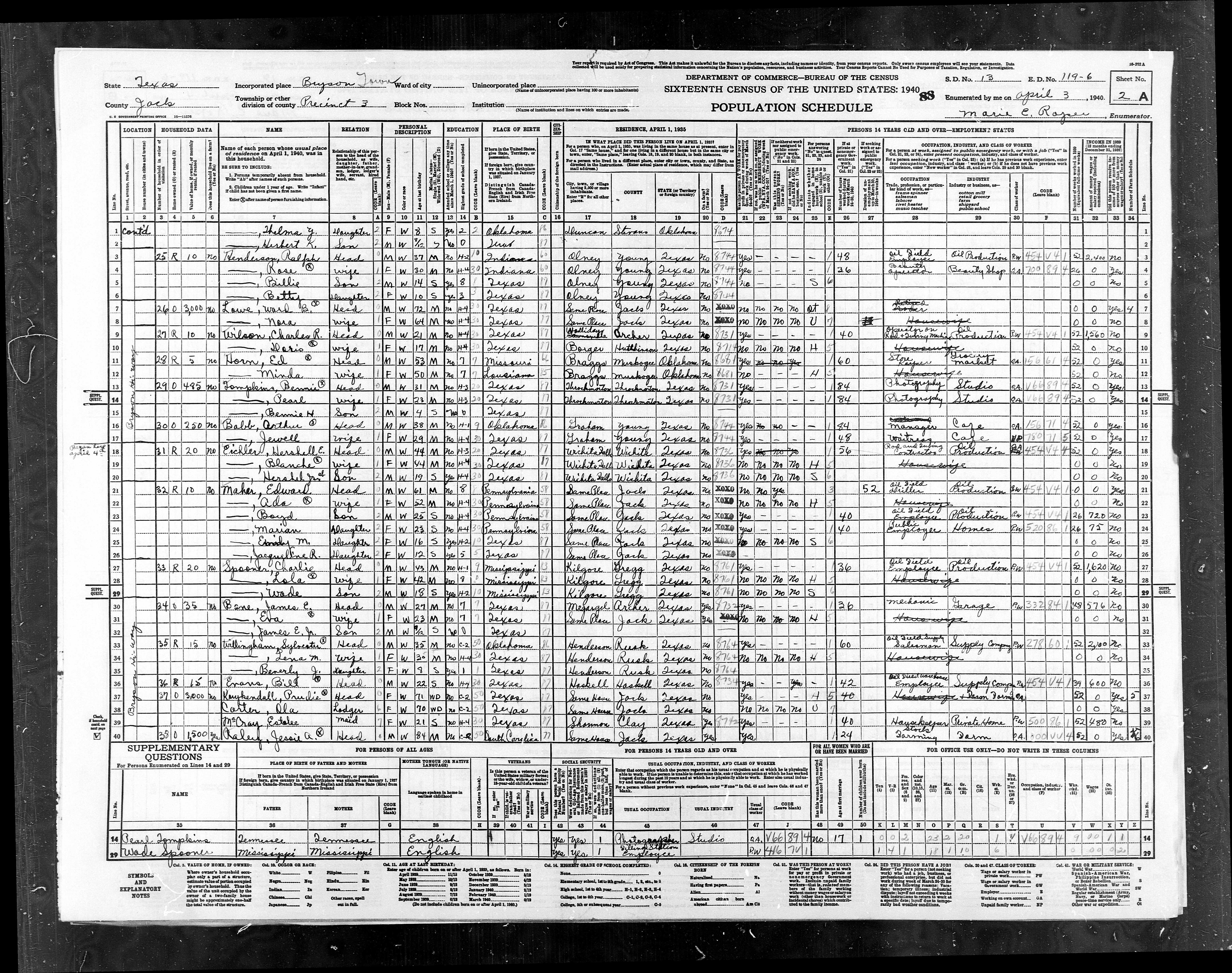
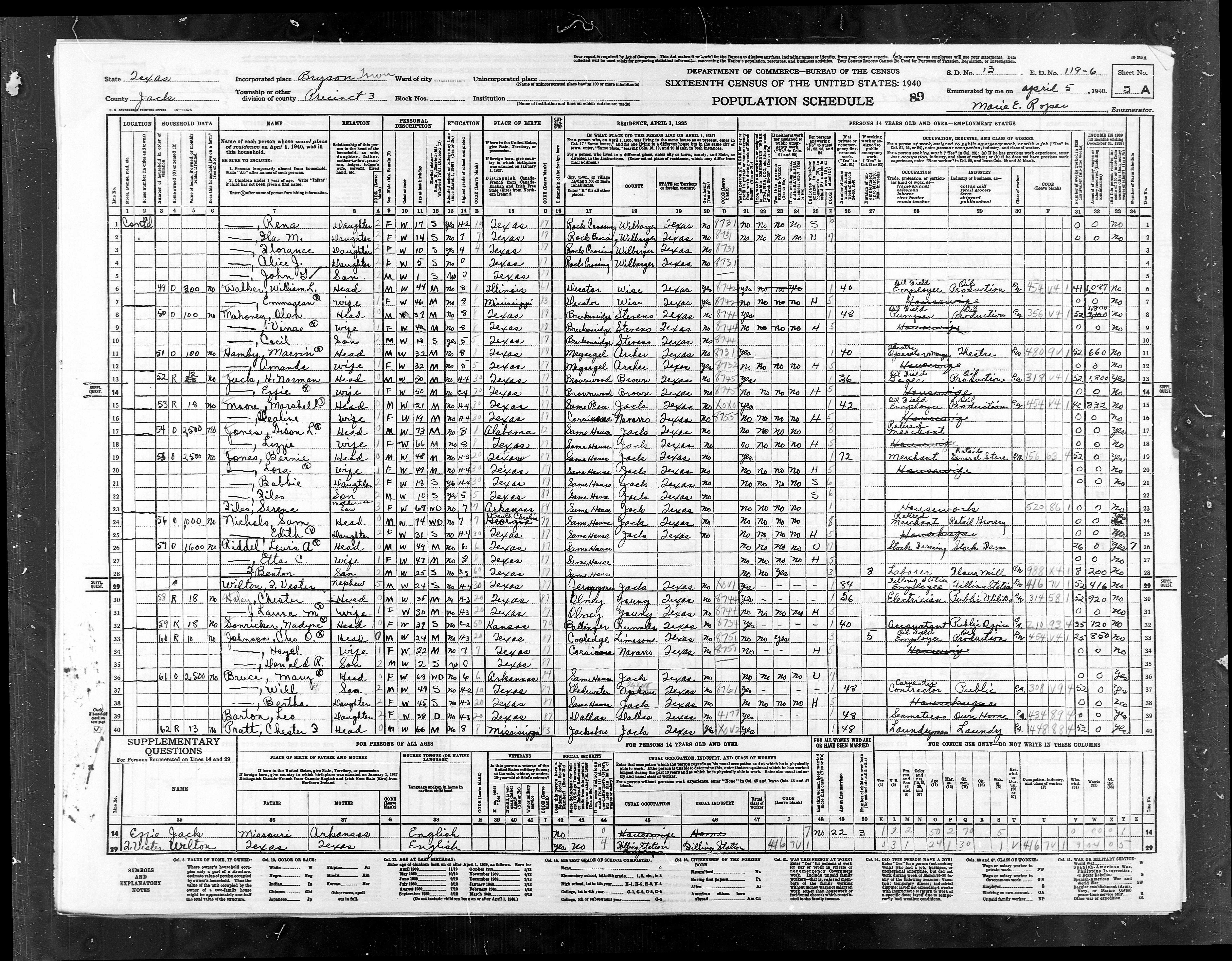
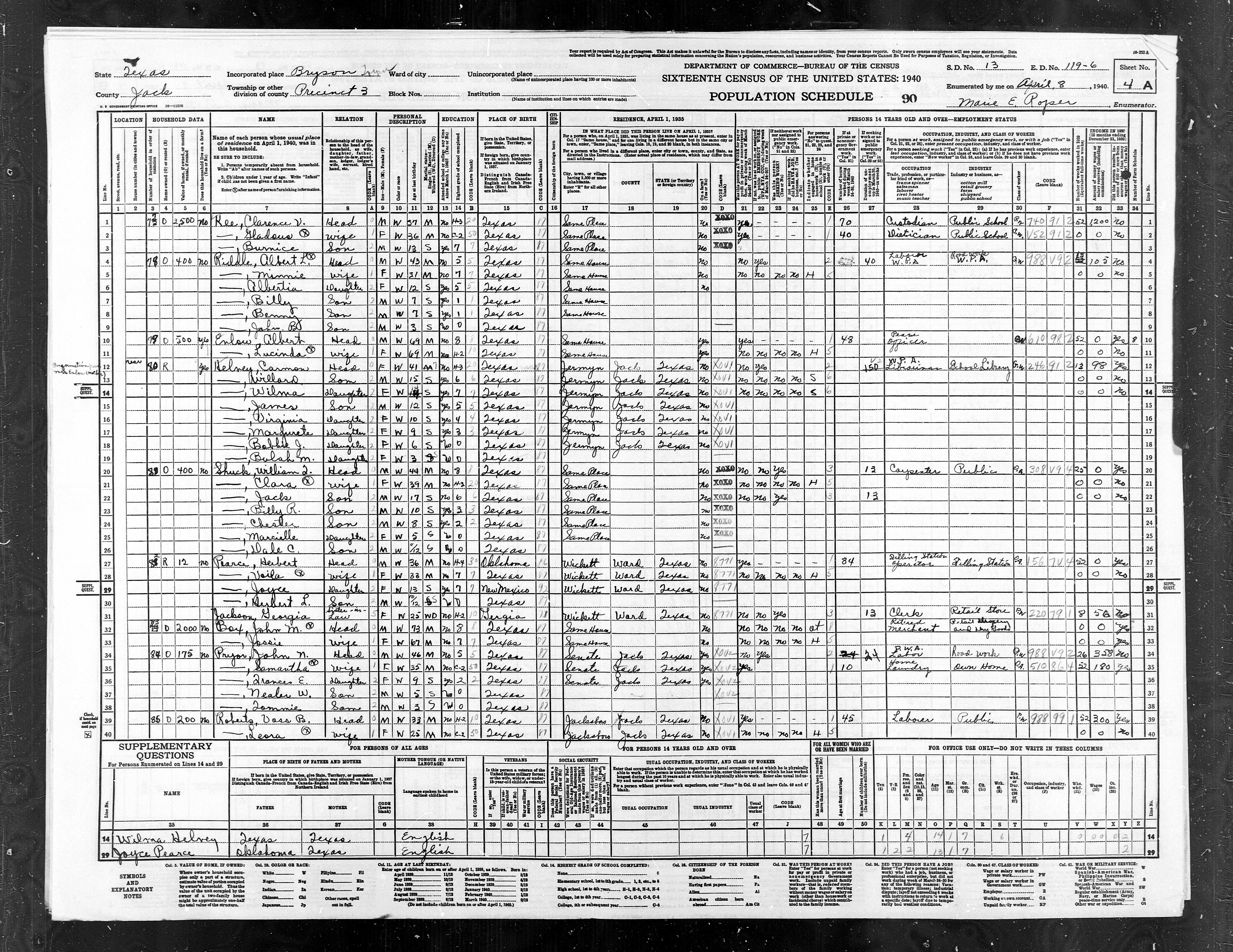
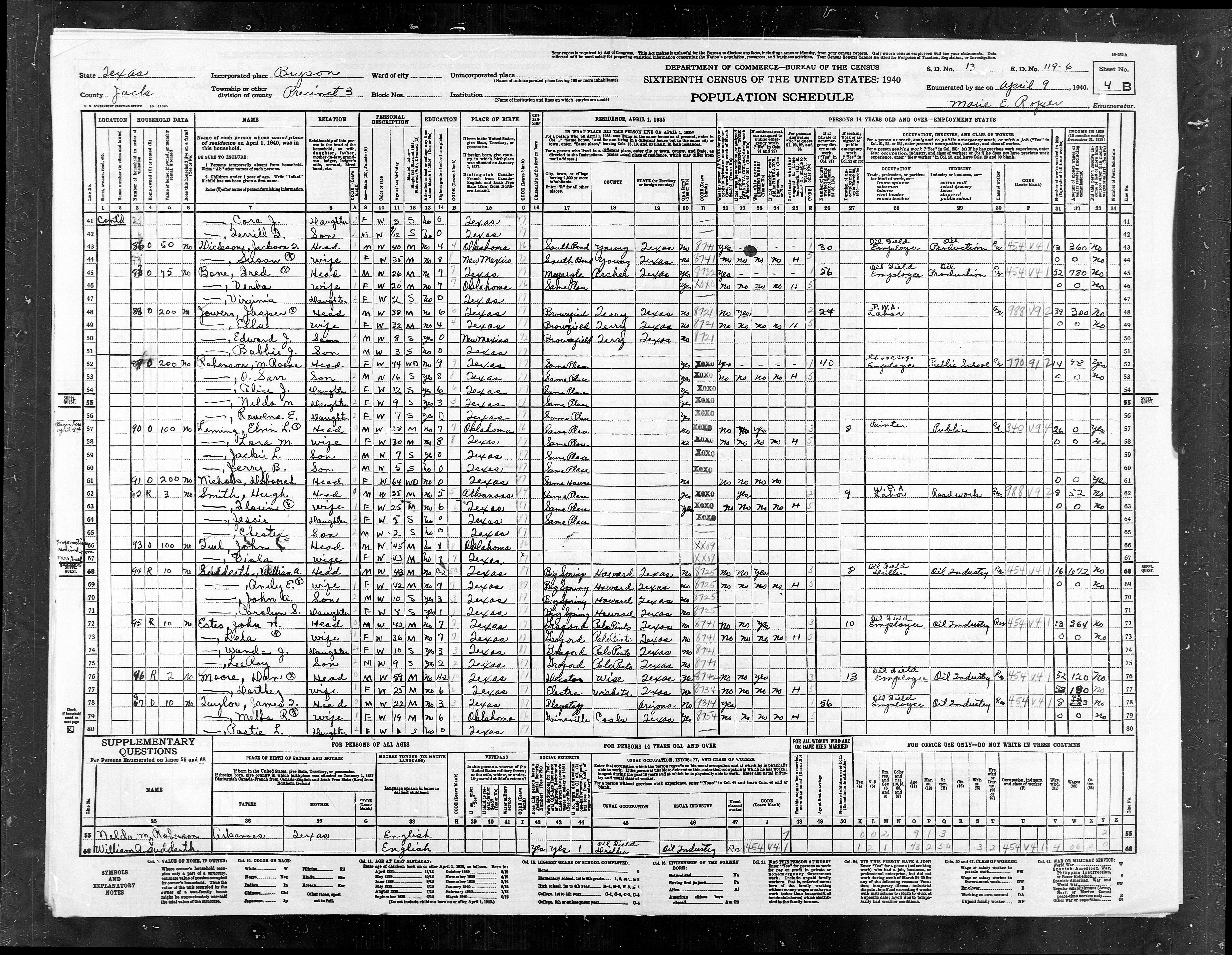
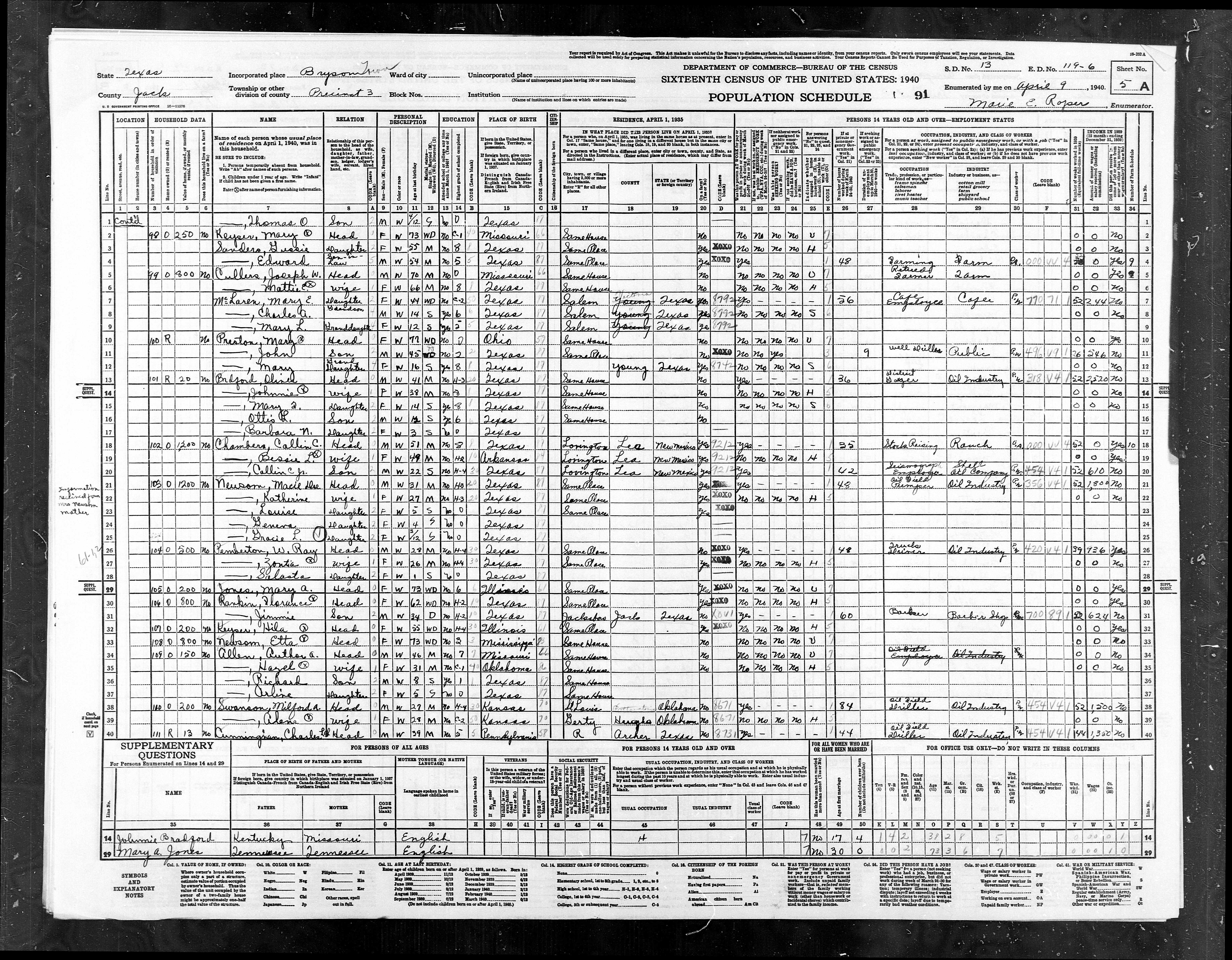
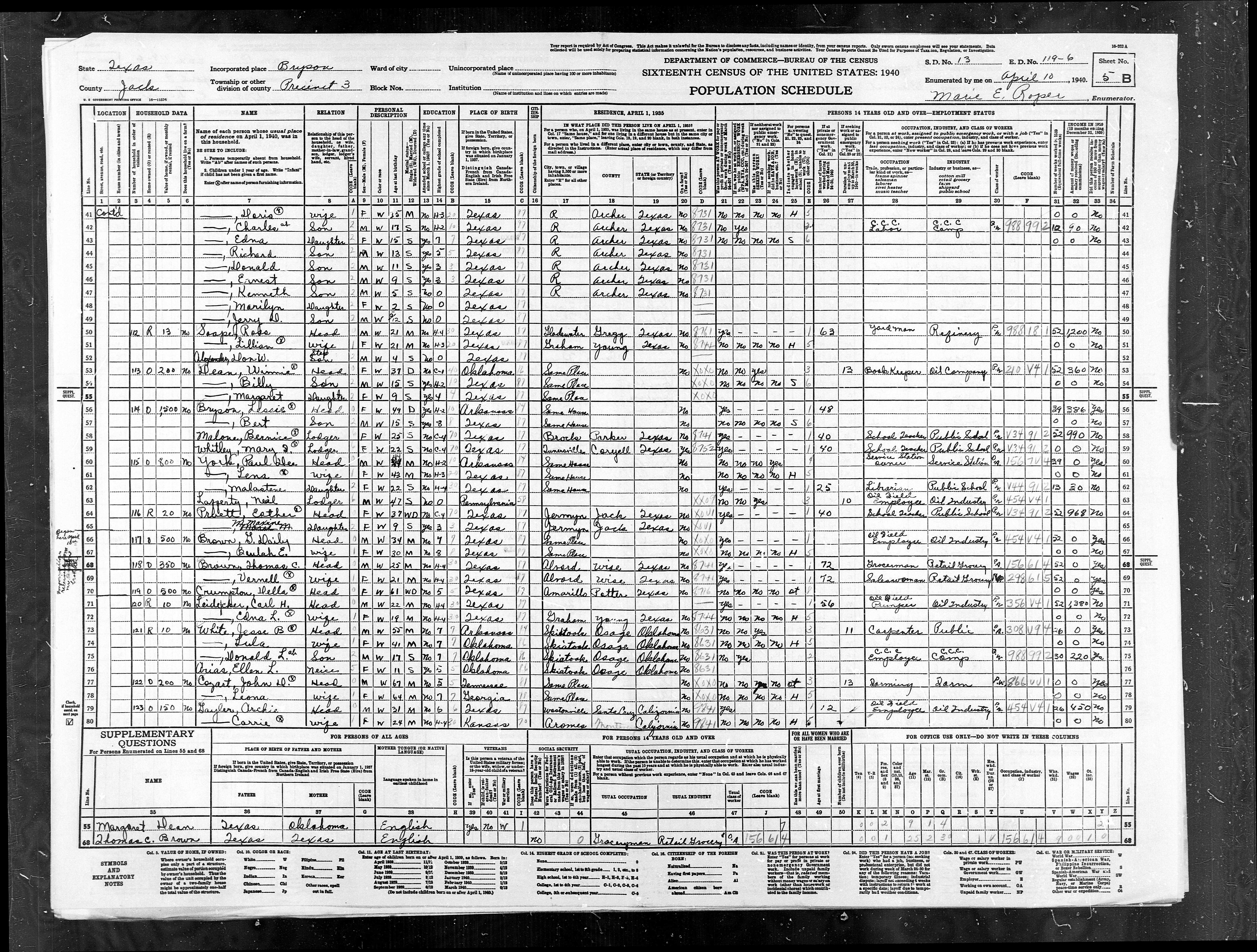
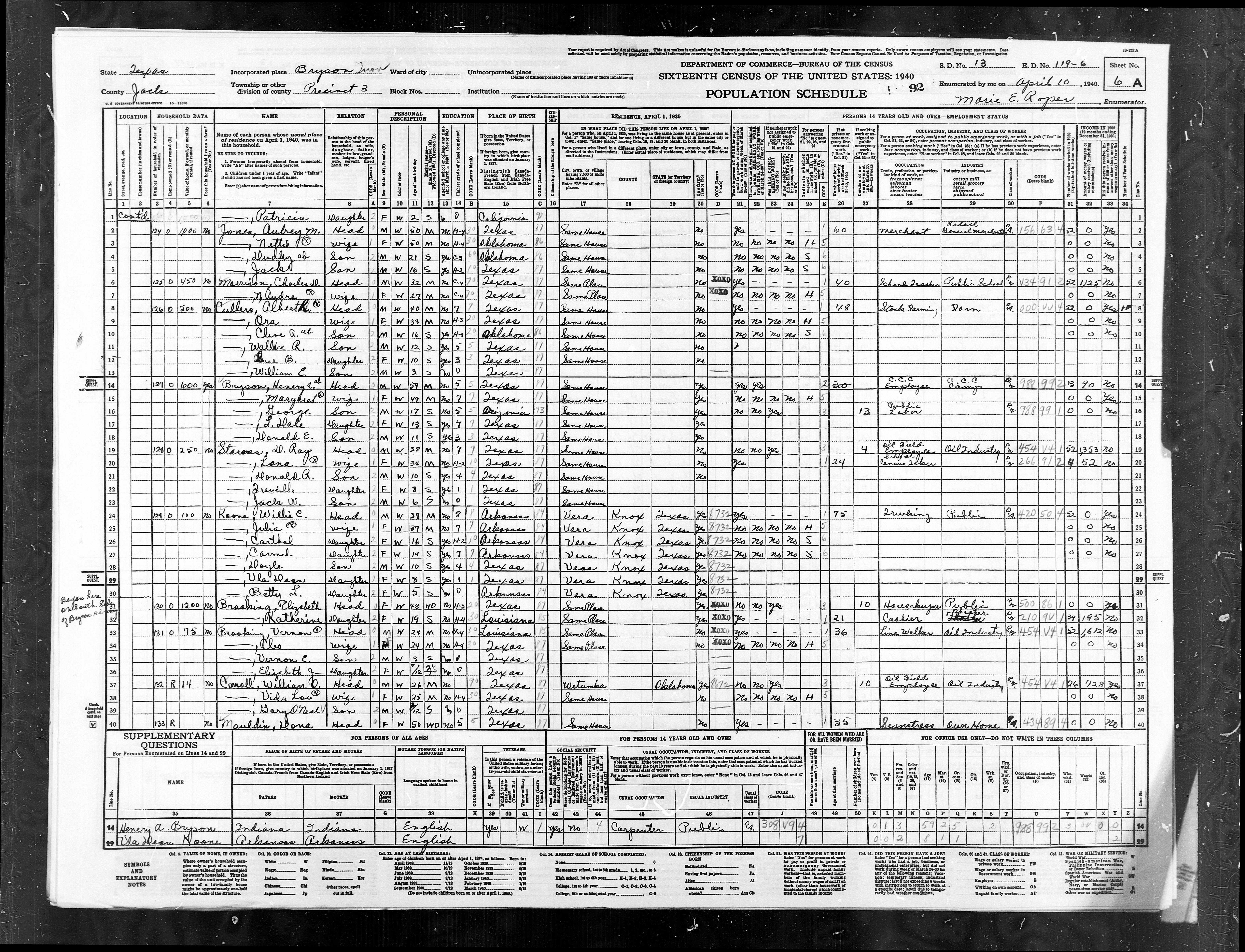
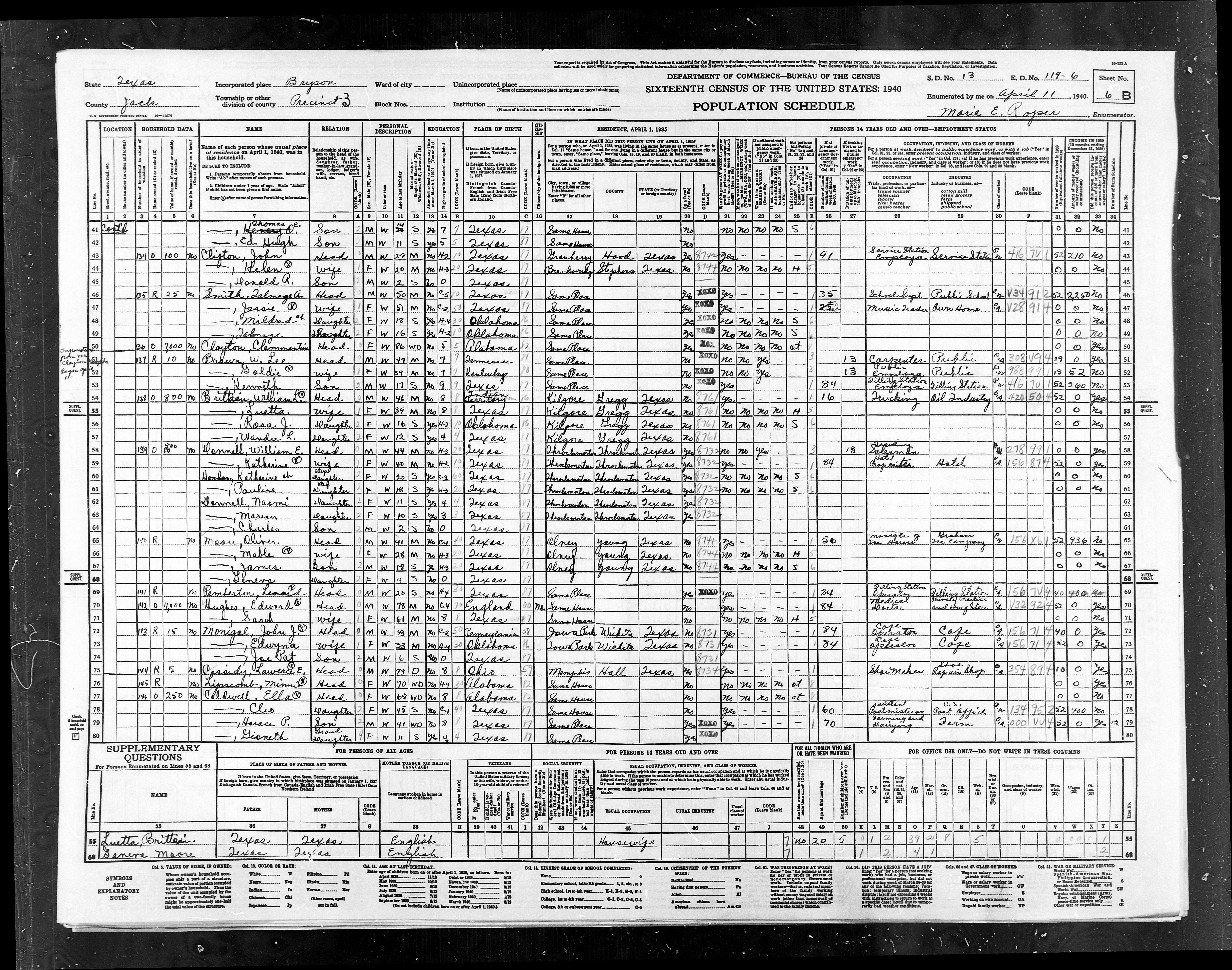
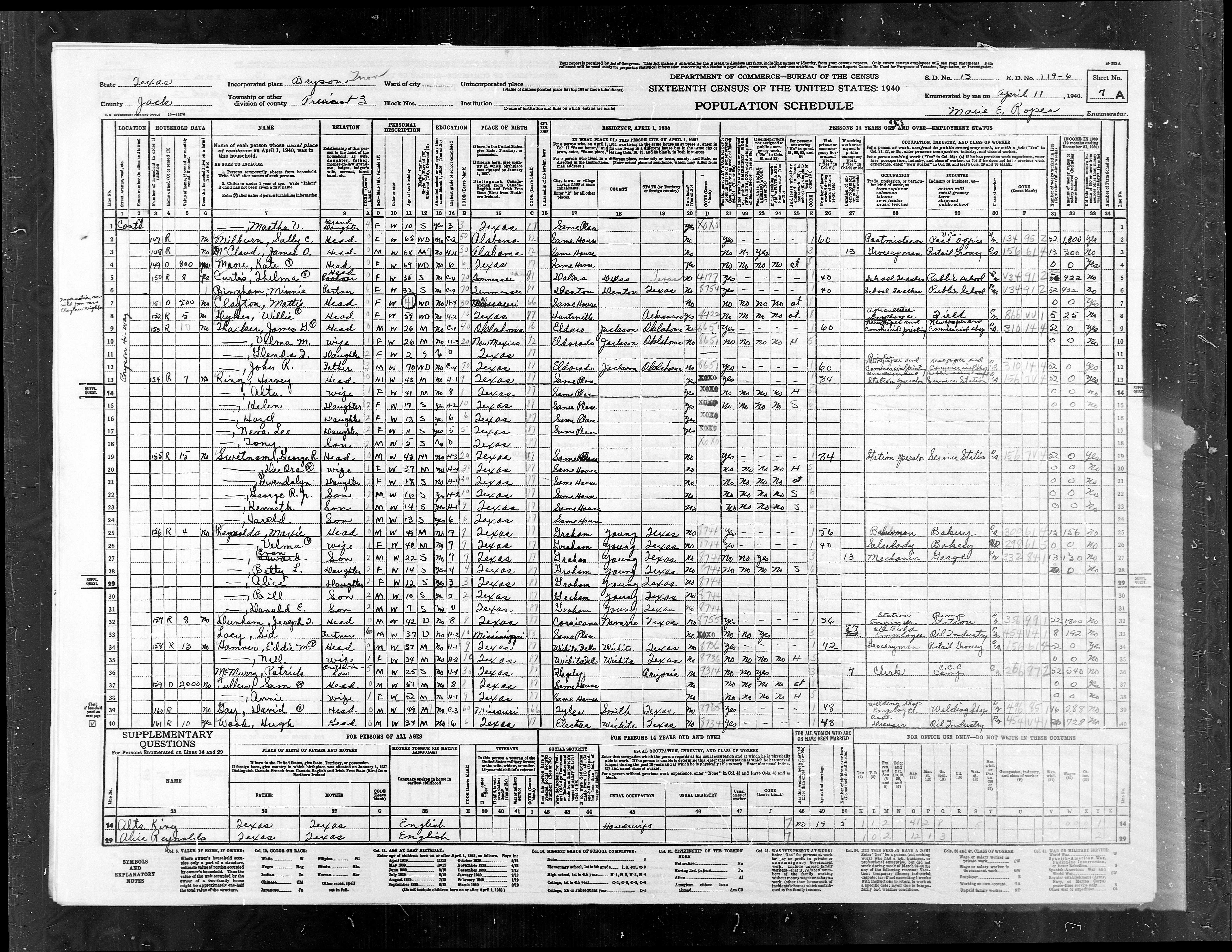
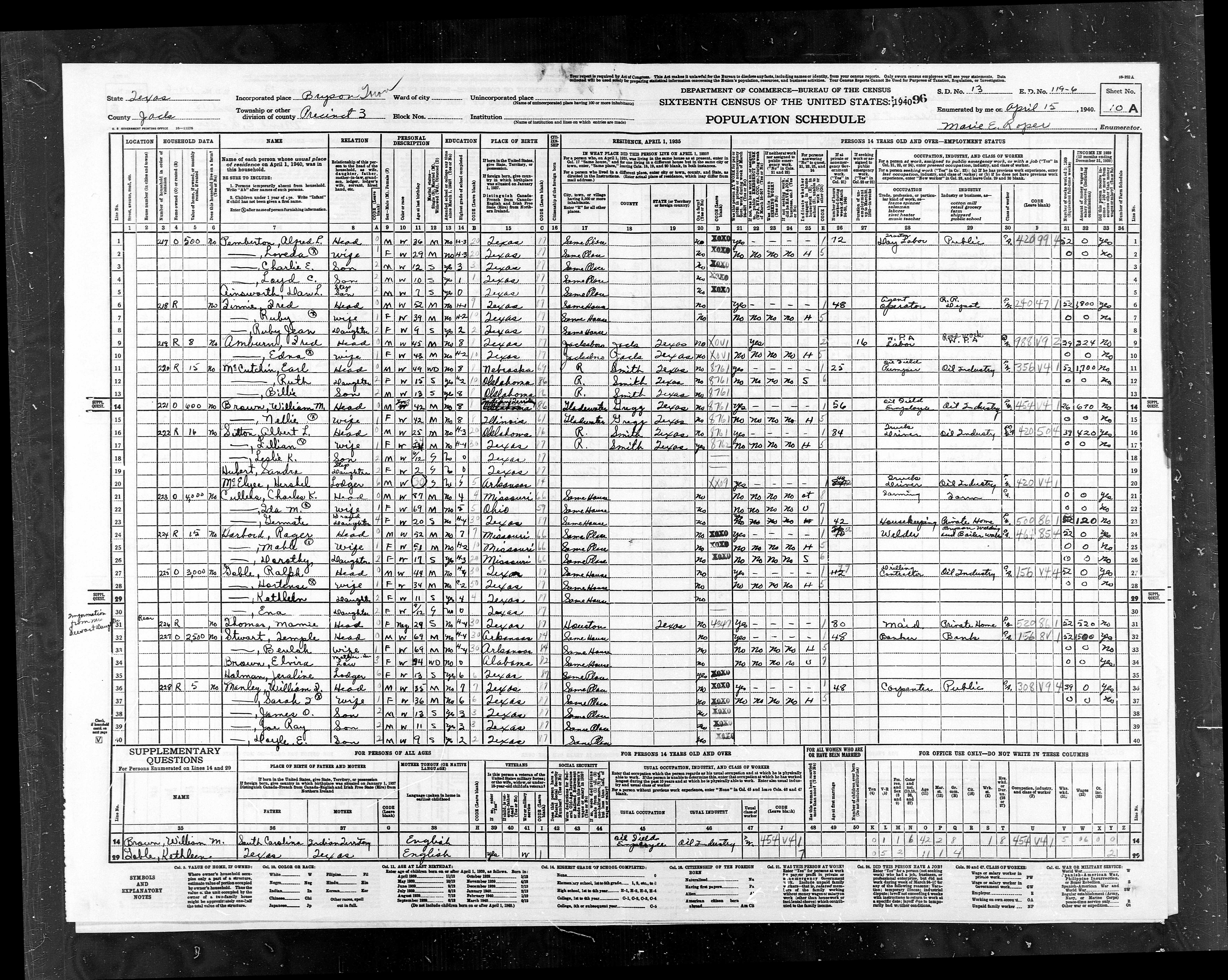
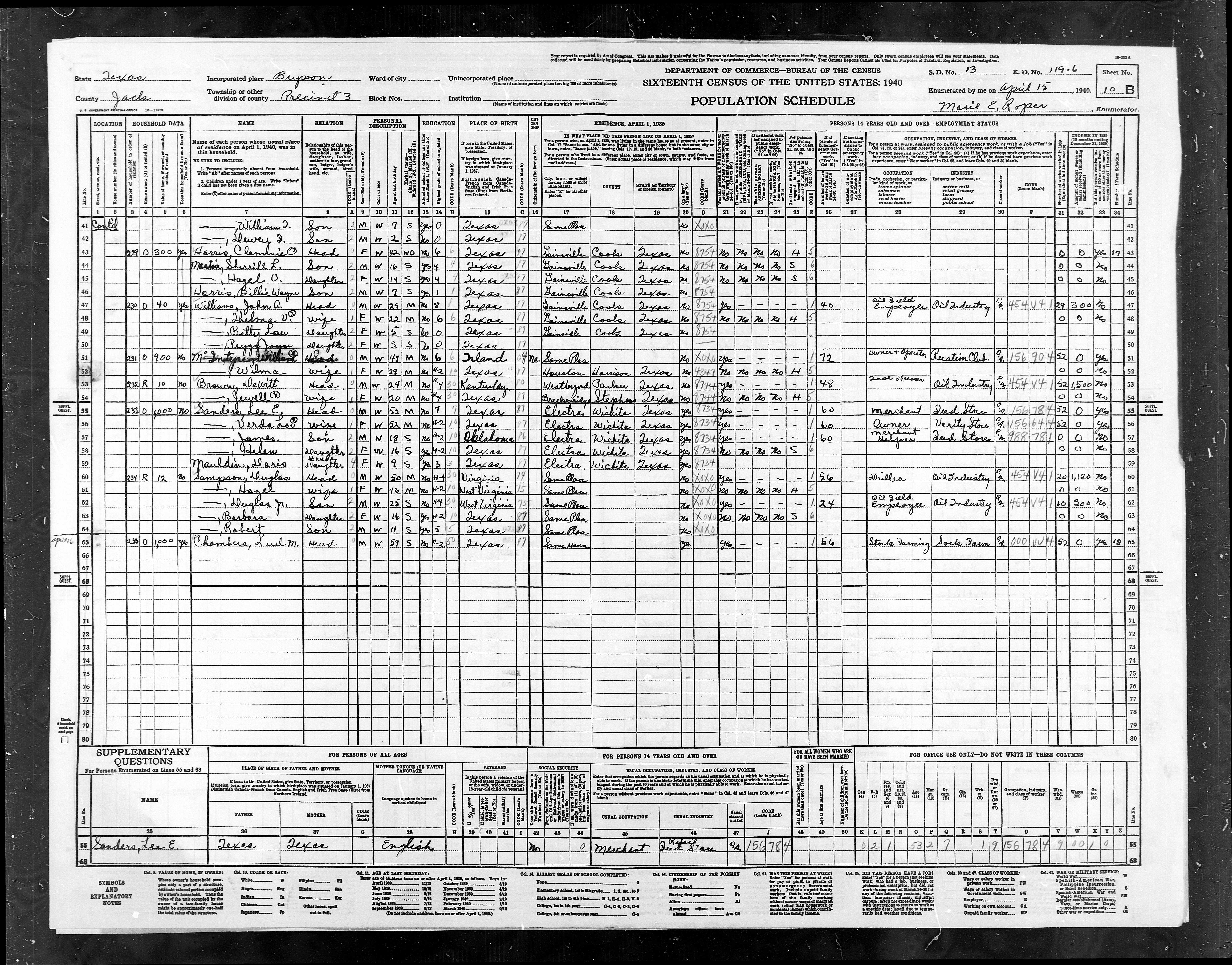
ED
119-6 |
Pct
3, Bryson Town |
641 |
806 |
|
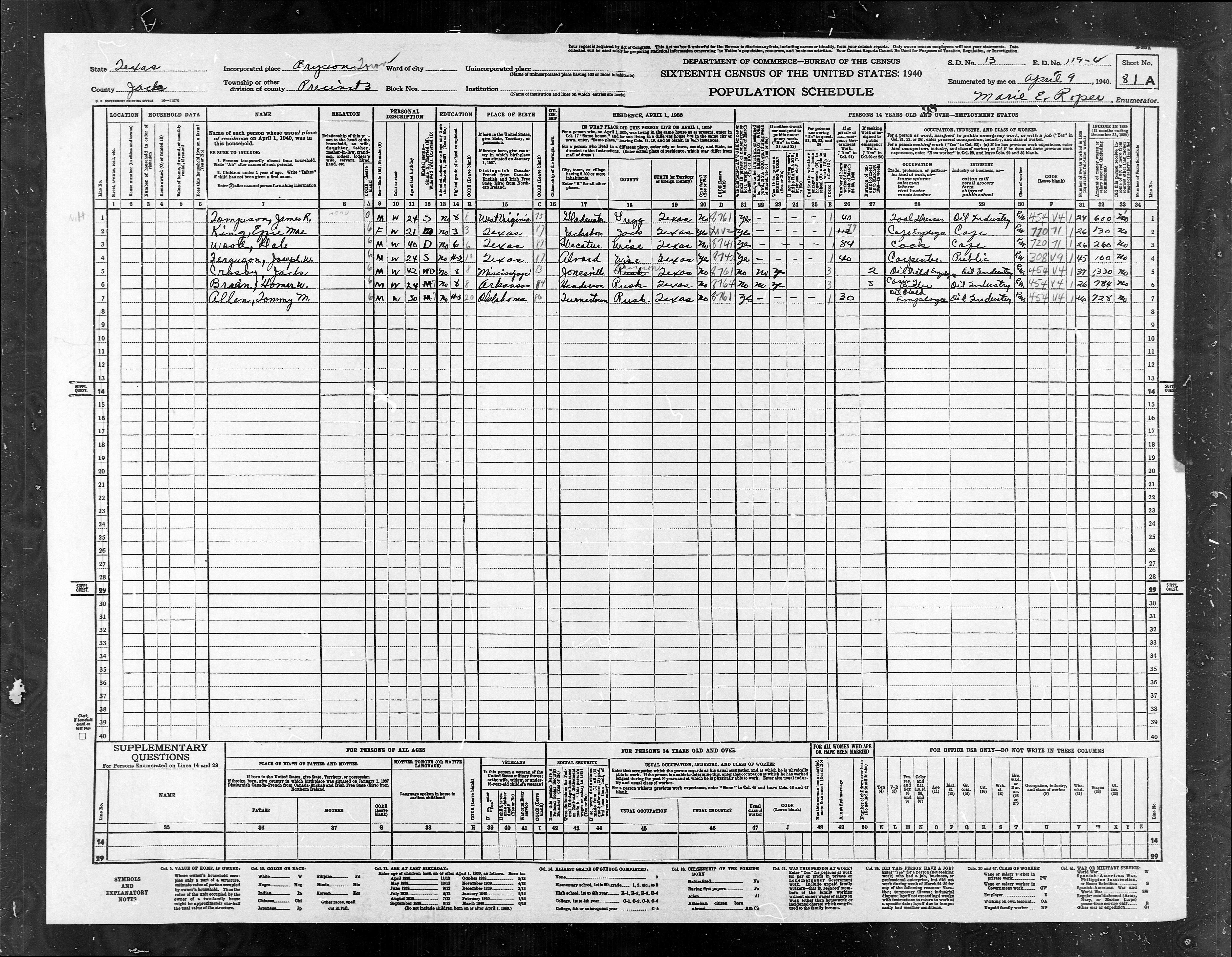
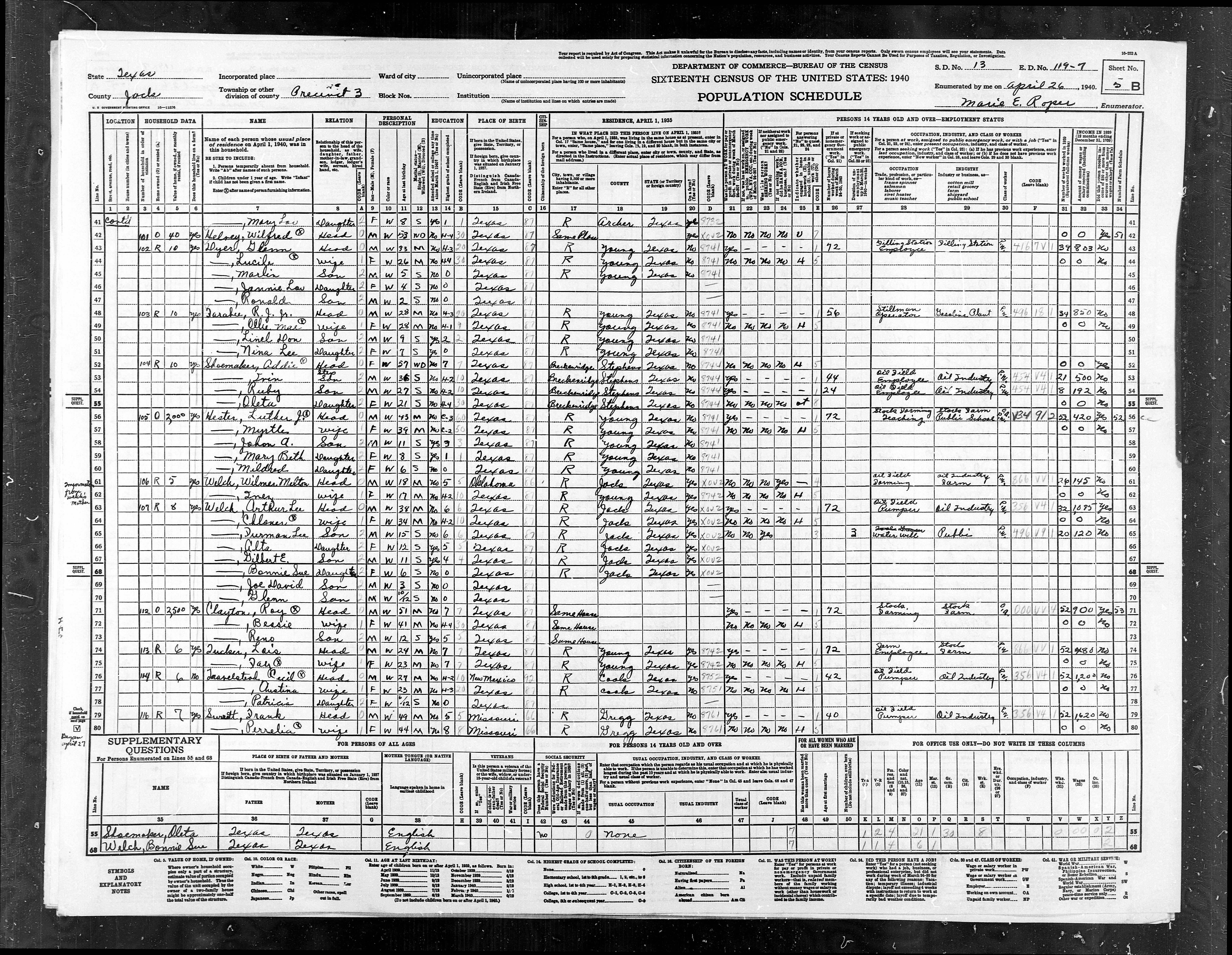
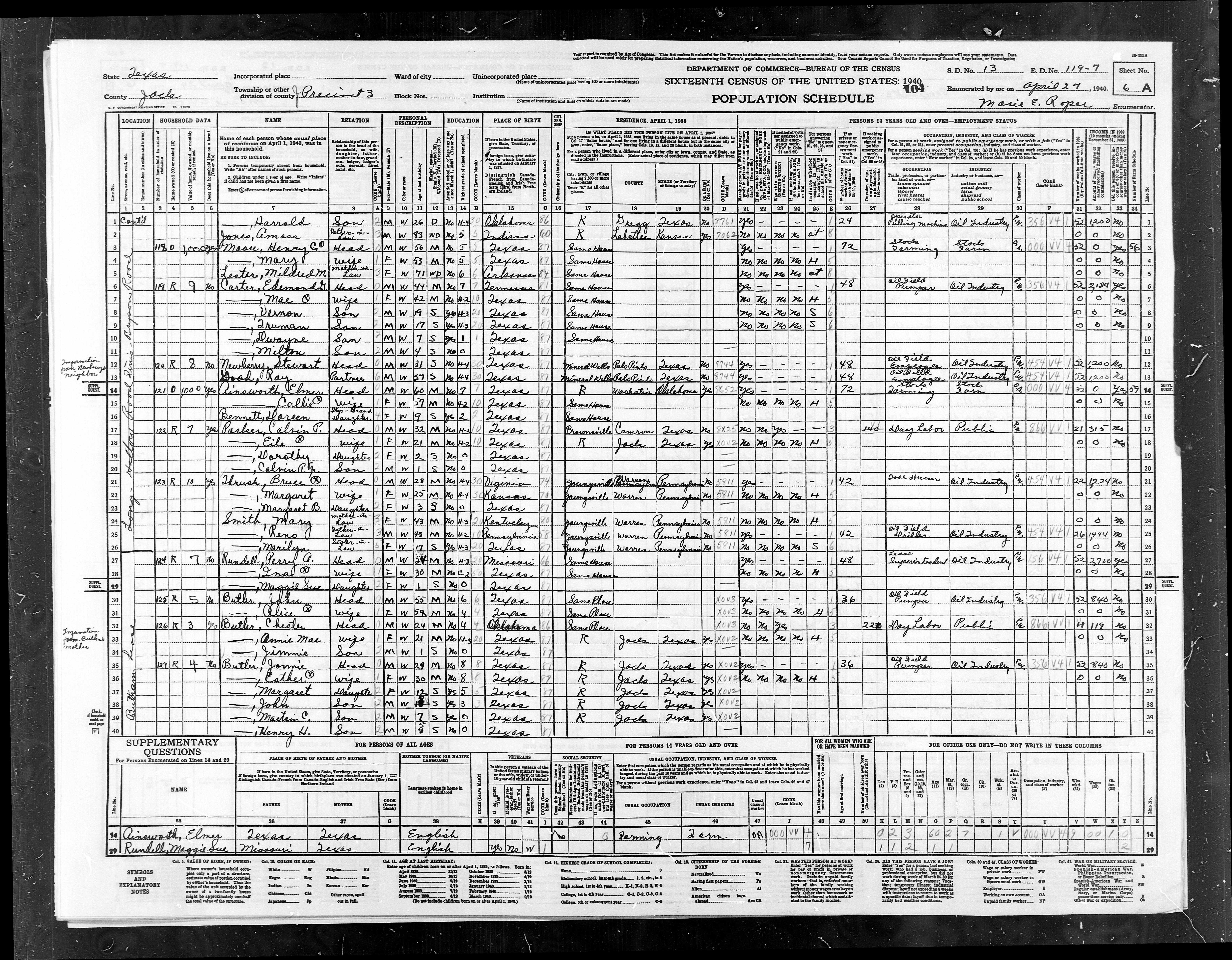
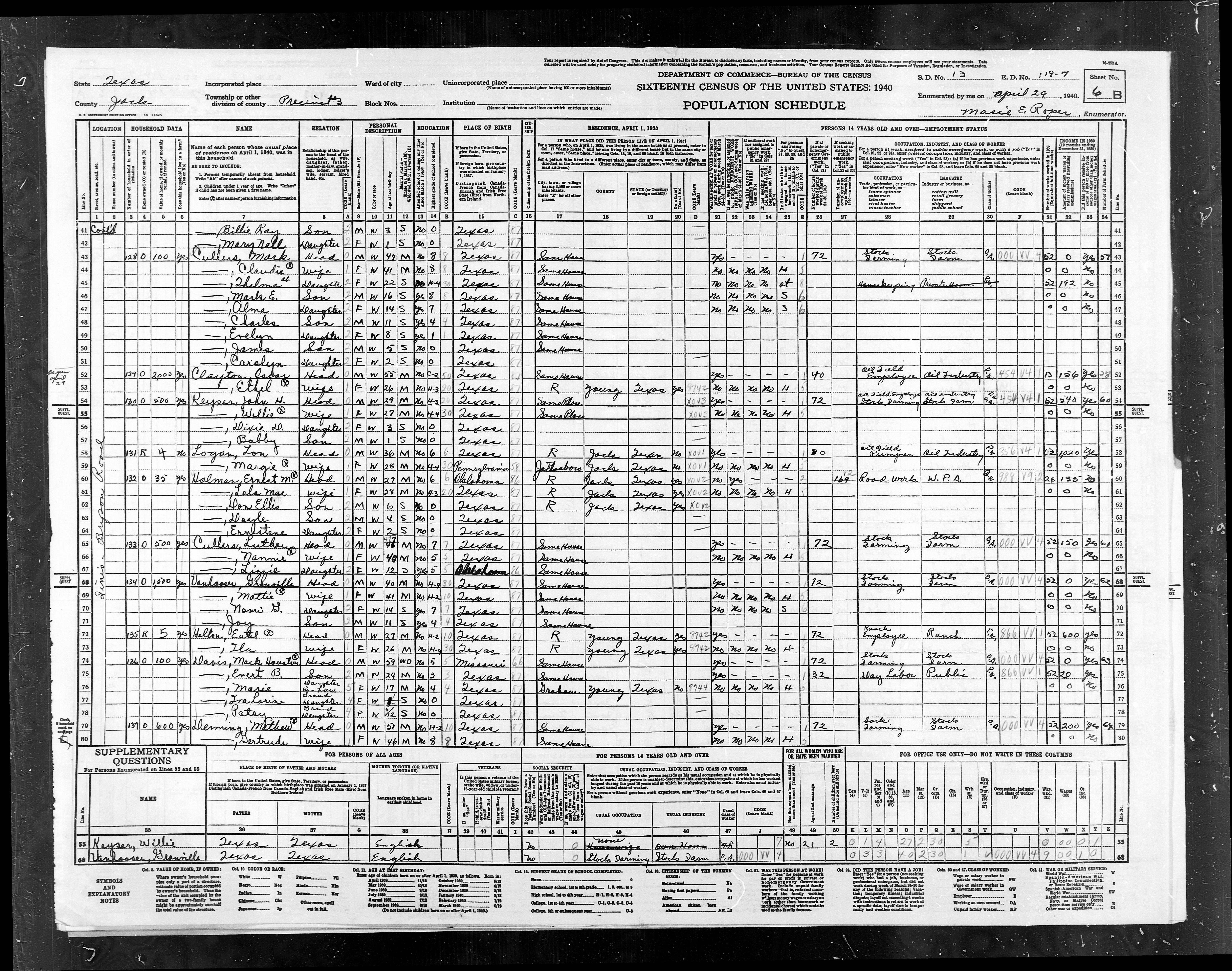
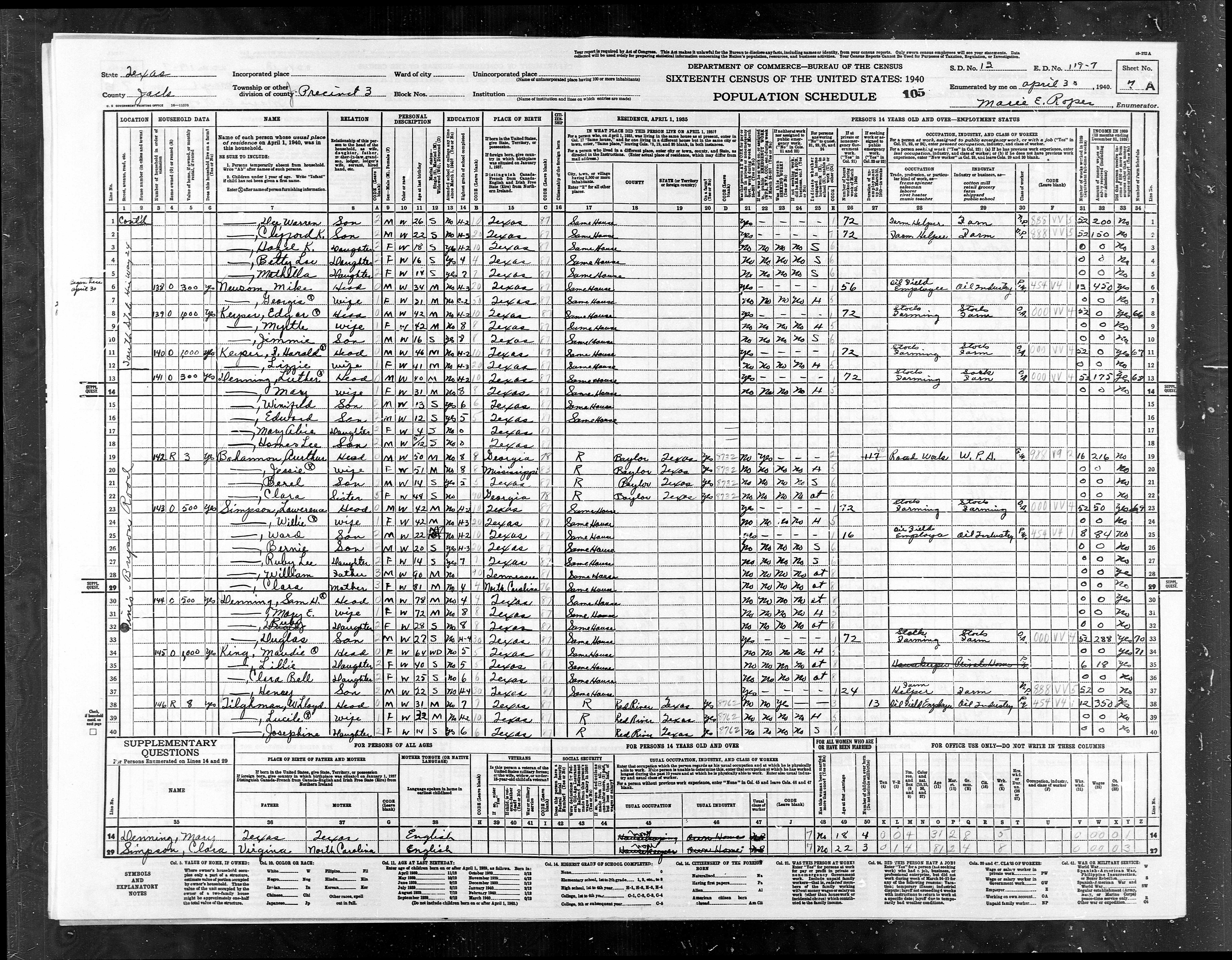
EDs
119-6+119-7 |
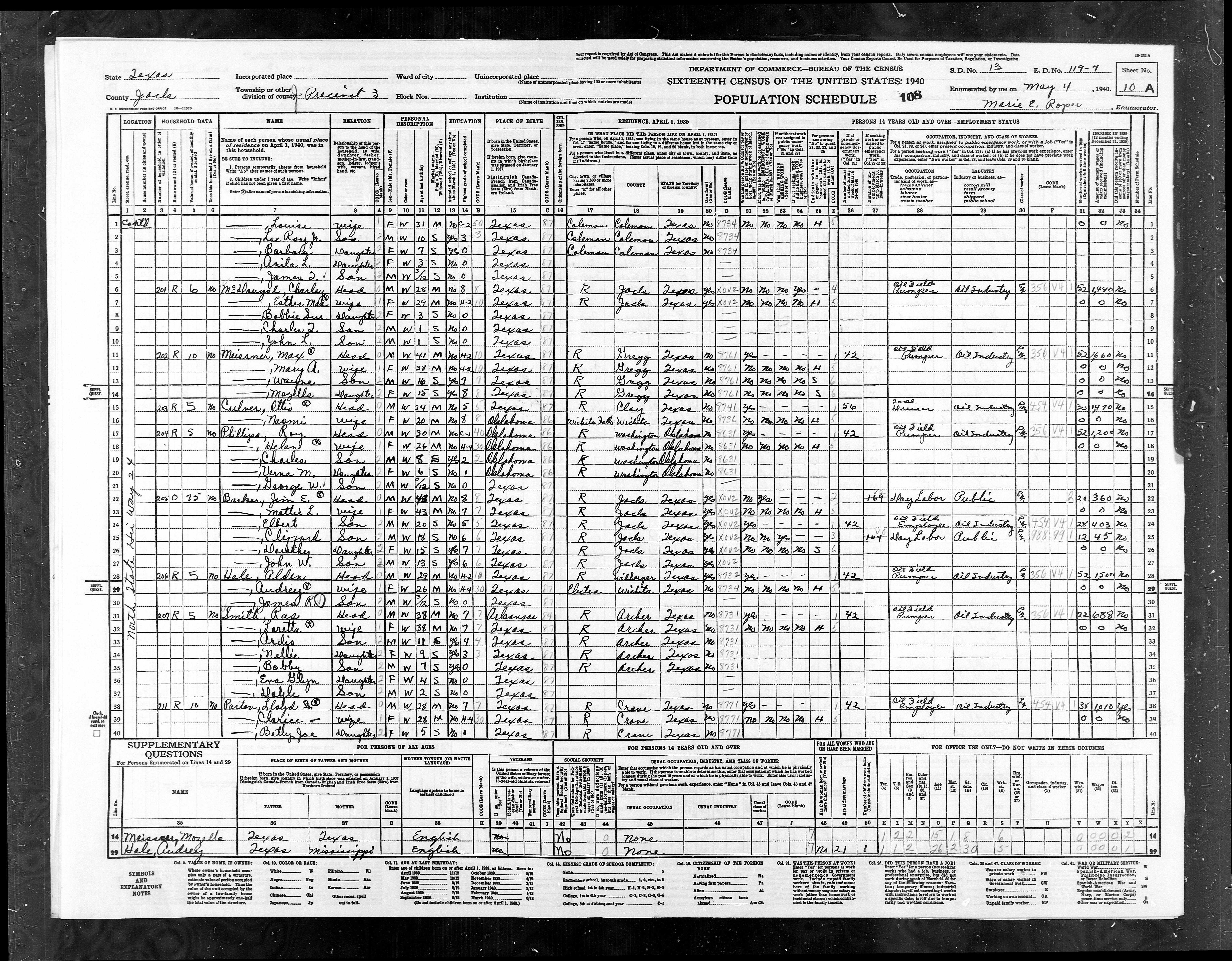
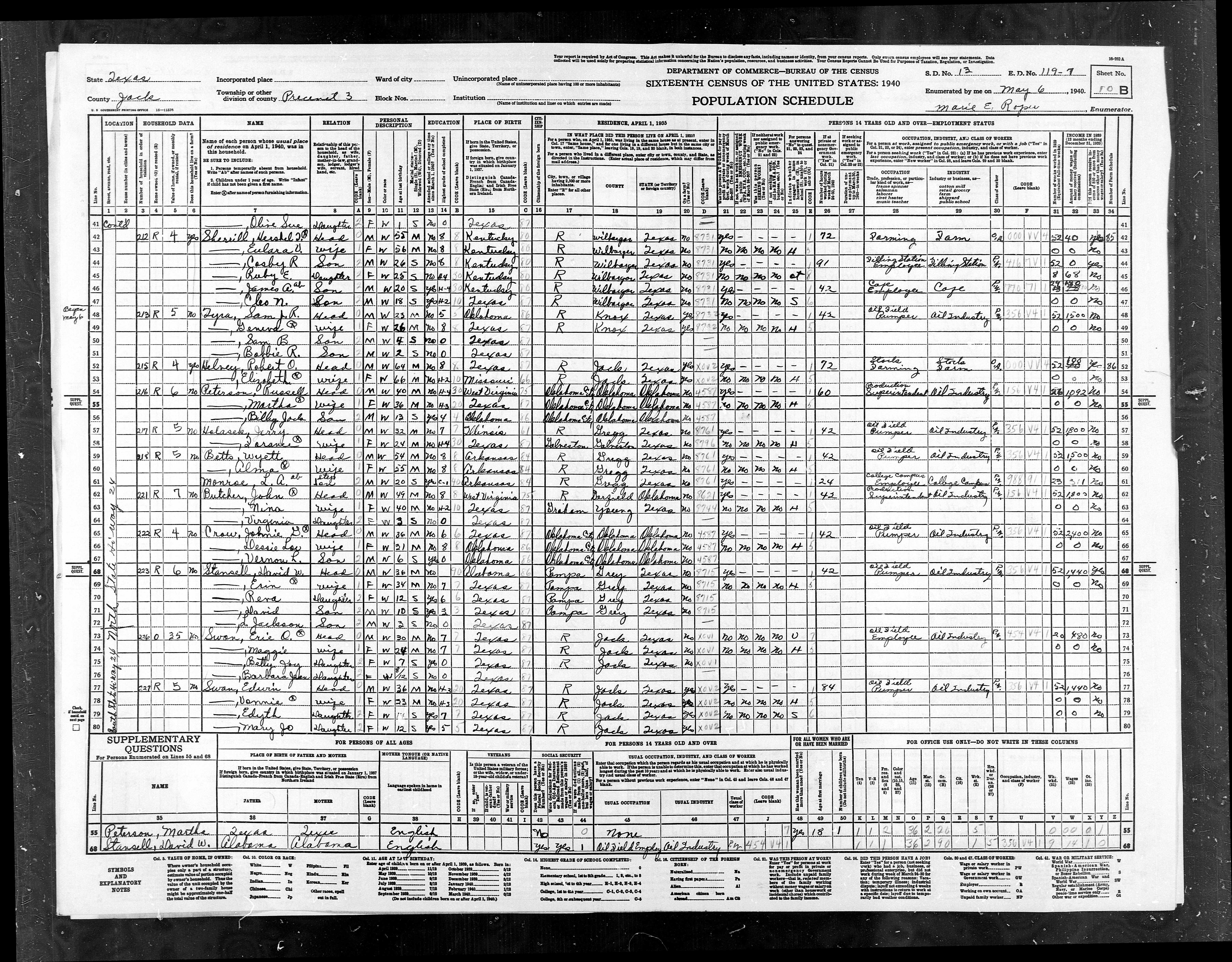
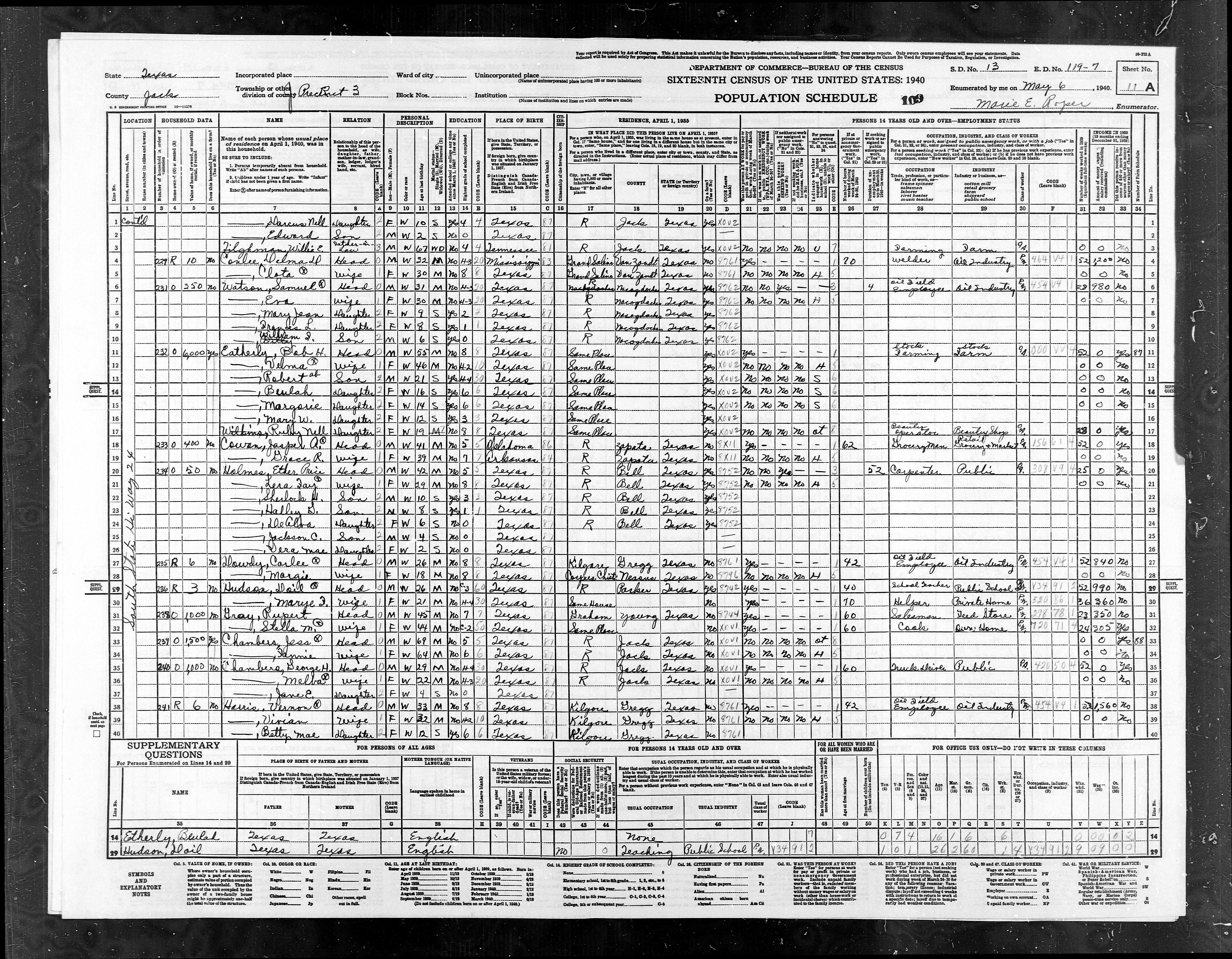
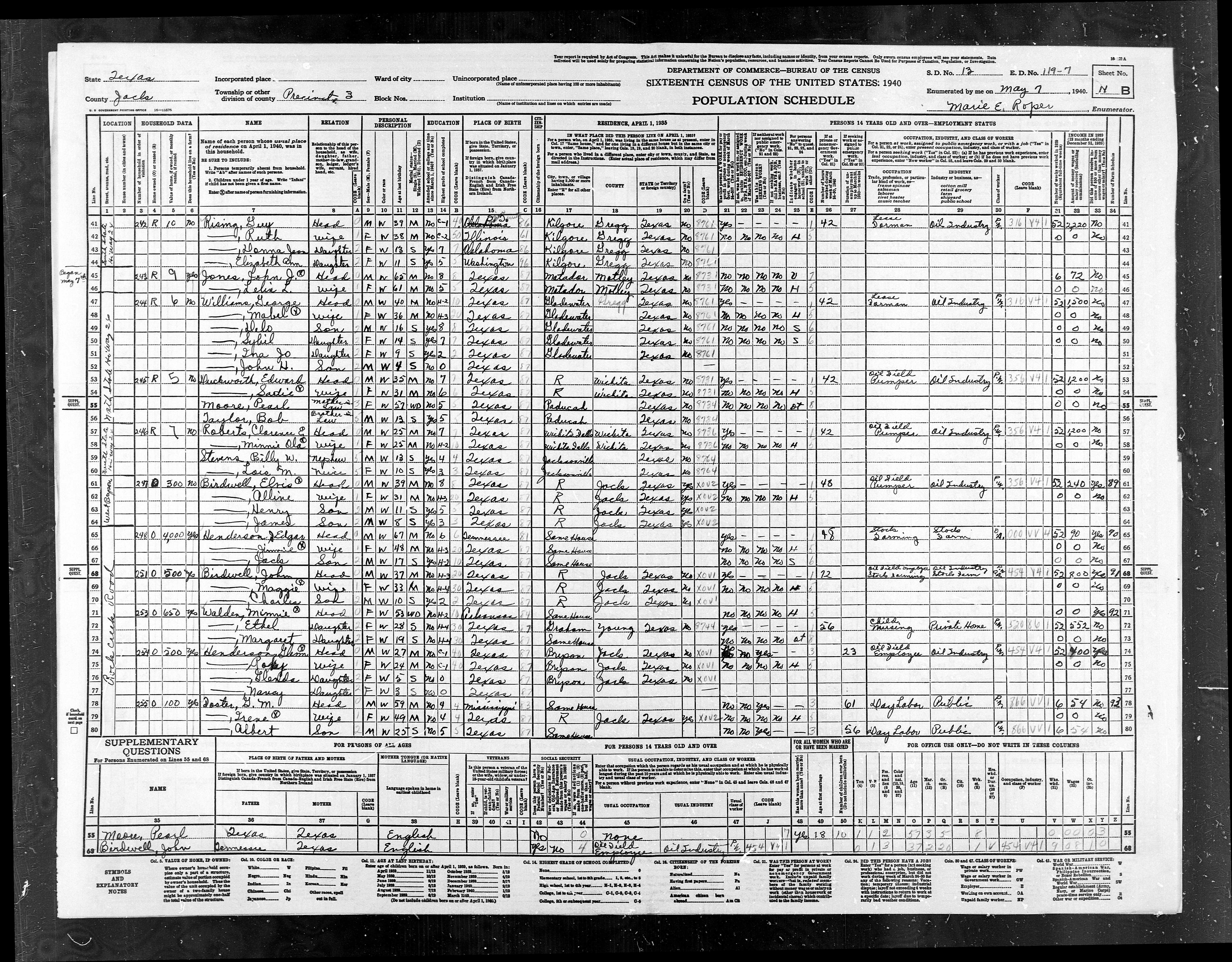
ED
119-7 |
Pct
3, Outside of Bryson Town |
966 |
1154 |
|
EDs
119-8+119-9 |
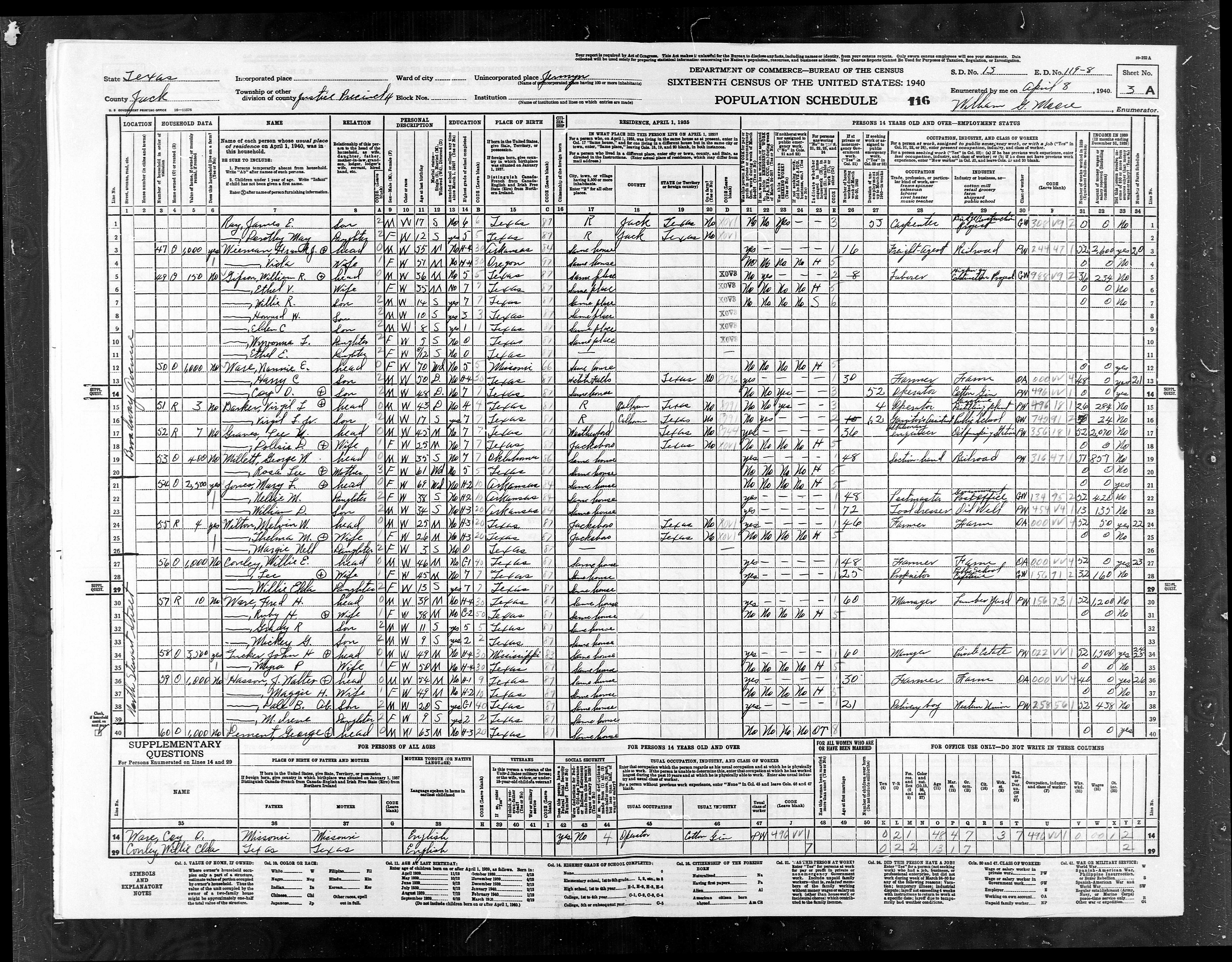
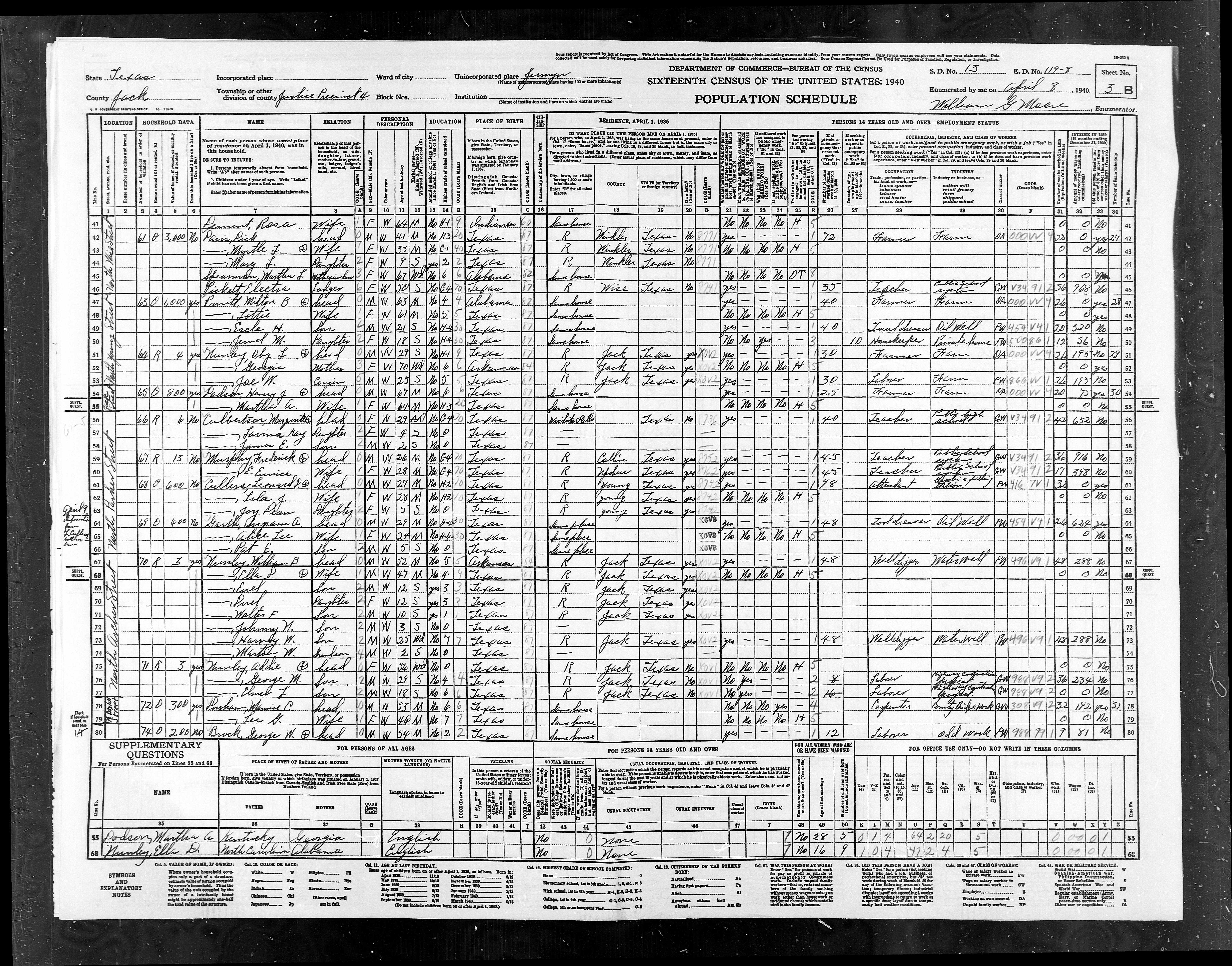
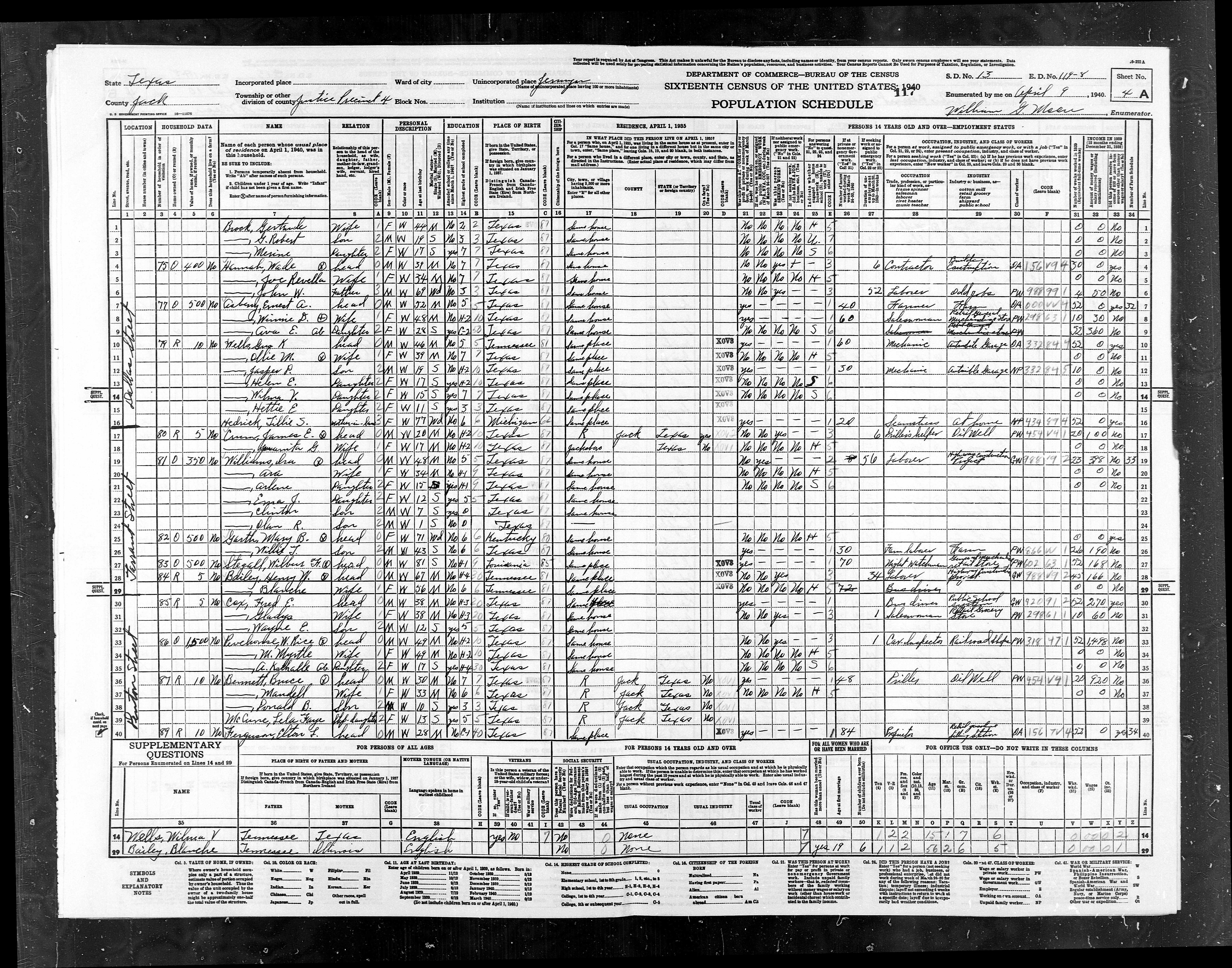
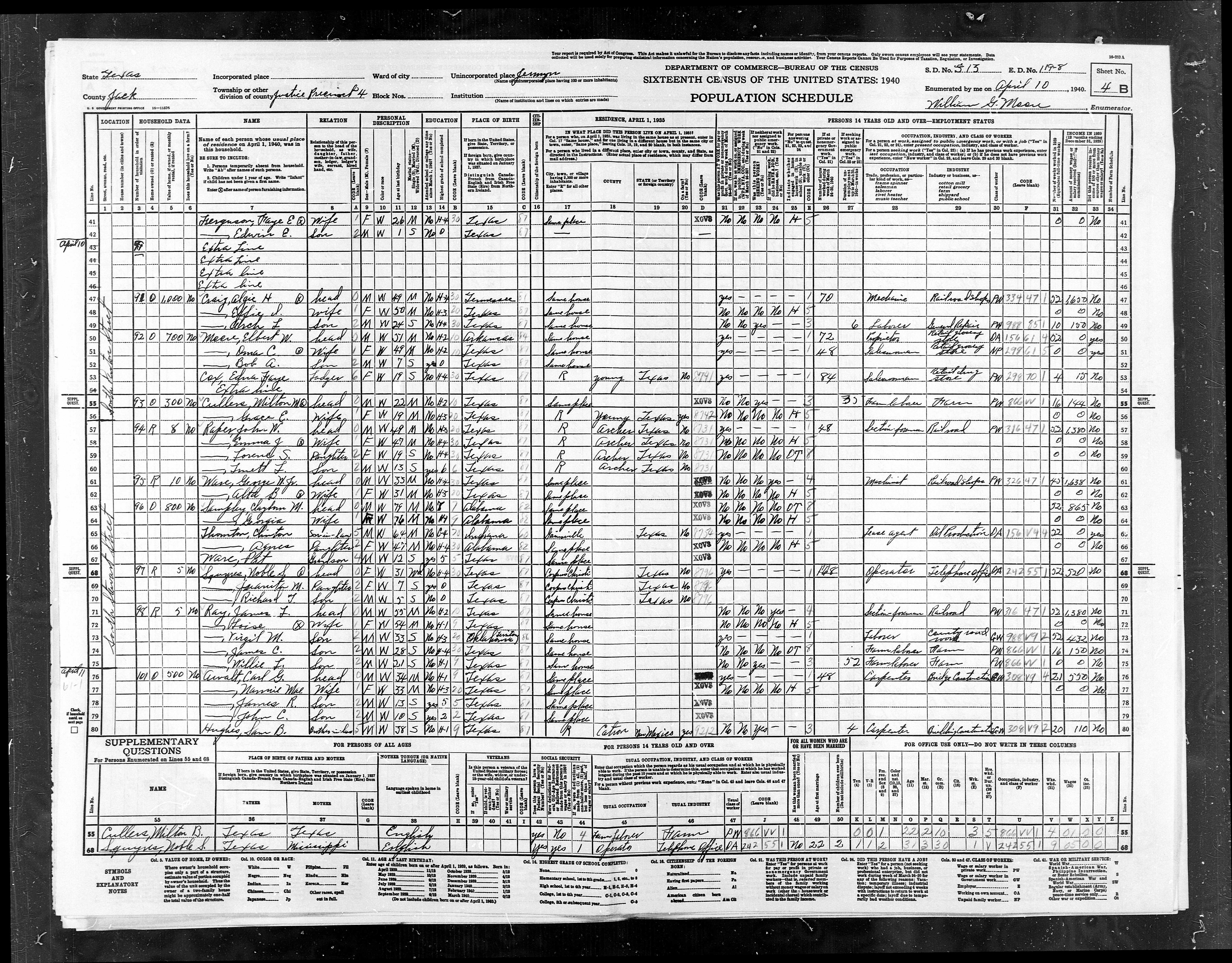
ED
119-8 |
Pct
4, Antelope, Jermyn |
977 |
1024 |
|
ED
119-10 |
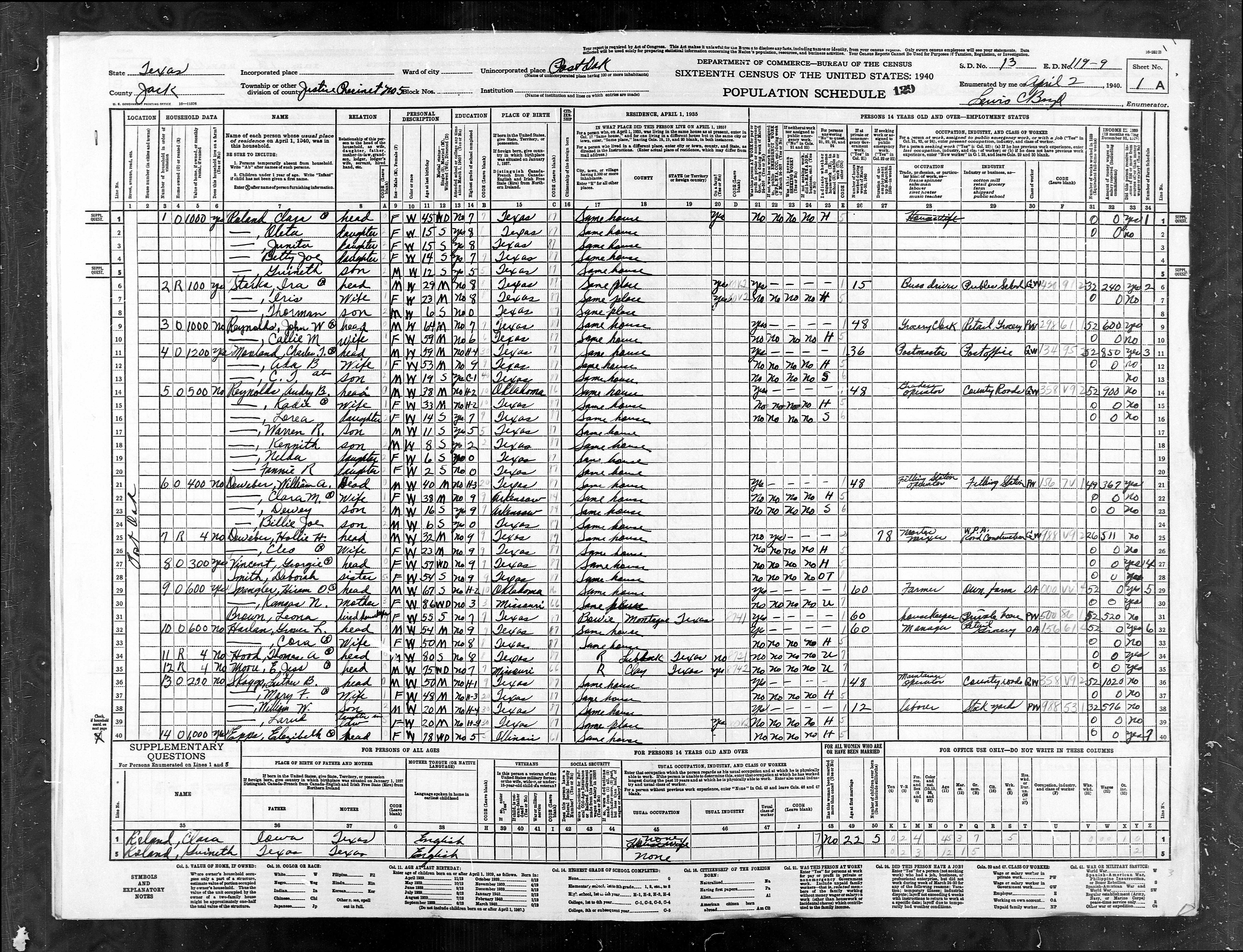
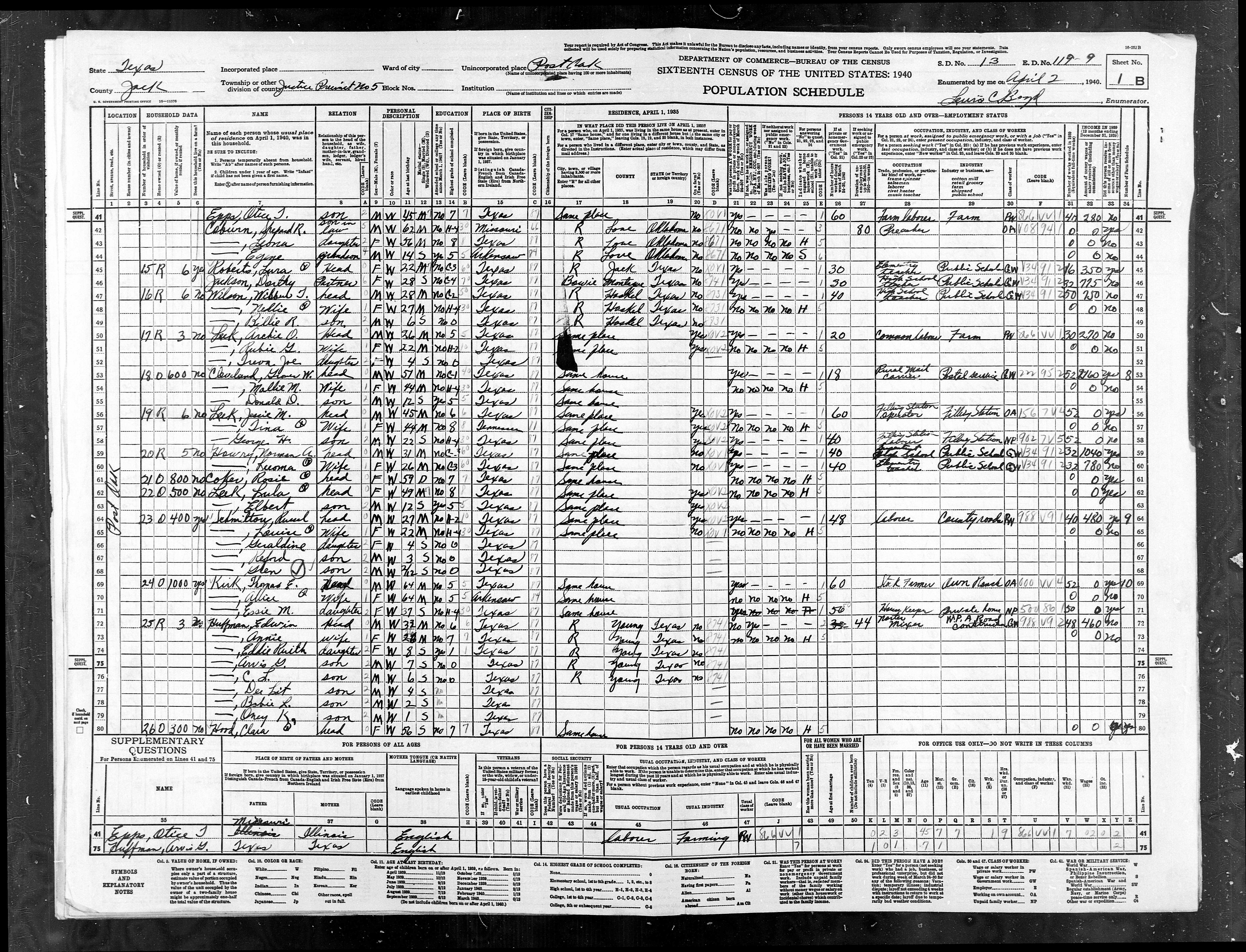
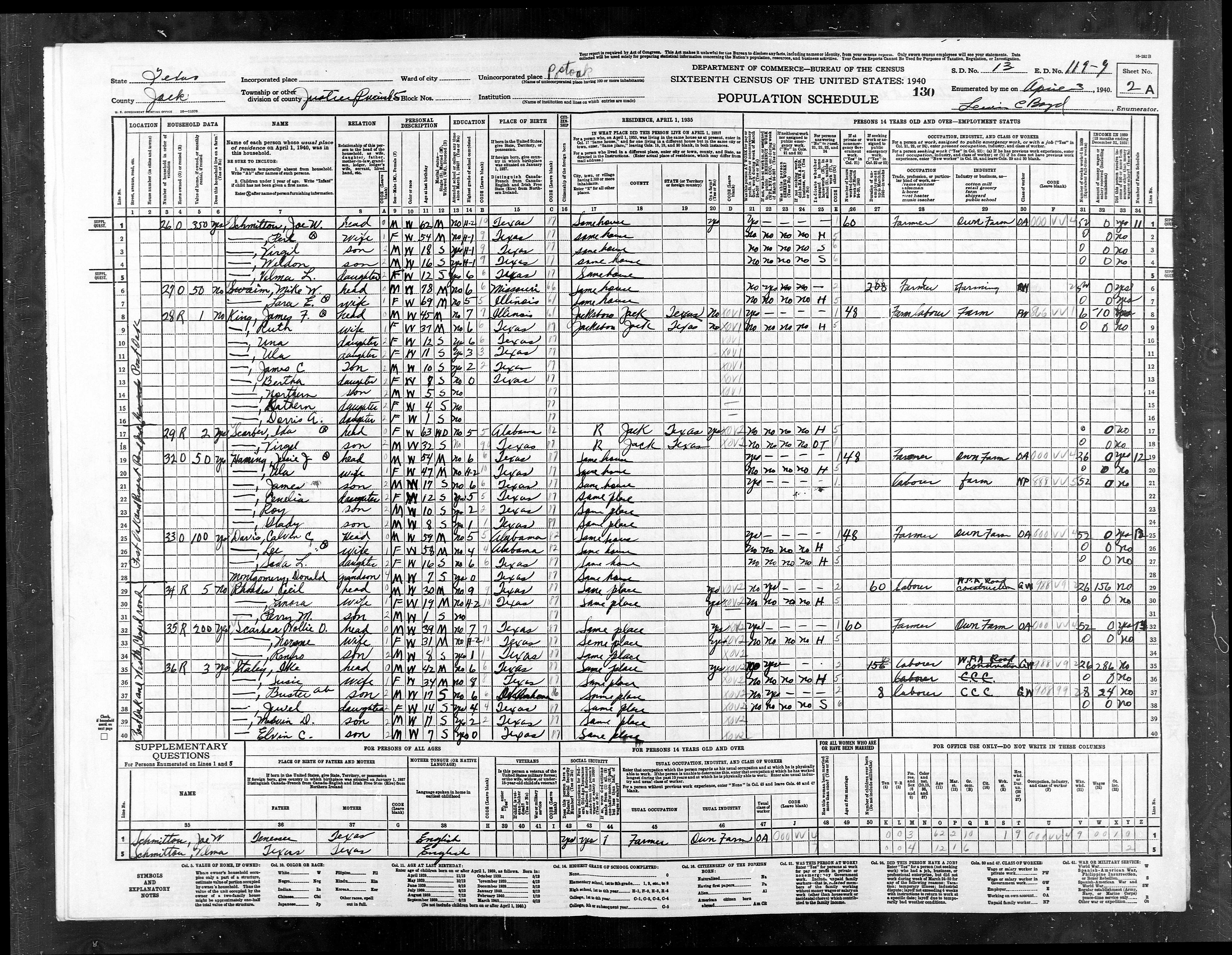
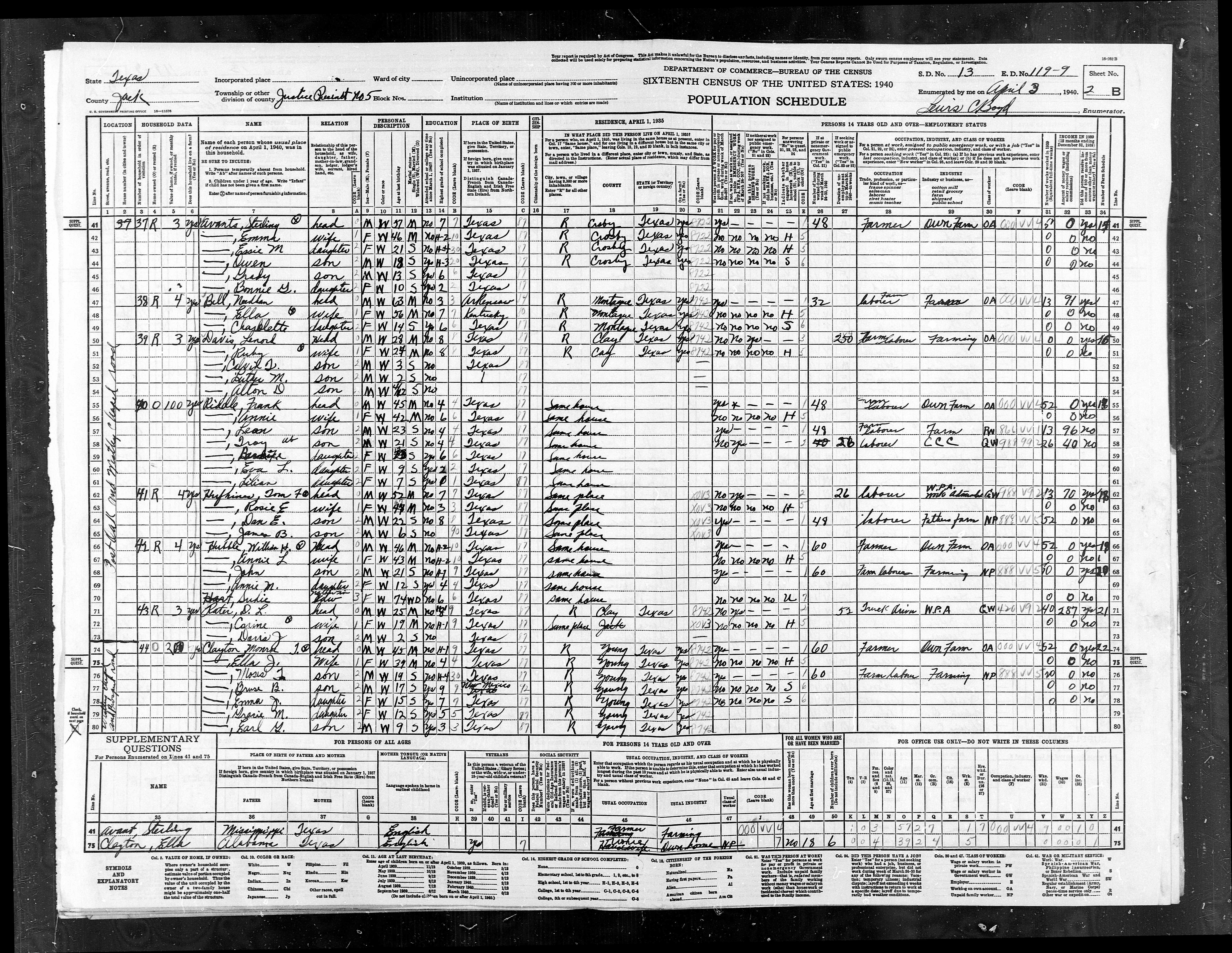
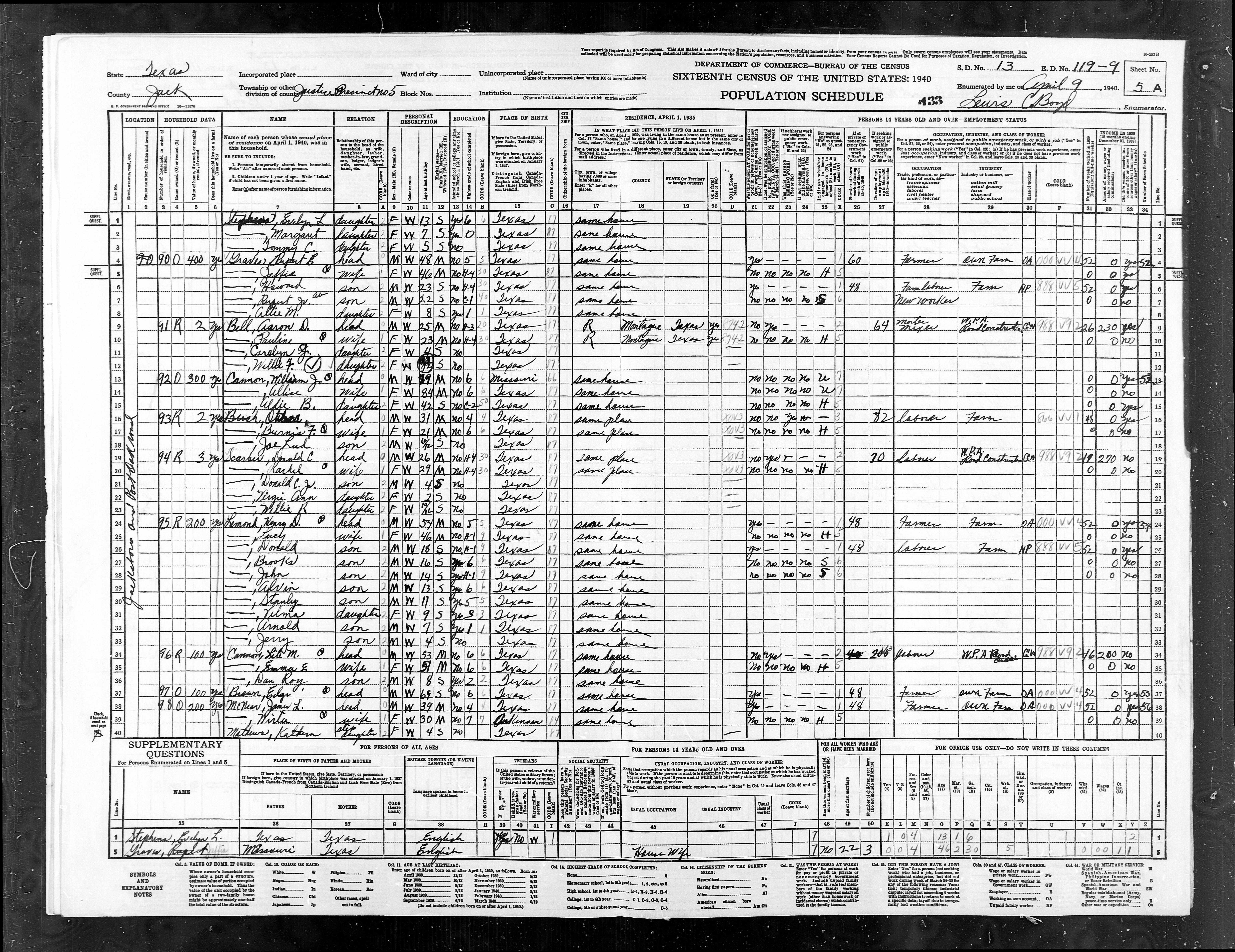
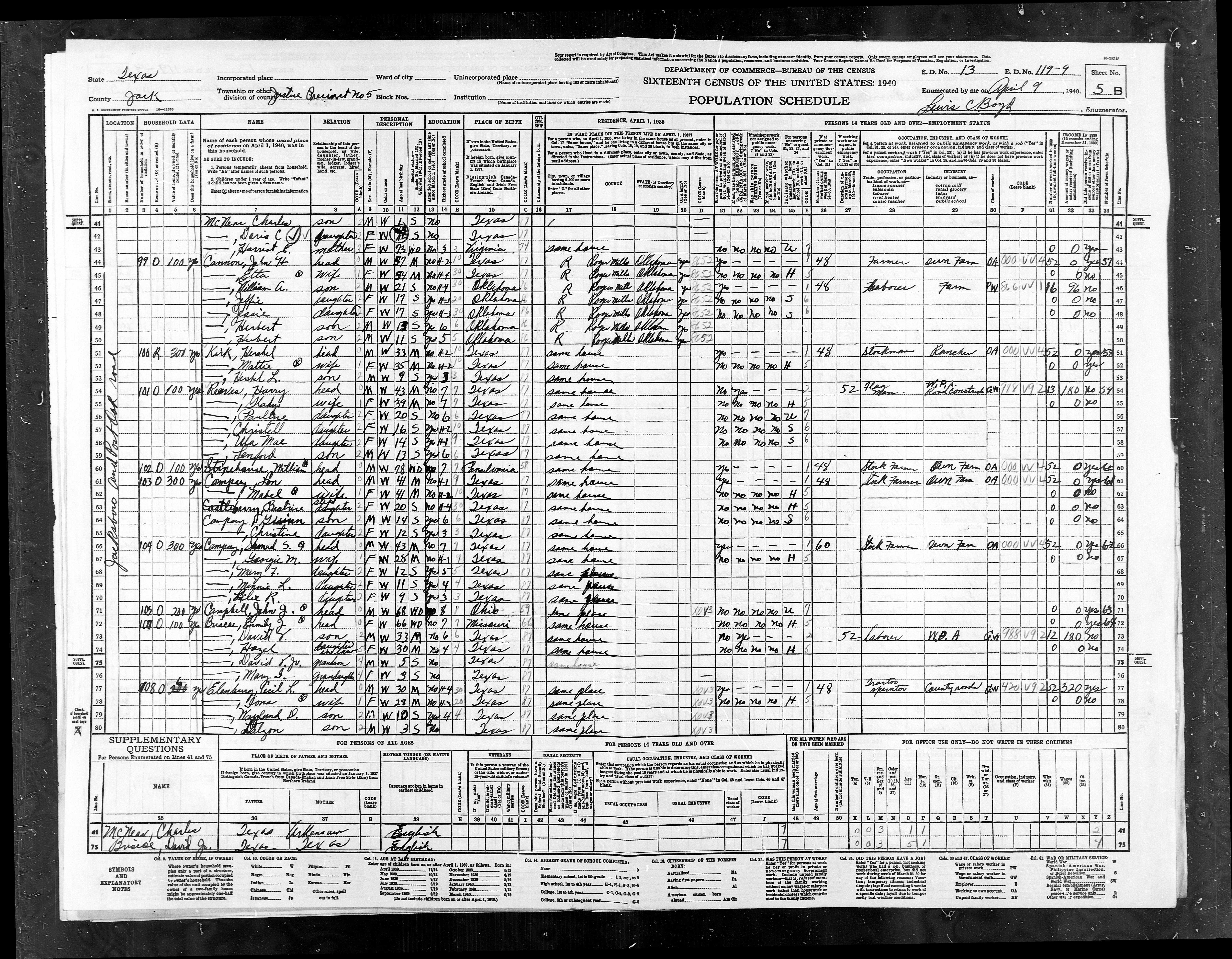
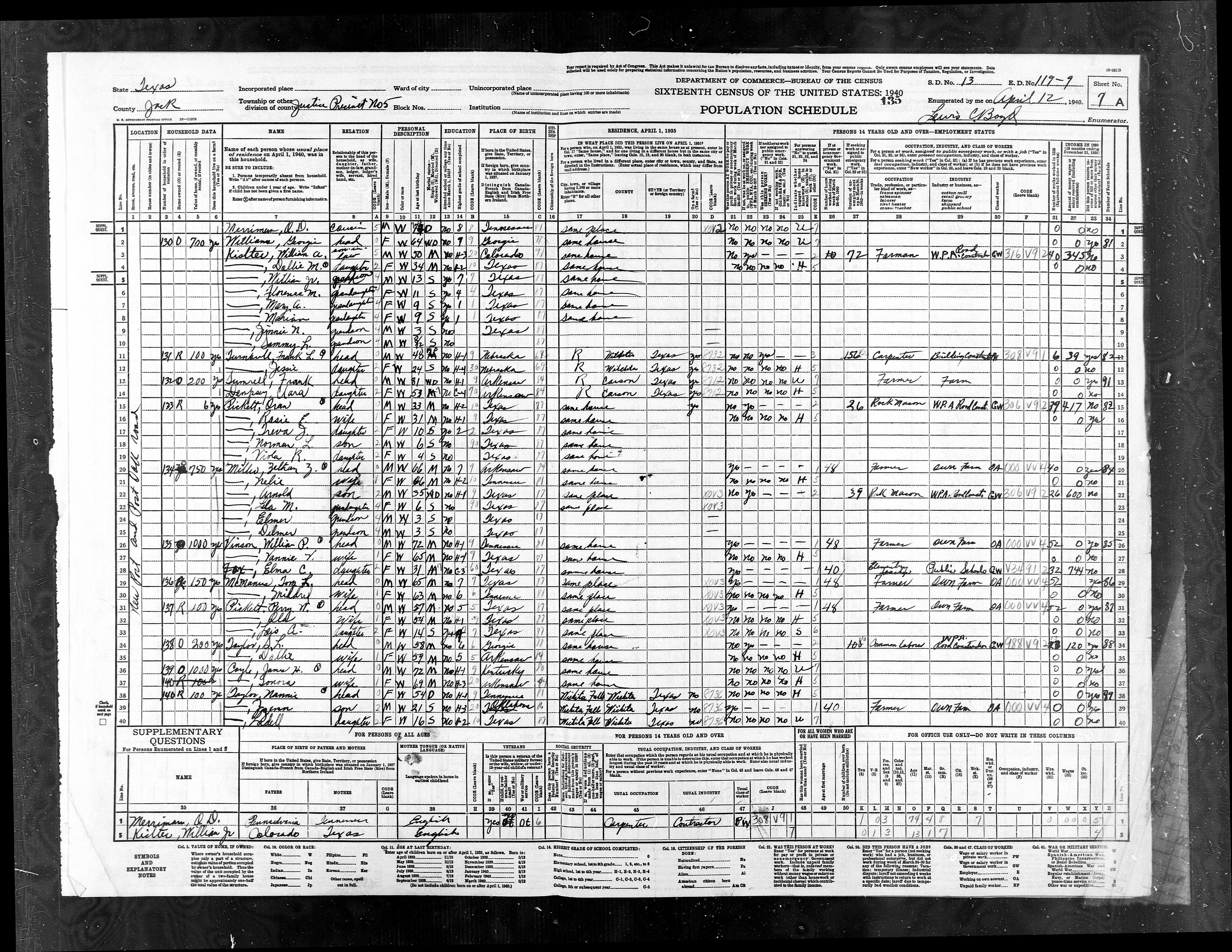
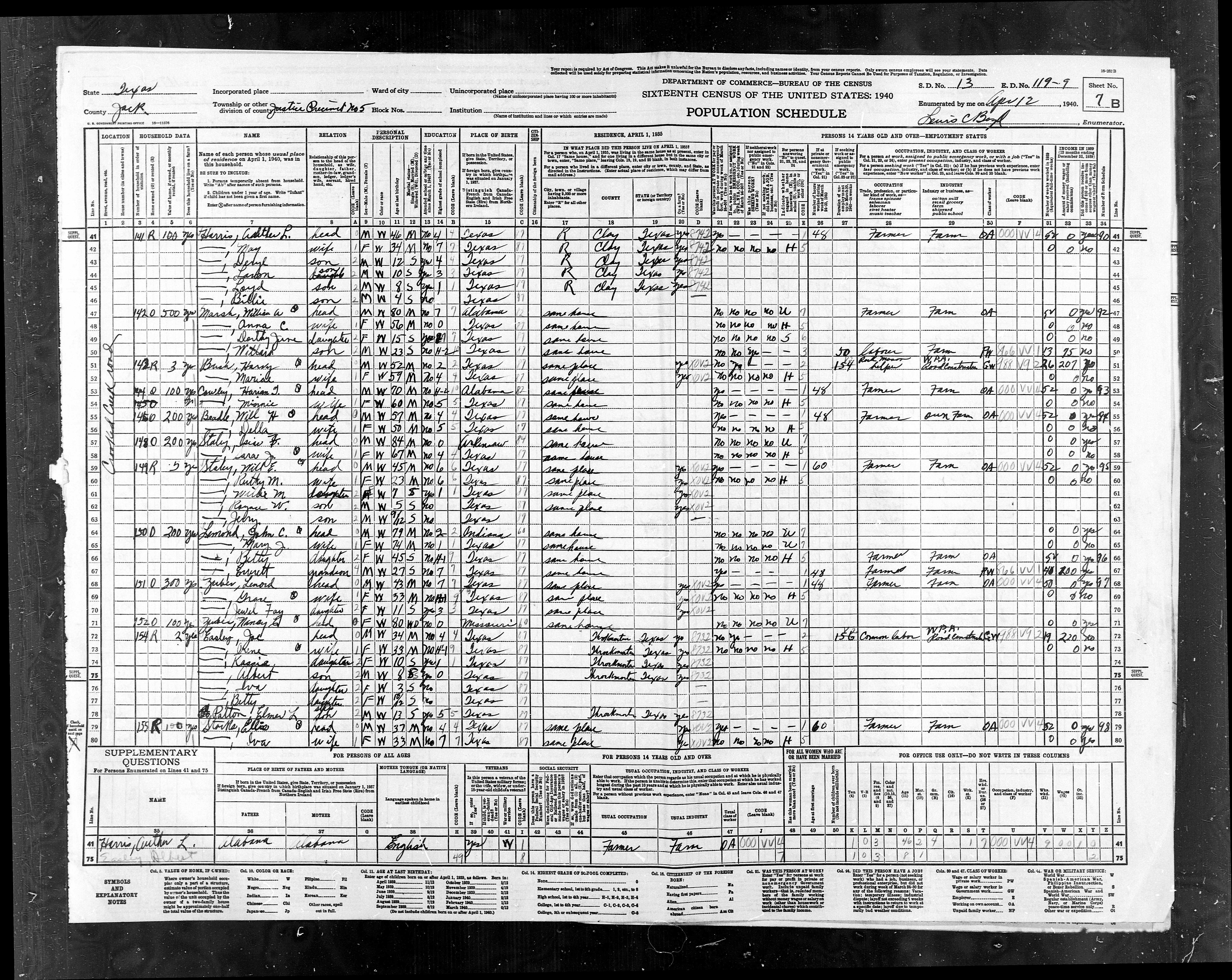
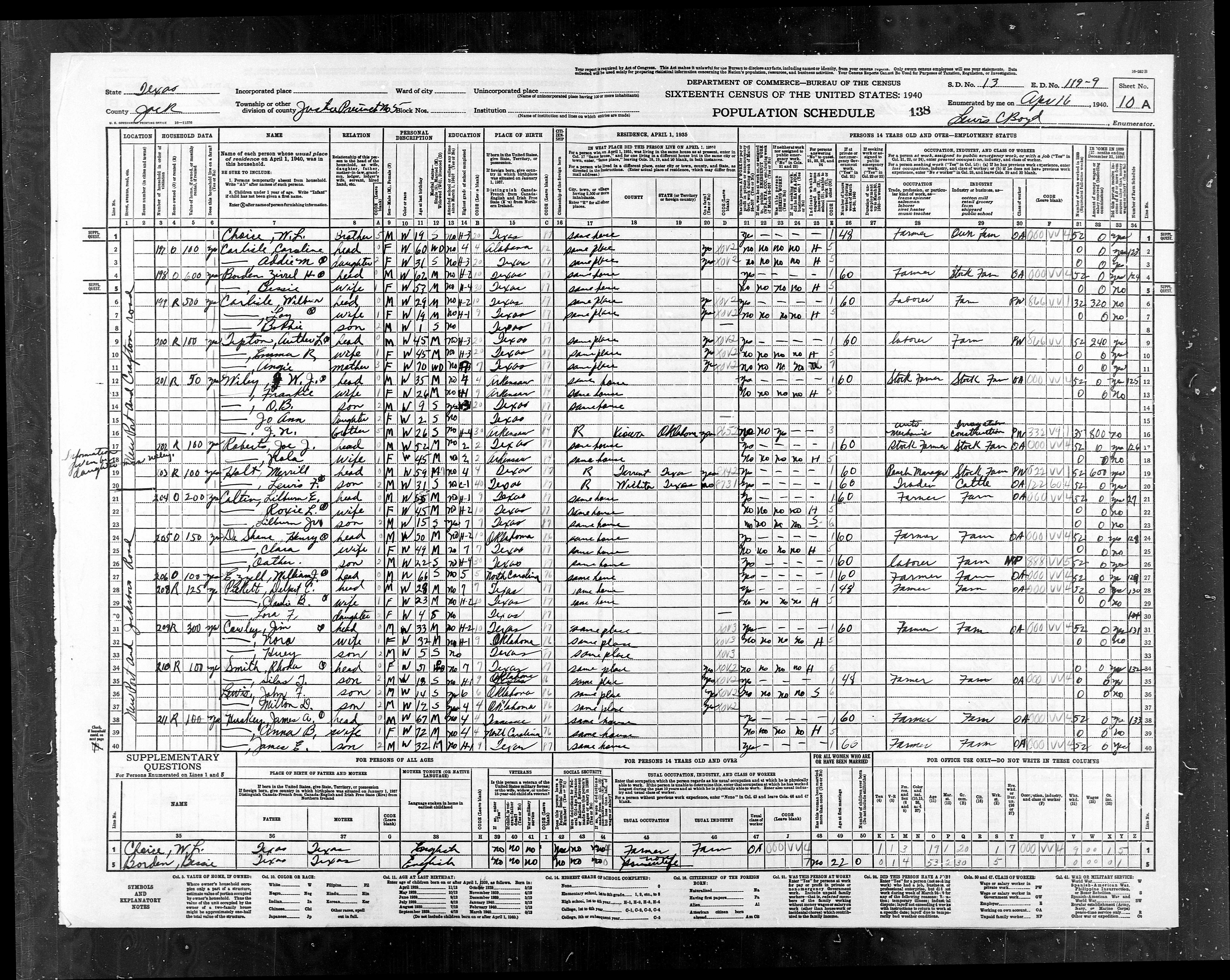
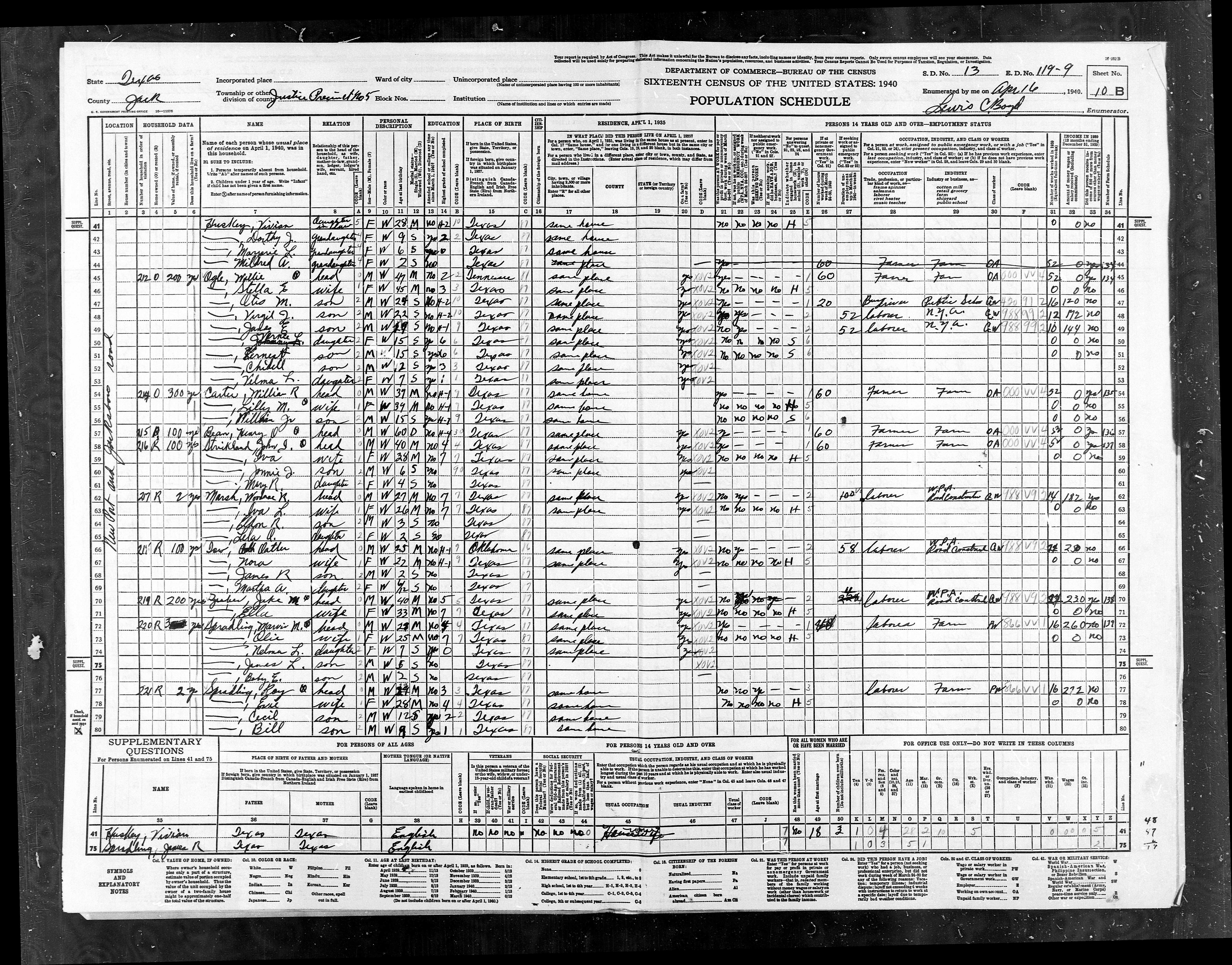
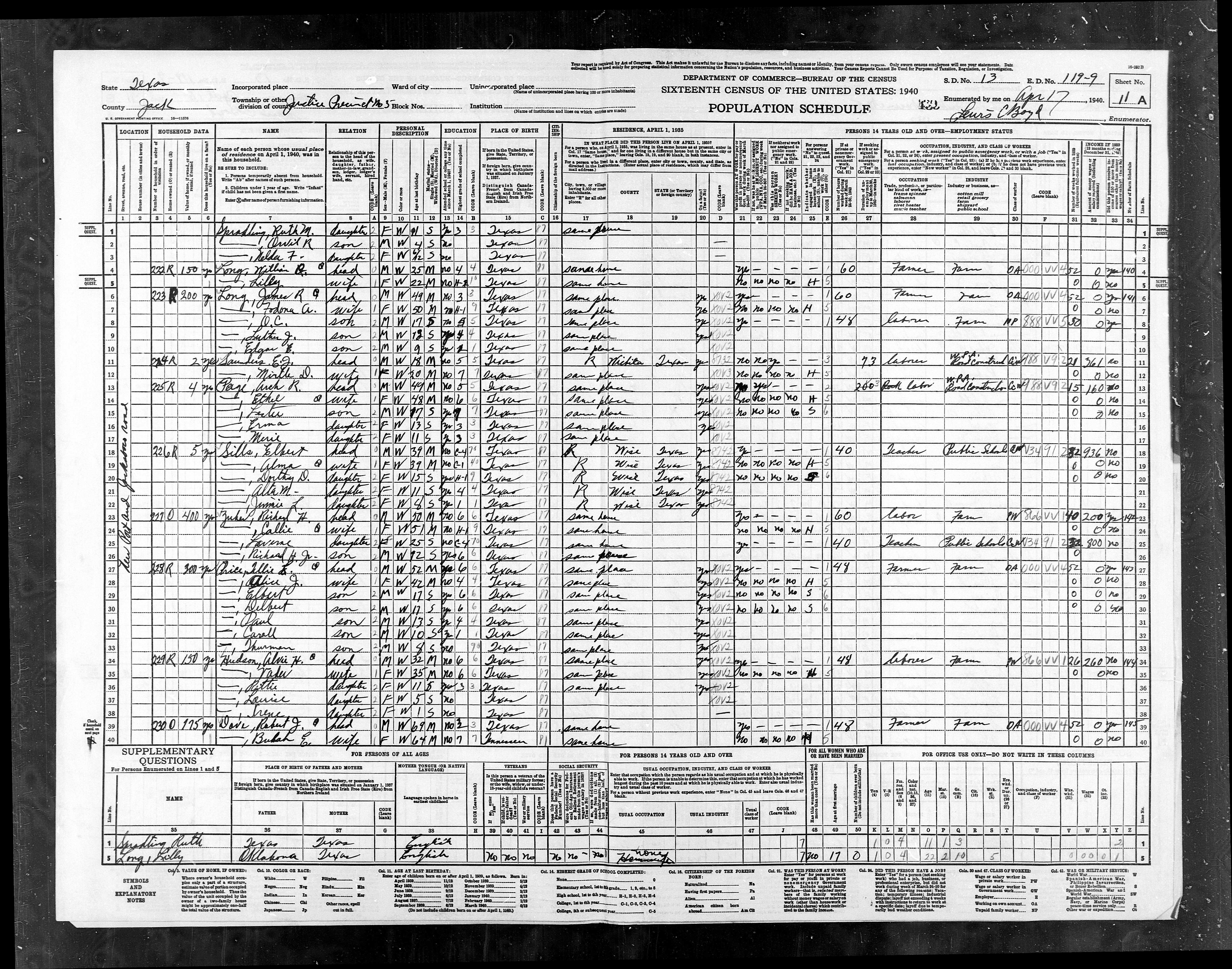
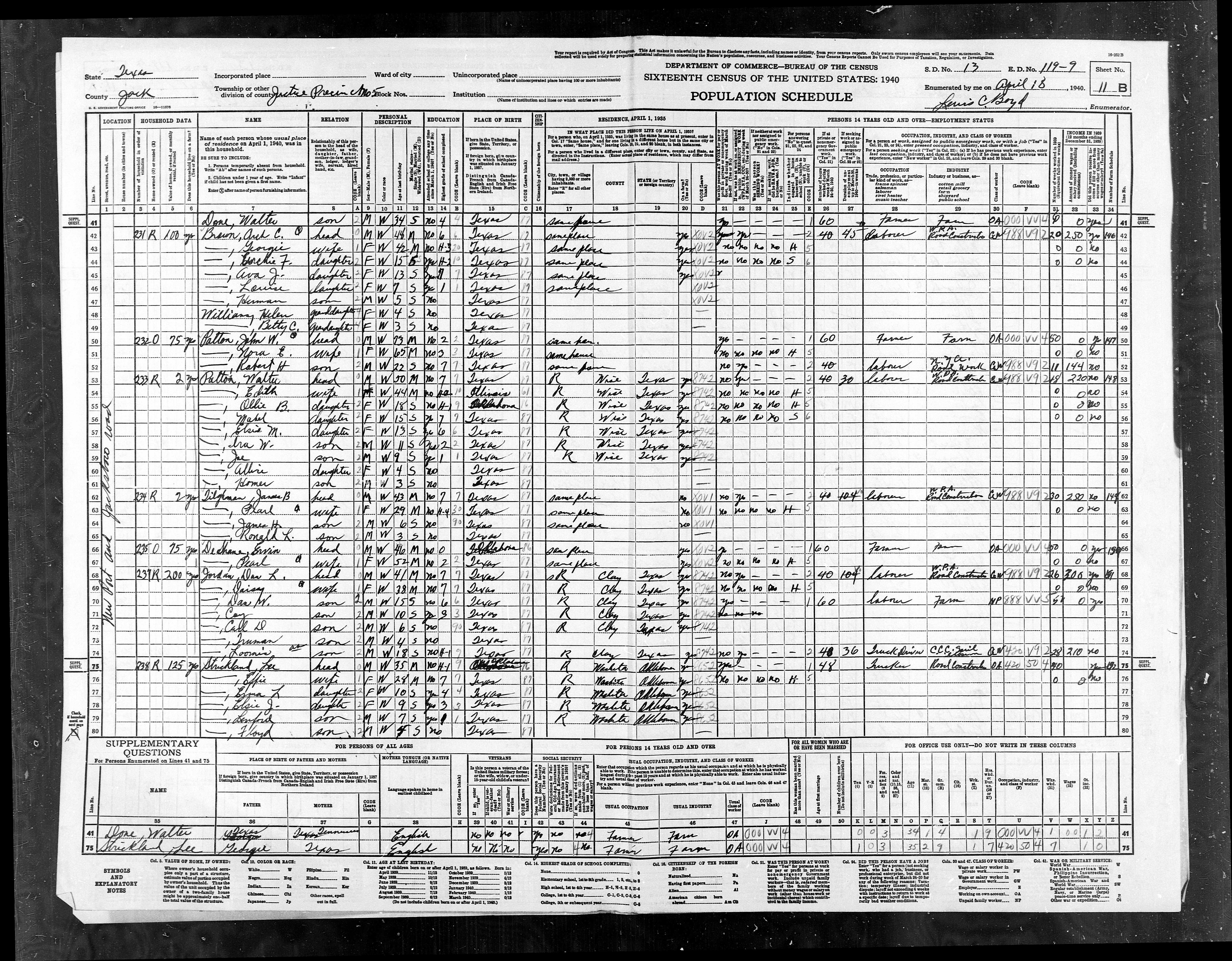
ED
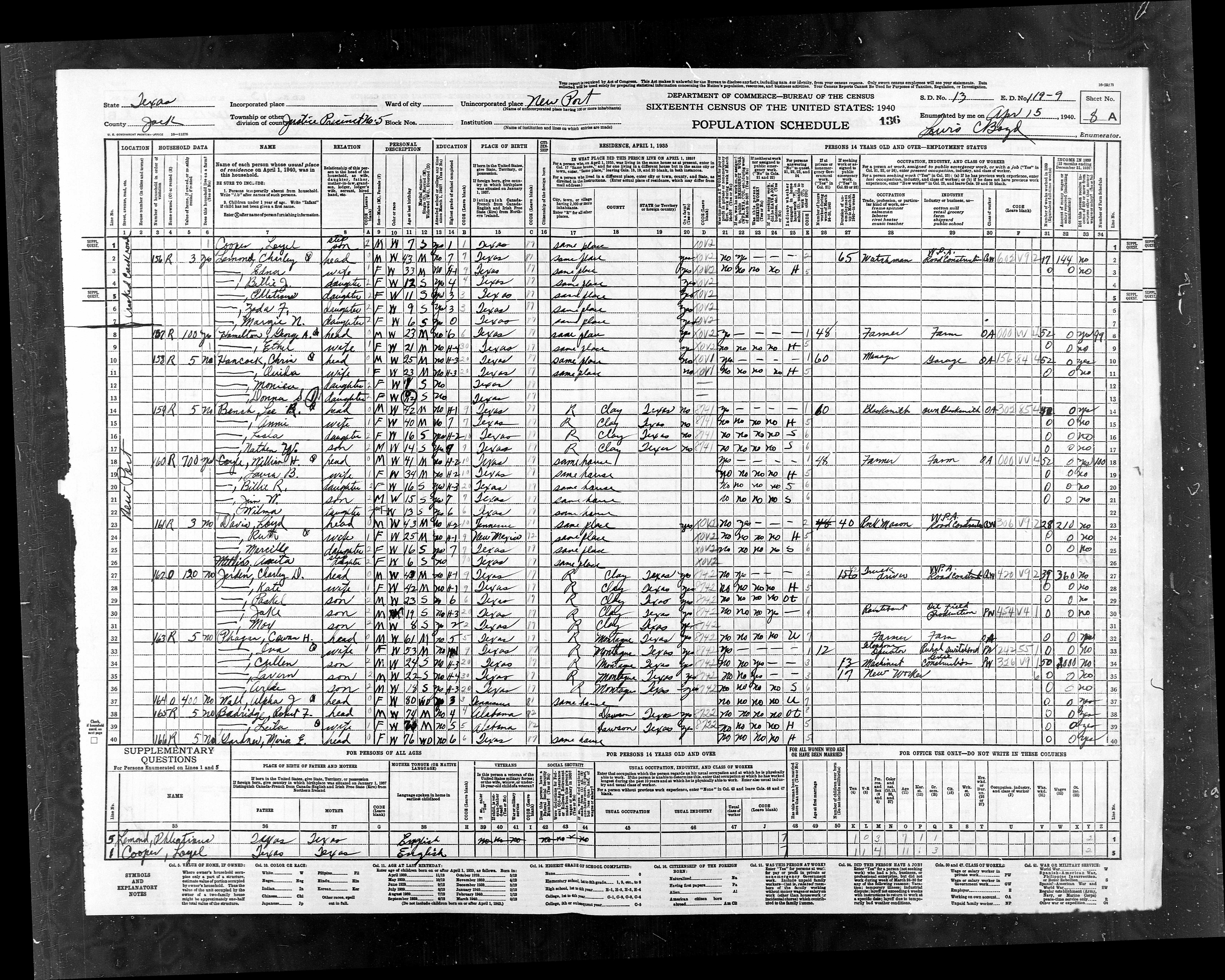
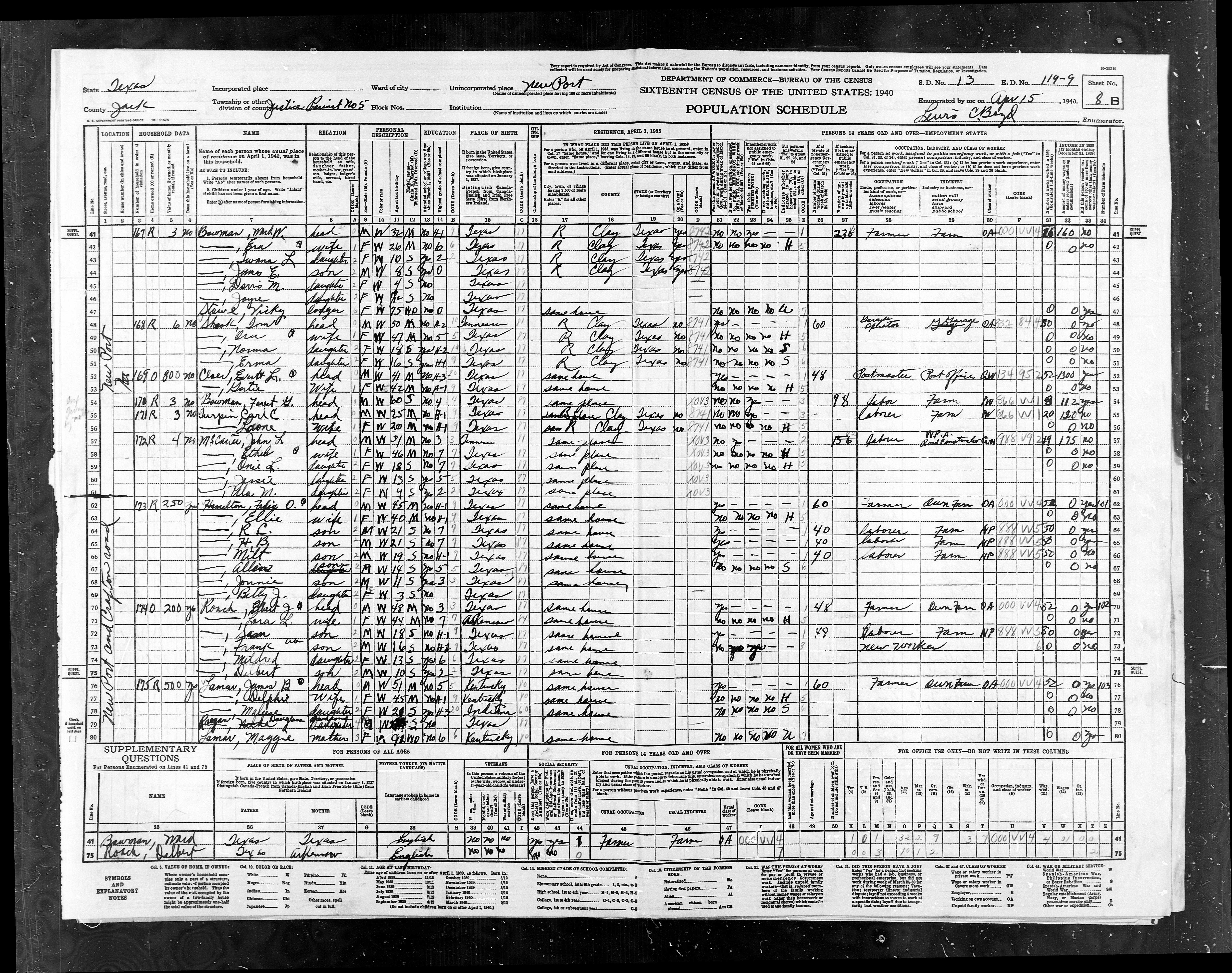
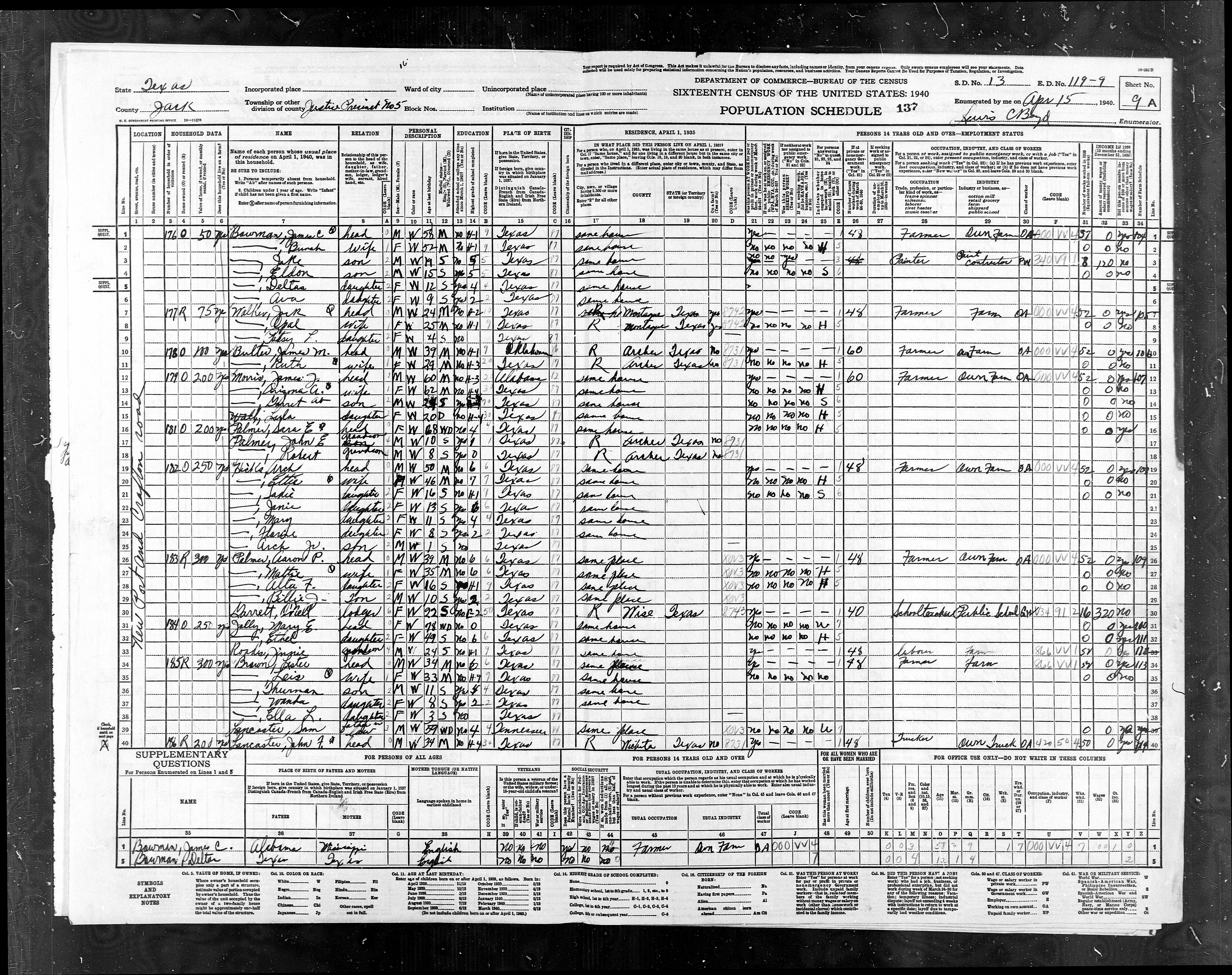
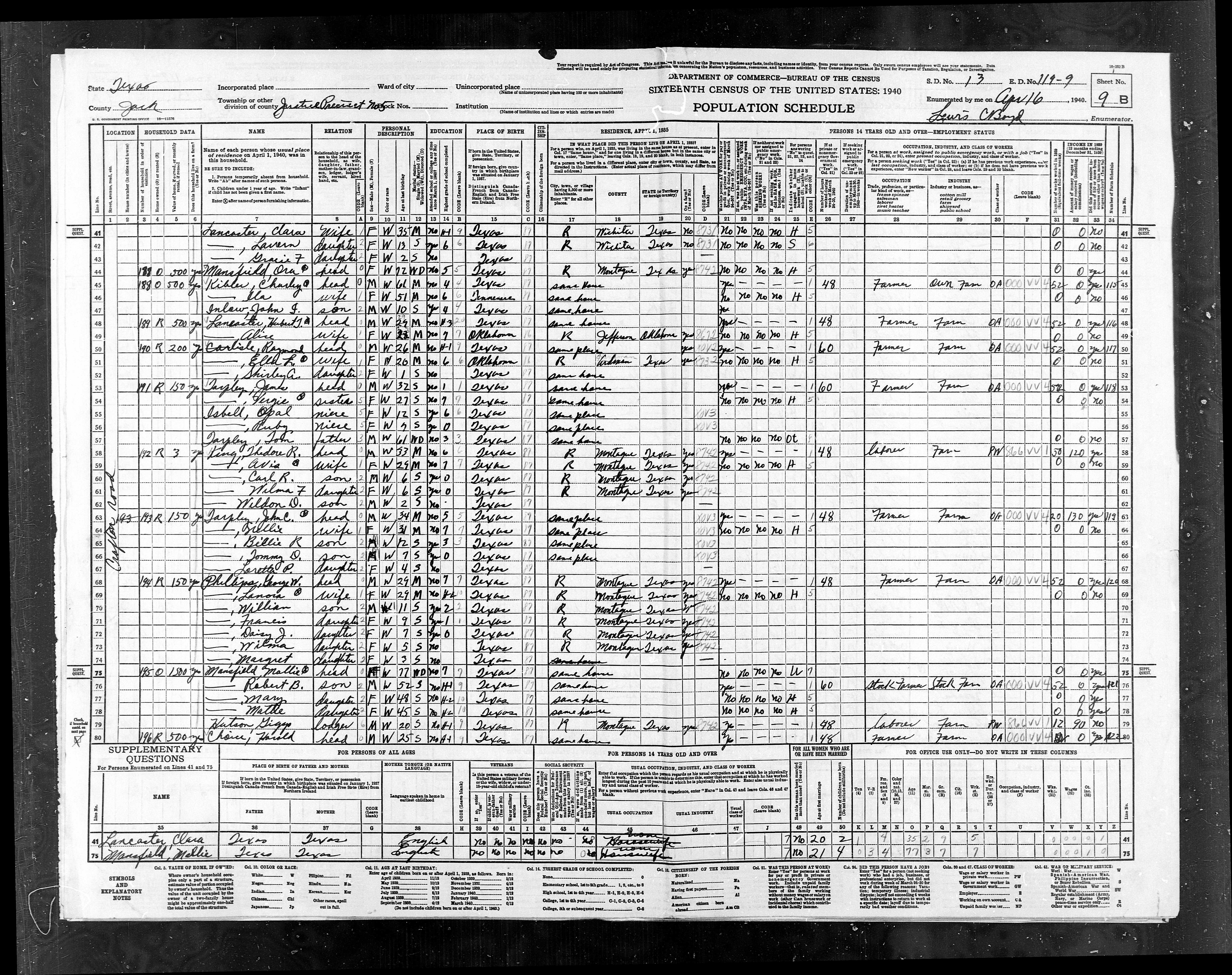
119-9 |
Pct
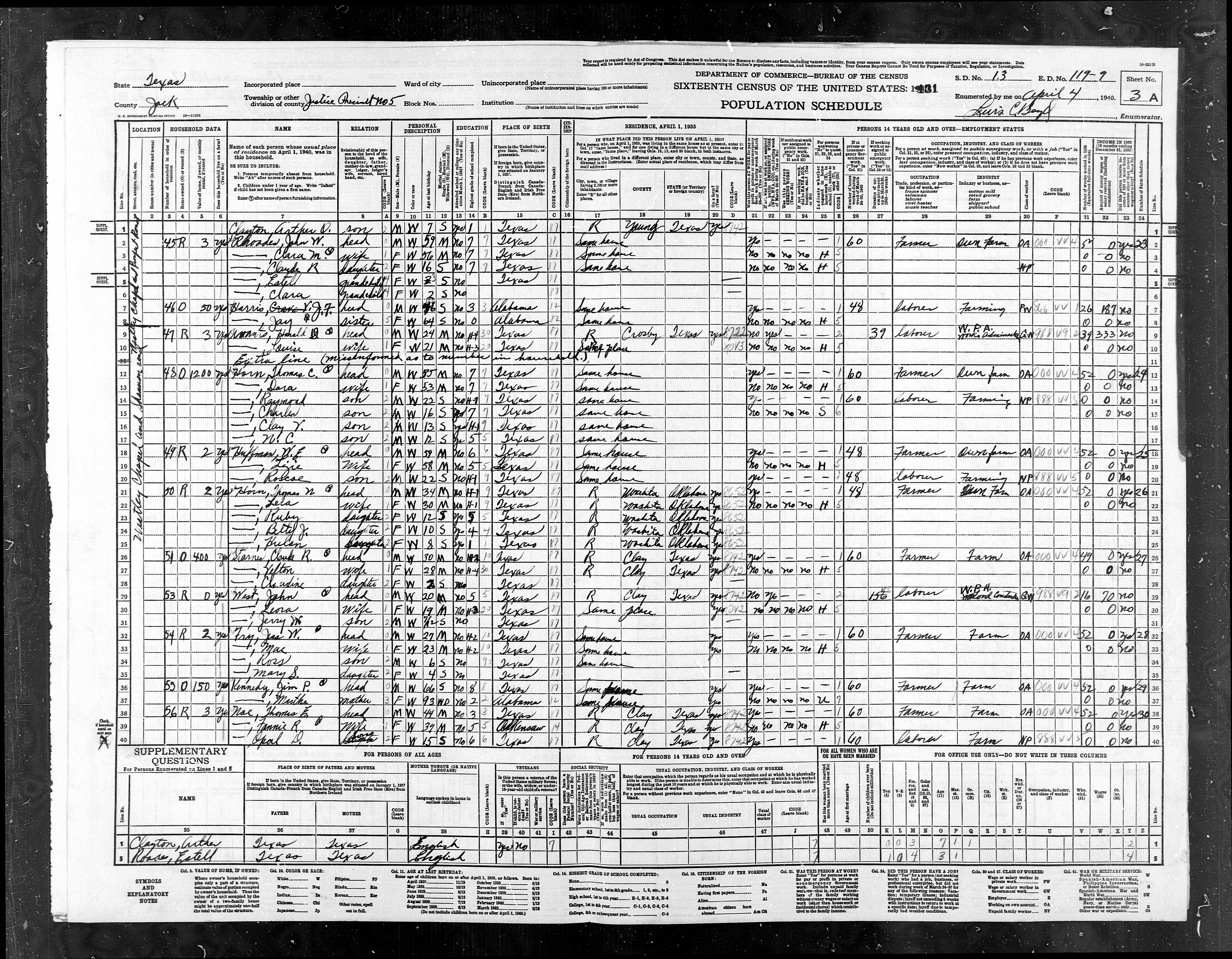
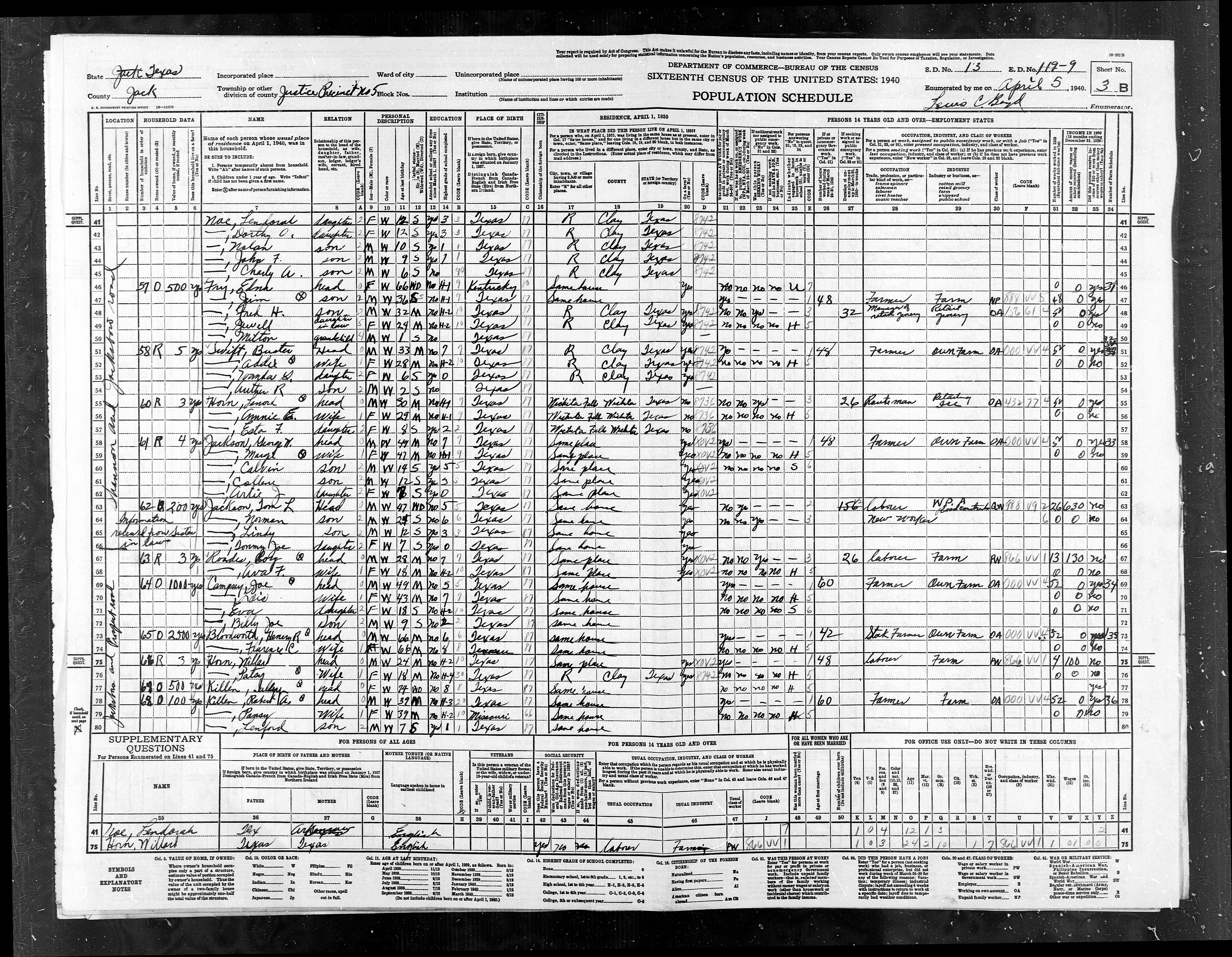
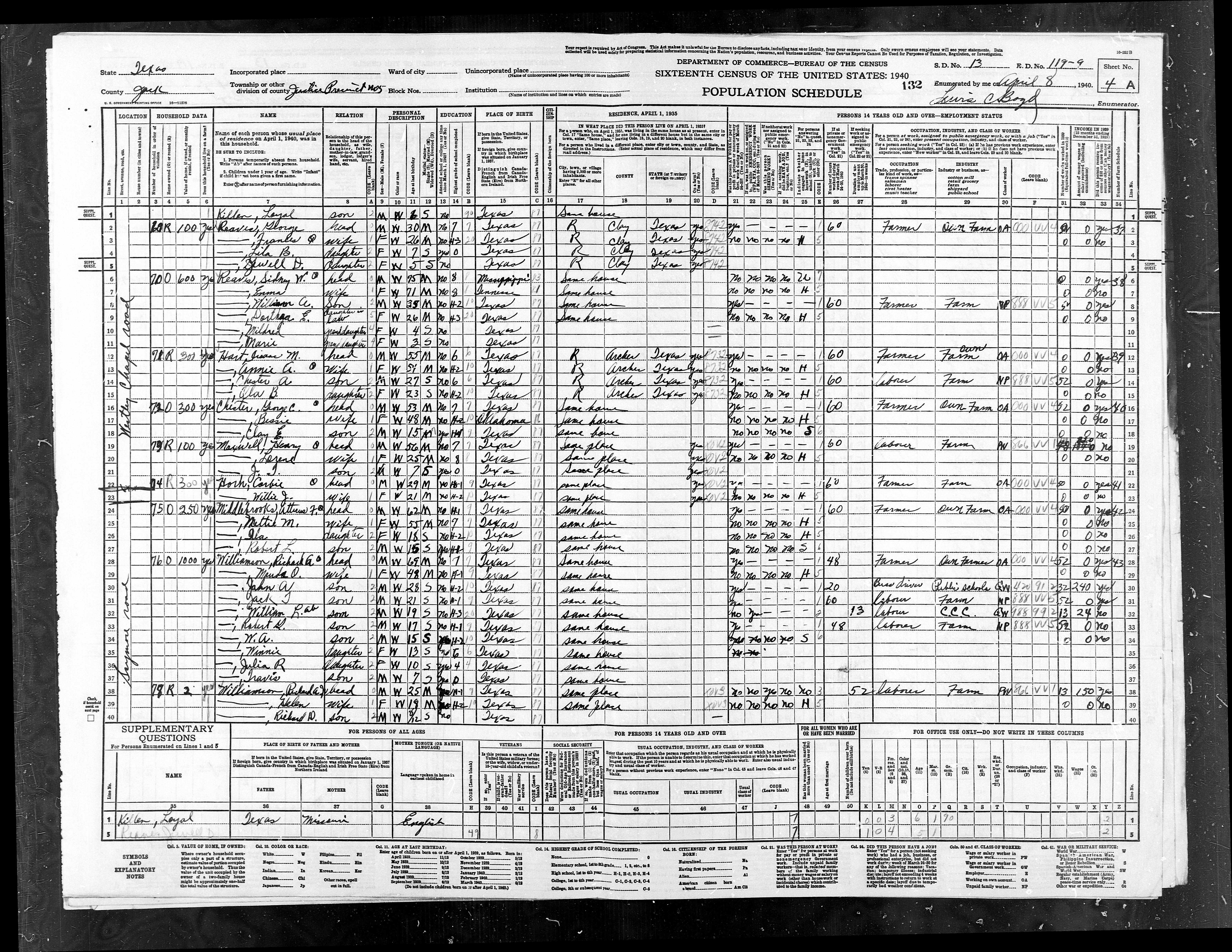
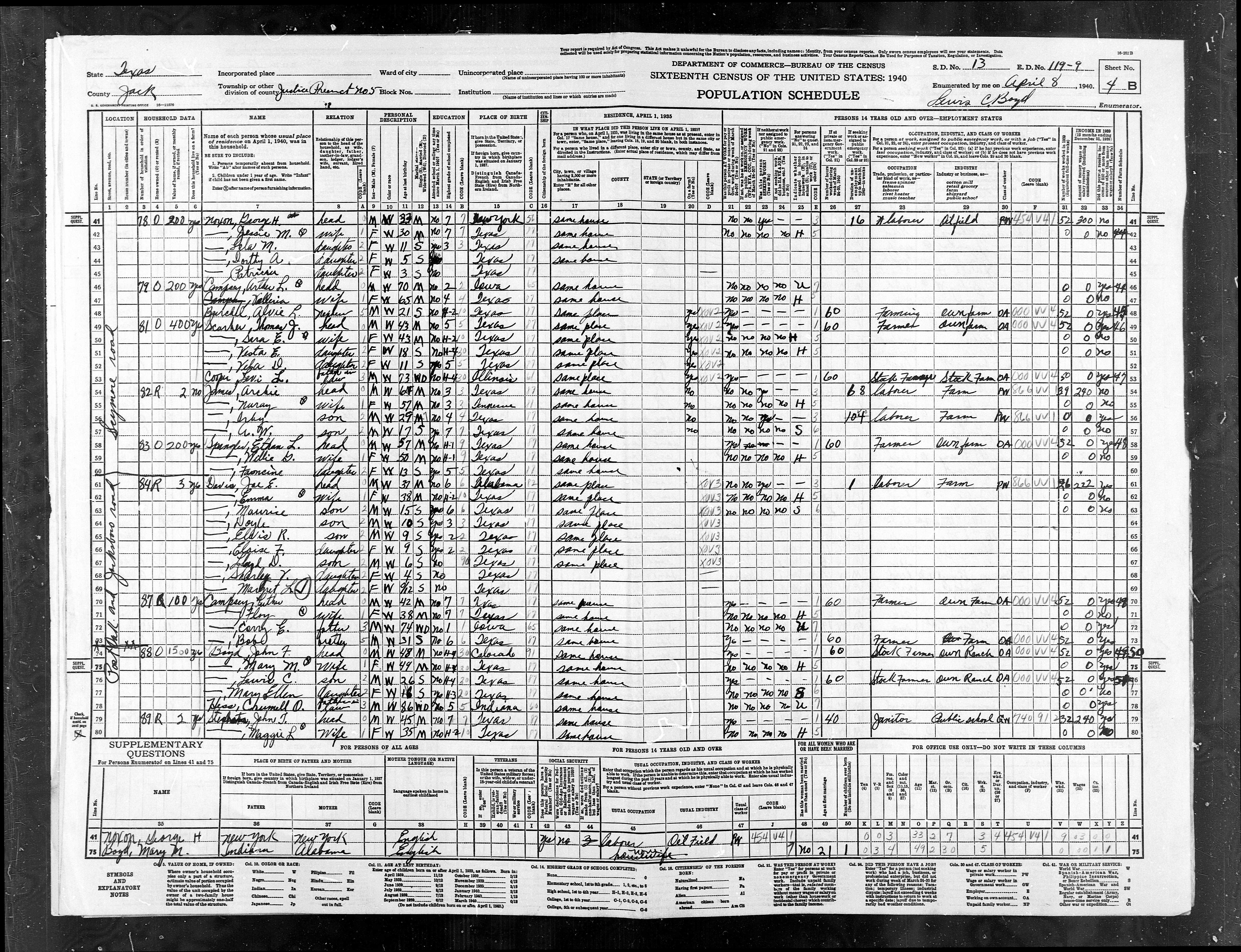
5, Newport, Postoak |
850 |
934 |
|
|
|
Total
for county |
9,046 |
10,206 |
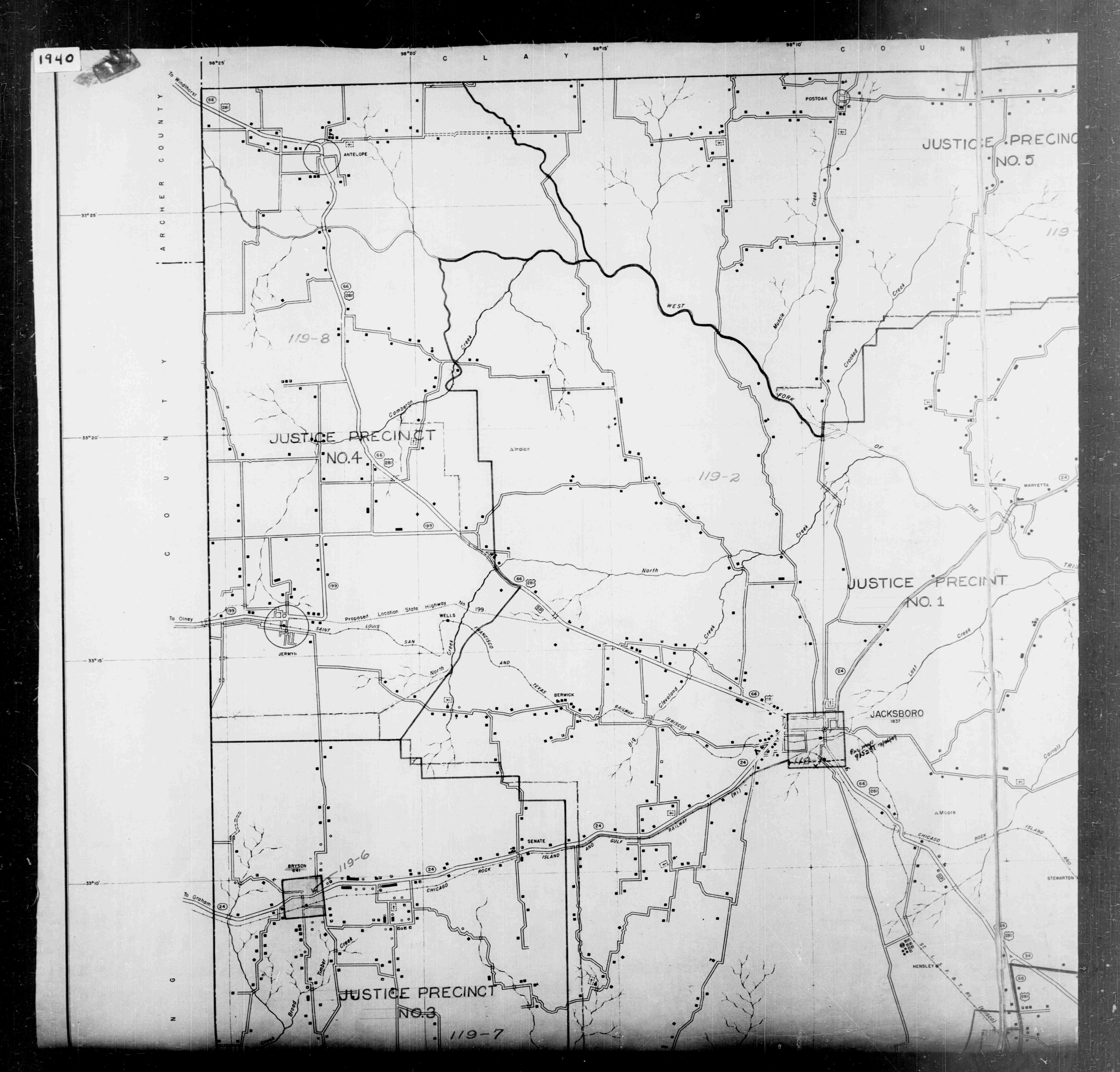
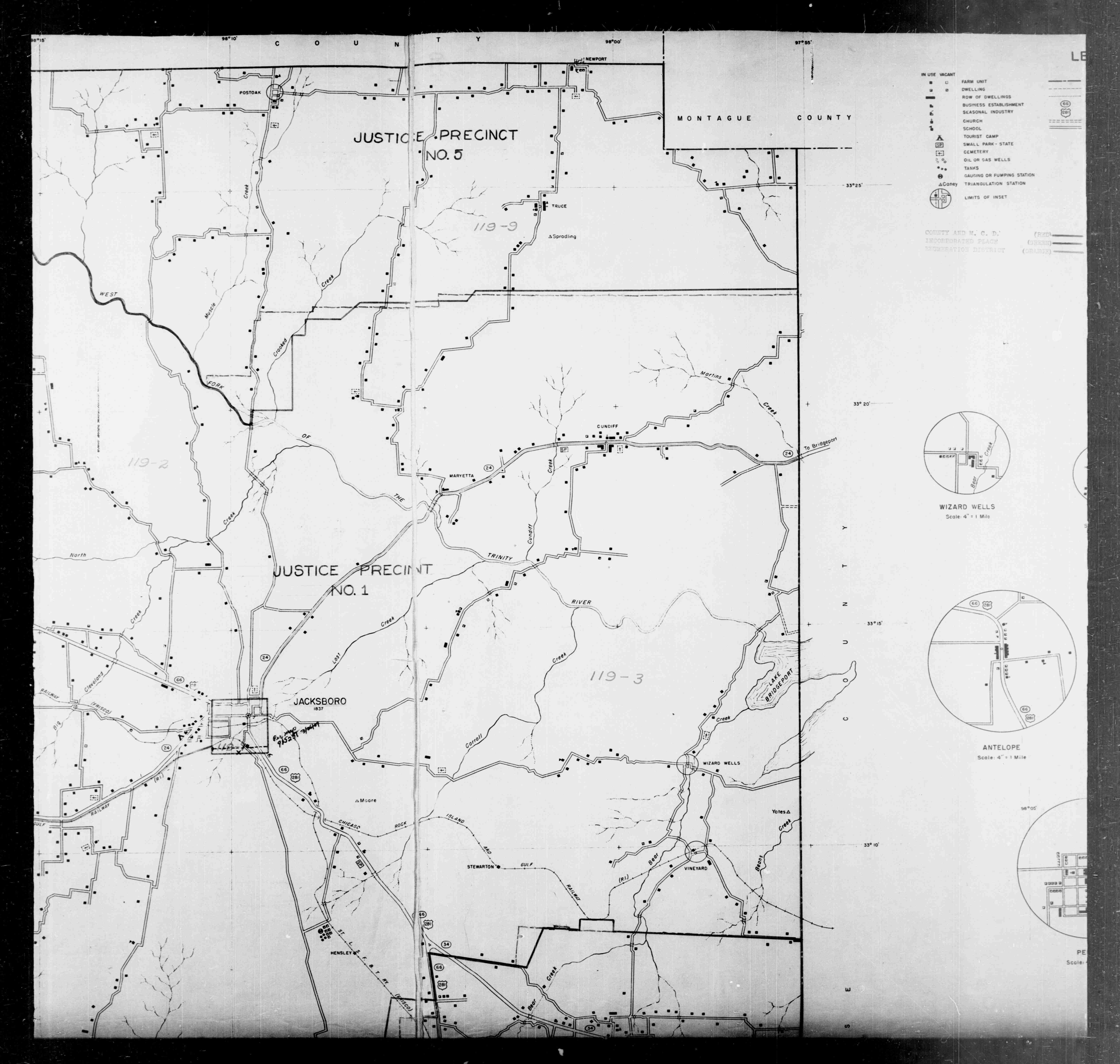
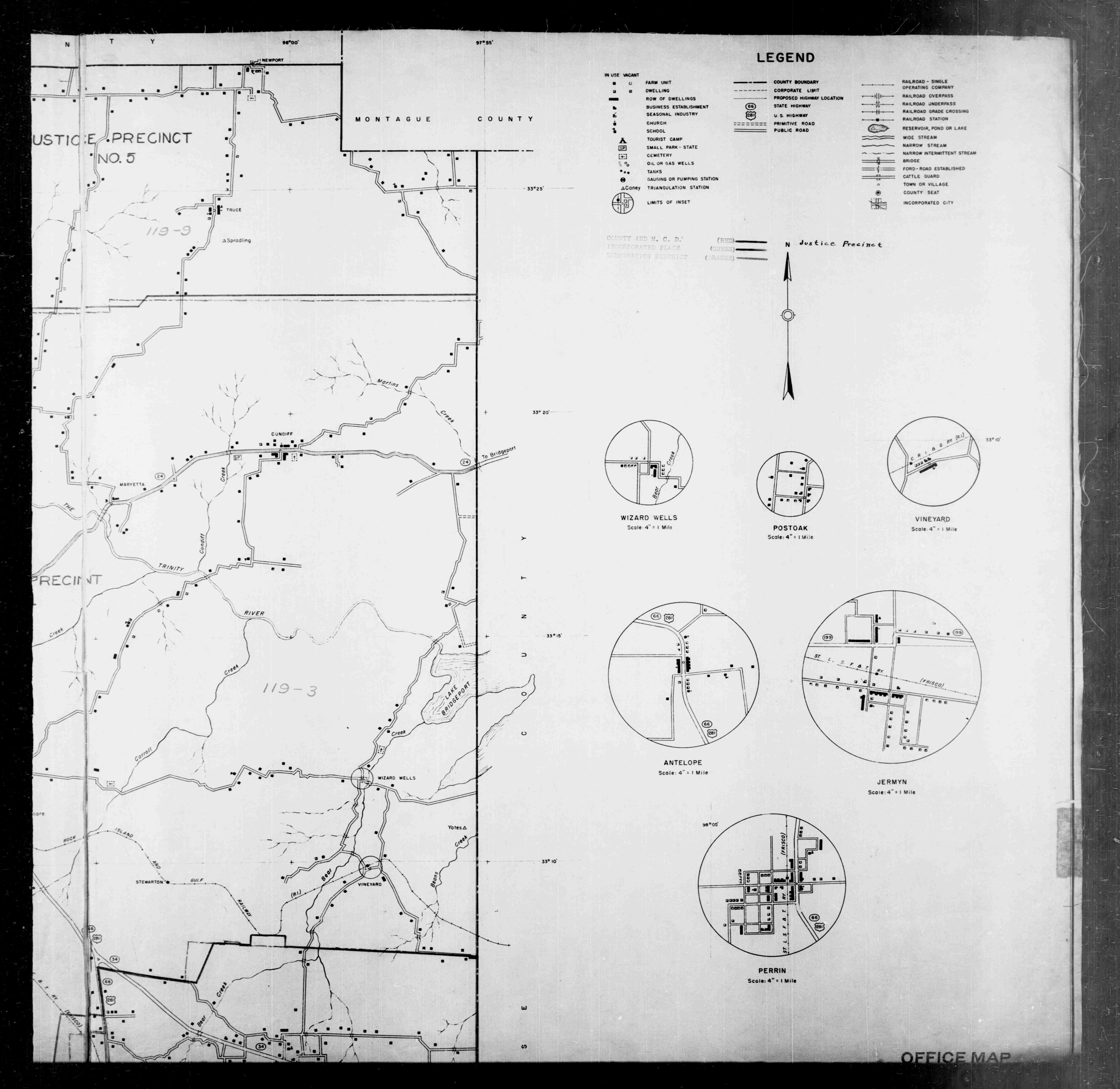
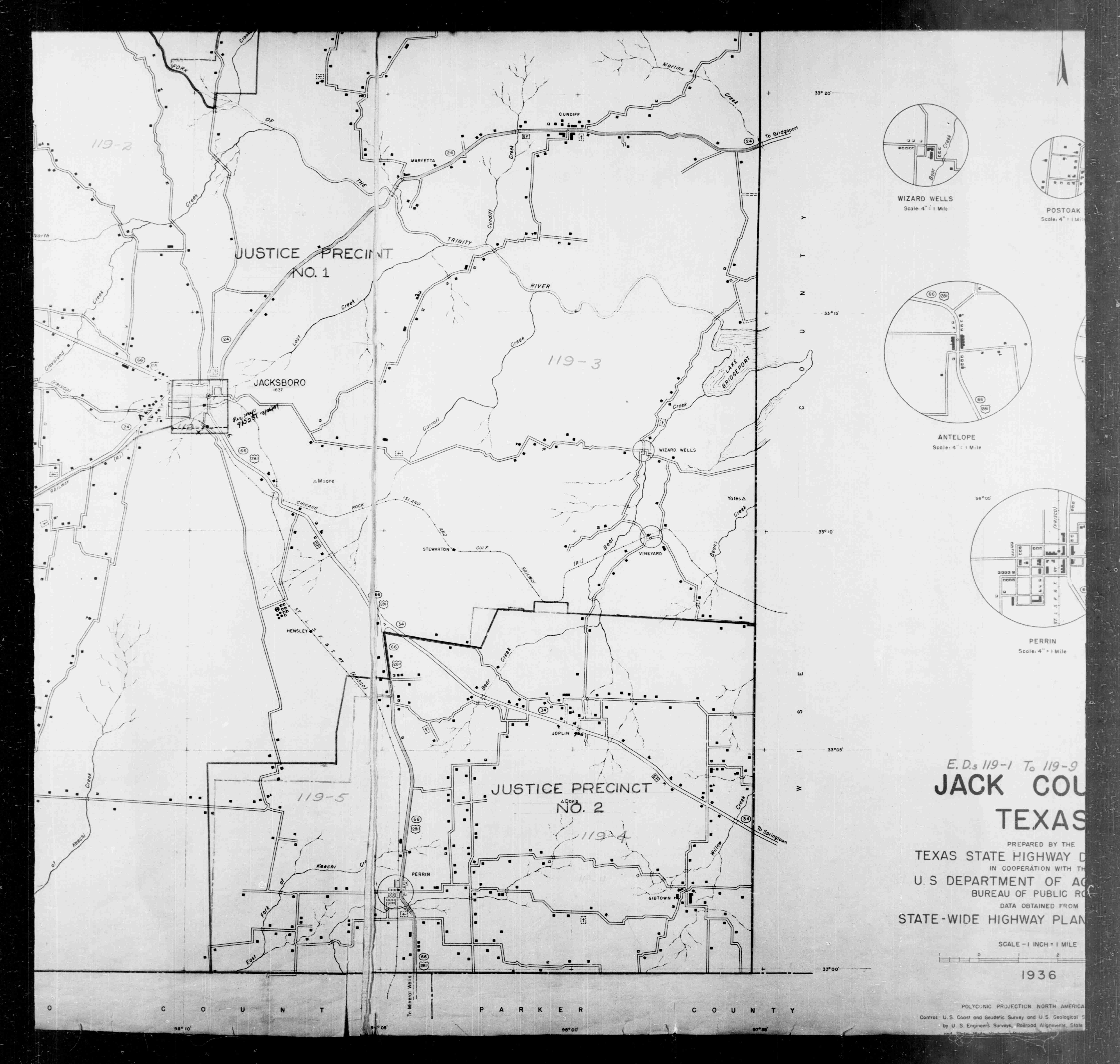
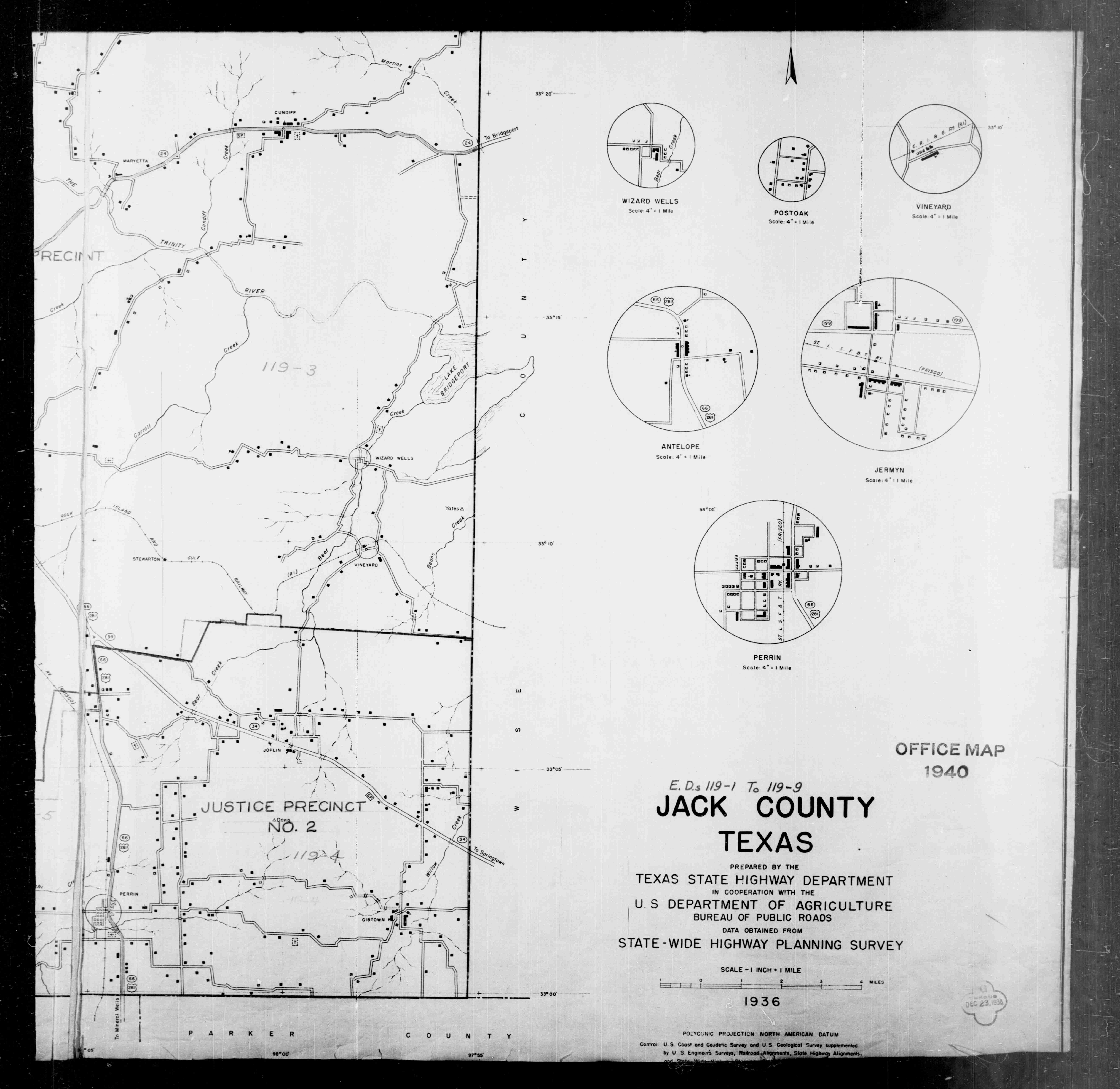
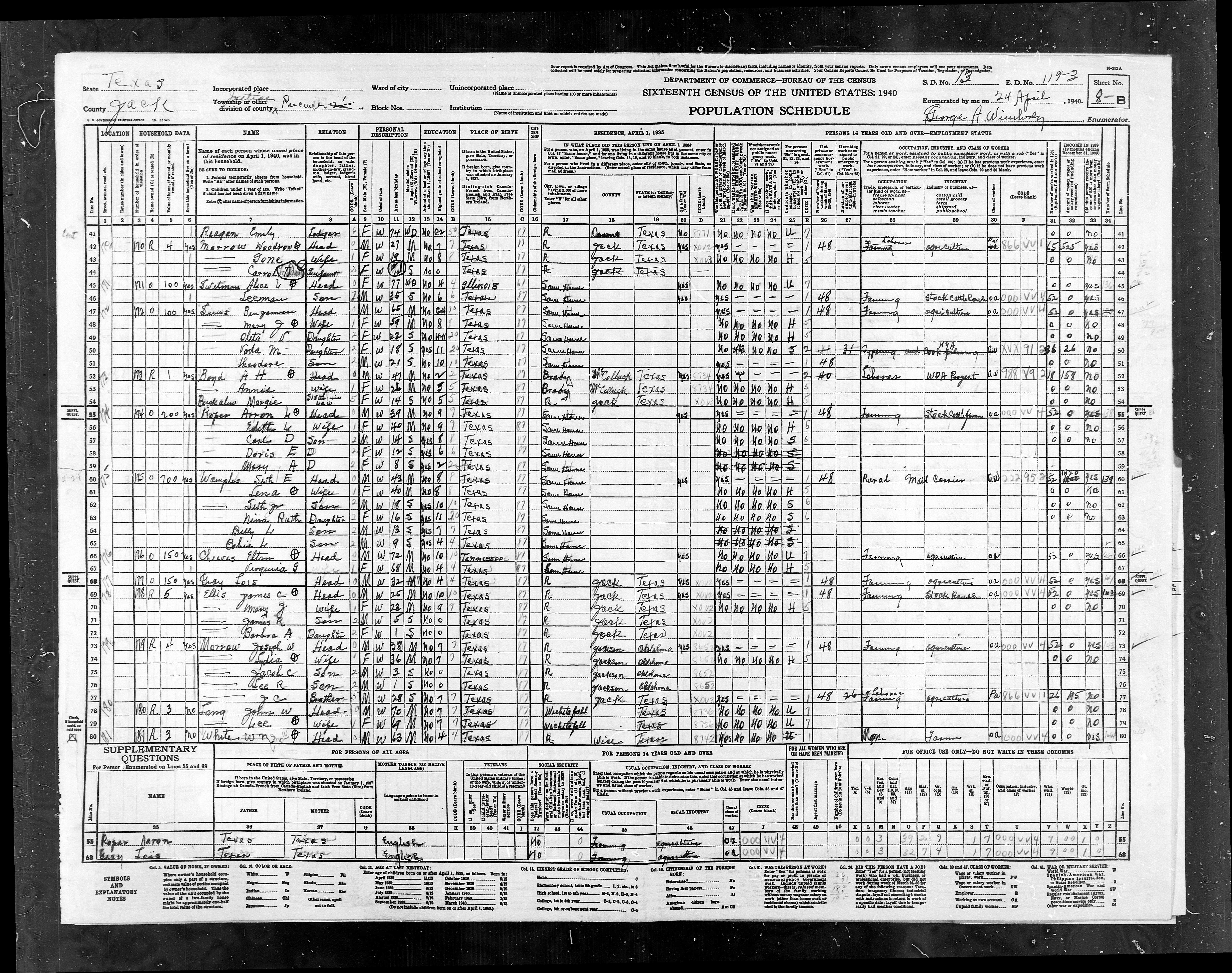
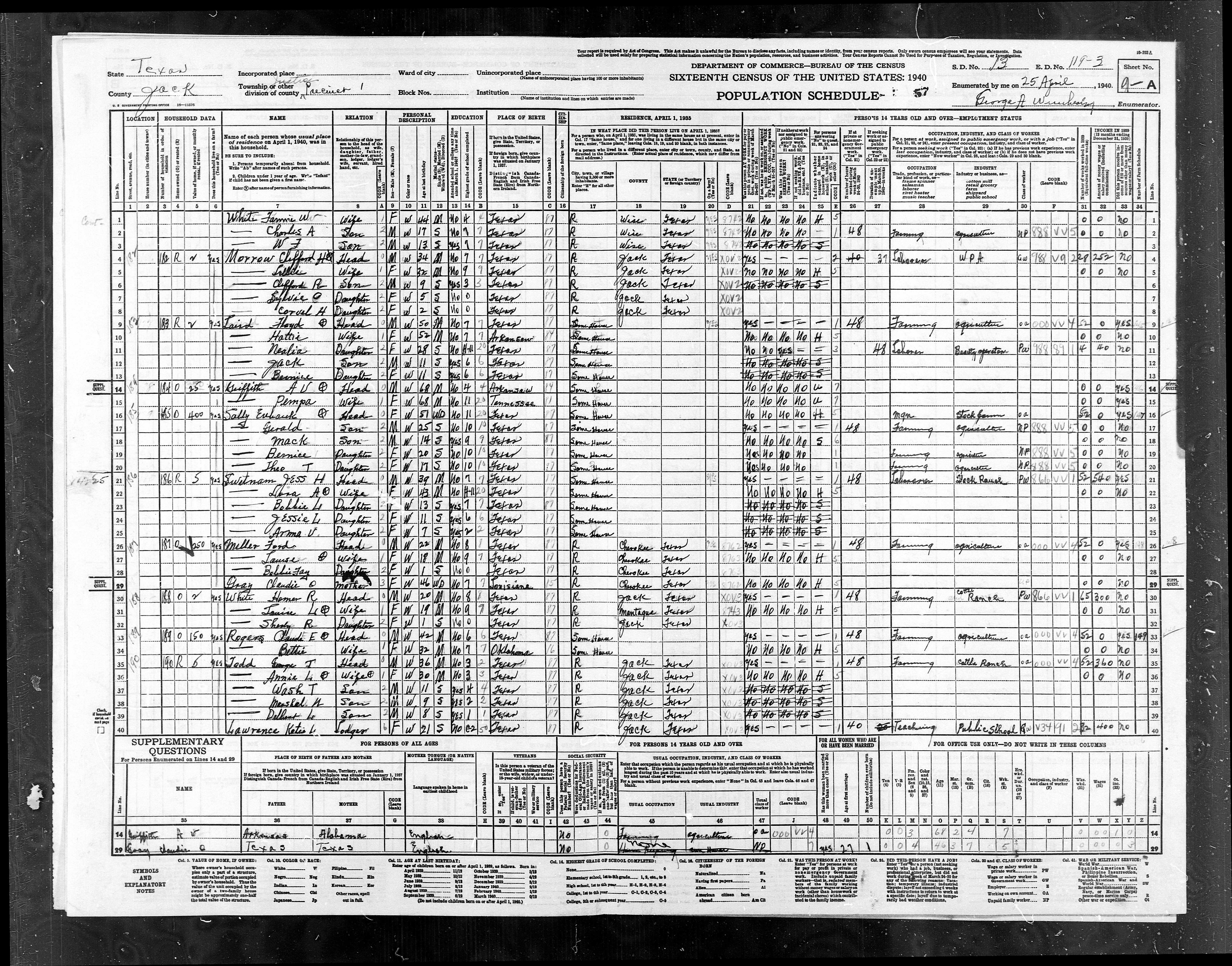
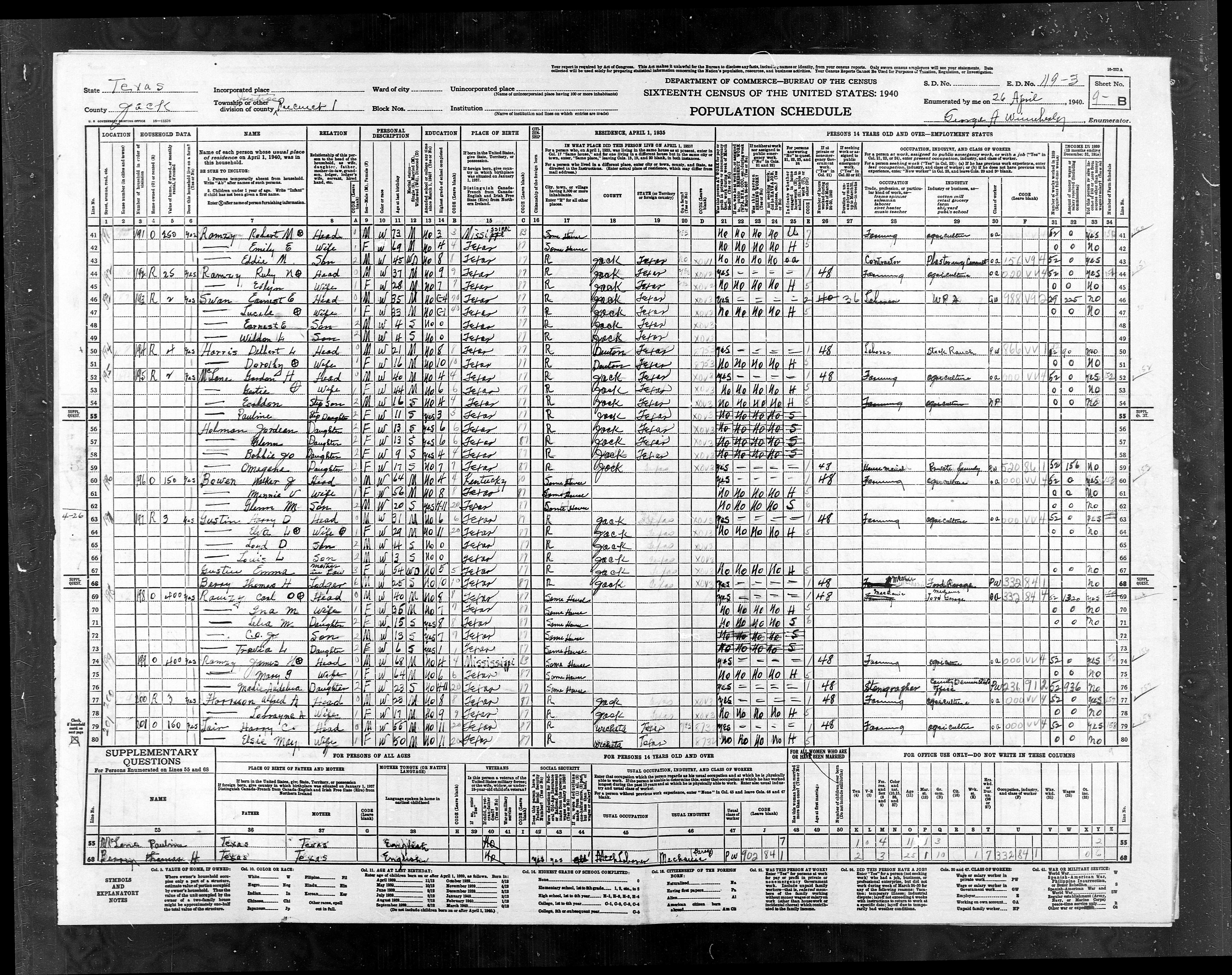
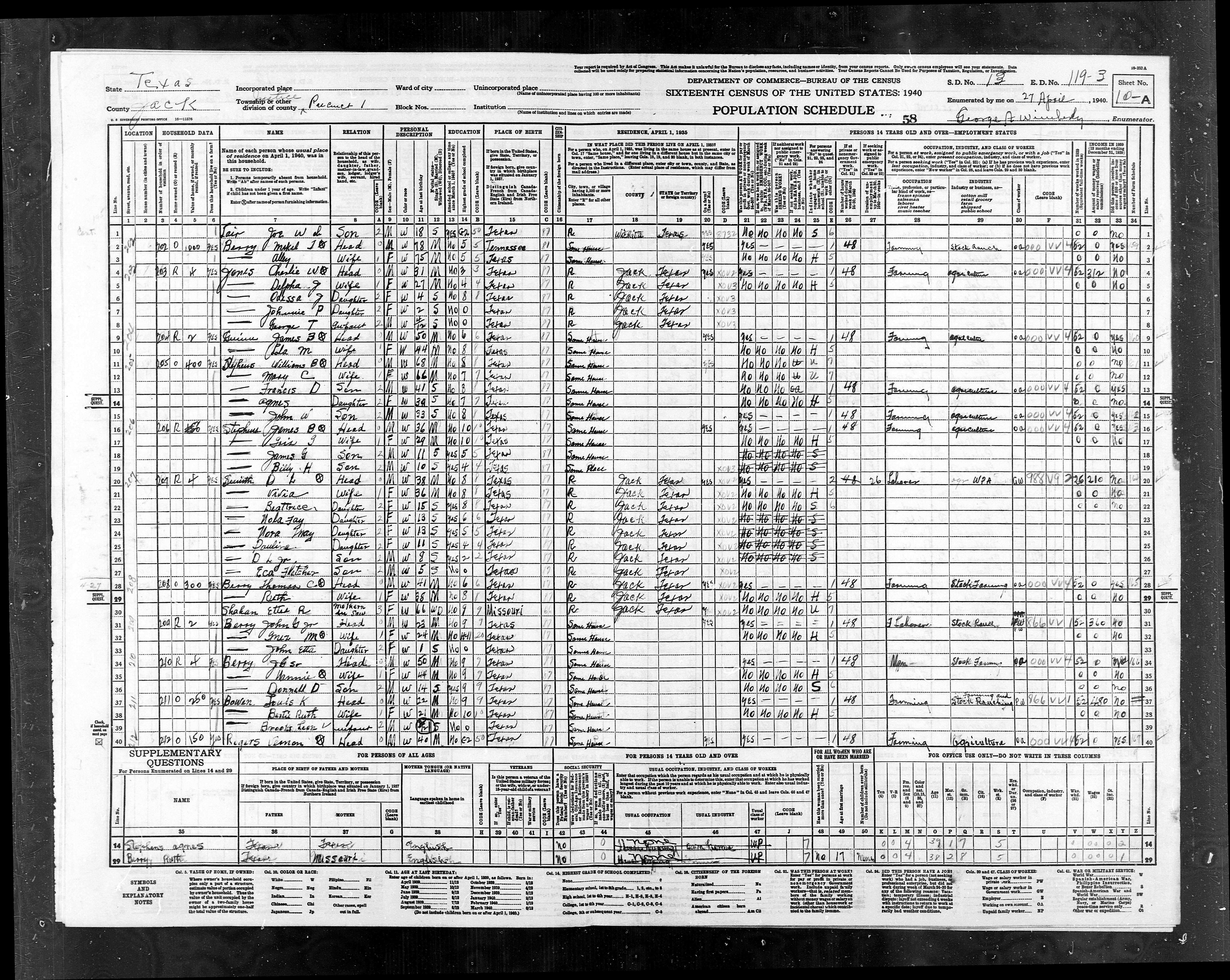
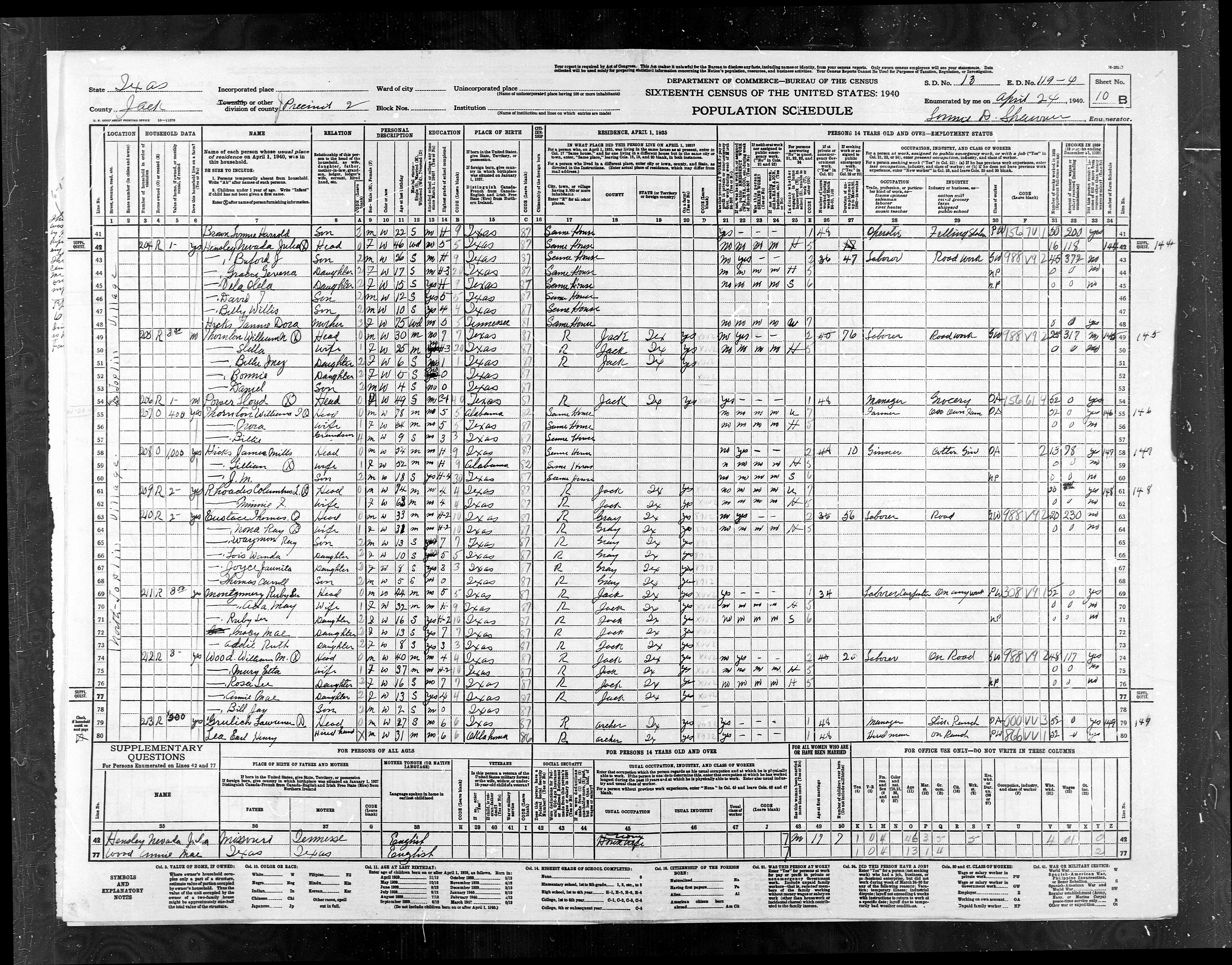
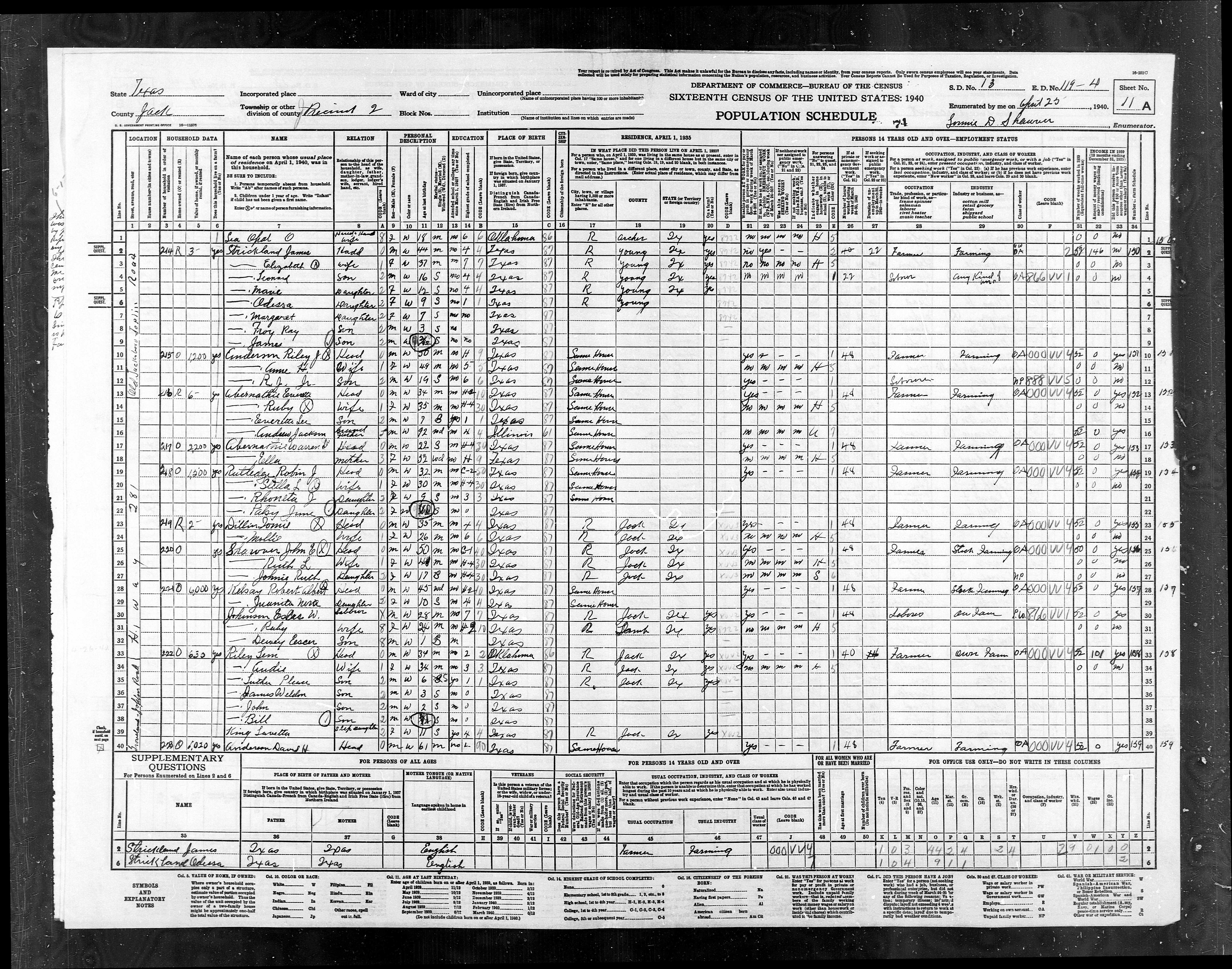
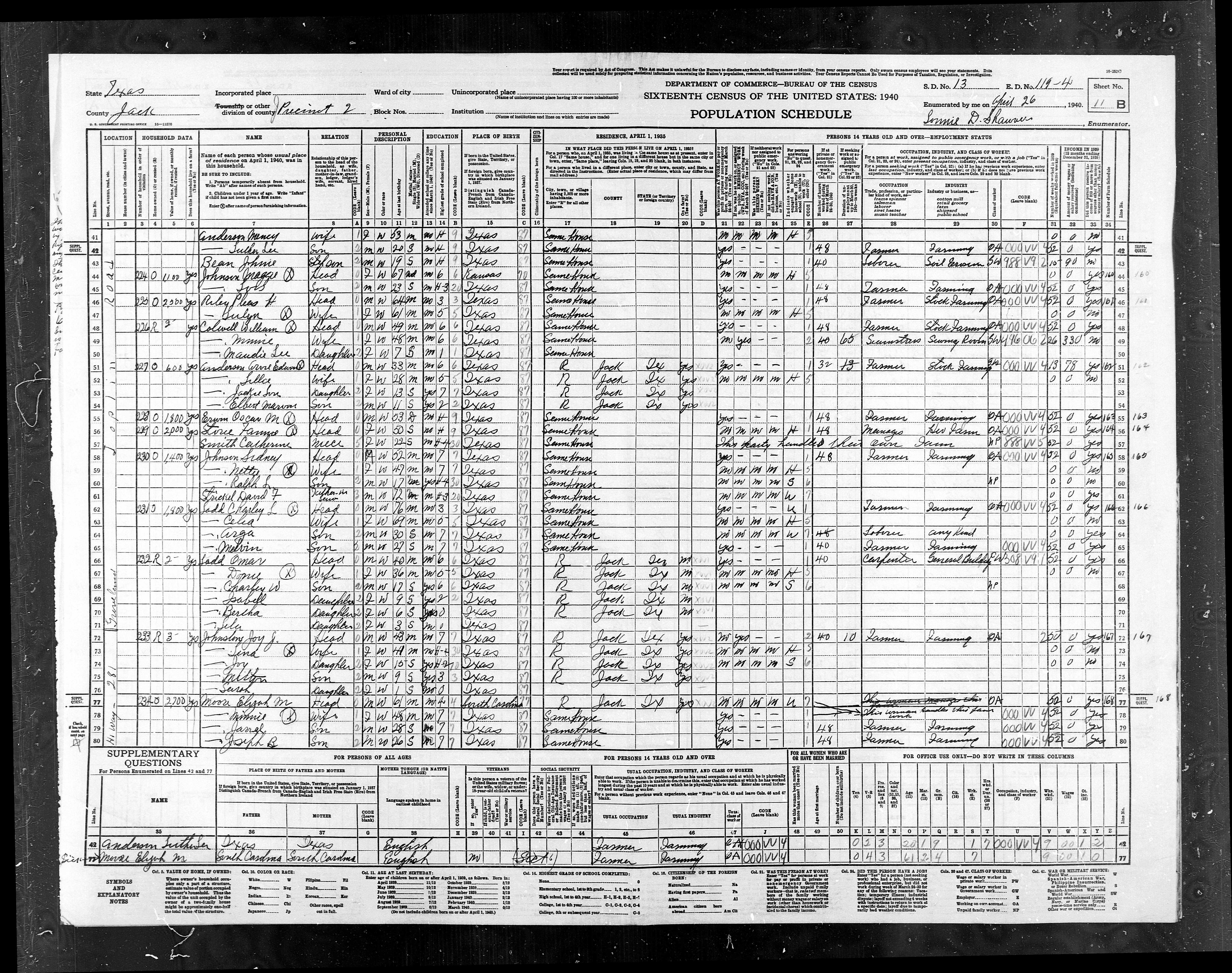
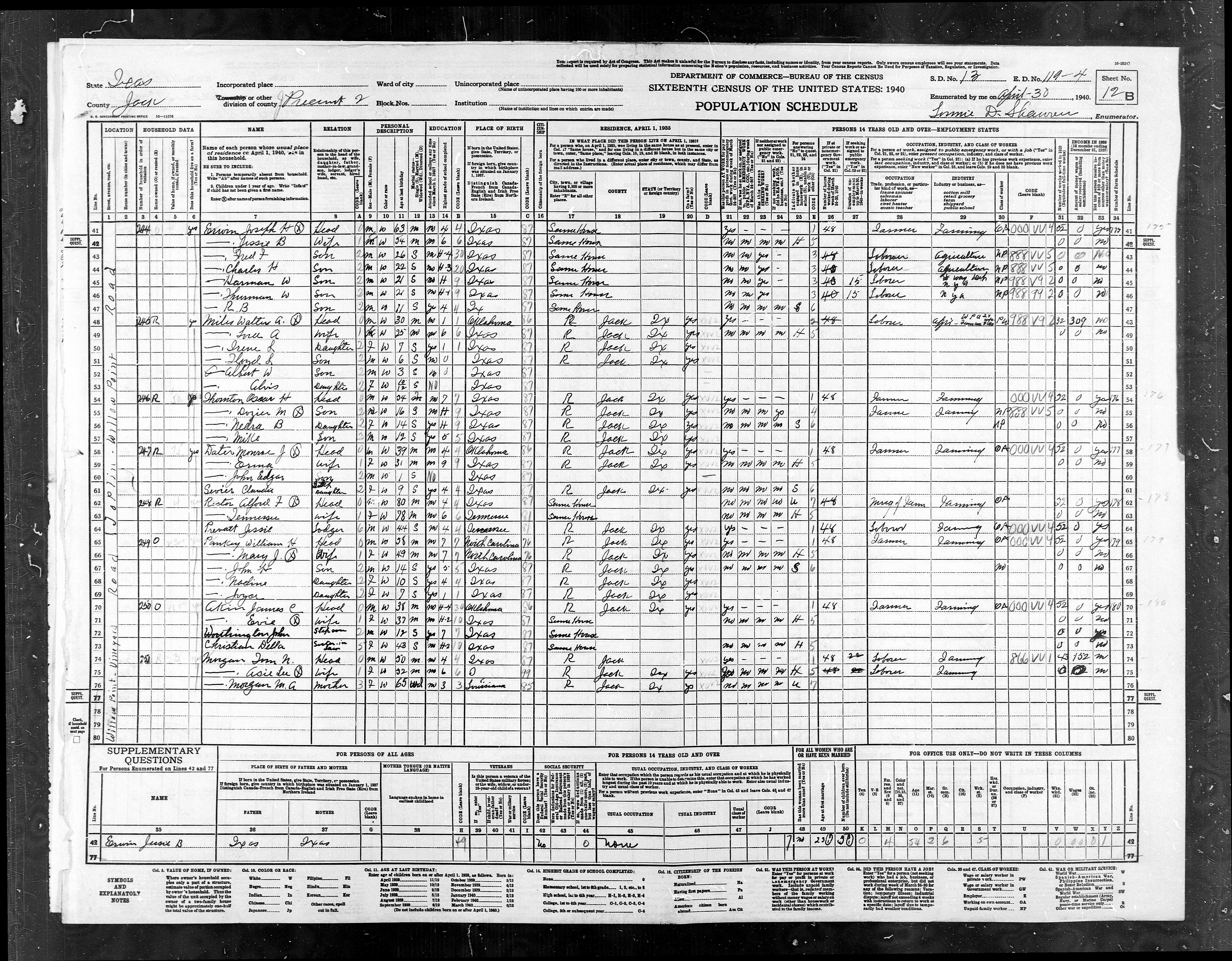
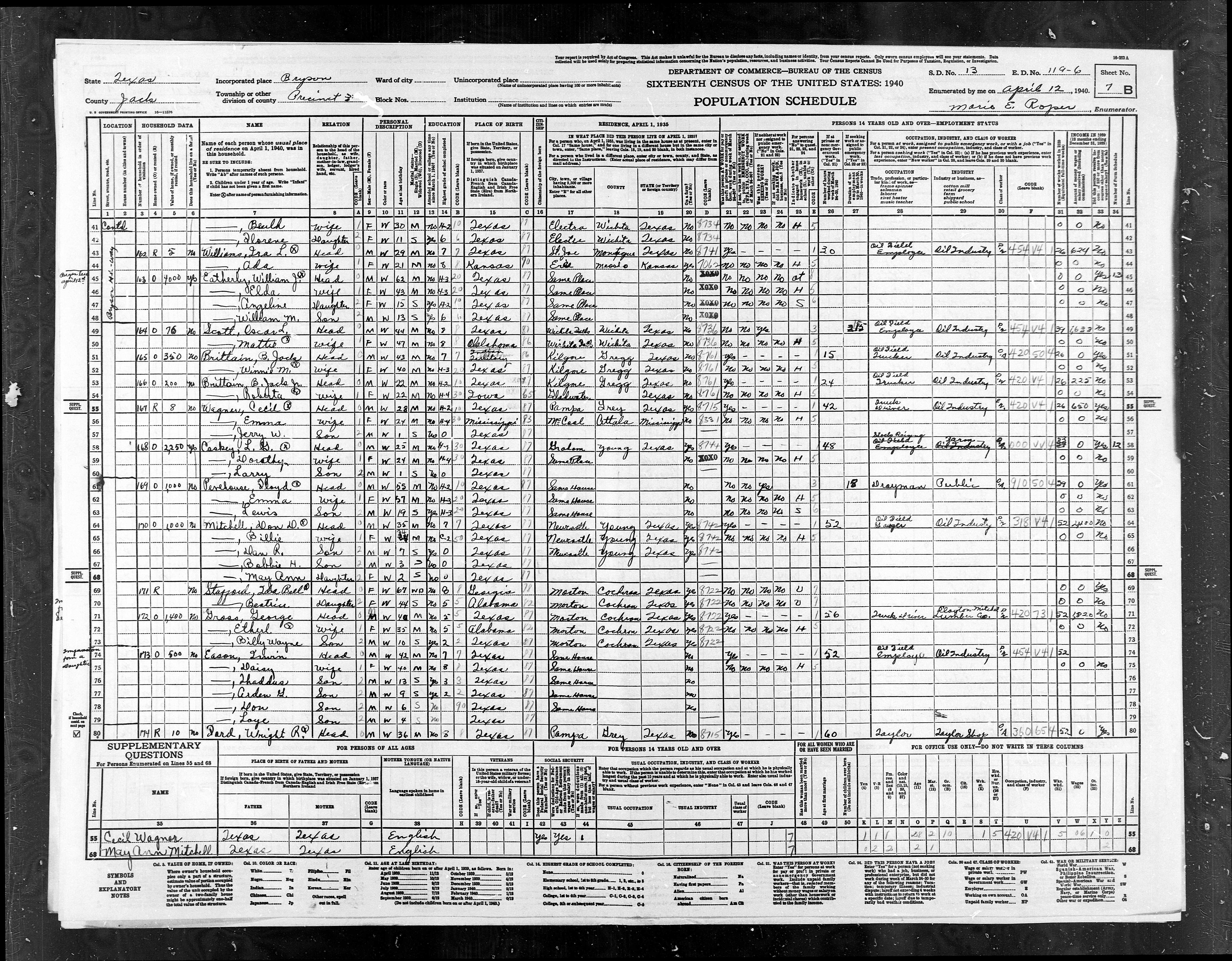
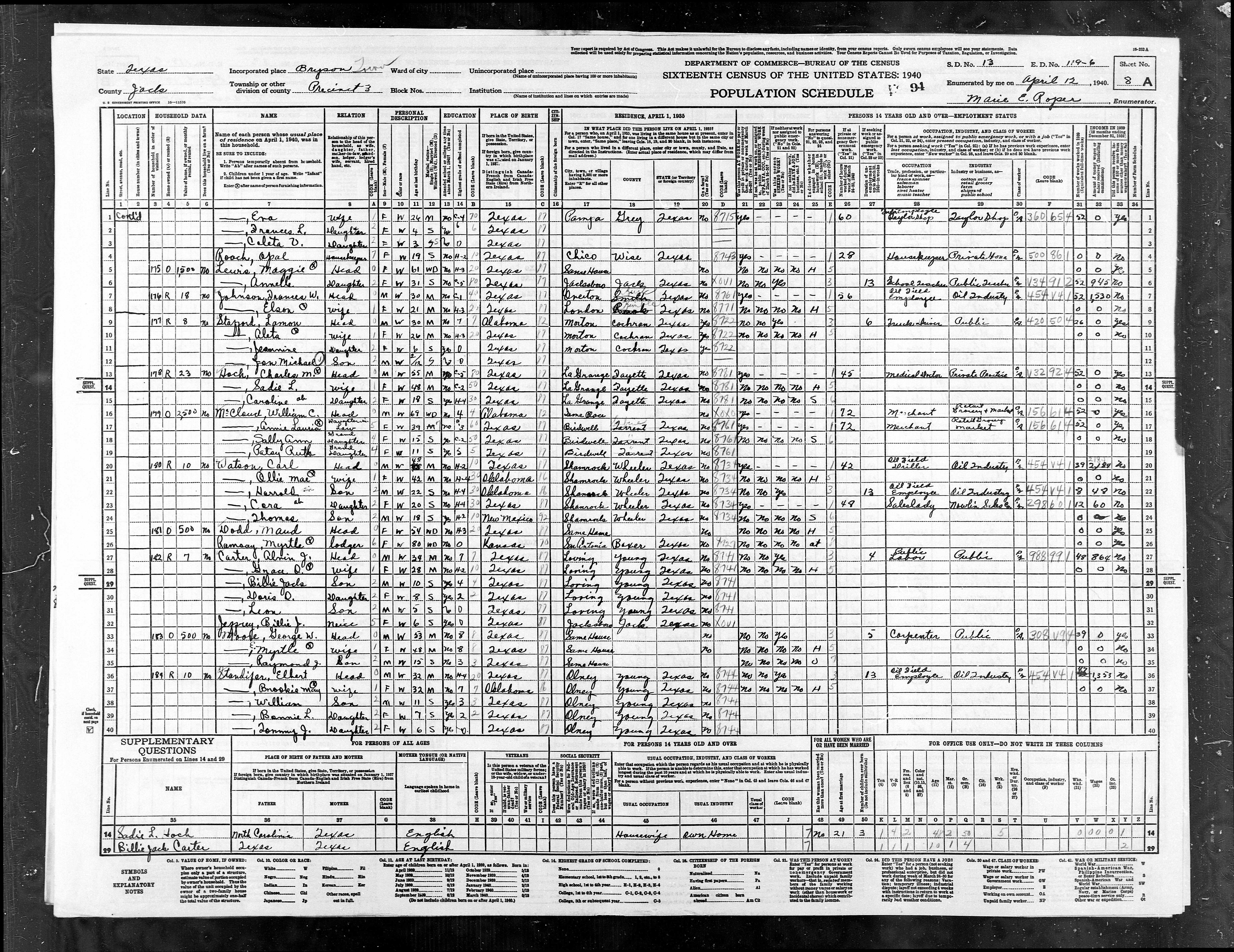
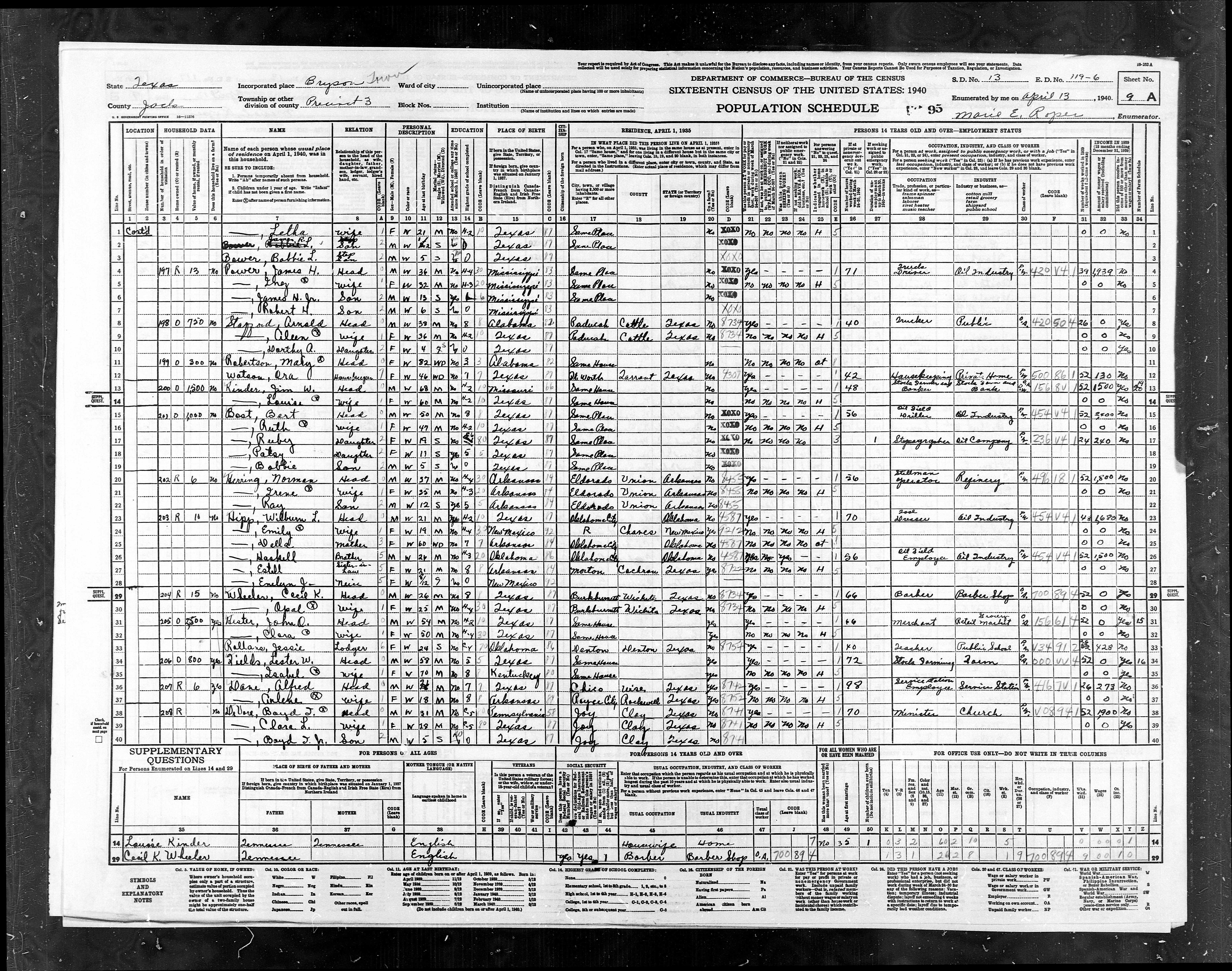
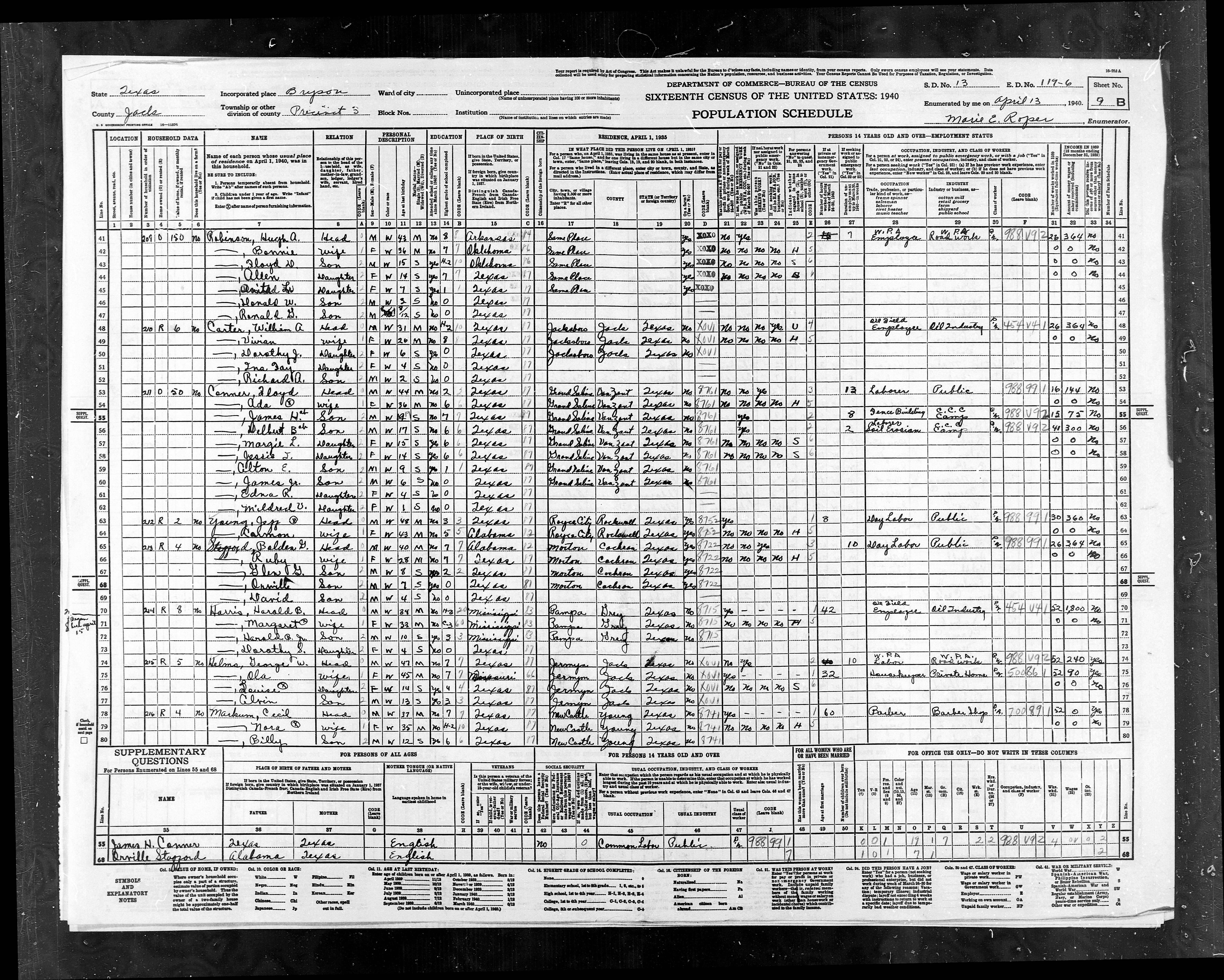
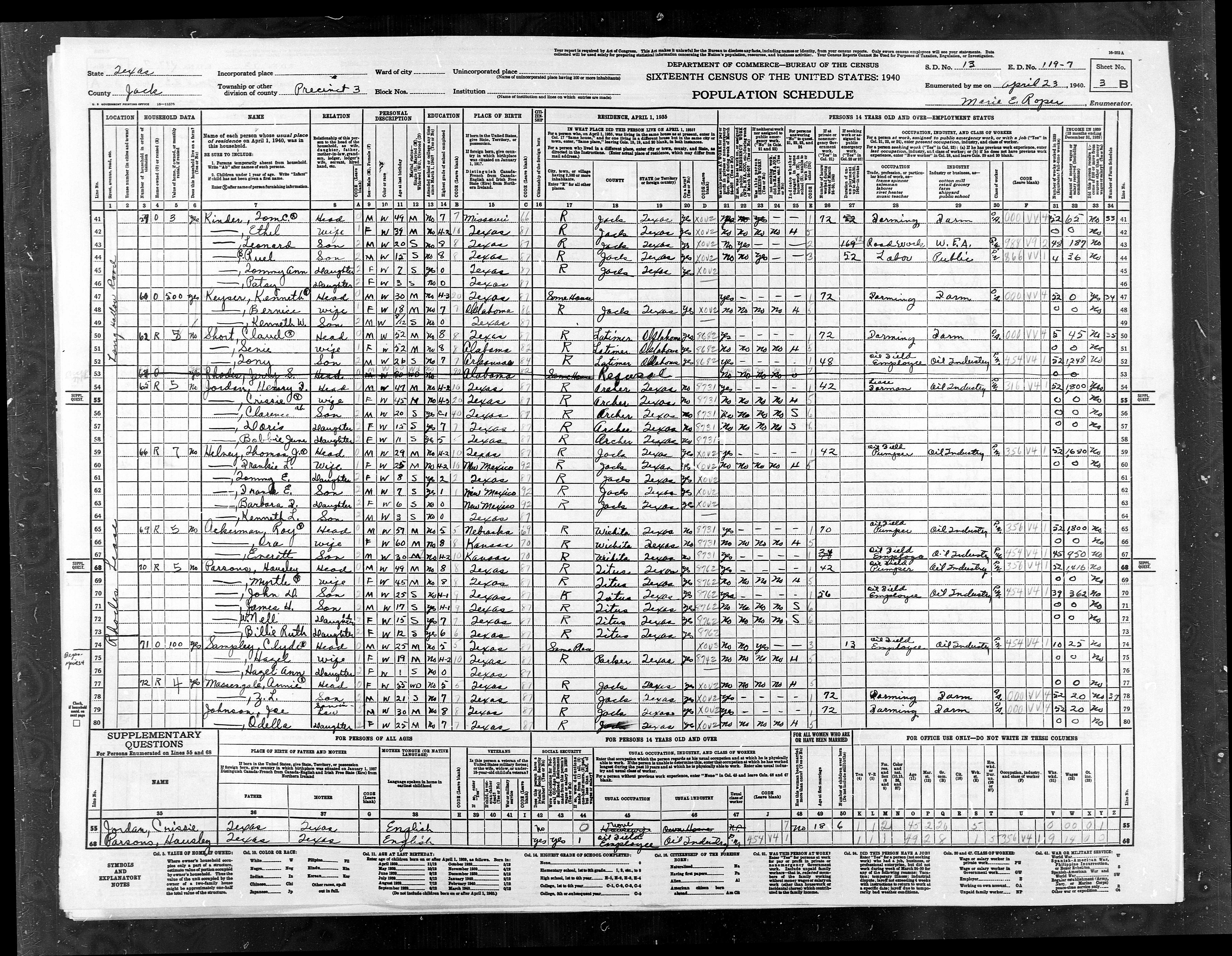
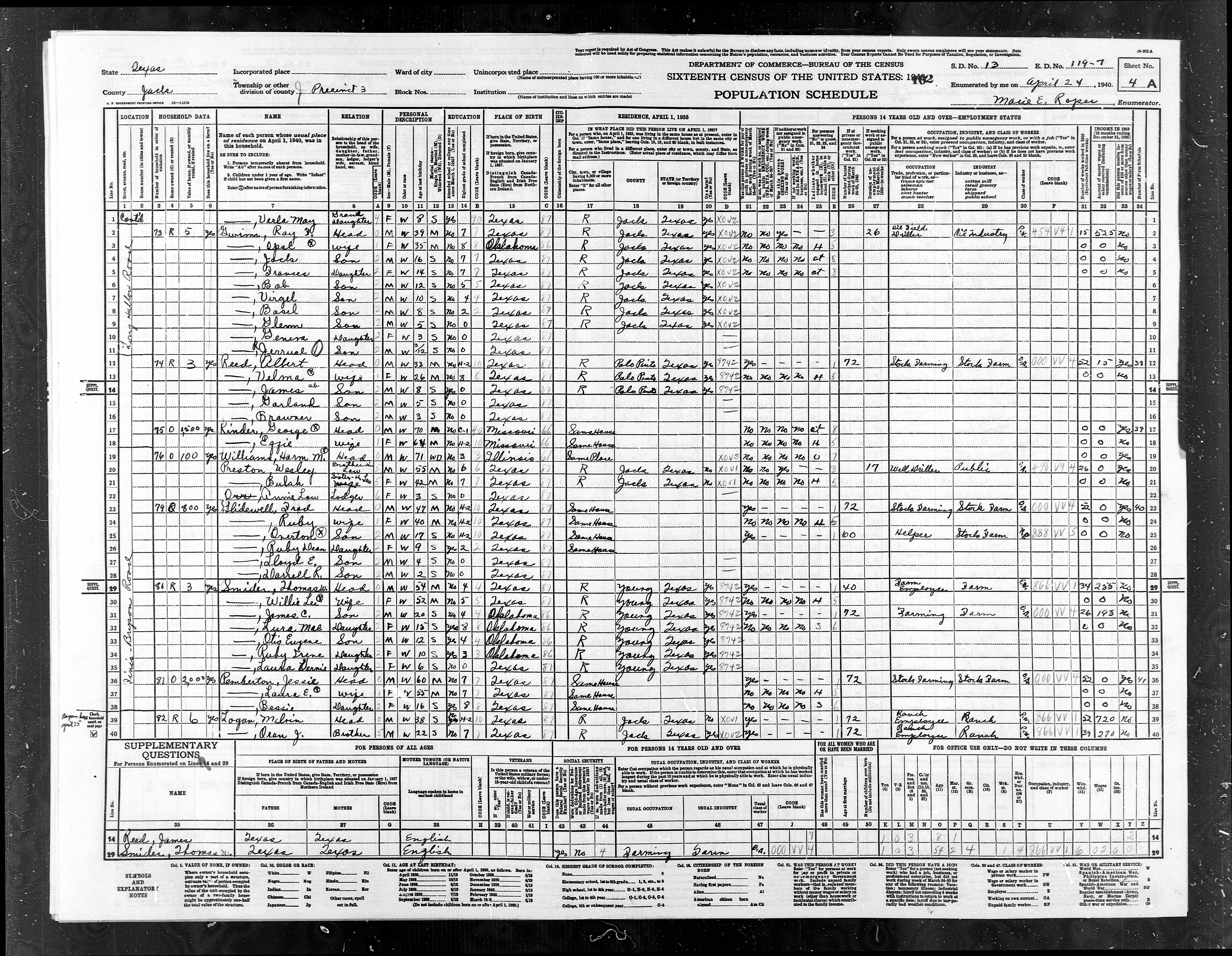
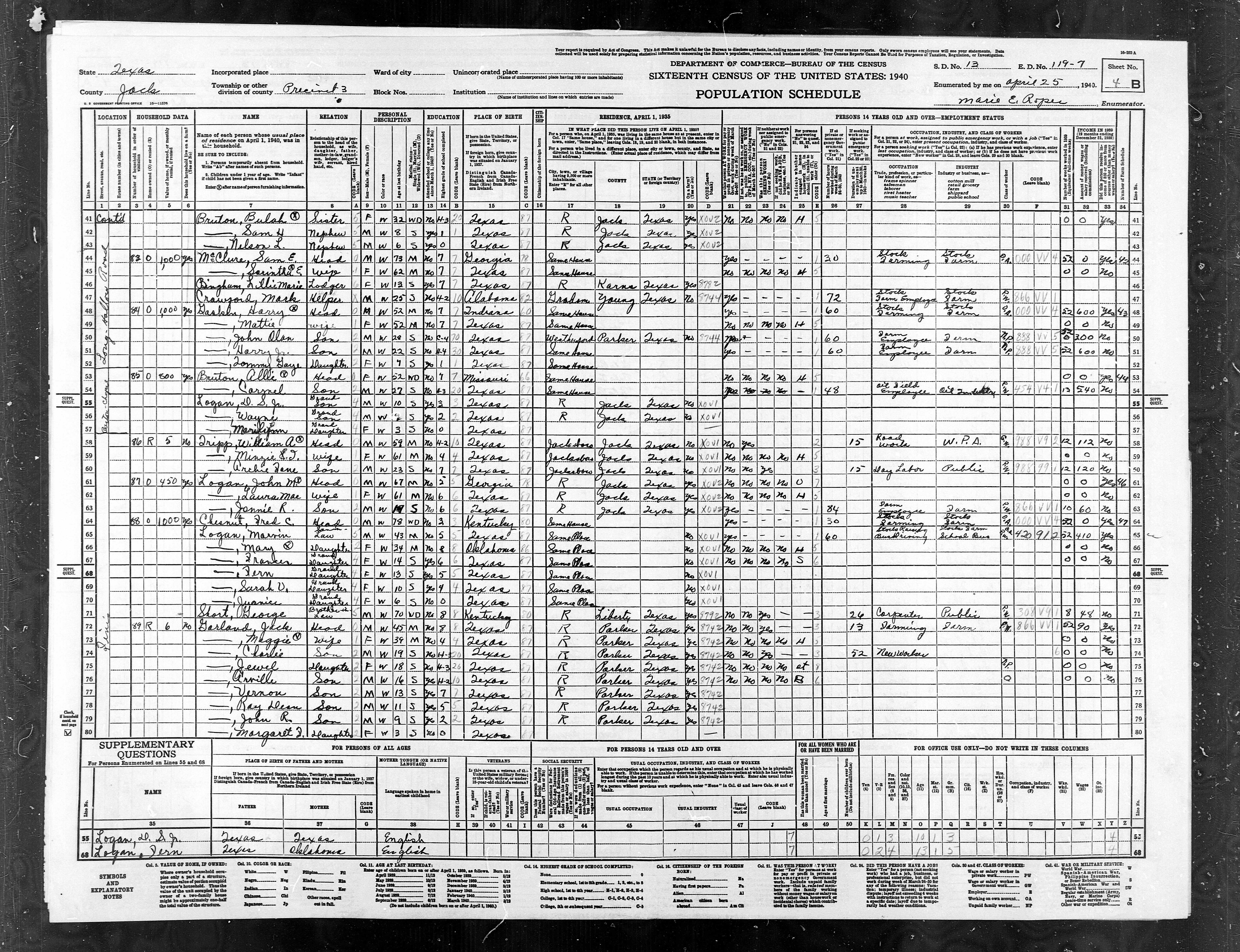
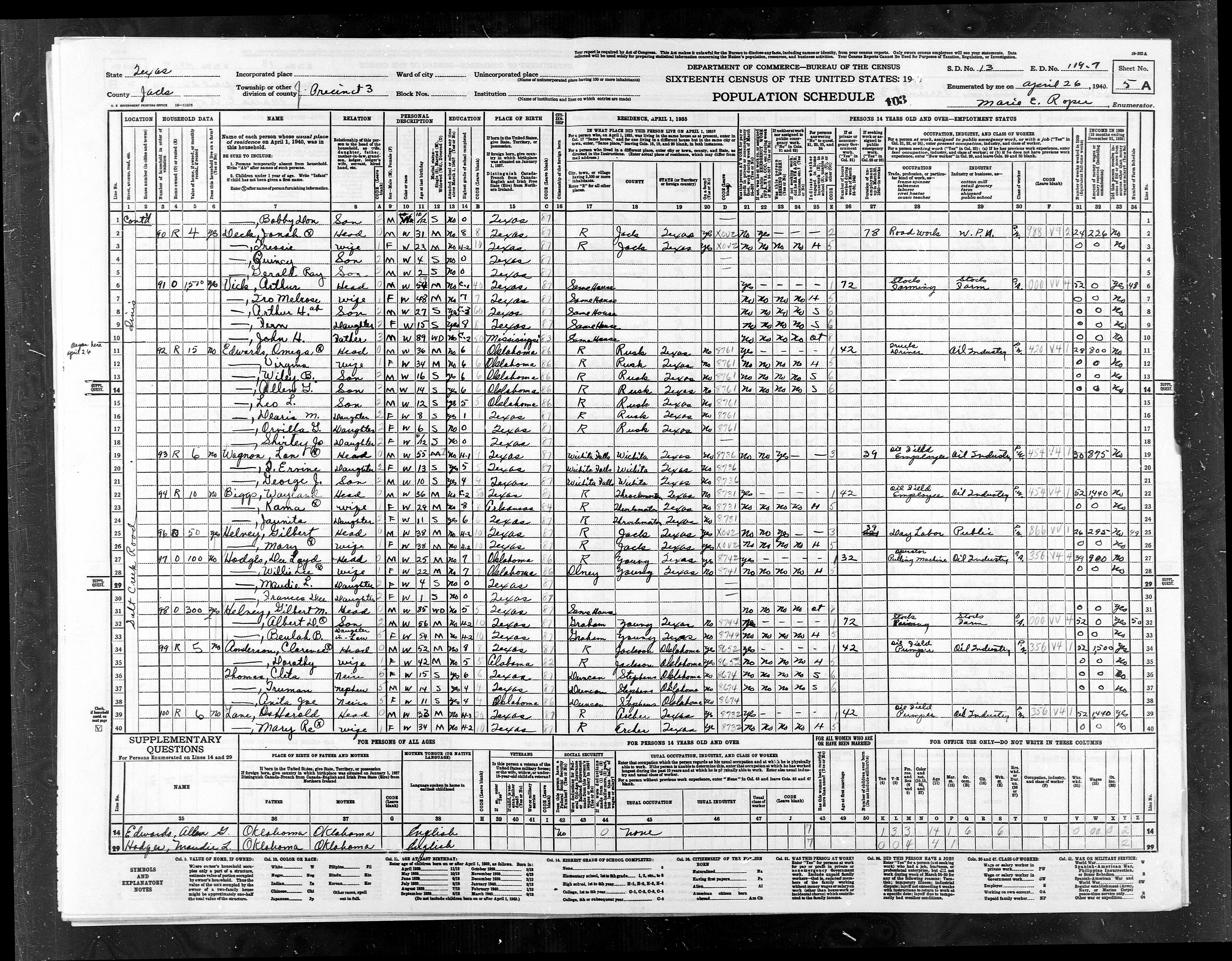
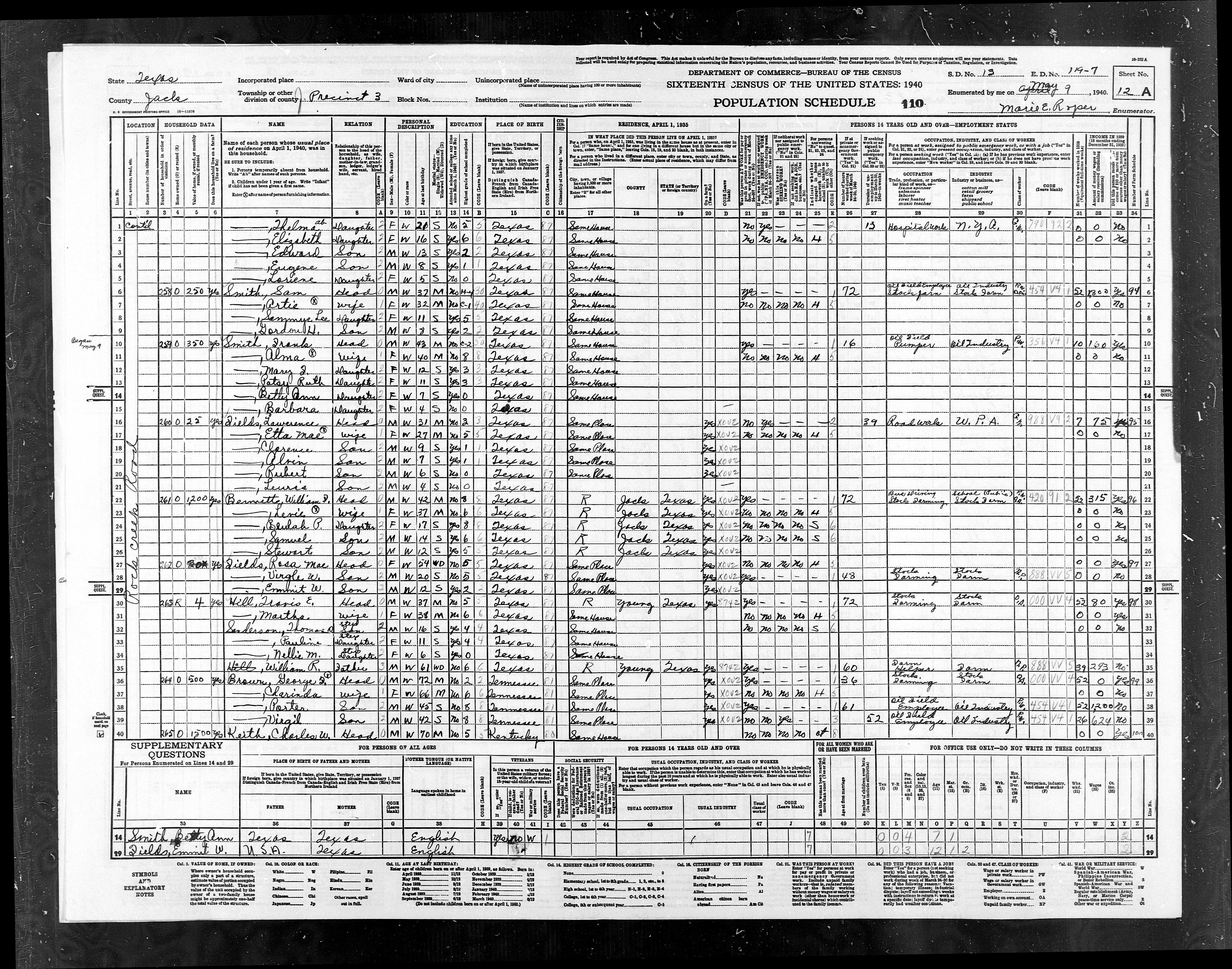
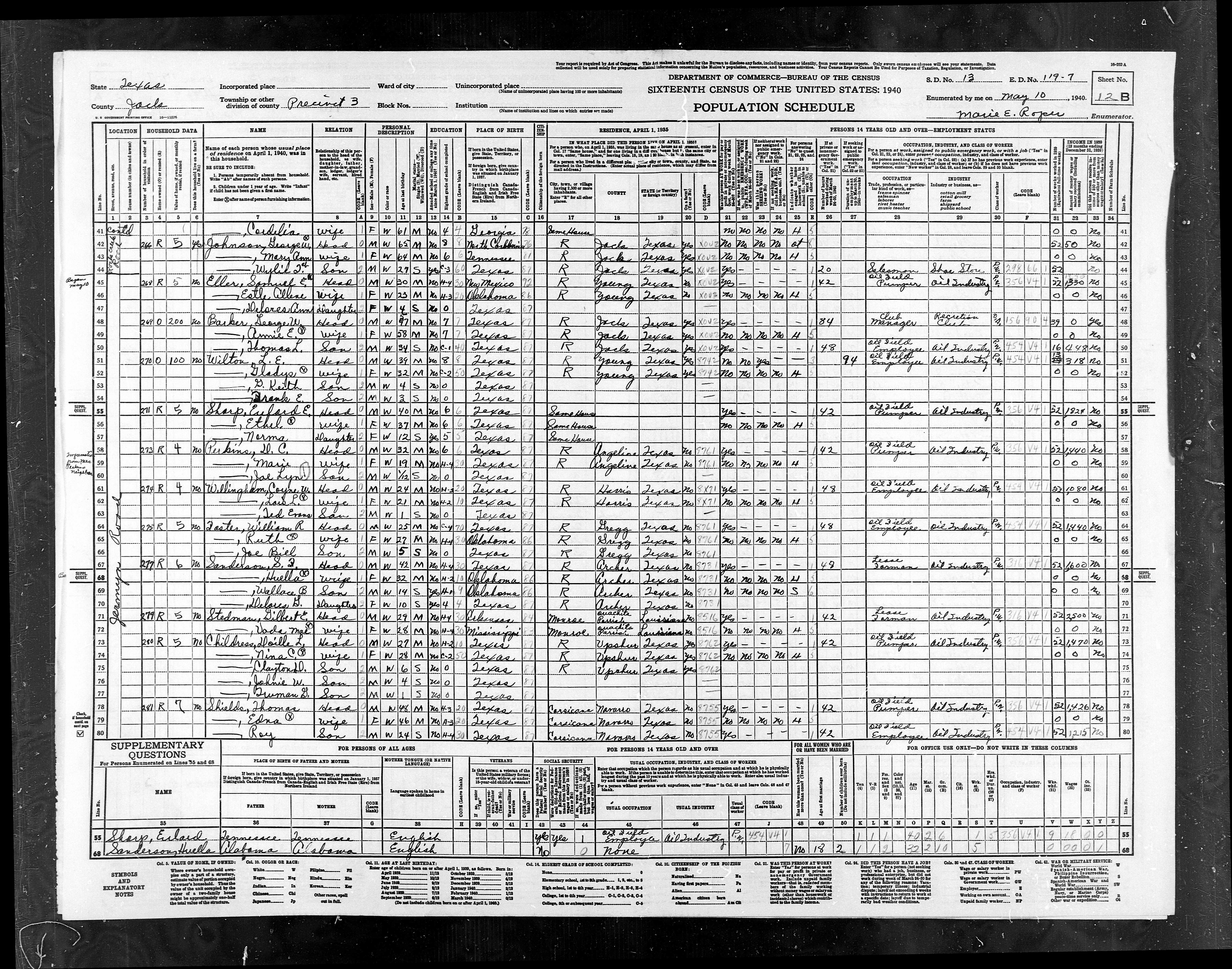
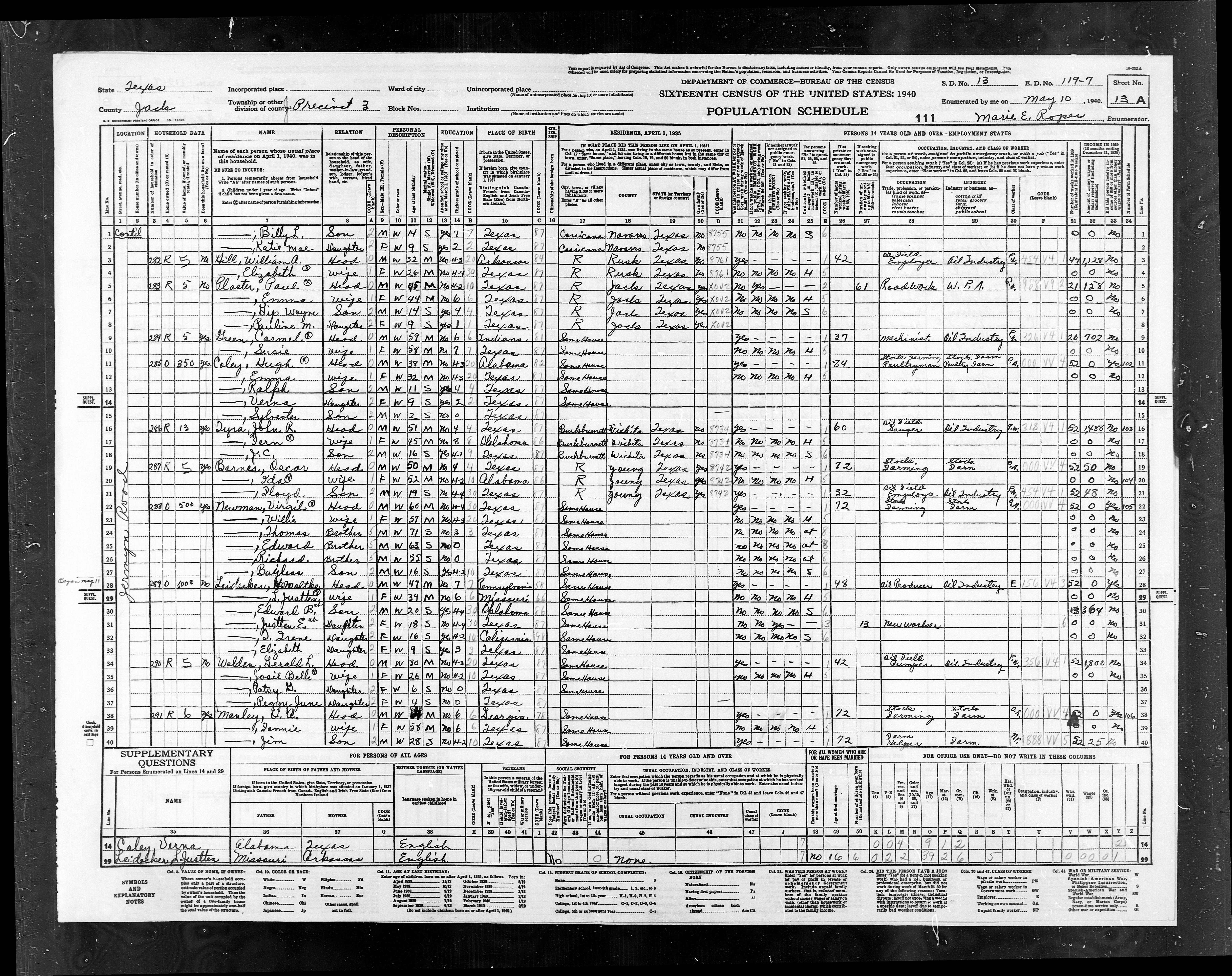
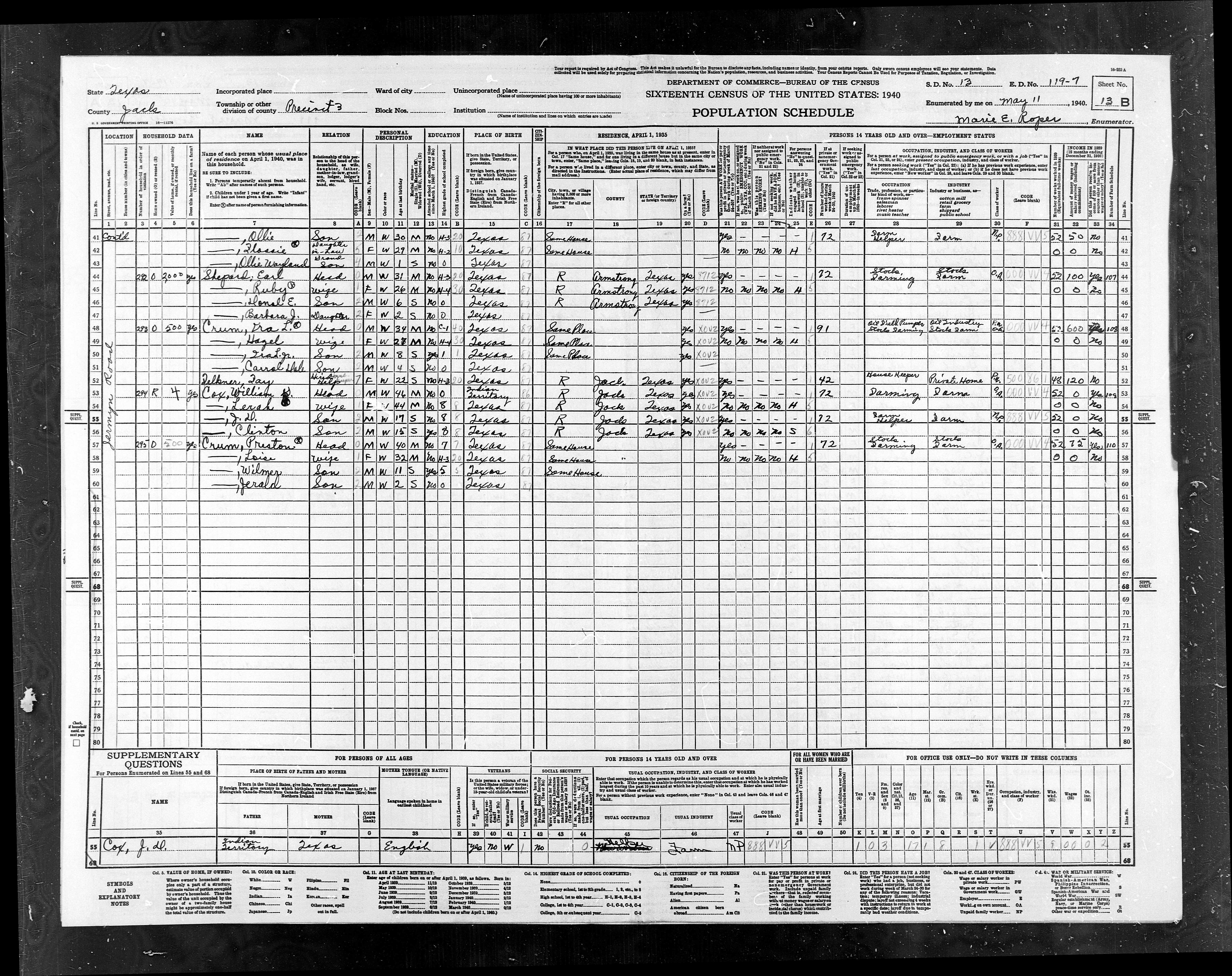
The maps below are from the
National Archives web page.
They are the maps used for the 1940 census.
Click
on any of the thumbnails below and the images will come up VERY
LARGE.
Houses are shown as little squares.
